UPDATE as of Tuesday, June 30, 8:01 P.M. – Heal the Bay staff, along with environmental partners and dozens of community members, attended and testified at the California Senate Select Committee on the Refugio Oil Spill last Friday in Santa Barbara. The hearing featured testimony from Plains All-American Pipeline, which spilled over 100,000 gallons of crude oil into the environment, reaching beaches here in Los Angeles County. This is the largest coastal oil spill in California over the last 25 years.
State Sen. Hannah-Beth Jackson (D-Santa Barbara), chair of the Senate Select Committee on the Refugio Oil Spill, Assemblymember Das Williams (D-Carpinteria), and Assemblymember Mark Stone (D-Scotts Valley) held the joint oversight hearing to examine the causes, response to, and impacts of the Plains All-American Pipeline oil spill at Refugio.
During testimony from Plains All-American, a timeline of the initial response was revealed. The oil company did not alert the National Response Center about the spill until an hour and a half after company officials confirmed the pipeline rupture (and several hours after unusual pipeline activity was discovered). At the hearing, Mark S. Ghilarducci, director of the Governor’s Office of Emergency Services, said the Texas-based oil company did not meet state guidelines for reporting an oil spill, which should have occurred within 30 minutes of detecting the spill. A 911 call from the public, responded to by the Santa Barbara County Fire Department and State Parks, triggered the initial contact to the National Response Center and oil spill response efforts.
Representatives for Plains All-American Pipeline came off as evasive and unprepared at the hearing, and avoided answering most of the questions from Sen. Jackson and Assemblymembers Williams and Stone. One of the expert panelists at the hearing, Janet Wolf, chair of the Santa Barbara County Board of Supervisors, criticized Plains All-American and response officials for insufficient communication to the County and public about the spread of the oil and release of oil testing results and fingerprinting analyses. Discussion also centered on the lack of best practices, such as automatic shut off valves, employed at the pipeline.
Recent documents have been uncovered describing what firefighters described the oil spill as gushing from the coastal bluffs onto the beach like a firehose “without a nozzle.” The documents also revealed that initially Plains All-American suggested the spill was too big to have come from their pipeline. Plains has reported that about 21,000 gallons of crude oil reached the ocean from the pipeline burst, but no one has confirmed that number, and we are among many who fear that the volume reaching the environment was much larger. Homeowners in Santa Barbara have also sued Plains All-American for the oiled beaches and unsatisfactory clean-up efforts near their homes. Criminal and civil investigations into the oil spill are underway by the state Attorney General.
Thanks to the many community members and environmental groups from throughout Southern California that came out to raise concerns and to comment at the hearing. Heal the Bay staff testified about linkage between oil deposits littering Los Angeles beaches and the Plains spill. We requested a throughout investigation also be conducted of all oiled beach reports in Southern California, so responsibility can be assigned.
Although reports are less frequent than in late May and June, we are still receiving documentation of unusual oil deposits at local beaches. If you do encounter oil along the beach, please report it to the National Response Center at 1-800-424-8802
UPDATE as of Monday, June 22, 3:13 P.M. – Official testing results from three Manhattan Beach oil samples confirm our suspicion: Oil from the May 19 spill outside of Santa Barbara traveled over 100 miles to foul South Bay beaches. Now that the oil fingerprinting analyses have been authenticated, we are calling on regulators to assign responsibility and secure proper compensation for the environmental damages caused by Plains All American Pipeline.
The California Department of Fish and Wildlife’s Office of Spill Prevention and Response (OSPR) collected samples from the oil that washed ashore in Manhattan Beach on May 27, 2015. Physical and chemical analyses conducted by OSPR and an independent peer review indicated that the oil in the South Bay matched a source sample taken from the Plains All American spill at Refugio State Beach. Plains All American also took samples from Manhattan Beach and has now confirmed that two of those samples originated from the Plains All American spill as well.
Although Santa Barbara has taken the hardest hit, the spill’s impacts are being felt throughout Southern California. Heal the Bay is working with a coalition of environmental groups in calling for steadfast action to aid in the oil spill response efforts and enforcement against Plains All American.
Below are the three primary outcomes we hope to realize in the wake of this tragedy:
- Document full extent of the oil’s reach. Surfrider Foundation and Heal the Bay are working with authorities to see that all post-spill sightings of oil outside of Santa Barbara are being investigated. Since the initial report of oil on South Bay beaches on May 27th, oiled beach reports have come in from Oxnard, Leo Carrillo State Beach, El Matador, Zuma Beach, Surfrider, Sunset surf spot, Santa Monica, Venice, the entire South Bay, Long Beach, San Clemente and Laguna Beach. Long Beach and 7 miles of South Bay beaches experienced closures at the beginning of peak summer season. We encourage the public to remain vigilant and continue reporting unusual tar or oil sightings to the National Response Center: 1-800-424-8802.
- Hold the polluter responsible. It is critical that Plains All American be held responsible for fouled beaches, oiled wildlife and damaged habitats from Santa Barbara to the southernmost reach of their oil pollution. Heal the Bay and a close-knit coalition of environmental groups are working with authorities to ensure that the documentation of the Plains All American Oil Spill is comprehensive so that strong legal action can be taken by state and federal agencies against this polluter.
- Protect our coast by passing new oil regulations. A coalition of environmental NGOs are calling for passage of key legislation to improve oil spill response and management in California:
- SB 414 (Jackson) would help make oil spill response faster, more effective and more environmentally friendly by creating a program for fishing vessels to voluntarily join in oil spill response and place a temporary moratorium on the use of dispersants within state waters.
- SB 788 (McGuire) would close the loophole in state legislation that allows for oil and gas extraction in state-owned submerged lands in the California Coastal Sanctuary if those lands are being drained from producing wells upon adjacent federal lands. In particular, it would protect Santa Barbara’s marine protected areas from offshore oil drilling.
- AB 864 will require an operator of an oil pipeline along environmentally and ecologically sensitive areas near the coast to use the best available technology to reduce the amount of oil released in an oil spill. This includes automatic shut-off technology, and requires a pipeline operator to document the best available technology used in their oil spill contingency plan.
UPDATE as of Thursday, June 11, 2:41 P.M. – It’s been 2 ½ weeks since oil has been observed washing ashore in the L.A. region. Although official beach closures in the South Bay and Long Beach have been lifted, Heal the Bay remains concerned about public health and safety. We’re still patiently awaiting the fingerprinting analysis to determine the source of the oil.
 Our policy team has appealed to a number of public health and spill response agencies to install warning signs along oiled beaches advising beachgoers to avoid contact with oil. We’re also pushing for more thorough testing to determine beach safety. Heal the Bay scientists are currently processing oil, sand and water samples taken at a number of L.A. beaches (see picture at right).
Listen: HtB marine scientist Dana Murray on NPR’s Morning Edition
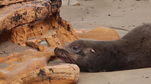
The oil cleanup and response is still underway in Santa Barbara, led by the Department of Fish and Wildlife’s Oil Spill Prevention and Response Unit and the U.S. Coast Guard. As of Tuesday, June 9, 2015, the Oiled Wildlife Care Network reported 161 dead birds and 87 dead marine mammals, with 60 oiled birds and 46 oiled marine mammals rescued and undergoing treatment and care.
With a warm weekend ahead of us, Heal the Bay urges beachgoers to:
Stay away from oiled sections of beach. If you come in contact with oil, remove it immediately (baby oil, mineral oil and olive oil are all helpful in removing tar and oil deposits from skin)
Report abnormal amounts of oil to the National Response Center: 1-800-424-8802
Report oiled wildlife sightings to the Oiled Wildlife Care Network: 1-877-UCD-OWCN.
Take a photo of oil on the beaches and post to social media with the hashtag #healthebay along with your location (it helps to include something in the photo that indicates scale)
UPDATE as of Monday, June 8, 8:11 P.M. – Revised animal casualty figures related to oil impacts: 67 dead marine mammals and 136 dead birds. The Long Beach coastline has now been re-opened following cleanup of four mile stretch of oil-strewn beaches.
UPDATE as of Thursday, June 4, 9:31 A.M. – Reports of oiled beaches in Southern California grow every day: Four miles of the Long Beach coastline is now closed as cleanup crews begin to remove blobs of oil on the beach. We are still awaiting official results from the U.S. Coast Guard and NOAA on initial oil sample sourcing to confirm whether the oil spreading from Ventura to Orange County is from the Refugio oil spill or a different source. Oil in the ocean is weathered by wind and waves and broken up into smaller tar balls which can spread for hundreds of miles in the ocean. In the meantime, Heal the Bay has deployed our staff scientists to collect samples and document the oil on our L.A. beaches, which we hope to send off for chemical testing to aid in source identification.
In addition to beach closures at Long Beach, Refugio, and El Capitan, 138 square miles of fishing grounds have been closed indefinitely off the Southern California coastline.
Heal the Bay has been fielding reports from our MPA Watch volunteers, surfers, and beach-goers in Southern California with oiled beach reports coming in from: Oxnard, Leo Carrillo State Beach, El Matador, Zuma Beach, Surfrider, Sunset surf spot, Santa Monica, Venice, the entire South Bay, Long Beach, San Clemente and Laguna Beach.
We are concerned that some L.A. beaches remain open where oil deposits have been documented. The oil may be hazardous to human health. As a reminder, beachgoers should avoid oiled stretches of beach. If they do encounter oil, they should remove it quickly with baby oil, olive oil or coconut oil.
Official clean-up crews in L.A. have been focused on removing oil from Zuma, Manhattan, Malibu (general area), and Hermosa beaches. Hundreds of bags of oil have been cleaned up from Manhattan and Hermosa Beaches. We are asking the public to report oil sightings to the National Response Center and to please take and post photos with location to Instagram with #healthebay hashtagged. Please, do not handle any oil you find!
While we await official results about the source of the oil deposits, Heal the Bay staff has been collecting its own samples from various affected areas of the L.A. coastline. We will remain vigilant about tracking the source of the spill. If the oil comes fron non-natural sources (highly likely at this point), then we will advocate for stiff penalites for the parties held accountable.
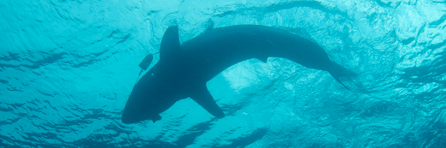
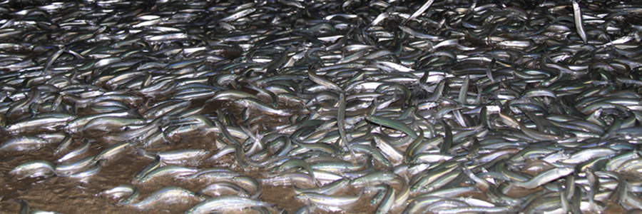
Meanwhile, up in Santa Barbara, over two weeks have passed since the Refugio Beach spill, but the wildlife death tol continues to rise, as has the spread of oil. As of today, almost 300 oiled animals have been recovered. This includes 173 oiled seabirds–including 20 different species–115 dead, 58 alive. 100 oiled marine mammals have been recovered (58 dead, 42 alive), including 12 dead, oiled dolphins. Although the numbers are unknown, the impacts have likely been much larger to other animals such as fish, lobster, abalone, and crabs that live in tidepools and kelp forests along the spill zone. Heal the Bay’s marine scientist will be joining a small research dive team in Isla Vista to document oil underwater in the Campus Point marine protected area next week.
On the policy front, Heal the Bay is working with the West Marin Environmental Action Committee and a coalition of environmental groups to help pass SB 788 – a bill to ban future oil drilling into California state waters from federal land. The bill passed throught the State Senate yesterday and is now moving onto the Assembly. If you haven’t already, please sign the petition and pass it on!
More on the Santa Barbara spill can be found here.
UPDATE as of Tuesday, June 2, 9:46 A.M. — We just got word that crews have been deployed in Redondo, Manhattan and Zuma beach to complete additional “visual” surveys of the beaches, while additional personnel are actually cleaning up oil at Venice Beach. USCG are still testing the “fingerprint” of the oil blobs that have washed up all over the Southern California coast, and we’re hopeful that we’ll soon know the origin of the invading oil.
Blobs, globs and pucks of oil have been reported from San Clemente to Ventura County, and we’re thankful for our citizen-scientists for sending in pictures and details of oil sightings. Click the mosaic below for some images submitted by our activist network.
Reminder: If you see oil blobs or “pucks” on the beach, please call the National Response Center: 1-800-424-8802. If you see an oiled animal or any wildlife in distress, call the OWCN response hotline: 1-877-823-6926.

UPDATE as of Saturday, 8:35 A.M. — At 6:30 p.m. last night, the Coast Guard deemed safe the nine-mile stretch of beach between El Segundo and Torrance and reopened it to the public. While this may come as a relief to weekend beachgoers, Heal the Bay urges an abundance of caution. Despite continued testing of the oil blobs and the removal of 40 cubic yards of the mysterious gunk, we still don’t know the source, and thus can’t determine the extent of harm to humans.
If you’re committed to heading to South Bay beaches this weekend, we ask that you use common sense: If you see oil blobs or tarry messes on the sand or in the water, tell a lifeguard and stay clear of the material. If you come in contact with the material, it may cause irritation and other negative health effects: Remove it promptly with baby oil, olive oil or coconut oil. If irritation or other adverse effects continue, contact your doctor.
At the end of the day, Heal the Bay values beachgoer health above all. If something seems off, please don’t compromise your health for a good break or skimboarding session!
UPDATE as of Friday, 11:35 A.M. — The Coast Guard announced at a press conference this morning that beaches from El Segundo jetty to the Redondo-Torrance border will remain CLOSED to swimmers until further notice and testing of the blobs, water and sand is complete. Beachgoers are safe behind lifeguard towers, but are advised to avoid wet sand and the water.
UPDATE as of Thursday, 5 P.M. — Sarah Sikich, Heal the Bay’s vp and longtime staff scientist, spent the entire day on South Bay beaches checking out conditions and talking to authorities. Here’s her eyewitness report of the latest news.
· Thanks to ongoing cleanup, there are fewer oil globs on Manhattan Beach shorelines, but small tar balls remain scattered throughout the wrack line. Hermosa Beach had larger and more dense oil globs south of the pier. There appear to be very few globs in the wash zone and waves this afternoon, so less seemed to be washing ashore.
· Closures are still in effect from the El Segundo Jetty to the Redondo-Torrance border. Enforcement of the closure varies along the beach. A few surfers were in the water earlier in the day at El Porto, but no one could be seen this afternoon.
· Manhattan Beach north of the pier was desolate, and lifeguards patrolled the beach. South of the MB pier and in Hermosa Beach, lifeguards cruised the beach in trucks, talking to waders and discouraging them from playing in the water.
· Authorities are considering opening the beaches tomorrow morning if the water samples test clear. Heal the Bay has concerns about opening the beaches and even allowing people on the sand between the lifeguard towers and water. It’s nearly impossible to walk along the beach in that area without encountering a small oil glob, and from a human health perspective, exposure through skin contact is a concern.
· Heal the Bay recommends that the beaches stay closed until all the oil is cleaned up. We also recommend regular testing of the sand until it’s clear. (Kids are at risk of putting oil contaminated sand in their mouths).
· Test results to determine the source could take a few days to several weeks. Testing at this point has indicated that the petroleum product washing ashore has moderate hazardous characteristics and is slightly flammable.
· Clean up crews have collected about 30 cubic yards of oil globs so far. That’s spread over one full industrial dumpster and three partially filled ones.
· Heal the Bay is also concerned that people displaced from closed beaches will journey to nearby beaches that may also be impacted by oil/tar blobs. Small tarball/oil globs have been found along the wrack line in Playa del Rey. Granted, it’s nothing like what we saw in Manhattan Beach yesterday, but people walking or running along the wet sand could easily encounter oil.
· People should avoid any beaches where they notice oil (in the sand or sea) until we have more information about where this substance is coming from and its extent.
UPDATE as of Thursday, 10 A.M. — Beaches are still closed from the El Segundo Jetty to the South Redondo Beach border, while professional clean-up crews continue to remove oil globs from the beach. Beachgoers are encouraged to stay away from the wet sand, and not go seaward of the lifeguard towers. Contact with the oil may cause skin irritation, headaches from the odors, and other negative health effects. The California Department of Fish and Wildlife said that as of this morning, no wildlife issues have been reported. Water and beach samples are being taken of the oil product for identification. All potential sources are being investigated, including the local refinery and marine terminal, the Refugio oil spill, and natural sources. Authorities are doing aerial flight surveys, and two oil response vessels were in the water this morning.
UPDATE as of Wednesday, 8:11 P.M. — Via L.A County Dept. of Public Health: A beach closure has been declared for the area from El Segundo Jetty to the North and the Redondo Beach city limit to the South, due to a release of petroleum effecting the area. Beach users are advised to avoid contact with the material washed on shore, the water, and wet sand. Contact with oil may cause skin irritation and long-term health effects.
ORIGINAL POST May 27, 2015 — Los Angeles’ Department of Public Health officials have closed a wide swath of South Bay beaches after an unusual and heavy concentration of oil globs washed ashore this afternoon.
A roughly 2-mile stretch of shoreline between 34th Street in Manhattan Beach and Longfellow Avenue in Hermosa Beach is now off limits while authorities begin cleanup efforts and investigate the source of the large clumps of oil and tar. The sand along the tideline is peppered with thousands of thick globs ranging in size from a baseball to a football. Many of these globs are visible in the shallows of the ocean and in the surfline.
While many observers might think that this unfortunate incident is directly related to the recent oil spill in Santa Barbara, it is simply too early to tell where the oil came from. It is unknown if the oil is from natural seepage or from an oil spill from a local refinery or pipeline located nearby.
Initial reports do not indicate that any local wildlife visible on the shore has been harmed.
The oil was first spotted offshore around 10 a.m., came onshore around noon, and Heal the Bay started getting notifications from surfers and the general public around 1:30. The U.S. Coast Guard is coordinating cleanup and investigation efforts with state and local agencies, including the L.A. County Lifeguards and Fire Department, the California Dept. of Fish and Wildlife, L.A. Beaches and Harbors, and the L.A. County Office of Emergency Management.
Cleanup and testing is underway, but no source has been identified yet. The National Ocean and Atmospheric Administration and the U.S. Coast Guard have taken samples and will continue efforts to identify the source, including the possibility of nearby oil refineries and transportation facilities, natural oil seeps, and the Refugio spill.
In addition, NOAA is re-running its oil spill and ocean current models related to the Refugio oil spill in Santa Barbara. At the time of this posting, we are not aware that any other oil has been detected along the Malibu coastline or elsewhere in Santa Monica Bay.
For now authorities say that they do not need volunteers, but that could change. If you would like to help with any cleanup efforts that may arise, you can send your name, phone, and email information to: info@healthebay.org. We will provide you with updates and engagement opportunities as they arise.
Heal the Bay staff scientists are traveling to the affected areas and will be providing us updates through the evening and tomorrow.


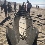 Over 200 ocean enthusiasts gathered to witness Mati Waiya, Executive Director of the Wishtoyo Foundation and an esteemed Chumash elder, perform a moving ceremony to thank the ocean for providing us with oxygen, food, and beauty. A gorgeous hand-carved tomol, a Chumash canoe made from redwood, was lifted by a dozen men and placed on the sand in the center of the congregated onlookers, highlighting Chumash maritime culture. After leading the crowd in traditional Chumash songs, Mati Waiya spoke passionately about the need to respect the ocean’s strength and power, yet also recognize its vulnerability to harmful human activities. His emotional speech ended with a call to action for each person to remember that we are all connected with nature and we must incorporate honor and respect for Mother Earth into our daily lives to keep her – and ourselves – healthy and thriving.
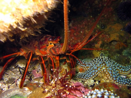
 El Niño-caused sea level rise, coupled with sea levels rising from ice sheet melt associated with climate change, is projected to lead to more coastal flooding, shrinking beaches, and shoreline erosion. This year’s El Niño has western U.S. cities planning for coastal flooding. Higher sea levels, high tides and storm surges that force waves well past their usual reach pose very real threats. And when these forces coincide, such as during an El Niño,
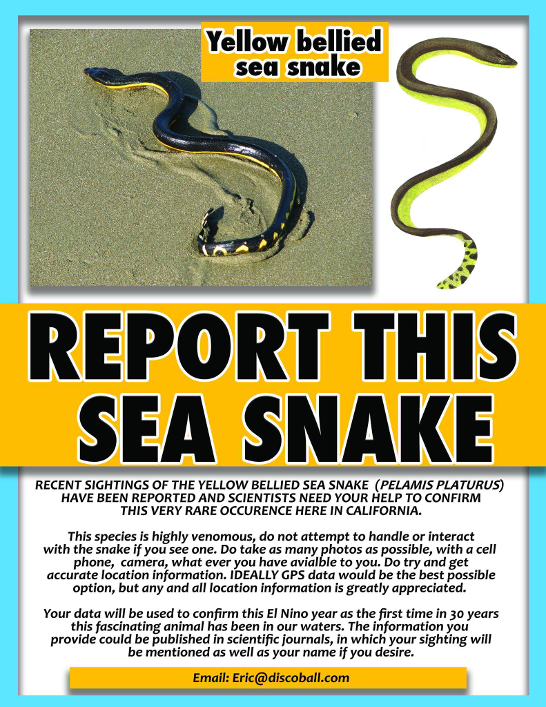
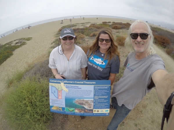 Staff scientist Dana Murray, center, helped install new signs in Malibu.
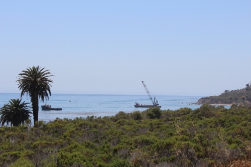 Ships conduct cleanup operations in tightly controlled Refugio Cove.
