The future of California’s kelp forests depends on the sunflower sea star, and the future of this species could depend on one star.
In this webinar, Heal the Bay Aquarium Associate Director of Operations Laura Rink and Jen Burney, Aquaculture Lab Technician at Santa Monica College, take you behind the scenes of our urgent work to save the critically endangered sunflower sea star.
After a Sea Star Wasting Event decimated more than 20 sea star species and left the California sunflower sea star virtually extinct, Heal the Bay joined the Association of Zoos and Aquariums SAFE (Saving Animals From Extinction) Program to help turn the tide.
This webinar captures a rare and time-sensitive moment: our 2026 work to spawn one of the only reproductive female sunflower sea stars in California. A successful spawning could allow us to raise her offspring and, with state approval, one day reintroduce juvenile sea stars into local waters to help restore balance to our coastal ecosystems.
You’ll learn how aquaculture supports species recovery, why sunflower sea stars are a keystone species, and what happens when they disappear.
Then meet “Chicken Fingers,” the sunflower sea star at the center of this critical effort—and one of the last reproductive females from Southern California waters.
Because healthy coastlines don’t happen by accident. They take care, science, and a community of people willing to show up.
You don’t have to be an expert.
You just have to start.
Around 2013, our California coast experienced a Sea Star Wasting Event caused by a disease outbreak that decimated over 20 different sea star species populations and left the California sunflower sea star virtually extinct.
In the years following this event, the Association of Zoos and Aquariums created the Sunflower Sea Star SAFE (Saving Animals From Extinction) Program, bringing together more than 50 facilities from around the world. Heal the Bay has been an active member in this program for several years and, joined by Santa Monica College, continues working to turn the tide.
The sunflower sea star is a fast-moving, many-armed keystone predator that can grow up to 3 feet wide and uses thousands of tube feet to hunt sea urchins, helping protect and sustain vital kelp forest ecosystems.
In 2026, Heal the Bay Aquarium supported a critical effort to restore this endangered species through aquaculture science and species recovery. This work represents a rare opportunity to help restore balance to Southern California’s coastal ecosystems and protect the future of our kelp forests.
Laura Rink
Associate Director of Operations, Heal the Bay Aquarium
Professor of Aquaculture, Santa Monica College
Jen Burney
Aquaculture Lab Technician, Santa Monica College
Laura and Jen lead this critical work to support sunflower sea star recovery through aquaculture, species restoration, and the SAFE Program. Together, they are helping protect one of California’s most important keystone species—and the kelp forests that depend on it.
Want to support the science, education, and advocacy you rely on?
Decades of toxic DDT and “forever chemicals” still linger in Santa Monica Bay, putting subsistence and recreational anglers at risk. Heal the Bay is urging the Office of Environmental Health Hazard Assessment to call for new testing and update safety standards to protect our local anglers.
California has a responsibility to protect its residents from toxic pollution. Sign the petition to urge OEHHA to take the necessary steps to keep our angler community safe.
As of April 21, harmful algal bloom (HAB) monitoring by SCCOOS has detected elevated levels of saxitoxin-producing dinoflagellate (Alexandrium) in the waters off Santa Monica. Meanwhile, the algae responsible for producing domoic acid (Pseudo-nitzschia) are still being detected off our coast and show significant spikes in March and April. This dual bloom event may intensify the impacts on marine wildlife, contributing to the recent surge in animal distress and mortality along our coast.
If you see a distressed or deceased marine mammal, it’s important to stay safe and protect the animal by working with local authorities, including lifeguards. Never approach, touch, or attempt to move an impacted animal. Read on to learn more about this algal bloom, how to report marine mammals in need, and how to stay safe.
Southern California is currently experiencing a significant harmful algal bloom (HAB) that poses serious threats to marine life and public health.
You may have recently seen disturbing reports of disoriented sea lions or deceased dolphins along the California coast. These marine mammals are experiencing the effects of harmful neurotoxins due to a toxic algal bloom. As the number of beached and injured animal cases rises, so does the spread of misinformation about their cause, their impact on marine life, and whether it’s connected to recent wildfires. Heal the Bay’s science team is here to break down the facts about this bloom and share what beachgoers, anglers, and coastal communities need to know to stay informed and safe.
The Bloom Below the Surface
Current Status of the Algal Bloom
The recent bloom was first detected in San Diego in December 2024, but the toxic algal bloom intensified in mid-February as it moved into Los Angeles County. It has now spread along the entire Southern California coastline and into Baja, affecting all Southern California counties from San Diego to Santa Barbara, and is now being detected along Central California waters as well.
What type of algae is this?
This bloom is primarily caused by the algae species Pseudo-nitzschia, a type of phytoplankton that produces domoic acid, a potent neurotoxin that causes domoic acid poisoning, also referred to as Amnesic Shellfish Poisoning. However, this is a unique and somewhat unprecedented bloom as we are also seeing another plankton, a type of dinoflagellate, blooming and producing saxitoxin, a different and yet equally dangerous neurotoxin that causes Paralytic Shellfish Poisoning. Marine life has been severely impacted, with reports indicating that hundreds of sea lions, dolphins, whales, and seabirds have been affected. These toxins accumulate in shellfish and small finfish such as sardines and anchovies, which are common prey for these marine animals, leading to neurological symptoms such as disorientation, seizures, and death.
Red-hued algal bloom appearing in SoCal waters. Photo by Laura Rink, Associate Director of Operations for the Heal the Bay Aquarium.
Are these types of algae blooms natural or unnatural?
While harmful algal blooms are natural occurrences in California’s marine ecosystems, their frequency and intensity are exacerbated by climate change and pollution. Warmer waters, increased nutrient runoff, and increased winds leading to increased upwelling (a natural occurrence that brings nutrient-rich water up to the surface from deeper water) create an ideal environment for algae to bloom. This is the fourth consecutive year that Southern California has experienced a severe, harmful algal bloom.
Did the January 2025 Wildfires cause this event?
We cannot definitively link this bloom to the wildfires, considering that high algal levels were detected before the fires began, and impacts from domoic acid have been observed for the last four years. However, it is possible that the post-fire conditions contributed to the algal bloom’s intensity this year.
The same high winds that intensified the firestorm also may have increased nutrient upwelling. After the fire, heavy rains washed nutrients such as sulfates, nitrates, and phosphorus found in ash and fire retardants onto the coastline. This influx of nutrients into coastal waters can stimulate the growth of algae, including harmful species. Additionally, wildfire ash can introduce iron into marine ecosystems, further promoting algal proliferation, but we do not yet have sufficient scientific evidence to see a definitive correlation between this year’s megafires and this year’s harmful algal bloom.
Wildlife Encounters & Seafood Warnings
What do I do if I encounter sick or injured marine life on the beach?
Photo: VALERIE MACON / AFP / Getty Images
While we have experienced serious, harmful algal blooms and domoic acid outbreaks for the past few years, this particular bloom affects even more animals than we have seen recently, including sea lions, seals, and dolphins. If you are visiting the beach, you may come across wildlife that is affected by domoic acid poisoning. The public is urged to exercise caution when encountering marine animals that appear sick, injured, or deceased. DO NOT APPROACH ANY ANIMALS.
Domoic acid poisoning can cause marine mammals to exhibit unusual or aggressive behavior, posing potential risks to human safety. As many Angelenos have probably heard, there have been recent incidents of sea lions exhibiting aggressive behavior towards humans, likely due to domoic acid exposure. These animals are also very sick and need space to avoid harming them further. While it is always illegal to approach a marine mammal due to the Marine Mammal Protection Act, it is critical to exercise caution now. If you come across such animals:
Do Not Approach: Maintain a safe distance to avoid potential injury to you or the animal. Do NOT touch the animal.
Contact Authorities: Report the sighting to local marine mammal rescue organizations or wildlife authorities.
To report a live marine mammal in need, call the Marine Mammal Care Center’s hotline at 1-800-399-4253
To report a deceased marine mammal from the Southern Border of LA County to the City of Malibu line, call the OARRA hotline at 949-276-2237
To report a stranded marine mammal in Malibu, call NOAA’s Malibu hotline at 866-767-6114
Follow Instructions: Provide accurate information about the animal’s location and condition, and follow any guidance provided by authorities.
Is it safe to swim in the algae-abundant waters?
When the “red tide” comes in, some surfers won’t hesitate to risk the pungent waters for the perfect break. But is it safe to be in the water during a visible algae bloom? While domoic acid and saxitoxin are generally only dangerous to humans when consumed in affected seafood like shellfish, they don’t pose a significant risk to swimmers. That said, the marine life impacted by this outbreak may behave erratically, which can pose a risk to recreators. Risk is a personal choice, however we at Heal the Bay don’t recommend swimming in affected waters out of an abundance of caution.
Can I eat locally caught shellfish?
Humans can get very sick from eating shellfish that have been contaminated with domoic acid and/or saxitoxin. In response to the elevated levels of these toxins in samples, the California Department of Public Health (CDPH) has issued multiple shellfish advisories in the past month.
The advisories warn against the consumption of recreationally harvested mussels, clams, oysters, and scallops from San Diego, Orange, Los Angeles, Ventura, and Santa Barbara counties due to the risk of Amnesic Shellfish Poisoning (ASP) and Paralytic Shellfish Poisoning (PSP).
Symptoms of ASP can range from gastrointestinal distress to severe neurological issues, including memory loss. Symptoms of PSP begin with tingling around the mouth and fingertips, followed by loss of balance, lack of muscular coordination, slurred speech, and difficulty swallowing. In severe poisonings from either ASP or PSP, death can occur.
What does this mean for seafood lovers? Stay away from locally caught shellfish for now to stay safe until this bloom dissipates – cooking does NOT eliminate these toxins from food.
Should I stay away from commercial shellfish products?
Commercial shellfish products remain safe for consumption, as they are subject to rigorous testing before reaching the market.
Heal the Bay’s Initiatives and Resources
Heal the Bay remains deeply committed to safeguarding the health of our coastal waters and marine life and the public health of all Angelenos. In light of recent wildfires and their potential impact on ocean health, we have launched the “Ash to Action” initiative, focusing on monitoring and mitigating wildfire-related pollutants in our waterways. Our dedicated water quality scientists have worked around the clock to collect, test, and analyze water samples from in and around the burn zone and we recently published those results to keep the public informed. We will continue to work with local County and City officials and other scientists to gather and disseminate information about post-fire water quality. To stay up to date, follow us on social media @healthebay, subscribe to our newsletters, and bookmark the Ash to Action splash page.
For more information, watch our recent webinar with the Marine Mammal Care Center where we answer questions about this harmful algal bloom. Click here to watch. Password: WELOVE0URBAY! (the “O” in “OUR” is a Zero)
Note: This information is based on the latest available data as of April 24, 2025. For real-time updates and advisories, please refer to official sources such as the California Department of Public Health, SCCOOS HAB Bulletin, and local wildlife authorities.
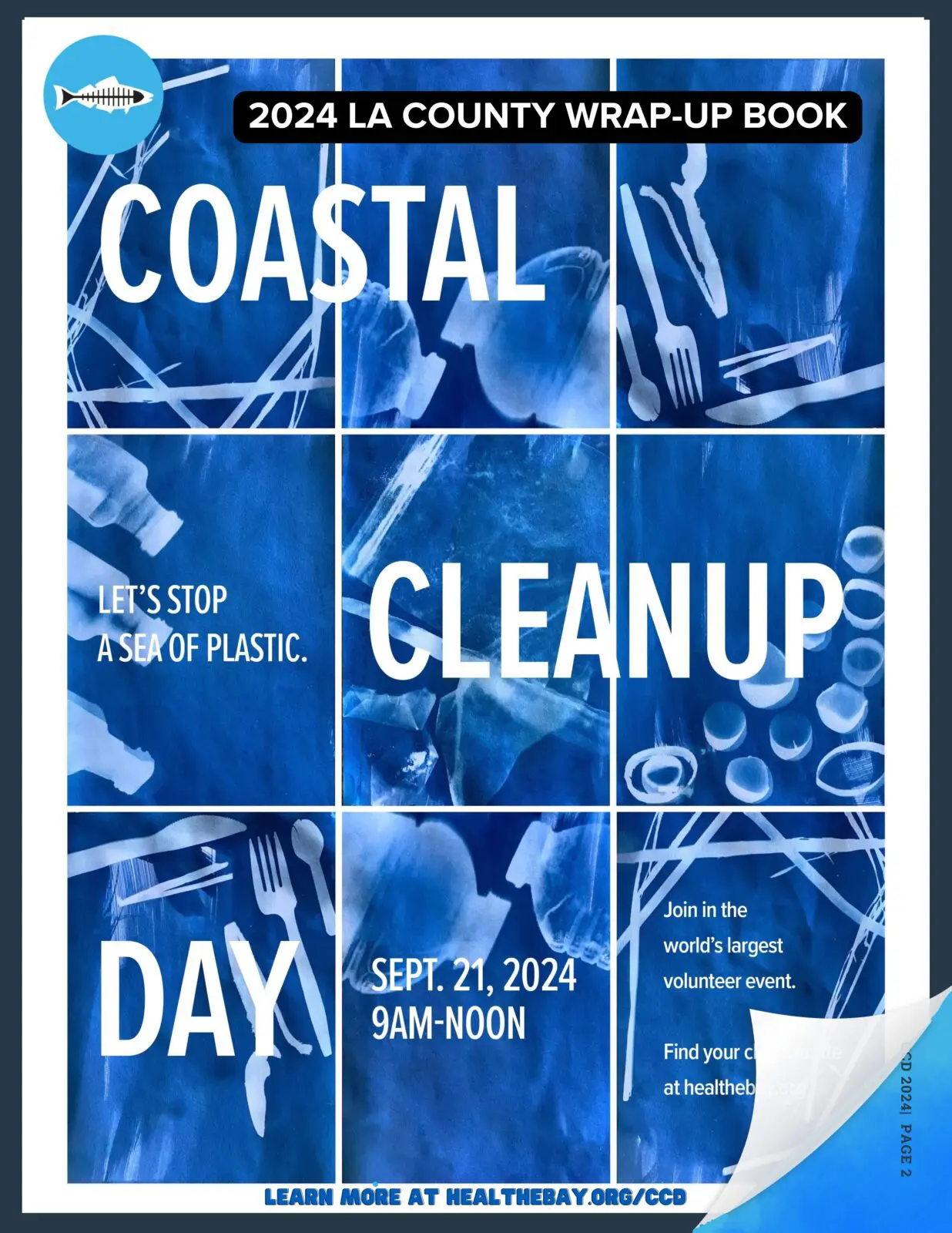
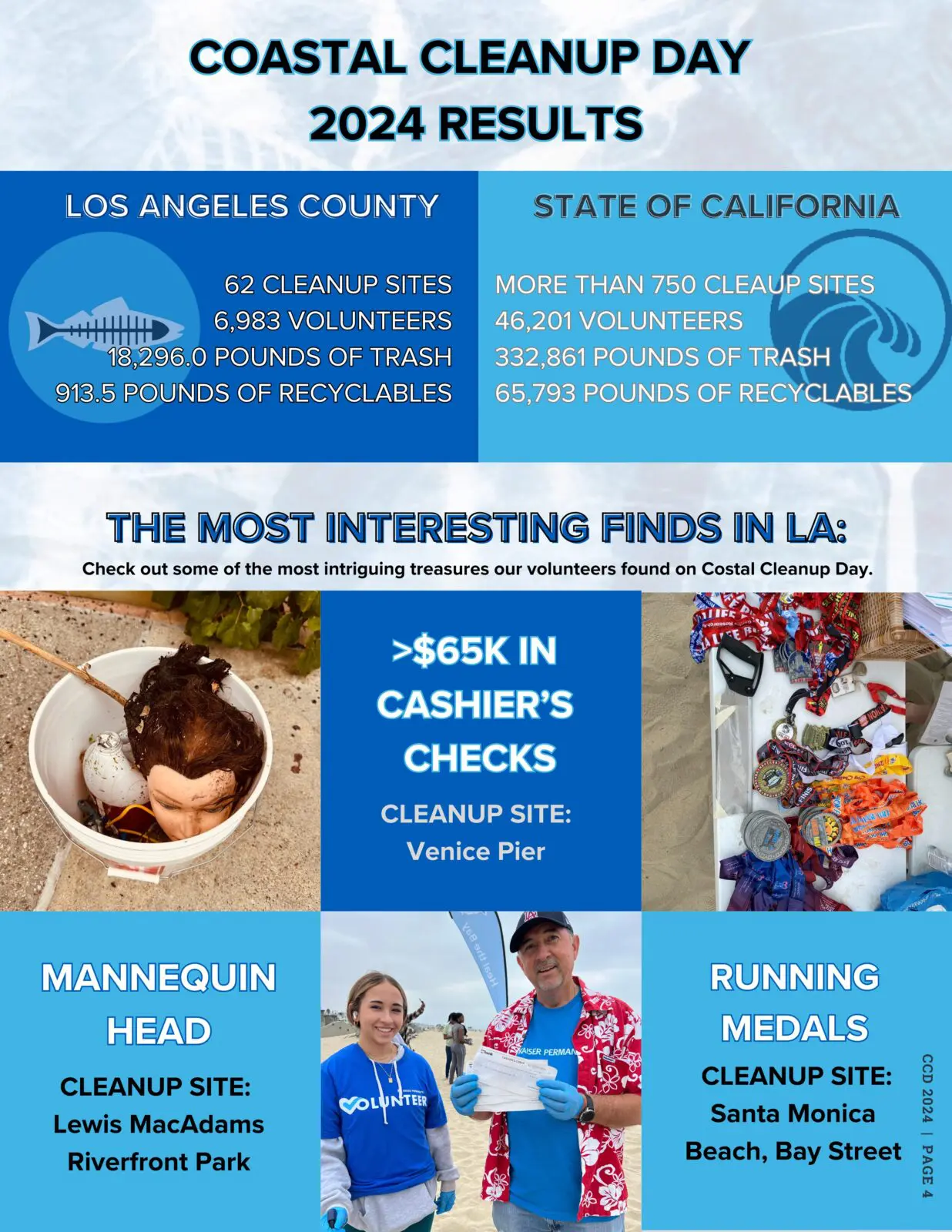
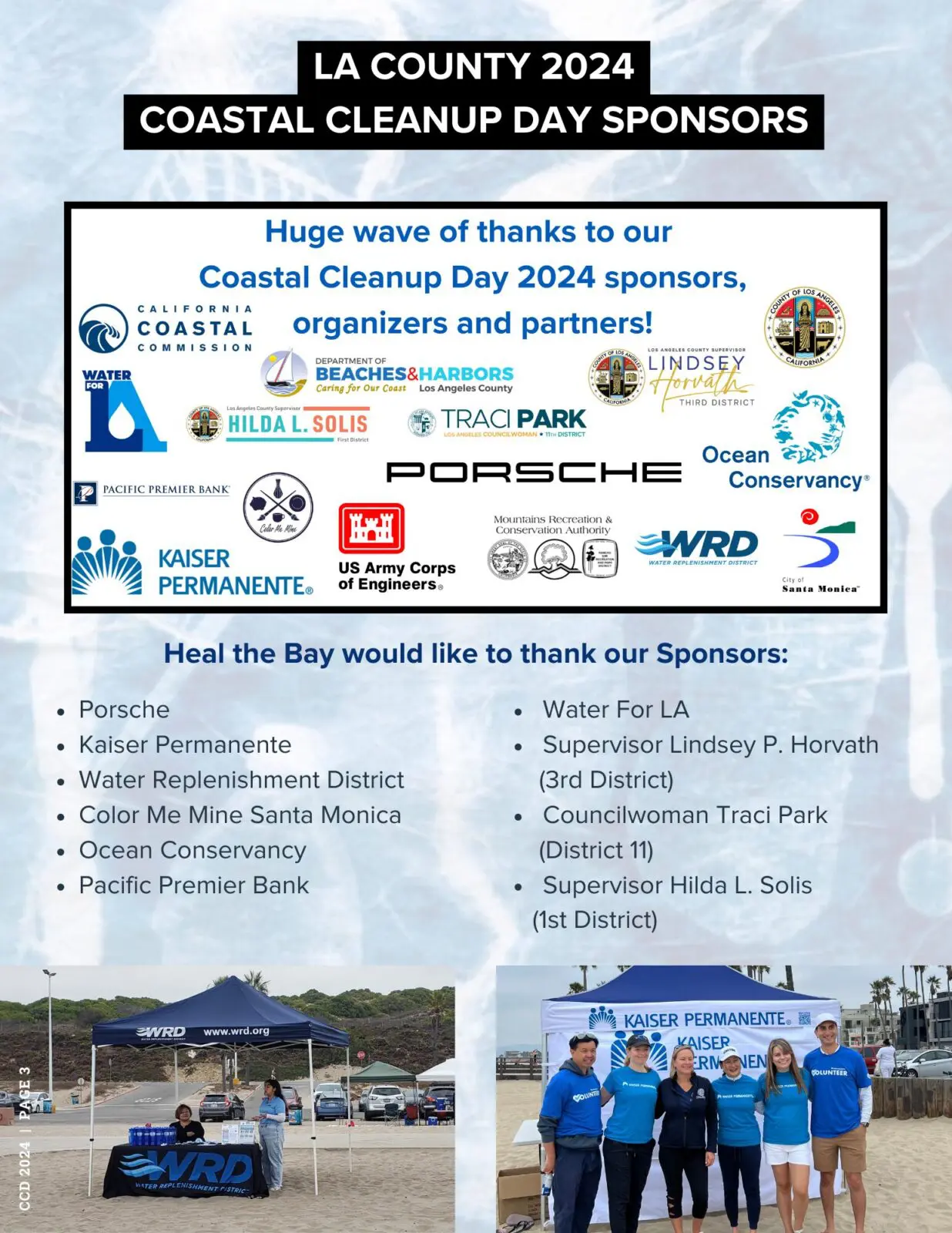
According to the California Coastal Commission, more than 250,000 pounds of trash was removed on the 2024 California Coastal Cleanup Day. The event took place on September 21, 2024, and nearly 29,000 volunteers participated.
Thank you to all who joined Heal the Bay in Los Angeles County on Coastal Cleanup Day 2024, and a special thank you to our 2024 Coastal Cleanup Day Sponsors:
Our South Bay town hall detailed how coastal cities can best protect themselves.
Remnants of a bluff-top apartment building in Pacifica that crumbled to the beach, where rocks form a barrier against the rising sea. (Carolyn Cole / Los Angeles Times).
The ocean is moving in. But unlike most unwanted guests, sea level rise is here to stay.
Because of the carbon emissions already emitted since the Industrial Revolution, sea level rise (SLR) is inevitable in our region. California’s oceans are expected to rise 1 foot by 2050. Although this number may appear small, this rise in sea level will result in devastating impacts – from severe coastal flooding to widespread loss of cherished beaches. But that does not mean all hope is lost. With proper resilience planning at the state and local levels, our region can escape the most cataclysmic effects. But we need to start acting right now.
Tracy Quinn (left), Rosanna Xia (center), and Warren Ontiveros (right) in conversation at Heal the Bay’s Sea Level Rise panel in Hermosa Beach.
That was the stark assessment of panelists gathered Sunday, April 28, for Heal the Bay’s “Rising Tides” town hall at the Hermosa Beach Community Center. Heal the Bay CEO Tracy Quinn moderated a lively conversation with Rosanna Xia, L.A. Times coastal reporter, and Warren Ontiveros, chief planner for L.A. County’s Beach and Harbors division. Hermosa Beach Mayor Justin Massey welcomed the audience.
Xia, author of the acclaimed book “California Against the Sea: Visions for a Vanishing Coastline,” urged policymakers to reframe SLR as an opportunity rather than a disaster. California can mend its “fractured relationship with our shoreline,” she argued, by adopting the mindset of the region’s first settlers. The Chumash, guided by a spirit of balance and reciprocity, looked to care for and heal the shoreline rather than command and control it. Our state has seen rising and falling seas for millennia, Xia noted. Centuries ago, California’s northern Channel Islands formed a single land mass until the Pacific Ocean rose and created five separate islands. The coast is not static, it is always changing.
But today’s challenges are starker given human-made emissions. Melting polar ice caps and increased expansion of water through rising ocean temperatures are the primary SLR drivers.
The California coastline (Allen J. Schaben / Los Angeles Times)
And those rising tides could prove disastrous. California could lose nearly 70% of all beaches and all its wetlands by 2100 if we fail to act. That loss would truly be a doomsday scenario, with 70M annual day visits to beaches annually and $1.3 billion in economic stimulus from the coastal economy.
Ontiveros shared some of the steps the County is taking to build greater resilience to the SLR onslaught. His division has created a scorecard for identifying the two dozen LA County beaches most vulnerable to erosion, flooding, and lack of public access. According to the County, the 10 beaches most at risk, in order of vulnerability, are Zuma, Redondo Beach, Malibu Surfrider, Point Dume, Dockweiler, Dan Blocker, Las Tunas, Topanga, Nicholas Canyon, and Will Rogers.
County engineers are readying several so-called beach nourishment projects to help preserve sand and public access in these threatened sites. In a hybrid mechanical-natural adaptation move, engineers hope to take tons of sand from the deep sea and “transplant” it on the Zuma and Point Dume shorelines. They would use the reclaimed sand to create “living shorelines,” where installed dunes and plant life would retain sand longer and provide natural buffers to flooding. The plans, which face many permitting and logistical challenges, would add 25 feet of sand to these iconic beaches.
Xia then encouraged the audience to think of the shoreline not so much as a place but as a process. Everything is always shifting, she said. Trying to fix straight lines and immovable objects on the shorelines is a fool’s errand.
The panelists agreed that buffering our coast and building resilience will require both engineered concrete solutions, such as relocating highways, and nature-based solutions, such as wetlands restoration, to accommodate increased flooding. Coastal residents will have to accept change. Their neighborhoods and the larger coastline will look different, panelists said.
Gleason Beach realignment bridge construction (Michael Sweeney Photography)
Xia described a recent project in Sonoma County that saw Caltrans rebuild an arterial coastline highway that once snaked along Gleason Beach as an overpass further inland. Underneath the roadway, engineers designed a series of natural buffers and floodplains. Some residents called the new project an eyesore, Xia noted, while others saw it as a boon to a threatened community.
“The ‘my way or the highway’ mentality can’t work,” Xia said. Communities need to compromise and be realistic.
Ontiveros singled out the threatened Cardiff Beach in northern San Diego as an example of residents and planners working together to successfully adapt to rising seas. Nearly five acres of dune habitat have been restored in a multi-benefit project that will help protect a vulnerable section of PCH and increase public access to local beaches.
The Cardiff Living Shorelines Project (Resilient Coastlines)
Xia noted that statewide resilience will be achieved through a series of iterative projects like Cardiff. There will not be one master document that solves all the many challenges in one fell swoop. Planning means envisioning and building continually over decades, where knowledge gained can be applied to the next challenge.
Panelists did not delve into the tricky question of how we find funds to pay for all this resilience work, which could hit $1 trillion statewide by the century’s end. Capitol lawmakers have made more federal funds available as part of a renewed push to protect the nation’s infrastructure.
While legislators and scientists have led the push to battle SLR, Xia urged decision-makers to widen the idea of who is an expert. Indigenous communities and frontline neighborhoods must be part of finding solutions, she said. Ontiveros echoed her comments, noting that millions of inland beachgoers depend on the sea for recreational and therapeutic relief. Hearing from inland communities is critical and will require proactive outreach, he said.
The session ended with thoughts on how everyday residents can best help their communities prepare for the ravages of sea-level rise. Coastal city residents should get involved in local city planning, Xia urged. By 2034, every beachside municipality must submit a Local Coastal Plan to state officials, with SLR vulnerability assessments and resilience recommendations.
To get a copy of Rosanna Xia’s book, please click here.
The only thing our Water Quality Scientists love more than “Safe Clean Water”, is love! Here’s Heal the Bay’s list of the cuddliest spots for couples, friends, first dates, and everything in between, along the local California shoreline.
Forget crowded restaurants and overpriced (environmentally unfriendly) roses: Unveil the perfect Valentine’s Day with sparkling waters and sandy toes! ️
This year, ditch tradition and escape with your someone special to a breathtaking beach paradise right here in Southern California. Picture yourselves strolling along the shore at sunset, the sky ablaze with color. Sounds pretty dreamy, right?
But wait, there’s more! We’re not just talking about beaches. We’ve curated a list of secluded, romantic havens (including beaches, lakes, and rivers) with A+ water quality ratings and positive environmental impacts that will warm the heart and beckon for exploration. No murky waves or questionable cleanliness here – just lovely local waterside wonders perfect for making unforgettable memories. ️
Whether you crave classic California sunsets or romantic river staycations, our list has the perfect destination for your love story, adventure with a friend, or self-love solo escape into the outdoors. So, pack your beach bag, grab your sweetheart, and get ready to dive into a Valentine’s Day unlike any other!
Ready to discover your ideal romantic beach escape? Your next friendly freshwater getaway? The perfect LA lakeside love nest? Scroll down and let the adventure begin!
Note: Many of these beaches contain hikes, PV trails, bike paths and pathways that may have recently closed due to land movement and recent storm events. Please check the Los Angelese County Park and Recreation website before visiting any trails and heed any closure signs.
Here are the top spots we love for love (and their great Beach Report Card water quality grades too!):
Point Dume State Beach and Natural Preserve, Malibu
Source: Heal the Bay MPA Watch Team (https://healthebay.org/mpa/)
What we love about it:Prepare to be mesmerized by two miles of scenic bluff trails at Point Dume State Beach and Nature Preserve. Whether you’re seeking a romantic stroll hand-in-hand or an invigorating hike, these trails offer breathtaking ocean views encircling a Marine Protected Area where wildlife thrives. Parking is a breeze at Point Dume. A conveniently located lot sits right next to the preserve, and additional free parking options are available along Westward Beach Rd. and Grasswood Ave. This accessibility makes Point Dume ideal for beach lovers, hikers, and anyone seeking a nature escape.
What to do here: Embark on diverse hiking trails, each offering unique perspectives. Look out for curious sea lions sunning themselves on the bluffs below, playful dolphins flitting through the waves, and, during their December-April migration, magnificent gray whales breaching in the distance. Witness the thrill of surfers riding the waves on the north side or (when safe to do so) delve deeper into the underwater estuary with snorkeling or scuba diving. Point Dume even caters to adrenaline enthusiasts with its popular rock-climbing spots. Prepare for an abundance of onshore and offshore recreational activities!
Water Quality/Water quality improvement elements: Rest assured, the water quality at Point Dume is pristine. According to our Beach Report Card, it boasts an A+ rating, signifying excellent water quality and guaranteeing a safe environment for swimming, sunbathing, and exploring.
What we love about it:Love knows no bounds, and neither should your Valentine’s Day celebration! Escape the ordinary and head to Ginger Rogers Beach, a cherished haven for Los Angeles’s vibrant LGBTQ+ community since the 1960s. Embrace the ocean breeze on this special stretch of Will Rogers Beach, just 15 miles from West Hollywood. Accessibility is a breeze: convenient parking, a dedicated bike path, and the Santa Monica Blue Bus 9 stopping nearby ensure stress-free arrival. So, ditch the traditional and celebrate your love in a vibrant, welcoming atmosphere where every couple shines just as brightly as the California sun.
What to do here: Proudly stroll hand-in-hand along the shore with laughter echoing amidst volleyball games, and maybe even join one of the spontaneous beachside dance parties this spot is known for as the sun sets. Celebrating “big love” with your whole crew? Don’t forget to take some group selfies at the #Pride Flag Lifeguard Station. Whether you’re seeking sun-kissed relaxation or playful competition, Ginger Rogers Beach offers something for every love story.
Water Quality/Water quality improvement elements:This beach boasted an A+ rating on January 21st, 2024, but check the Beach Report Card app for real-time updates as recent storms may impact water quality. (beachreportcard.org)
Torrey Pines, San Diego
Source: Dan_H, flickr
What we love about it: Torrey Pines State Beach has picturesque views of the San Diego coastline and the adjacent Torrey Pines State Reserve is filled with little trails leading down to the shore. We recommend that you only take marked trails and watch your footing, but the views are worth the adventure.
What to do here: We love the Torrey Pines Trail to Black’s Beach in the morning for a beautiful way to start your day. Fair warning: some nudists like to visit this beach as well.
Water Quality: The only sampling site at Torrey Pines is at the Los Penasquitos Lagoon outlet. That site received good grades in our most recent annual Beach Report Card.
La Jolla, San Diego
Source: Wikipedia Commons
What we love about it: This spot is great for lovers and families alike, with plenty of adventure to be had by all ages.
What to do here: This is the perfect spot for a SUP (stand-up paddleboard) adventure, snorkeling, kayaking, or even just a picturesque walk along the beach. For stunning ocean views over dinner, check out the Marine Room at the La Jolla Beach and Tennis Club.
Water Quality: La Jolla Shores received great grades in our annual report last year.
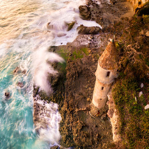
Victoria Beach, Orange County
Source: Daniel Peckham, Flickr
What we love about it: Straight out of a fairy tale, this shoreline spot is guarded by La Tour, a 60-foot castle-inspired tower. Built in 1926, the structure provided beach access for a home on the cliff above.
What to do here: Looking to be someone’s knight in shining armor? Look no further. To get here, walk to the north end of Victoria Beach in Laguna Beach, around the bluff, and past another sandy section of beach. (This is a privately owned structure, so while you can walk up to it, please do not try to go inside or climb on the structure.)
Water Quality: Victoria Beach received A+’s across the board in our last annual report.
Crystal Cove State Park, Orange County
Source: Wikipedia Commons
What we love about it: With such a long swath of open sandy shores, this is an ideal spot for a romantic seaside stroll, or perhaps for a love-inspired photoshoot.
What to do here: If you’re looking for post-beach walk eats with an ocean view, the Beachcomber Café is a fun option.
Water Quality: Crystal Cove has great water quality in the summer or whenever the weather has been dry. Given the buckets of rain we have (thankfully) gotten this year, make sure to heed any beach posting signs you may see.
Palos Verdes Peninsula, Los Angeles
Source: Mark Esguerra, The Marke’s World
What we love about it: We love the PV areas so much, that we had to lump the whole peninsula together as one of our top locations. Palos Verdes wraps around from the base of the South Bay down to San Pedro and features beautiful neighborhoods, coastal trails, clean beaches, and tidepool adventures.
What to do here:For those seeking marine biology-inspired adventures, plan your visit during low tide to explore the tidepools at Abalone Cove. For a scenic hike and a secluded rocky beach, don’t miss Palos Verdes Bluff Cove.
Water Quality: Seeking a beach escape with guaranteed sparkling waters? Look no further than Abalone Cove Shoreline Park, a jewel nestled within the Palos Verdes Peninsula. Not only is Abalone Cove recognized as an Honor Roll beach, signifying top-notch amenities and impeccable upkeep, but the entire Palos Verdes Peninsula boasts an A+ rating on our Beach Report Card, assuring pristine water quality for swimming, sunbathing, and creating unforgettable memories.
El Matador State Beach, Malibu
Source: Elliot McGucken, 500px
What we love about it: El Matador Beach is characterized by dramatic cliffs, hidden coves, and even secret sea caves, evoking the atmosphere of a Hollywood romance scene. Whether you’re igniting a new flame or spending time with a longtime partner, El Matador is sure to kindle your passion. Keep in mind that accessing the beach requires descending stairs.
What to do here: Explore the dramatic landscape, take Instagram-worthy photos, find little hideaway spots for you and your date to share secret kisses, and wrap up your evening with a gorgeous sunset view. Please note that parking can cause a little heartache as spaces are limited.
Water Quality: Beyond the captivating rock formations and breathtaking scenery, El Matador Beach boasts another hidden gem: impeccably clean, A+-rated water quality. As recognized by our Beach Report Card, this Honor Roll beach guarantees safe, clean, sparkling waves perfect for a day at the beach.
Arroyo Burro, Santa Barbara
Source: Damian Gadal, flickr
What we love about it: Santa Barbara is the perfect little getaway for a weekend of romance. If you’re looking for some time together to rest, rejuvenate, and rekindle the fire, Santa Barbara is the perfect place.
What to do here: We love Arroyo Burro for a sunset walk, and with plenty of parking and restroom access it’s a stress-free beach walk experience.
Water Quality: Arroyo Burro has great water quality in the summer or whenever it has been dry enough that the creek hasn’t been breached. Make sure to heed any beach posting signs you may see if you’re feeling like taking a dip. But if the creek is flowing, be sure to stick to the sand over the waves.
Freshwater Sites
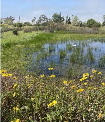
Madrona Marsh, Torrance
Source Safe Clean Water Team (https://healthebay.org/safecleanwater/)
What we love about it: More than just a mall neighbor, Madrona Marsh is a vibrant ecosystem thriving in the heart of Torrance. This beautiful seasonal wetland boasts unique vernal pools teeming with diverse life, from fascinating birds and insects to curious animals and aquatic wonders. Escape the hustle and bustle by venturing onto the multiple trails that weave through the pools and wetlands, immersing yourself in nature’s tranquility.
What to do here: It’s a wonderful place to take a walk with a loved one and enjoy nature. Slow down, soak in the vibrant hues of California poppies and sunflowers and become captivated by the symphony of birdsong. Let the serenity of the marsh wash over you as you reconnect with nature and each other.
Water Quality/Water quality improvement elements: Beyond its beauty, Madrona Marsh plays a vital role in environmental sustainability. The marsh uses nature-based solutions to treat stormwater from the surrounding neighborhood! Water is pumped into a modular wetland system where it is cleaned using a pre-filtration chamber, biofiltration with vetiver (a non-invasive perennial grass) that removes pollutants, and then the filtered water is pumped to wetlands at the marsh.
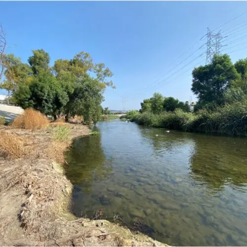
L.A. River at Benedict St. in Frogtown, Los Angeles
2023 Heal the Bay Stream Team
What we love about it: No need to kiss this frog to turn it into the “prince” of Valentine’s Day destinations. Frogtown, nestled between the bustling I-5 and the vibrant LA River, is a vibrant neighborhood. Chic outdoor cafes beckon with the aroma of freshly brewed coffee, perfect for cozy hand-holding moments. Imagine the gentle murmur of conversation blending with the soft city breeze, setting the stage for an unforgettable date. (Heal the Bay would like to acknowledge that gentrification has taken place here and would like to pay respect to the original neighborhood landmarks and communities).
What to do here: Embark on a hand-in-hand adventure along the picturesque LA River Greenway Trail. Cycle leisurely side-by-side, weaving through sun-dappled paths and enjoying the refreshing green spaces. If a slower pace beckons, find a quiet spot by the river’s edge, to sip a coffee from a nearby cafe and watch the water flow serenely next to your loved one. we advise against entering the water right now and outside of the open recreation season (May-Sept), but the scenic backdrop guarantees a picture-perfect memory.
Water Quality/Water quality improvement elements:During the 2023 summer Stream season, the L.A. River at Benedict St. achieved an impressive A+ rating on the River Report Card, confirming its excellent water quality permitted recreational activities during designated open seasons.
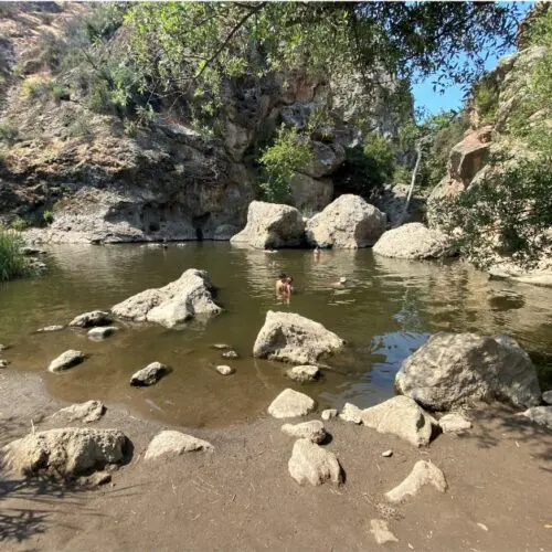
Rock Pool, Malibu Creek State Park
Source: 2023 Heal the Bay Stream Team (https://healthebay.org/2023-water-quality-successes-river-report-card-upgrade-and-summer-stream-team/)
What we love about it: Nestled roughly 1.5 miles from the parking lot, the journey itself to Rock Pool is a shared adventure. Prepare to be mesmerized by the picturesque surroundings – towering trees and lush greenery frame the crystal-clear waters. Trust us, the entrance fee is completely worth it.
What to do here: The swimming hole at this location is of considerable depth, perfect for a refreshing dip after a lengthy hike. After an exhilarating dip, spread out a cozy picnic under the shade of the trees or simply relax and dip your feet in the water.
Water Quality/Water quality improvement elements: This natural haven earned an A+ on the 2023 Summer River Report Card, signifying excellent water quality, guaranteeing a refreshing and safe escape for your love story.
Parks
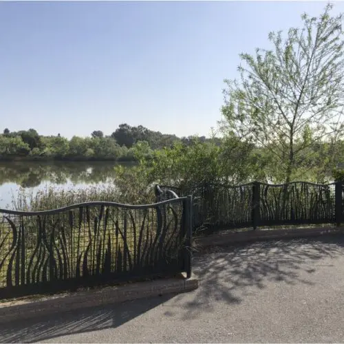
Machado Lake in Ken Malloy Regional Park, Harbor City
Source: Safe Clean Water Team (https://healthebay.org/safecleanwater/)
What we love about it: This natural lake isn’t just a body of water; it’s a vibrant ecological hub and a haven for recreation within the sprawling Ken Malloy Harbor Regional Park. This impressive park, one of the largest in Los Angeles, boasts a remarkable diversity of habitats, including Machado Lake itself, a seasonal freshwater marsh, a thriving riparian woodland, and even a nonnative grassland.
What to do here: Imagine your children giggling on the play structures, laughter filling the air during a family picnic at the designated tables, or the thrill of spotting diverse wildlife species. Fishing enthusiasts can try their luck with catch-and-release fishing, adding to the diverse activities available. You might even hear whispers of Reggie, the resident alligator who once called the lake home (trust us, Google him – you won’t be disappointed!).
Water Quality/Water quality improvement elements: Thanks to renovations originally funded by Prop O and other initiatives, the lake’s water treatment systems were revitalized to effectively remove pollutants like trash, bacteria, and even oil and grease. Now, thanks to the Safe, Clean Water Program, regular upkeep ensures the continued health of this vital ecosystem.
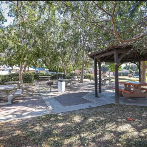
Ladera Park, Los Angeles
Source: https://parks.lacounty.gov/ladera-park/
What we love about it:More than just a park, Ladera is a testament to sustainable practices and community connection where you can make a love connection. Thanks to funding from the Safe, Clean Water Program, this park has implemented smart solutions (like infiltration wells) to capture and permeate stormwater and non-stormwater runoff, ensuring a healthier environment for everyone. Here rainwater nourishes native plants instead of flowing into polluted waterways. Stroll hand-in-hand with your favorite environmentalist through paths marked with educational signage or enjoy lunch in this living classroom for visitors of all ages. The perfect outdoor date for those committed to each other, and sustainability.
What to do here: This park has it all – areas for parties and barbeques, playgrounds, sports areas, walking paths, and lots of large sycamore trees. Wildlife abounds and there are frequently western bluebirds, hawks, and more.
Water Quality/Water quality improvement elements: The impact goes beyond the park’s boundaries. By capturing and treating over half a million gallons of stormwater annually, Ladera Park significantly reduces harmful pollutants like bacteria and metals from entering nearby waterways. This contributes to a cleaner Centinela Creek, Ballona Creek, and ultimately, the ocean, benefiting countless species and the entire community.
Heal the Bay’s Beach Report Card is the only comprehensive analysis of coastline water quality in California. We grade more than 700 beaches weekly from Oregon to the Mexico border, assigning an A to F grade based on the health risks of swimming or surfing at that location.
Special thanks to the romantics on our Science, Outreach, and Water Quality Team:
Dr. Katherine Pease, Science, and Policy Director;Dr. Alison Xunyi Wu, Water Quality Data Specialist;Dr. Tania Pineda-Enriquez, Water Quality Data and Policy Associate Specialist;Nancy Shrodes, Senior Watershed Specialist, South Santa Monica Bay; Jillian Marshall, Communications Manager; and Leslie Griffin, former chief water quality scientist Heal the Bay.
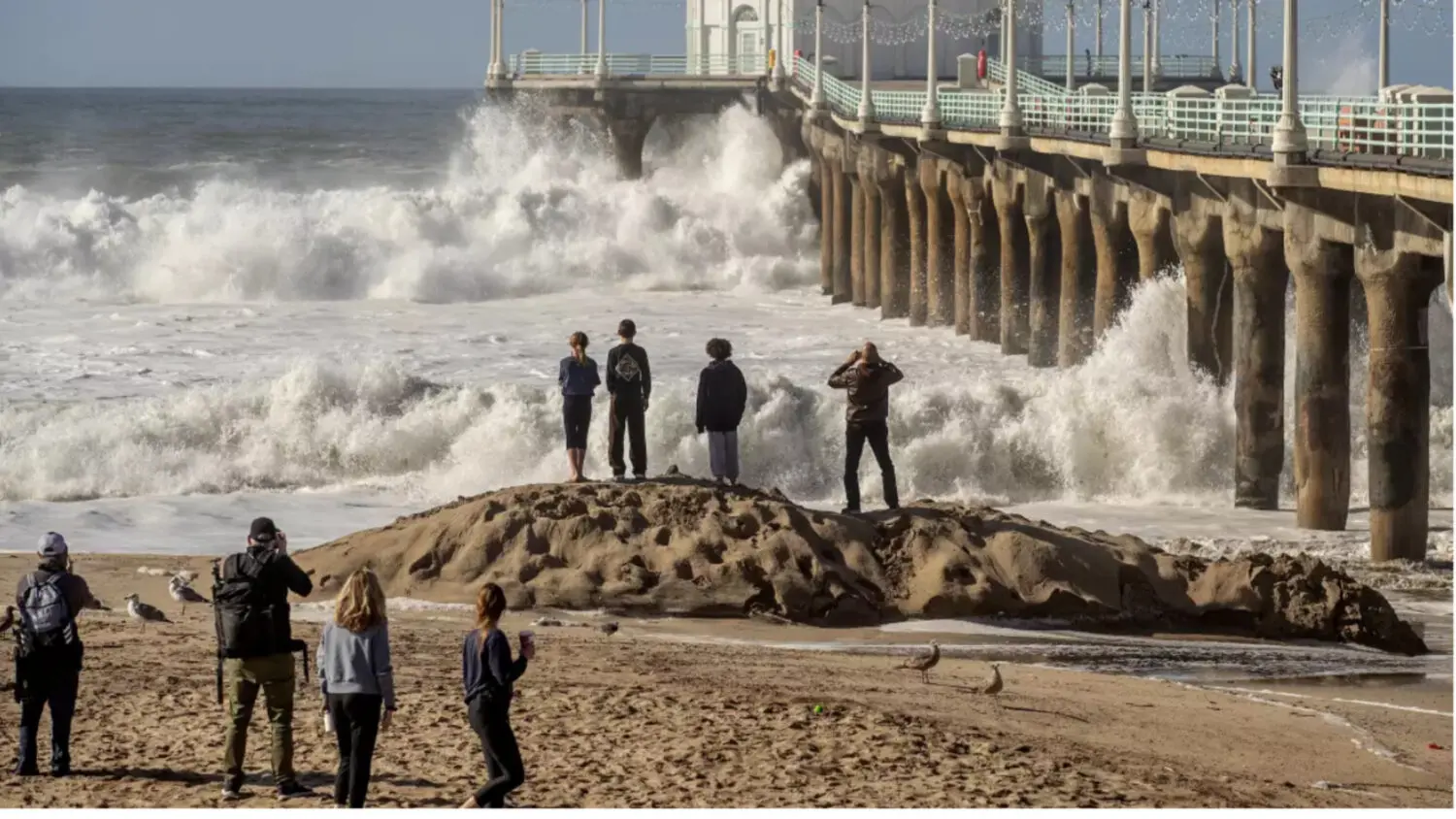
“Large waves at the Manhattan Beach Pier draw onlookers on Saturday. The pier was closed to the public due to the high surf.” (Mel Melcon / Los Angeles Times)
Waves of Waves in a Future of Climate Change
From the Desk of Meredith McCarthy, Director of Campaigns & Outreach and a Heal the Bay leader for over 20 years.
With almost macabre curiosity my boys and I head to Manhattan Beach last week to get a peek at the recent monster swell and watch the “gnarly” waves roll into Santa Monica Bay. I try to see the 10-foot sets through their eyes. The waves pound the beleaguered shoreline, a rolling thunder, an epic echo of Mother Nature’s raw power. The crunching swell is a formidable challenge for surfers struggling to paddle out. But as countless YouTube Nazare videos have shown, big waves are a challenge that can be tamed by humans.
LA Times image: A person standing on a sand berm watches as high surf breaks near Manhattan Beach on Thursday. The National Weather Service has issued high surf warnings for much of the West Coast and parts of Hawaii, describing the waves and rip currents expected to hit certain coastlines as potentially dangerous and life-threatening. (Richard Vogel / Associated Press)
I want to cling to the surfer’s narrative that these waves are gifts, a rare occurrence to be treasured. But the recent swell demonstrates that these waves are as much to be feared as cherished.
They are a preview of the future ahead of us and a reminder that a disaster can happen over decades, not just seconds. And they beg the question: can we ever really tame these waves?
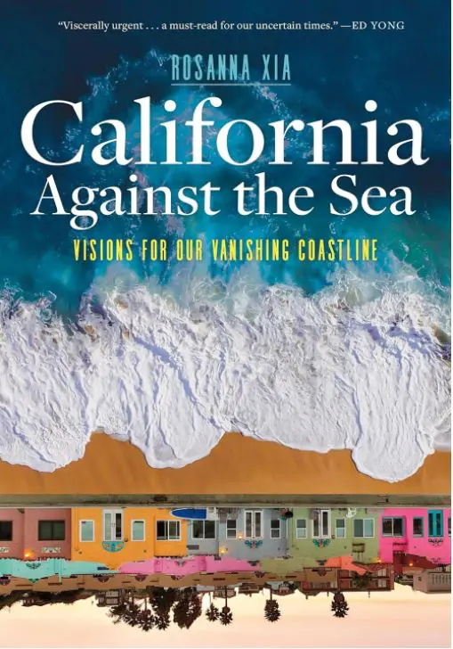
Rosanna Xia’s new book “California Against the Sea” opened my eyes as to why escalating impacts of climate change are intricately linked to the heightened severity of winter storms in the North Pacific, setting the stage for profound and harmful impacts to our beloved coast. (Purchase the book locally at Diesel Bookstore)
During my 20 years at Heal the Bay, protecting what you love has been our mantra. That mission will be harder to meet in the years to come. This recent swell is just one small harbinger of the many challenges ahead.
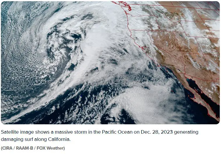
The connection lies in the intricate dance between climate change and the dynamics of these storms. Warmer oceans provide the necessary energy for storms to intensify, amplifying wind speeds and precipitation rates. This, in turn, translates into more powerful and potentially devastating winter storms.
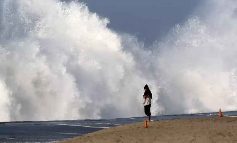
The implications for coastal areas, such as Santa Monica Bay, extend beyond the immediate visual spectacle of towering waves. We all were held in awe and fear as we clicked on videos of eight people being toppled over by a rogue wave in Ventura and winding up in the hospital.
The increased storm intensity poses a dual threat: First, the potential for more severe storm surges that can inundate coastal communities, and second, the exacerbation of sea level rise. As ice continues to melt and ocean temperatures climb, sea levels rise accordingly. The cumulative effect is a compounding threat to coastal communities and the regional economies they support.
The huge surf becomes a symbol not just of the immediate dangers but of a broader trend — one that demands strategic foresight and effective management. Addressing the impacts of climate change requires a holistic approach that encompasses significant efforts to reduce greenhouse gas emissions and adaptation strategies to safeguard vulnerable coastal areas.
It can seem hopeless sometimes, but I look at my kids staring at the towering waves crashing on the sand. I wonder if they can hear the ticking of a time bomb amid the roar of the sea. I know we must act, take one small step and then bigger ones, facing this challenge head on.
Like our volunteers, the way to keep our legs under us is to rise each day in services of positive action. Our Heal the Bay volunteers are the village we rely upon to realize our mission – check out one of the opportunities below:
Become a Heal the Bay Volunteer – Orientation (Jan 11, 6p-8p): Take the first step toward helping Heal the Bay work for safe, healthy, clean coastal waters and watersheds. Come to our in-person Volunteer Orientation at Heal the Bay Aquarium.
Participate in the next King Tide’s Project on January 11 & 12, 2024, & February 9, 2024: The California King Tides Project helps us visualize future sea level by observing the highest tides of today. You can help by taking and sharing photos of the shoreline during King Tides to create a record of changes to our coast and estuaries. Observe and document King Tides on your own or join a scheduled group event.
Los Angeles King Tide Watch 2024 will be held at Manhattan Beach Pier – Jan. 12, 8:30-9:30am at Roundhouse Aquarium. Join nature enthusiasts and scientists to document the King Tide of 2024 at the base of the Manhattan Beach Pier. More information and RSVP
Join our January Beach Cleanup (Jan 20, 10 Am – 12 PM): Heal the Bay hosts cleanups every 3rd Saturday of the month (rain or shine)! This January’s storms are sure to make a mess of our beaches so kick-off your New Year’s Resolution by attending the next “Nothin’ But Sand Beach Cleanup” on January 20, 2024, at Tower 2, Zuma Beach, 10 am – 12 pm.Register today to reserve your bucket.
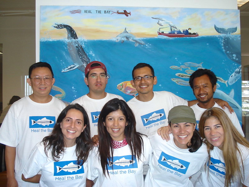
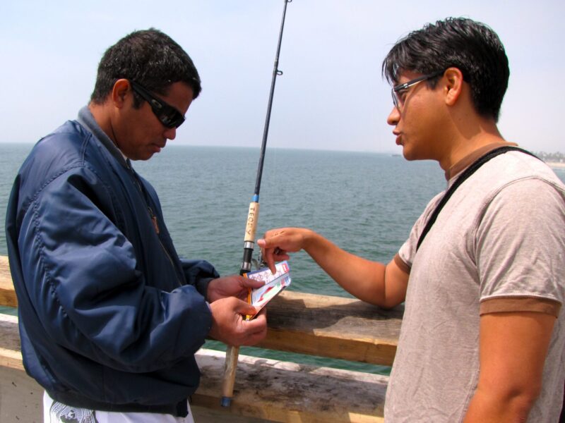
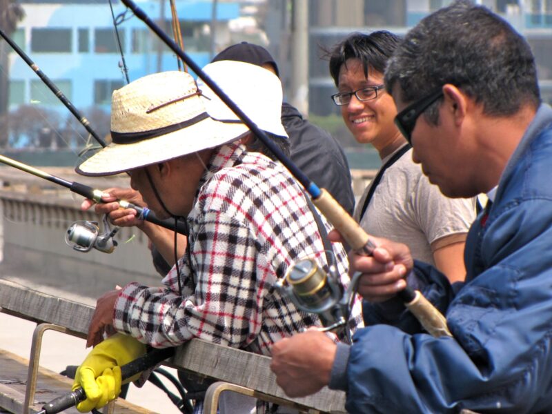
Heal the Bay’s Angler Outreach Program Manager, Frankie Orrala, shares the program’s positive impacts and successes from over the last 20 years.
Heal the Bay’s Angler Outreach Program (AOP) is celebrating 20 years! This program is designed to educate pier and shore anglers in Los Angeles and Orange County about the risks of consuming fish contaminated with toxins such as dichloro-diphenyl-trichloroethane (DDT) and polychlorinated biphenyls (PCBs). Created in 2003, AOP is a component of the Fish Contamination Education Collaboration (FCEC) and managed by the US Environmental Protection Agency (EPA) as part of a far-reaching public education and outreach program. Notably, the program also works in association with federal and state agencies as well as local community organizations.
The FCEC was established to address a major contamination site (aka Superfund site) off the coast of Los Angeles, along the Palos Verdes shelf. DDT and PCBs were historically discharged into the ocean near the Palos Verdes Peninsula, pollution which still exists in the sediment today. These toxins can travel through the food chain into fish and potentially have negative impacts on human health if the fish are eaten; certain species of fish and certain areas are more likely to be contaminated.
The goal of the AOP is to educate anglers about this contamination and share which fish should be avoided. During visits to different piers in Southern California, Heal the Bay’s educational team has interacted with diverse fishing communities and outreach is conducted in multiple languages. Heal the Bay is proud to have a team of bilingual staff who have educated Southern California pier anglers in multiple languages, including: Spanish, Chinese, Tagalog, Vietnamese, Khmer and Russian.
Since its inception 20 years ago, Heal the Bay’s AOP team has educated more than 190,000 pier anglers. Along the way, we have heard many stories and learned a lot about the people who frequently fish on our local piers. We appreciate these anglers and the knowledge and experiences they share with us.
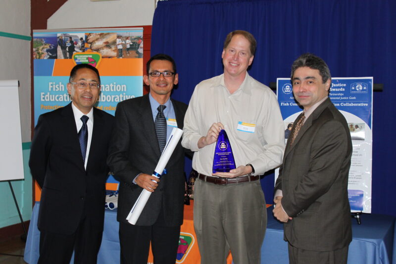
Awards Received at the National Level
In 2009, the EPA presented two prestigious awards to the Fish Contamination Education Collaborative. FCEC was recognized for its work to protect the most vulnerable populations in Southern California from the health risks of consuming fish contaminated with DDT and PCBs; the other award was given to Heal the Bay and all FCEC partners in Los Angeles for Achievement in Environmental Justice.
On behalf of the AOP and Heal the Bay, I traveled to Washington D.C. to receive the distinguished award in recognition of Citizen Excellence in Community Involvement. This award is presented annually to an individual or community group working with a Superfund team for outstanding achievements in the field of environmental protection.
Heal the Bay was thrilled to be selected to present to the FCEC among other national projects. The recognition was significant as it confirmed Heal the Bay’s work is truly protecting the health of all people, especially communities with economic and social disadvantages.
2009 Award Winner: Frankie Orrala of Heal the Bay receiving the Citizen Excellence in Community Involvement and Environmental Justice Achievement Awards
In addition to accepting this award in Washington D.C, in 2009, I traveled to Ecuador in South America, along with scientists from the National Fisheries Institute (Instituto Nacional de Pesca) as well as professors, researchers and students from the University of Guayaquil. We came together to talk about FCEC’s efforts to monitor pollution and educate the public about its effect on human and environmental health.
The international interest our program receives is an honor; the AOP team is busy building on these relationships and with more communities as they are facing similar problems as Southern California.
Continuing to advance environmental justice is a critical objective of our work. Moving forward, Heal the Bay’s AOP program remains committed to educating and protecting chronically underserved populations in the region, many of whom are exposed to higher rates of pollution compared to the general population.
In closing, there are many reasons for the AOP team’s continued success, from our great team members to the communities we work with, to the experts who are providing us with advice. All of it wouldn’t be possible without Heal the Bay’s dedicated supporters and for that we say THANK YOU!
To learn more about our program, visit www.pvsfish.org and if you want to join our bilingual team call us at 310-451-1500 or visit our site at www.healthebay.org
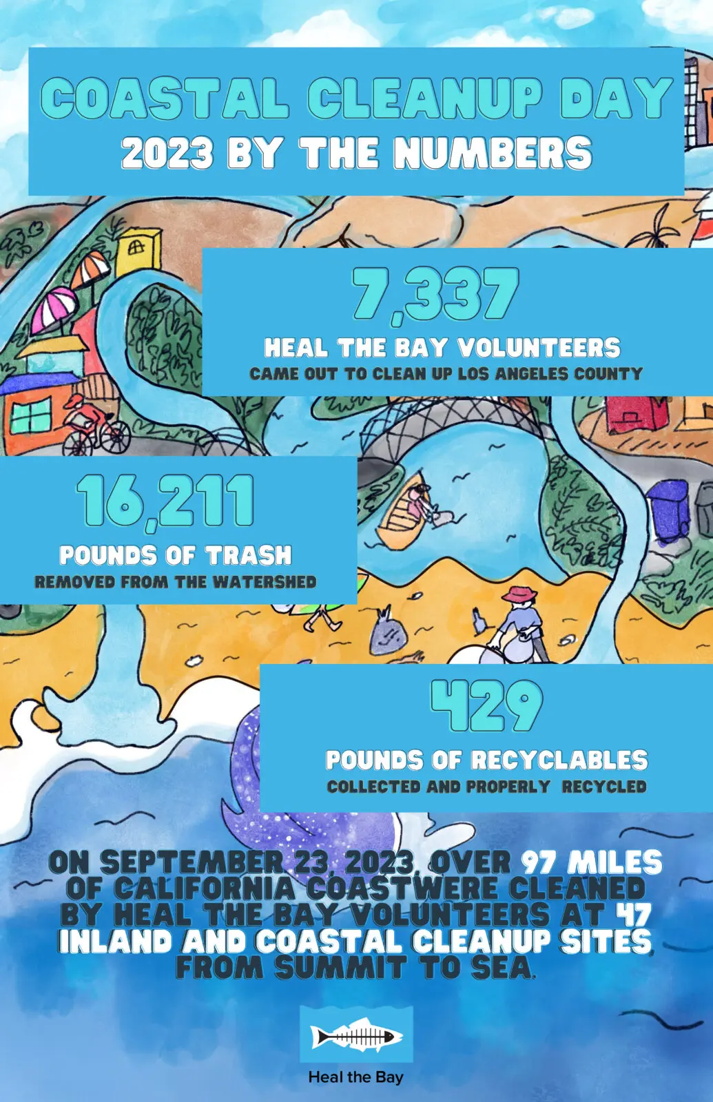
Those volunteers picked up 126,605 pounds of trash at cleanup sites all along California.
An additional 7,041 pounds of recyclable materials were collected.
A total of 133,645 pounds or 67 tons of refuse were removed from watersheds all over California.
Thank you to all who joined Heal the Bay in Los Angeles County on Coastal Cleanup Day 2023, and a special thank you to our 2023 Coastal Cleanup Day Sponsors:
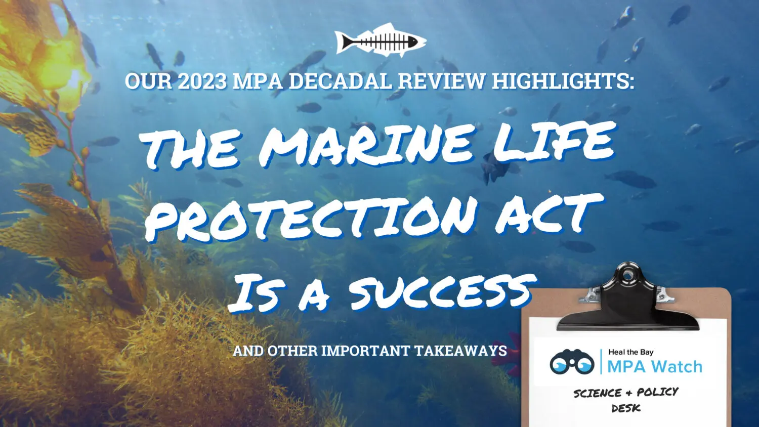
After a decade of volunteer surveys and scientific review, we now know that Marine Protected Areas are working, but inclusivity and climate resiliency must be considered to ensure the full benefits of these precious sanctuaries for all.
Nearly 24 years ago, the state of California passed the Marine Life Protection Act (MLPA), forever changing the course of marine conservation in our coastal state. Following an arduous community centered process, California established a globally recognized network of 124 marine protected areas, or MPAs. These MPAs, which run up and down our nearly 1,000-mile coastline in varying degrees of protection, limit certain consumptive human behaviors like fishing and collecting tidepool animals in an effort to protect and restore biodiversity and coastal resources.
(Above) Heal the Bay Marine Protected Area Watch Volunteers completing MPA Survey Training at Point Dume, California.
After California instituted these Marine Protected Areas, there was an immediate need to establish a successful management program and a system to refine or adapt MPA Network over time based on both ecosystem and human data. The state built an adaptive management program, requiring a review of our MPA network every ten years.
Now, a decade after the final MPA was put into place, the very first California MPA Decadal Management Review (DMR) is underway. Led by the California Department of Fish and Wildlife (CDFW) and California Fish and Game Commission (FGC), this review process looks at the four managing pillars of MPAs: research and monitoring, education and outreach, policy and permitting, and enforcement and compliance. For more info on the DMR process, check out our blog from last year.
How is this highly anticipated Decadal Management Review going? In mid-March, Heal the Bay’s MPA team traveled to Monterey along with activists, researchers, Tribal members, Tribal elders, enforcement officers, anglers, and community members to attend three days of MPA management review. We heard from MPA managers, Fish and Game Commissioners, Indigenous leaders, scientists, and many others through a series of meetings, panels, and open forums.
Here are our top four take-aways from California’s FIRST MPA Decadal Review thus far:
California’s MPAs are working. Long-term monitoring shows that, at least for highly fished species in certain areas, MPAs are supporting larger and more abundant fish compared to reference sites that are not protected. Further, modeling across the central coast showed connectivity and spillover, indicating that MPAs are behaving as designed (i.e., as a network) and that benefits are seen even outside and across MPAs. While there is still much more research to be done, these initial results are incredibly promising, and we expect these positive outcomes to increase with time.
Indigenous people must be elevated to MPA leadership positions. The Indigenous nations of our coastline have been and continue to be the original stewards of this land. They have cared for coastal ecosystems since time immemorial and their knowledge and perspectives are necessary components in managing and evaluating our MPAs. Unfortunately, Indigenous nations and people were largely excluded from the original MPA designation process. Heal the Bay supports the requests made by Tribal members for expanded access to the coastline and to be elevated to positions of leadership within the MPA management system. Access to the coast and all it has to offer must be expanded for all Indigenous people.
Future MPA management MUST prioritize climate resiliency. We are in the midst of unprecedented climate disruption, not only on land but in our marine and coastal ecosystems. California’s network of MPAs presents a unique opportunity to evaluate the climate resiliency potential of MPAs against climate stressors like increased temperature, increased acidity, rising sea levels, changing tides and storm surges, increased erosion, and decreased oxygen. Heal the Bay would like to see the future of MPA monitoring include climate resilience metrics.
MPA monitoring and research needs to broaden in scope. While the level of MPA research that has been conducted over the past 10 years is nothing short of impressive, there are areas where the state can do so much more. For example, long-term monitoring of MPAs should utilize innovative research tools like environmental DNA (eDNA) to measure biodiversity trends in space and time. Analysis of biological data must be expanded to compare the different types of MPAs in the network to assess how effective different levels of protection are. Finally, there are opportunities and a need to better analyze compliance, or how well people are following MPA regulations, to give us the full picture of MPA effectiveness. Heal the Bay is advocating for these expanded monitoring priorities to improve our understanding and management of MPAs overall.
(Above) Emily Parker, Coastal and Marine Scientist, and Crystal Barajas, Senior Community Science & Outreach Coordinator, represented Heal the Bay at the March 2023 Decadal Management Review Forum in Monterey, California.
At the meetings in Monterey, Heal the Bay advocated for the inclusion of Indigenous leadership, the prioritization of climate resiliency, and the broadening of MPA research in an oral testimony to the FGC Marine Resources Committee and submitted these suggestions via a written comment letter. We will continue this advocacy in future FGC meetings and as we meet with agencies, collaborate with partners and stakeholders, and engage the public.
California’s network of MPAs is still young. It will take more time and improved protection and management to see the maximum benefit for biodiversity. To see those benefits, the MPA network must remain intact and protections must, at the very least, remain as strong as they currently are. This first glimpse of our MPA,s success is incredibly exciting, and we can’t wait to see what 10 more years of MPAs bring.
Less than 10% of all plastic ever produced has been recycled.
This Plastic-Free July, Reuse Is a Right. Learn why expanding reusable systems is key to reducing plastic pollution, then take action by signing our petition urging LA leaders to support a reusable future for Los Angeles.