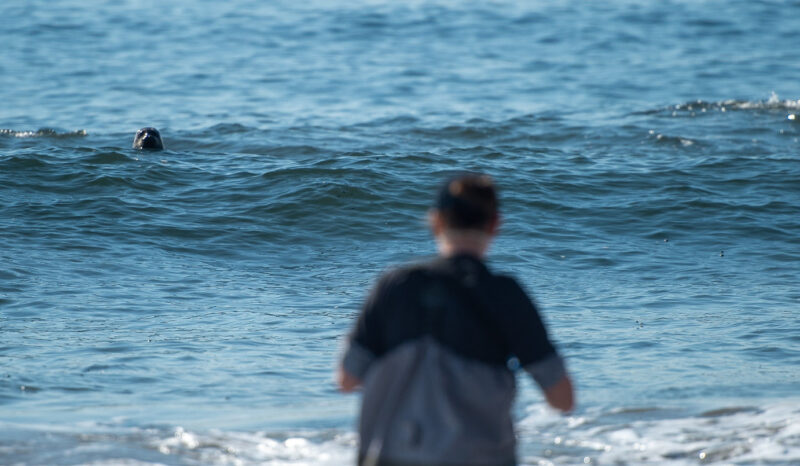
A single exposure to water contaminated with bacterial pollution can lead to illnesses, including rashes, ear infections, respiratory illness, and gastrointestinal symptoms. At Heal the Bay, we believe no one should get sick from a day at the beach or along a river, which is why our Beach Report Card and River Report Card translate bacterial monitoring data into simple A–F grades that help the public understand when and where it is safe to recreate. A and B grades represent generally safe-to-swim conditions, while C, D, and F grades indicate increased risk of illness. For more than 36 years these reports have been the gold standard for annual water quality monitoring.
Weekly water quality grades, available on our app and website, help residents and visitors make informed, real-time decisions about where it is safe to enjoy the water.
For deeper analysis, our annual reports provide a broader look at long-term trends. This allows us to highlight beaches and freshwater recreation areas that consistently support safe recreation and allows us to identify pollution hotspots where problems persist and action is needed.
See below for the annual grades and important insights from these reports.
The latest annual reports highlight three major statewide water quality trends:
California’s water quality remained generally strong last year, but wetter conditions and urban runoff led to slight declines. The 2025-2026 Beach Report Card found that 91% of beaches still earned A or B grades during summer dry weather, though wet-weather grades dropped statewide during storms. The 2025 River Report Card revealed similar declines in urban stretches of the L.A. River compared to the previous year.
Where you are matters; location and surrounding land use play a major role in water quality. Southern California saw some of the largest declines, as increased rainfall and stormwater runoff carried more pollution onto beaches and waterways. Freshwater quality was strongest in open-space upper watersheds but declined as waterways moved through more urbanized areas.
Persistent pollution hotspots continue to reveal long-term infrastructure challenges. Many of the same pollution trouble spots identified in previous years reappeared in this year’s reports, underscoring ongoing water quality issues tied to polluted runoff, low-flow conditions, and aging systems across both coastal and freshwater environments.
About the Reports
What are the Beach and River Report Cards?
Heal the Bay’s 36th annual Beach Report Card and 8th annual River Report Card take a deep dive into bacterial pollution trends at more than 700 beaches along the Pacific Coast and 35 freshwater sites in Los Angeles.
Each site gets an annual letter grade from A to F based on how much fecal indicator bacteria is found in the water during each testing season (summer dry weather, winter dry weather, and annual wet weather). The bacteria come from stormwater runoff, failing sewage systems, or other pollution, and they can cause illnesses like stomach flu, ear infections, upper-respiratory infections, and rashes. In short: The lower the letter grade, the higher the risk of getting sick.
All county health departments in California are required to test beach water quality samples for three types of indicator bacteria at least once a week during the summer season. Many counties also monitor heavily used beaches year-round. Heal the Bay compiles and analyzes the data to produce the annual Beach Report Card.
Freshwater sites don’t have the same monitoring requirements, so Heal the Bay deploys its own scientists with the Stream Team — students trained in field and lab techniques — and works with other local groups and municipalities to collect and analyze samples throughout the summer (May to September).
Bummers and Fails
Beaches and rivers that are chronic pollution hotspots
2025–2026 Beach Bummers
The Beach Report Card’s annual Beach Bummer list identifies the ten beaches with the poorest Summer Dry grades in California. Rankings for last year once again identified beaches impacted by storm drains, enclosed circulation patterns, and chronic problems with wastewater discharges and urban runoff.
6 of the 10 Beach Bummer sites were in San Mateo County, many within enclosed harbor or lagoon systems where limited circulation contributes to chronic bacteria problems. Beaches impacted by storm drains also continued to dominate the list.
Playa Blanca and the Tijuana Slough at the Tijuana River Mouth remain heavily affected by ongoing transboundary wastewater pollution originating from Baja California. Efforts are underway on both sides of the border to reduce sewage flows at the source and strengthen wastewater treatment and infrastructure to improve water quality over time.
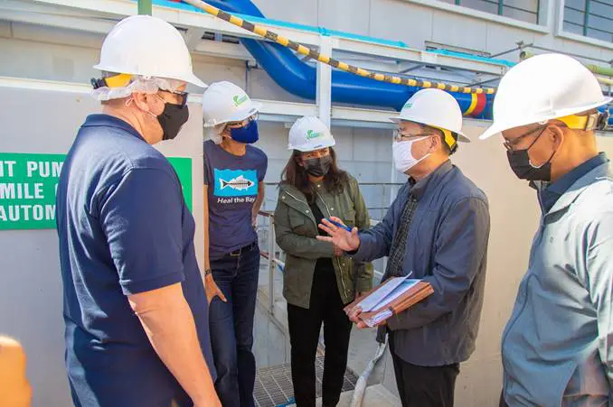
The Santa Monica Pier continues to rank among California’s most polluted beaches during dry weather conditions. Heal the Bay is actively investigating bacteria pollution sources near the Pier through the Santa Monica Pier Task Force in partnership with the City of Santa Monica. For ongoing updates on this work, follow Heal the Bay.
2025 River Report Card Freshwater Fails
The River Report Card similarly identified recurring freshwater pollution hotspots concentrated in urbanized downstream sections of the L.A. River watershed. The Freshwater Fails list identifies freshwater recreation areas with the poorest annual water quality grades.
As watersheds transition into more developed areas, water quality conditions become more variable and begin to decline. In 2025, these areas also showed greater week-to-week variability, likely reflecting a mix of dry-weather urban runoff and, in some locations, possible localized post-fire impacts from the January 2025 Eaton Fire, underscoring how sensitive water quality is to both land use and short-term pollution events.
This downstream trend continues into heavily urbanized areas, where water quality is consistently lowest and chronic bacteria pollution persists. Sites in the Lower L.A. River watershed regularly show elevated bacteria levels and repeated exceedances year after year, reflecting the combined pressures of dense development and polluted runoff.
The Honor Roll
Beaches and rivers with excellent water quality
Despite statewide challenges, several beaches and freshwater recreation areas earned top marks for consistently excellent water quality.
2025–2026 Beach Report Card Honor Roll
To earn Honor Roll status for the Beach Report Card, a beach must receive A+ grades during Summer Dry, Winter Dry, and Wet Weather conditions while being monitored year-round. This year, only 21 beaches earned a spot on the Honor Roll, down significantly from 62 beaches last year. Southern California beaches again dominated the Honor Roll, particularly in Orange and San Diego Counties.
2025 River Report Card Honor Roll
The River Report Card Honor Roll recognizes freshwater recreation areas with consistently excellent annual water quality and bacteria levels well below public health thresholds. Most Honor Roll freshwater sites are in upper watershed areas surrounded by natural landscapes and lower levels of urban development.
Tips to stay safe around beaches and rivers
Heal the Bay recommends taking a few simple precautions before entering recreational waters:
Avoid swimming at least 72 hours after rainfall
Stay away from storm drains, river outlets, and enclosed stagnant waters
Always check water quality conditions before you go using the Beach Report Card app or River Report Card website.
For 36 years, Heal the Bay’s Beach Report Card has evaluated fecal indicator bacteria levels at hundreds of beaches across the West Coast, from Washington State to Baja California, helping increase public awareness of bacterial pollution while supporting stronger water quality protections and expanded monitoring programs. The River Report Card was launched in 2017 to extend this approach to 35 freshwater recreation sites across Los Angeles County commonly used for swimming, wading, and other outdoor recreation, filling a long-standing gap in routine monitoring and public reporting for rivers and streams used for swimming and wading.
Together, these programs are designed to make water quality information publicly accessible, consistent, and comparable over time, so conditions can be tracked not just week to week, but across decades. This long-term perspective helps support public health decision-making and provides a foundation for agencies, researchers, and policymakers working to improve water quality management systems across the West Coast. As climate change intensifies rainfall extremes, wildfire impacts, and urban runoff pressures, accessible public health information and sustained investment in water infrastructure will only become more important.
What’s the difference between the annual and weekly report cards?
Weekly grades for beaches and freshwater sites monitored by Heal the Bay are available on the Beach Report Card (beachreportcard.org) and River Report Card (healthebay.org/riverreportcard) websites. These weekly grades are based on the most recent samples, offering a snapshot of bacteria levels to help people gauge their real-time risk.
The annual reports examine patterns and trends over longer periods to identify consistent problem spots, sources of pollution, and ongoing impacts. These findings help policymakers formulate solutions, aid scientists in improving testing and monitoring methods, and give the public a look at which waters are best avoided throughout the year.
How can I read the full reports?
The 2025-2026 Beach Report Card is available here. The full 2025 River Report Card is available here. Sign up for our Blue Newsletter to stay up to date on the latest Beach Report Card and River Report Card releases, water quality alerts, and coastal action opportunities.
If you care about science-based research that protects our coastline, watersheds, and public health, please consider donating to Heal the Bay. Your support powers critical water quality investigations and drives solutions for a more resilient Los Angeles.
This Earth Month at Heal the Bay served as a reminder of something simple but powerful: change doesn’t start somewhere else, it starts where we are.
From science to education to volunteering, actions both big and small added up to create real impact.
This month, we said “no more” to the single-use plastic problem.
We uncovered the truth about plastic pollution with the In-Disposable webinar. Heal the Bay’s Senior Marine Scientist Emily Parker dove into the origins of plastic pollution, tracing how it became so deeply embedded in daily life and what it takes to turn the tide.
That momentum was carried into policy and everyday action. The Reusable LA coalition launched the all-new Hold the Plastic guide, giving Angelenos an easy way to take plastic reduction into their own hands and look up the latest local laws for restaurants and businesses across the city. Search up the laws that apply to you and your favorite restaurants and discover tools to help businesses reduce single-use plastic waste.
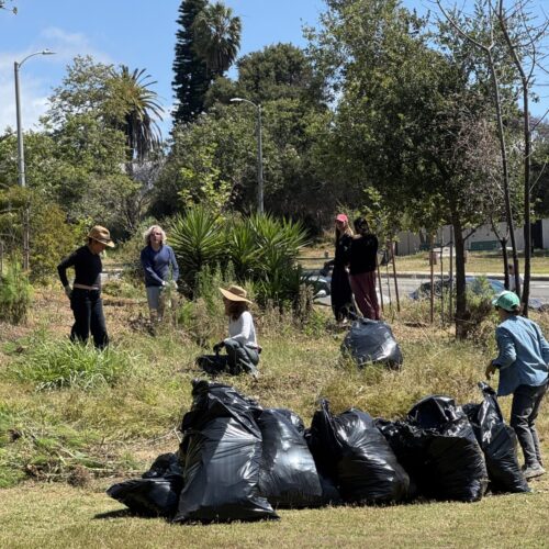
Volunteer action took over Santa Monica Pier Beach
At the April Nothin’ But Sand Beach Cleanup, more than 800 participants gathered at Santa Monica Pier Beach, one of LA’s most iconic (and most polluted) beaches, and removed over 220 pounds of trash. Each piece collected represents one less threat to marine life and a step toward a healthier coastline. There’s a reason why thousands of people across the region have joined Heal the Bay’s clean ups: they’re as impactful as they are fun.
Join us for our next clean up: Heal the Bay’s annual Nothin’ But Nature inland clean up at Whittier Narrows! Register now.
But clean ups alone can’t tackle every pollution problem.
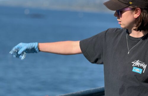
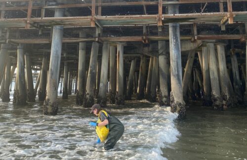
At the Santa Monica Pier, Heal the Bay’s science team has been hard at work testing ocean water for fecal indicator bacteria, monitoring a serious issue that continues to impact one of Los Angeles’ most visited beaches.
This location regularly earns an F on the Beach Report Card and has appeared on the Beach Bummer’s list year after year due to consistently high bacteria levels, making it unsafe for swimming.
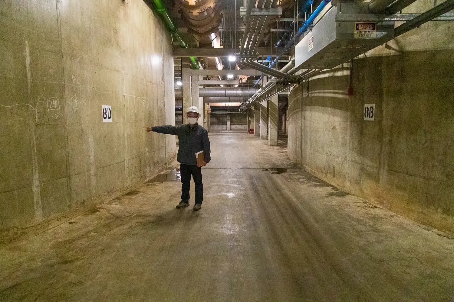
In response, Heal the Bay has partnered with the City of Santa Monica to launch a dedicated Task Force focused on identifying pollution sources and advancing real, long-term solutions.
As testing continues, updates will be shared as new information becomes available.
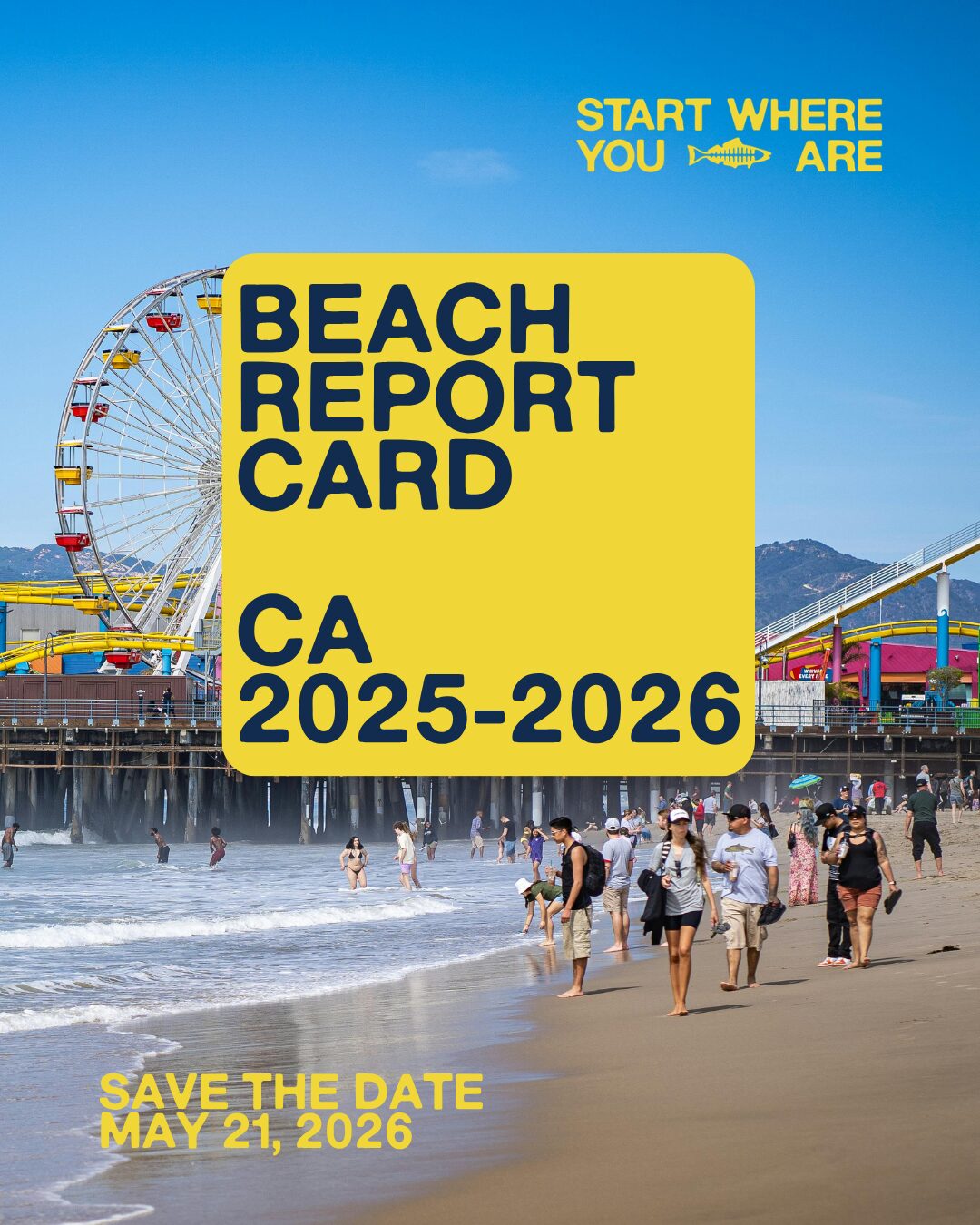
Stay informed about the water quality of your favorite beach at beachreportcard.org or through the Beach Report Card app. Plus, stay tuned for the reveal of Heal the Bay’s annual Beach and River Report Cards, a comprehensive report of your local watershed and coastal health, coming May 21!
A closer look at local ecosystems revealed opportunities for impact.
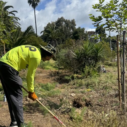
Two sold-out BioBlitz events at the Manhattan Beach Dunes and Temescal Canyon Park brought community scientists outdoors to document biodiversity and restore a habitat impacted by the Palisades Fire.
Our Heal the Bay community remained at the center of it all.
During the Earth Month Open House, supporters came together to celebrate, connect, and support Heal the Bay Aquarium following recent flooding. With live performances, dancing, and interactive experiences, the event highlighted how joy and environmental action can exist side by side.
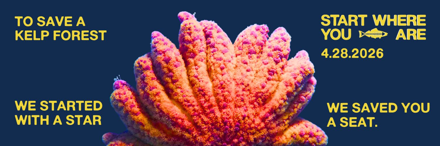
And beneath the waves, there is still hope.
In The Comeback: Saving the Sunflower Sea Star From Extinction webinar, the spotlight turned to a critically endangered species and its vital role in ocean health. Our expert aquarists explored how the decline of the sunflower sea star has harmed local marine ecosystems and how Heal the Bay Aquarium is helping lead efforts to support its recovery.
Earth Month 2026 may be coming to a close, but the work continues.
“Start Where You Are” is more than a saying, it’s a mindset. Because when action begins where we are, meaningful change becomes possible.
Start Here:
Start with a donation: Support Heal the Bay’s work to protect coastal waters and advance a healthier, more resilient future for our ocean and communities. • Start with the health of your favorite beach: Stay tuned for the launch of the Annual Beach and River Report Card on May 21, live on Instagram. • Start by getting involved: Attend an upcoming volunteer orientation to deepen your knowledge and discover new ways to make an impact. • Start with an email you actually look forward to: Subscribe to the newsletter for ongoing updates, advocacy, and ways to take action from anywhere.
Water quality at many West Coast beaches and Los Angeles freshwater sites improved over the past year, according to Heal the Bay’s annual Beach Report Card and River Report Card, released today. The reports’ findings highlight both progress and persistent risks for millions of people who swim, surf, and play in local waters each year.
A near-record 62 beaches earned a spot on the nonprofit’s coveted Honor Roll with perfect A+ scores in 2024-2025. It was the highest Honor Roll count in over a decade. Only 12 beaches made the Honor Roll last year and just two in the 2022-2023 report. Freshwater sites also saw gains in the 2024 River Report Card, with 24 out of 35 graded safe for recreation.
But the good news comes with caveats. Climate “whiplash” is making water quality more variable. Dry years are generally bringing cleaner water — with less bacterial pollution washing into waterways — while wet years are dragging down grades. Persistent hotspots like the Santa Monica Pier, several San Diego County beaches, and the lower L.A. River remain unsafe despite improvement efforts. And January’s wildfires added a new layer of concern, underscoring the importance of Heal the Bay’s work to expand testing and monitoring in the wake of the disasters. “More beaches and rivers were safe for swimming than we’ve seen in years,” said Annelisa Moe, Heal the Bay’s Associate Director for Science & Policy. “But persistent pollution hotspots and new threats from climate extremes like wildfires make it clear that we can’t take clean water for granted. That’s why Heal the Bay is pushing for stronger infrastructure and policies to protect public health and our waterways.”
1. Dry weather meant cleaner water, but climate extremes loom large. Nearly 9 in 10 beaches and more than two-thirds of freshwater sites were safe for recreating last year, likely thanks to a dry summer and winter. But progress is uneven, as climate extremes drive swings in bacteria levels and highlight the urgent need for resiliency planning.
2. Persistent hotspots show where work is most urgent. Trouble spots like the Santa Monica Pier, beaches along the U.S.-Mexico border, and stretches of the lower L.A. River remain unsafe year after year. Outdated sewage and stormwater systems, polluted runoff, and poor water circulation all contribute, underscoring the need for stronger infrastructure and controls.
3. Wildfires add layered threats to water quality. The January 2025 Palisades and Altadena fires washed ash, debris, and toxins into local waters, and early results suggest a link with worsened bacteria levels. Since Beach and River Report Cards only measure fecal indicator bacteria, more study is needed to assess impacts from wildfire-related contaminants like heavy metals. Heal the Bay is advancing this work through its Ash to Action initiative.
About the Reports
What are the Beach and River Report Cards?
Heal the Bay’s 35th annual Beach Report Card and 7th annual River Report Card take a deep dive into bacterial pollution trends at more than 700 beaches along the Pacific Coast and 35 freshwater sites in Los Angeles.
Each site gets an annual letter grade from A to F based on how much fecal indicator bacteria is found in the water during each testing season (summer dry weather, winter dry weather, and annual wet weather). The bacteria come from stormwater runoff, failing sewage systems, or other pollution, and they can cause illnesses like stomach flu, ear infections, upper-respiratory infections, and rashes. In short: The lower the letter grade, the higher the risk of getting sick.
All county health departments in California are required to test beach water quality samples for three types of indicator bacteria at least once a week during the summer season. Many counties also monitor heavily used beaches year-round. Heal the Bay compiles and analyzes the data to produce the annual Beach Report Card.
Freshwater sites don’t have the same monitoring requirements, so Heal the Bay deploys its own scientists with the Stream Team — students trained in field and lab techniques — and works with other local groups and municipalities to collect and analyze samples throughout the summer (May to September).
How is this different from the reports shared in May?
In May, Heal the Bay released a first look at this year’s Beach Report Card with a list of California’s Honor Roll beaches and bottom 10 Beach Bummers. Today’s release expands on those lists with deeper insights and annual grades for more beaches across California, Oregon, Washington, and Baja California.
The 2024 River Report Card was released today and includes annual grades and insights into 35 freshwater sites across Los Angeles.
How did the wildfires impact the reports?
The January wildfires delayed the full report release as Heal the Bay scientists worked to quickly assess how toxins from fire debris were impacting beach and water quality and notify the public about potential health risks beyond bacteria pollution. More information about Heal the Bay’s post-fire response work is available in a special section of the Beach Report Card (pgs. 52-54).
Note: The water-quality grades released today only reflect monitoring of fecal indicator bacteria. They do not include data related to testing for harmful heavy metals and other toxins that made their way to L.A.-area beaches following the Palisades and Altadena wildfires in January.
To follow along with Heal the Bay’s continued exploration of wildfire impacts and solutions, visit the Ash to Action webpage
What’s the difference between the annual and weekly report cards?
Weekly grades for beaches and freshwater sites monitored by Heal the Bay are available on the Beach Report Card (beachreportcard.org) and River Report Card (healthebay.org/riverreportcard) websites. These weekly grades are based on the most recent samples, offering a snapshot of bacteria levels to help people gauge their real-time risk.
The annual reports examine patterns and trends over longer periods to identify consistent problem spots, sources of pollution, and ongoing impacts. These findings help policymakers formulate solutions, aid scientists in improving testing and monitoring methods, and give the public a look at which waters are best avoided throughout the year.
If you care about science-based research that protects our coastline, watersheds, and public health, please consider donating to Heal the Bay. Your support powers critical water quality investigations and drives solutions for a more resilient Los Angeles.
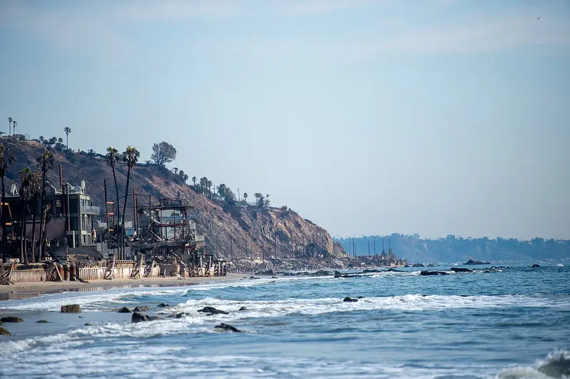
In late January, Heal the Bay’s staff scientists began collecting ocean-water samples from 10 shoreline sites along the Bay to test for heavy metals, PCBs, asbestos, and other toxins. See our water quality testing timeline
The ocean water advisories along LA’s coast have been lifted, and based on recent data, Heal the Bay is cautiously optimistic that chemical contamination from the fires no longer poses a major risk for beachgoers. Post-fire debris is still a danger.
Is it finally safe to swim and surf? This week the Los Angeles County Department of Public Health lifted the ocean water advisories along LA’s coast. Based on data collected in January and February, Heal the Bay is cautiously optimistic that the chemical contamination from the fires does not pose a significant risk for recreation at our local beaches or in our coastal waters. However, the burn area may still pose some risks to beachgoers, swimmers, and surfers. Here’s what we know:
Physical debris is still being observed in the water and along the shore, primarily off the coast of the burn area from Las Flores to Will Rogers Beach. The good news is that LA County Beaches and Harbors is reporting a decrease in the volume of debris washing onto our shores. But because debris can include sharp objects, everyone should continue to use extra caution to avoid anything that looks like wildfire reminants, whether on the sand or in our coastal waters.
Debris removal has begun on the 300 homes along PCH that were tragically lost in the fires. While this is great news for the bay, there may be a risk to human health within 250 yards of debris removal activity. The LA County Department of Public Health has issued a health advisory stating that it is not safe to reside within 250 yards of debris removal because the activity can disturb contaminants and send them into the air and water. Out of an abundance of caution, Heal the Bay would like to highlight that recreating within 250 yards of debris removal may also pose additional risk to beachgoers, swimmers, and surfers.
If you choose to visit our beaches or get in the water, HTB recommends the following safety precautions:
Avoid areas within 250 yards of active debris removal.
Wear closed-toe shoes if walking on wet sand, as debris such as broken glass and structural fragments may still wash ashore.
Never touch trash or debris with bare hands.
Keep children and pets away from debris, especially in wet sand or high tide areas, where contamination risk may be higher.
Do not approach injured or distressed wildlife. If you have concerns about a marine mammal, contact the Marine Mammal Care Center at (1-800-39-WHALE).
Heal the Bay continues to urge beachgoers to recreate south of Santa Monica at Montana Avenue or north of the fire boundary in Malibu, where impacts are significantly lower.
Avoid eating seafood caught in Santa Monica Bay. Contaminants in the ocean water exceed safe levels for fish consumption. Additionally, the SoCal coast is experiencing a harmful algal bloom, which may pose a risk when consuming locally caught shellfish.
Please use this information to make informed choices for your safety and the well-being of your family and pets. The LA Regional Water Quality Control Board has also published risk-based recreational thresholds and a tool to help beachgoers decide how often they can safely enjoy the coastal waters.
While the beaches are open to the public now, the long-term impacts of wildfire contamination continue to raise concerns. Our January data shows elevated levels of heavy metals in the bay, posing risks to marine life. Heal the Bay continues to investigate the effects of wildfire-related pollutants and bioaccumulation in our coastal ecosystems, but we can’t do it without you. Visit healthebay.org/donate to support our science, safety, and post-fire recovery work. Together, we can protect what we love.
UPDATE MARCH 27, 2025
**New data has become available since March 27. An update is coming soon.
According to water-quality testing results released today by Heal the Bay, local marine life faces significant and ongoing threats from heavy metals that leached into Santa Monica Bay after January’s Palisades wildfires.
PRESS RELEASE 3/27/2025 –Test results from 10 collection sites along the entire length of Santa Monica Bay show that immediately after the fires, water quality at LA’s beaches was much better than expected, diminishing fears about human health impacts from polluted runoff in fire-scarred areas. We cannot definitively say that the water is safe until we have additional data and information about risk-thresholds for recreational contact, but based on the data we have seen to date, we are cautiously optimistic.
However, our analysis indicates that marine mammals, multiple fish populations, and other species further down the food chain are at serious risk from elevated levels of beryllium, copper, chromium, nickel, lead, and other harmful heavy metals and nutrients.
Silver, arsenic and zinc were also detected above average marine-health limits. Aluminum, iron, and manganese also showed elevated levels, though no marine health limits exist for these metals. In all, Heal the Bay staff scientists and a regional water agency tested for 116 known pollutants at multiple sites in January and February. (Please click here for a detailed analysis of the results, our data spreadsheet, and raw data from the PHYSIS lab.
Following heavy seasonal rains, toxic pollutants washed into the intertidal zones from burned structures and scorched earth in the Palisades, Topanga, and Malibu. Waves lapping onto fire-ravaged buildings along Pacific Coast Highway continue to sweep harmful metals into the sea.
Even at low concentrations, heavy metals can disrupt vital biological processes, damage cells, and impair reproductive and immune functions for marine life. Metals can also be transferred and magnified through the food chain. This impacts the entire food web, which inevitably impacts humans. In short, when animals get sick, humans can get sick, particularly from consuming seafood that has a bioaccumulation of metals in their systems.
Heal the Bay is urging authorities to expedite the removal of burned-out structures and other fire-related debris from PCH as soon as possible. Unfortunately, some homeowners have been slow to respond to U.S. Army Corps of Engineers’ offers to facilitate debris removal. Roughly 45 shoreline homeowners have opted out of the program, while nearly 100 have not responded at all. Whether or not a homeowner decides to use the US Army Corps of Engineers or a private contractor, it’s imperative that debris removal happens quickly.
“Every day that hazardous debris remains along the coast, more harmful contaminants flow into the sea,” says Tracy Quinn, President and CEO of Heal the Bay. “If we want to give our marine life a fighting chance, we need that debris removed as soon as possible.”
The most concerning findings come from the hardest-hit fire areas, including Topanga Beach, the Big Rock section of Malibu, and Will Rogers State Beach near Pacific Palisades. However, the waters around Santa Monica Pier and Dockweiler State Beach also spiked for heavy metals — suggesting that more studies are needed to understand the movement of contaminants offshore or identify other sources.
Because it is now March, these data do not tell us the current conditions in Santa Monica Bay, but they do provide valuable insight into the impacts of the Palisades Fire on marine life and the potential impacts on human health.
Risk tolerance is a personal decision. Here is some information that can help beachgoers decide if, when, and where they may want to enter the ocean.
The contaminants tested seem to be below human health limits for recreational contact for the data where limits could be identified. The Los Angeles Regional Water Quality Control Board is still assessing risk-thresholds, including those for PAH, a harmful organic compound related to fire-scorched debris.
PAHs, the group of contaminants that may be above human health limits, are unlikely to sicken people who swim or surf a few times, but frequent or prolonged exposure may contribute to an increased risk for future chronic health issues.
Beachgoers should also be careful about walking on the sand, which may contain sharp fire-related debris like nails and broken glass. For the time being, Heal the Bay recommends avoiding beaches within the fire-impacted areas and as far south as Montana Ave in Santa Monica. The Regional Water Quality Control Board has already posted some sand and sediment data for LA’s beaches. We are waiting for the complete test results to post our analysis. Stay tuned.
The fire and recent marine mammal deaths
It’s also worth noting the recent uptick in marine mammal beach stranding and deaths in Santa Monica Bay related to domoic acid poisoning. Elevated levels of runoff-related nutrients can contribute to the development of algal blooms in the Bay and accumulate in shellfish. When mammals consume shellfish, they can get sick and die from the neurotoxins produced by certain algae.
This is the fourth consecutive year of domoic acid outbreaks. The recent fires did create a significant dump of nutrients like sulfate and phosphorous into the ocean, but there is no evidence, yet, of a correlation between the wildfires and the domoic acid outbreak.
About the testing
On Jan. 24-25, before the first winter storms came, Heal the Bay staff collected ocean-water samples at 10 shoreline sites across Santa Monica Bay. From Paradise Cove to Malaga Cove, they tested for 116 pollutants. They took samples again on Jan. 28, after heavy rainfall, to better understand how stormwater might carry toxins from the burn zone.
Processing samples took multiple weeks due to the complexity of sample preparation, the need for precise instrumentation, and the rigorous quality control required. It also took several weeks to receive the data results back from Physis Lab. Then, additional time was needed for Heal the Bay’s Science and Policy Team to analyze and assess the data.
Staff members from the Los Angeles County Department of Public Health collected water samples on Feb. 18, which Heal the Bay also analyzed for its report. After the intense Feb. 13 storms, testing showed elevated levels of contaminants that do not have established risk-thresholds for recreational contact. Further analysis is required and will be included in an upcoming post.
Heal the Bay is part of a collaborative task force working with government agencies, researchers, and other nonprofits to better understand the extent of the contamination and how to clean it up efficiently. We will be updating our analysis and sharing the findings in the weeks to come as soon as new data becomes available.
Heal the Bay is the only organization providing this kind of in-depth analysis of water quality data.
But to continue this important work, we need your support. If you’d like to see more of these efforts, please consider donating.
Watch the Webinar for today’s latest Heal the Bay Ash to Action Updates.
Learn about the critical work that Heal the Bay and its academic partners are doing to protect the environment and monitor water quality in Santa Monica Bay.
UPDATE MARCH 13, 2025
The Los Angeles Regional Water Quality Control Board has released its 2025 Post-Fire Water Quality Monitoring results.
“The board has been working with Los Angeles County to monitor ocean water quality since Jan. 22, 2025. Samples are collected regularly at 12 beach sites from La Costa Beach to Dockweiler Beach by the Los Angeles County Department of Public Health. They then are analyzed by the board for metals, nutrients, polychlorinated biphenyls (PBCs) and polycyclic aromatic hydrocarbons (PAHs), which are chemicals that may be found in water runoff based on previous California wildfires.” (Waterboards.ca.gov)
Post-Fire Water Quality in Santa Monica Bay: We reviewed results from the LA County Department of Public Health (DPH).
Recent wildfires in Los Angeles that started on January 07, 2025, have impacted water quality in Santa Monica Bay. To understand the extent of these water quality impacts, we looked for contaminants that are likely to be mobilized after a wildfire, and that pose a risk to human and ecological health when concentrations are elevated; this includes heavy metals, PAHs (polycyclic aromatic hydrocarbons), nutrients, bacteria, and solids that decrease water clarity. Right now, Heal the Bay has data that our staff collected for bacteria and water clarity (referred to as “turbidity”), which have faster processing times and which we can test on-site in the Heal the Bay lab, while other contaminant samples were sent to a contracted lab to process.
While we wait for Heal the Bay’s results for the other contaminants, we reviewed results from the LA County Department of Public Health (DPH), which took samples on January 22, 2025, and January 27, 2025, at beaches from Las Flores State Beach to Dockweiler State Beach. These data points are representative of water quality before and after the first flush rain event, over a month ago. Since then, we have had additional significant rainfall, including nearly two inches of rain on February 13, 2025, which, unfortunately, was not tested by DPH in time to provide wet weather data. Data that are more recent will provide needed insight into overall conditions in our coastal waters. Heal the Bay will continue to provide updates as new data become available.
Water contact limits do not exist for most of the contaminants of concern associated with wildfires, so to understand potential health risks, we compared results to limits in the CA Drinking Water standards, the CA Ocean Plan (for both human health and marine life), and the Hawai‘i Department of Health Surface Water Action Levels for Marine Habitats (used to assess impacts of the Lahaina Fires). Our initial findings show elevated heavy metals, bacteria, nutrients, and other organic compounds, along with a decline in water clarity, all of which indicate that wildfire runoff does pose a risk to human and ecological health and that contamination is traveling beyond the immediate burn zone.
Key Findings from January 22 and 27, 2025:
Heavy Metals and Metalloids: Aluminum, iron, selenium, and manganese were elevated above drinking water standards, sometimes as much as 10x the limit. This is not an immediate human health threat,but we urge caution if there is the possibility of ingestion. These four metals, in addition to arsenic, copper, and zinc, also exceeded safety thresholds for marine health, particularly at Will Rogers State Beach and Topanga Beach, posing a health risk to marine life. Even at low concentrations, these metals can disrupt vital biological processes, damage cells, and impair reproductive and immune functions for marine animals.
PAHs (polycyclic aromatic hydrocarbons): PAHs were detected at unsafe levels, based on human health standards in the CA Ocean Plan, at Will Rogers State Beach and Topanga Beach and were not detected at other sites. This poses a site-specific risk to human health within the burn zone.
Nutrients: Elevated phosphorus levels have increased nutrient concentration in Santa Monica Bay, leading to the formation of a persistent brown foam along the shoreline and increasing the risk of algal blooms.
Turbidity & Solids: While turbidity may not pose a direct risk to public health, it can disrupt biological processes for marine life, and water clarity can help to show how far runoff from the burn zone traveled along the coastline. Water clarity declined significantly after rain from Surfrider Beach down to at least Dockweiler Beach, indicating wildfire runoff spread beyond the burn zone. Turbidity levels were consistently good at Paradise Cove (north of the burn zone) and Malaga Cove (just north of Palos Verdes Peninsula), indicating boundaries on the extent of pollution traveling up and down the coastline, but that boundary is not yet clear.
Bacterial Contamination: High bacteria levels were observed near storm drains, worsening after rainfall, following the typical pattern for bacterial pollution in Santa Monica Bay.
What You Need to Know:
A day at the beach should never make anyone sick. Heal the Bay is dedicated to protecting public health by sharing water quality information, and we remain concerned about the potential risks associated with post-fire contamination in ocean water and sand. Additionally, hazardous debris, such as nails and pipes, continues to wash ashore, posing a physical risk to beachgoers.
At this time, Heal the Bay recommends avoiding beaches and ocean water from Las Flores to Santa Monica State Beach and exercising caution at beaches further south, at least to Dockweiler State Beach. While water clarity does improve further south at Malaga Cove, we do not yet have comprehensive data for beaches south of Dockweiler State Beach, so we cannot determine potential health risks. If you visit the beach anywhere in Santa Monica Bay south of Surfrider Beach:
Stay vigilant; look out for sharp debris and avoid picking up objects with bare hands.
Keep children and pets from touching or ingesting water or wildfire debris.
Refrain from full-body submersion into the coastal waters in the designated areas, which can lead to accidental ingestion.
Heal the Bay has collected additional sand and water samples throughout Santa Monica Bay from Paradise Cove down to Malaga Cove. We will share results on our website as soon as those data become available. We urge the Los Angeles County Department of Public Health to enhance transparency in decision-making and ensure all relevant data is made publicly accessible in a timely manner. Until further testing is completed and more information on current water conditions is released, we advise the public to remain cautious when visiting affected beaches.
UPDATE FEBRUARY 26, 2025
On Monday, February 24, 2025, Heal the Bay learned that the Los Angeles County Department of Public Health (DPH) had stated beachgoers may recreate on the sand in the fire-impacted areas. We also learned that this determination is likely based on only two debris samples taken by Los Angeles County Public Works, one at Topanga Creek and the other at Will Rogers State Beach. These samples were collected to determine the disposal method required to remove the debris, not to determine if it is safe for people to be on the sand. It is alarming that DPH would make this proclamation based on only two data points. While preliminary debris and ocean water quality testing have not shown elevated levels of harmful contaminants attributed to burned household items, the sample size for both water and sand thus far is quite small. At this time, we simply do not have enough information to determine if the sand or water at beaches where debris is present is safe for recreation. Furthermore, dangerous debris such as nails, screws, and pipes continue to wash up on shore, often concealed in sand or near-shore waves, increasing the risk to people playing on our beaches. This is an unprecedented event, and we must wait for the results of additional testing before declaring our beaches safe. We ask for increased transparency from the LA County Department of Public Health in decision making going forward, data used to protect our public health should be available to the public.
For now, Heal the Bay recommends that people avoid beaches (both sand and water) from Las Flores to Santa Monica State Beach and use extra caution on beaches south of Santa Monica. If choosing to go to the beach, watch out for sharp debris, do not pick up debris with your bare hands, and keep a close eye on children and pets to ensure they do not touch or ingest debris.
Heal the Bay and the Regional Water Quality Control Board have each collected sand samples from throughout the burn area, and we are awaiting results. We will share our ocean water and sand testing results on our website as soon as they are available.
Los Angeles County Department of Public Health’s full statement on beach safety: “The ocean water advisory due to fire impacts from Las Flores State Beach to Santa Monica State Beach remains in effect until further notice. Beachgoers may recreate on the sand but continue to be advised to stay away from visible fire debris and to stay out of the ocean water during any posted ocean advisory.”
UPDATE FEBRUARY 18, 2025
We expect results this week from Heal the Bay’s first round of expanded ocean-water quality testing.
In late January, Heal the Bay’s staff scientists began collecting ocean-water samples from 10 shoreline sites along the Bay to test for heavy metals, PCBs, asbestos, and other toxins. These harmful pollutants are flowing unchecked to the sea from recent heavy rains and other runoff from burn zones. We expect results from before and after the “first flush” storm during the week of February 17th and will post them here.
UPDATE JANUARY 14, 2025
We present the updated timeline detailing our recent water quality assessment activities in the coastal regions affected by the Palisades fire.
January 24-25, 2025
Heal the Bay conducted initial pre-rain water quality testing at 10 locations throughout Santa Monica Bay: five within the burn zone, three outside of the burn zone but within the beach advisory zones, and two control sites (one north and one south of the beach advisory zones).
Our water quality scientists tested for temperature, turbidity, Fecal Indicator Bacteria, PAHs, PCBs, PFAS, benzene, mercury, and other heavy metals. This sampling involved coordination with the Fire Department and Lifeguards to gain access to the closed burn zone.
January 28, 2025:
After the January 26 rainstorm, staff took water quality samples again for the same pollutants and at the same locations tested on January 24-25, to compare pre- and post-rain results.
Jenny Jay from UCLA joined us for the six northernmost sampling sites to test for metals, antibiotic-resistant bacteria, and nutrients.
February 3, 2025:
Heal the Bay staff examined the Beach Report Card on Friday, January 31, 2025, and identified data gaps within the burn zone.
Staff went out on Monday, February 3, 2025, to sample the five locations within the burn zone for temperature, turbidity, and Fecal Indicator Bacteria (which we can process ourselves in our lab) to fill those data gaps.
On this sample day, journalists from NPR and Spectrum News and the Fire Department’s photography team joined us to document and report on our testing.
Heal the Bay staff attended the Post-Fire Coordinated Water Quality Testing Meeting hosted by SCCWRP. While this group aims to establish a working group to coordinate long-term post-fire water quality monitoring (which Heal the Bay will participate in), this meeting addressed urgent needs arising from the weather conditions by identifying who would be conducting sampling that week, where the sampling would occur, and which contaminants would be tested.
February 10, 2025:
Heal the Bay returned to the field one last time to support ongoing research, visiting six of our ten original sample sites, from Surfrider Beach at Malibu Lagoon to Will Rogers State Beach at Santa Monica Canyon.
An assessment of the BRC on Friday, February 7, 2025, indicated no remaining data gaps, so we did not collect Fecal Indicator Bacteria samples.
Instead, this trip was intended to gain access to the burn zone one more time and show our sampling locations to researchers from the Proteocean Lab at USC. They plan to build on our initial testing with weekly sampling for heavy metals, microbial health, and nutrients.
Staff from Surfrider also joined us so that we could show them where there is safe access to their regular testing locations within the burn zone.
We also collected sand samples at each site from below the high tide line and above the high tide line where the sand was dry (where possible). These samples have been delivered to CSU Northridge, where researchers will test them for heavy metals and PAHs. They will also compare the results from our sand samples to soil samples that they collected within the Eaton Fire burn zone.
UPDATE JANUARY 29, 2025
Our fire response has just begun.
Over the past six days, the Heal the Bay Science and Policy Team has been testing water in and out of the burn zones along Santa Monica Bay impacted by the Palisades Fire.
The Palisade Fire has increased sedimentation and introduced harmful pollutants into our coastal waters, and Heal the Bay is dedicated to understanding the impacts, which is why we are testing for key pollutants that may be transported into Santa Monica Bay due to runoff from the Palisade Fire.
Not only are we testing for bacteria and turbidity (which we can process in-house), but we are also collecting samples to test for Heavy metals, Mercury, PAHs/PCBs, Benzene, and PFOS/PFOA (two types of PFAS). We collected samples before and after the rain event on January 26, 2025, which will provide a comparative analysis of initial pollutant levels and stormwater runoff effects.
During a typical rain event, stormwater runoff is considered the most significant source of water pollution. Following the unprecedented wildfires in Los Angeles this past weekend, the “first flush” amplified the pollution – carrying not only higher levels of typical pollutants like oil and grease, trash, plastic, bacteria, and heavy metals but also wildfire debris and other hazardous materials including ash, fire suppressant, household chemicals, car batteries, and more. These contaminants pose significant risks to water quality, marine ecosystems, and public health.
The team collected water samples from 10 key locations, including areas within the burn zone, adjacent impacted areas, and control sites.
(NOTE: We were joined in the field by Professor Jennifer Jay of UCLA, and there may be additional data from agency offices like the LA County Department of Public Health, that will also contribute to the very limited water quality dataset for understanding the impacts of the Palisades Fire.)
Heal the Bay is one of only a few organizations doing this water quality testing in the wake of these devastating fires. Still, great science is collaborative, and our team is excited to be one of the only nonprofits contributing to this initial and limited data set. Every bit of data will help us understand the long-term impacts of this unprecedented fire season.
Our findings will be shared as soon as possible to inform the public about potential environmental and public health risks. We will also contribute to coordinated monitoring efforts that will inform policymakers and guide future mitigation and response efforts.
While our samples are being processed to help us understand what is in our coastal waters, we strongly urge everyone to avoid contact with ocean water and to refrain from walking on the beach, as fire debris runoff may contain toxic or carcinogenic chemicals. The LA County Department of Public Health has issued Ocean Water Closures from Las Flores State Beach to Santa Monica State Beach, with additional Beach Advisories issued as far north as Surfrider Beach at Malibu Lagoon and south to Dockweiler State Beach at World Way, all of which will remain in effect until further notice. Your health and safety are our top priority—thank you for doing your part to protect yourself and our environment.
PCBs = Polychlorinated biphenyls, chemicals used in industrial / commercial products (PCBs stopped being produced in the 70s, so a legacy chemical)
PFASs = Per- and polyfluoroalkyl substances, forever chemicals (manmade chemicals that do not breakdown ) used to make waterproof, nonstick, and flame-resistant products.
Heal the Bay achieved significant accomplishments in 2024 in safeguarding our waters, preserving biodiversity, and raising awareness about the importance of environmental conservation. Through our collective efforts and with your unwavering support, we worked tirelessly to create cleaner, healthier, and more sustainable coastal waters and watersheds for Los Angeles and beyond from summit to sea. As we reflect on the achievements of this past year, we are thrilled to carry this momentum into the coming year, always aiming to make a lasting difference. Celebrate them with us!
2024 Highlights
Our expertise was sought after, and our work was celebrated.
In 2024, Heal the Bay was honored for decades of commitment to the environment.
Heal the Bay was selected as a 2024 California Nonprofit of the Year by Assemblymember Jacqui Irwin of District 42 in recognition of nearly four decades of accomplishments and “outstanding contributions to the communities and environment” we serve.
The 4th Annual Heal the Bay One Water symposium was convened at Lewis Macadams Riverfront Park, establishing Heal the Bay as a thought leader among civil engineers, water conservation experts, and local, county, and state legislators.
Heal the Bay continued its work on the LA28 Environmental Sustainability Committee for the 2028 Summer Olympics to ensure the games are the most sustainable yet and leave a legacy of environmental stewardship in the region.
Heal the Bay played a pivotal role in successfully advancing policies and legislation to improve water quality, affordability, and coastal ecosystems and ensure a more sustainable Los Angeles region and climate-resilient California.
In response to advocacy from Heal the Bay, the LA Regional Board recently approved more stringent regulation of surface water runoff from the highly contaminated Boeing Santa Susana Field Lab site. Boeing immediately filed a legal petition opposing the new regulations. Heal the Bay is engaging in this lawsuit as an interested party in support of the Regional Board.
Heal the Bay co-authored the Vision 2045 Report with NRDC and Los Angeles Waterkeeper and shared it with LA County decisionmakers tasked with overseeing the ambitious Safe, Clean, Water Program (SCWP). This collaborative “vision” laid out a roadmap of bolder goals, and recommendations to more quickly and definitively reach 2045 SCWP targets and is now being used as a resource by LA County for the SCWP Watershed Planning Efforts.
Big trouble for Big Plastic
Recognizing the urgent need to combat plastic pollution, Heal the Bay continues impactful environmental policy work and campaigns to amplify sustainable practices. For several years, staff has worked with LA City and County to help create legislation to break the harmful plastic cycle. We took significant steps toward a plastic-free future by advocating for reducing single-use plastics and promoting responsible waste management.
We sued Big Plastic! Heal the Bay took historic legal action and joined a coalition of leading environmental groups to file a lawsuit against ExxonMobil, the world’s largest producer of single-use plastic polymers. California’s Attorney General also filed a similar lawsuit today.
Heal the Bay advocacy supported major wins for state and local plastics regulation this year, including the passage of SB 1053, which removes ALL plastic film bags from checkout counters at convenience stores and grocery stores across the state by 2026 and increases the minimum recycled content requirements for paper bags to 50%.
In 2024, Heal the Bay made big waves for the environment by advocating for the unanimous approval of the Environmental Impact Report for the City of LA’s Comprehensive Plastics Reduction Program.This means that in the next 6 months, we could have powerful new legislation in the City of LA to really reduce plastics, and Heal the Bay will be right there alongside key decision-makers to ensure success.
It Takes a Very Large Village
This year Heal the Bay volunteers made massive waves of change.
In 2024, more than 24,900 Heal the Bay volunteerscollected over 24,000 pounds of trash and contributed 71,048 hours to protecting our precious watershed and coastal waters!
In September, Heal the Bay mobilized 6,600 volunteers on Coastal Cleanup Day, removing 18,269 pounds of trash (including 429 pounds of recyclables) from greater Los Angeles coastlines and waterways.
This year Heal the Bay Aquarium welcomed 59 new volunteers, and a total of 128 volunteers completed and served 5,494 hours at the Aquarium.
Environmental Health IS Public Health
In 2024, Heal the Bay continued its relentless commitment to ocean water and freshwater quality from summit to sea.
Our annual Beach Report Card remains the gold standard for water quality reporting, providing access to the latest water quality information based on levels of fecal-indicator bacterial pollution in the ocean at over 700 beaches. For more than 30 years, our annual report has assigned “A-to-F” letter grades and ranked the “Best and Bummer” lists across beaches from Washington State to Tijuana, Mexico.
The annual River Report Card was also released, ranking freshwater quality and providing grades for 35 freshwater recreation areas in Los Angeles County tested during the summer of 2023. This summer 14 students from colleges across Southern California joined Heal the Bay the Stream Team internship program – our biggest cohort yet! These two programs are at the forefront of our efforts to keep LA’s waters safe and enjoyable for all.
Conservation and Marine Protection Are Key to Our Mission
Heal the Bay reaffirmed its commitment to biodiversity through both volunteer activations and the tireless efforts of our husbandry, operations, and education Aquarium teams.
Heal the Bay Aquarium plays a pivotal role in species conservation through research, breeding programs, and public awareness campaigns. In 2024, four Swell sharks, dozens of Pacific Sandollars, Giant Spine Sea Stars, Bay Pipefish, and hundreds of Moon jellies were born at the aquarium. Our animal care team released seven protected and rehabilitated marine animals, including keystone species like Swell sharks and Leopard sharks, into Santa Monica Bay. By releasing these animals back into the wild, Heal the Bay continues its mission to protect and support the biodiversity of wild fish populations.
As part of our commitment to successful conservation efforts, Heal the Bay Aquarium continued its work with the Association of Zoos and Aquariums (AZA) Wildlife Trafficking Alliance. As an official member of the US Fish & Wildlife Department’s Wildlife Confiscation Network pilot program, the aquarium is certified to care for the well-being of wildlife confiscated from illegal trade.
Heal the Bay’s Science and Policy Team successfully lead public meetings to educate Californian’s on the impacts of DDT on public health and biodiversity.
They were also featured as experts in the Los Angeles Times documentary “Out of Plain Sight.”.
As a watchdog for Marine Protected Areas, Heal the Bay’s MPA Team is actively contributing and analyzing critical data on California’s first decade-long review that began in 2023. One of the biggest conclusions of the review highlighted the fact that protecting these precious estuaries for the past decade has worked, allowing for flourishing biodiversity, larger populations, and bigger individual animals in these safeguarded areas.
Environmental Equity and Inclusion are pillars of Environmental Health
This year, Heal the Bay continued to advocate for communities that experience the worst systemic and often immediate impacts of environmental injustice and climate change.
After 10 years of effort by Heal the Bay Outreach, Inell Woods Park, a first-of-its-kind stormwater park, is complete in the Compton Creek watershed. This pocket park will provide green space to an underserved community. The ribbon cutting is estimated for early 2025, highlighting the connection between communities, green space, and health.
Environmental Education, Outreach and Sharing our Passion to Protect What We Love
Education remained a cornerstone of our mission. In 2024, Heal the Bay expanded our outreach program, teaching schools and communities to understand the importance of environmental conservation and the role each individual can play.
Educational efforts continued to inspire and inform diverse audiences through innovative approaches and interactive science-based programs. The Heal the Bay Aquarium Education Team sponsored 247 field trips and welcomed 11,668 enthusiastic students from 22 school districts in LA County, including 85 students from Title 1 schools.
This year, “Coastal Cleanup Education Day” at the Aquarium hosted more than 118 3rd-6th grade students from across Los Angeles County for a day of beach exploration, scientific excursions, education, and hands-on learning while having fun in the sun.
In 2024, Heal the Bay built a blue economy, providing professional training on sustainable aquaculture practices in partnership with Santa Monica College. This program not only empowers future environmentalists with hands-on job training, but it has also allowed Heal the Bay Aquarium to lead a program that has put them on track to achieve 90% sustainability through aquaculture and animal donation within the next five years.
Speakers Bureau and Beach Programs (through the Adopt a Beach Program) gave 195 talks this year to educate the public on all Heal the Bay’s amazing and impactful work.
Cheers to 2024
As we look back on 2024, Heal the Bay celebrates a year of accomplishments, resilience, and collaboration. These achievements underscore the collective efforts of our dedicated team, volunteers, and supporters who positively impact the health of our oceans and coastal ecosystems.
Here’s to a future with even more significant strides toward a sustainable and thriving planet!
Looking to the Future with 2025 in our sights
In 2025, Heal the Bay will celebrate its 40th Anniversary, marking four decades of dedicated environmental work. Since its founding, the organization has been a powerful advocate for clean water, coastal protection, and environmental justice across California. Through education, outreach, and policy efforts, Heal the Bay has significantly improved local ecosystems, making beaches, rivers, and communities safer and healthier. The organization remains committed to addressing climate change, promoting sustainability, and protecting the region’s natural beauty for future generations.
Thank you to all our supporters, both past and present.
Thank you for all our supporters both past and present.
Climate change, aging infrastructure cited in Heal the Bay’s annual Beach Bummer list.
Heal the Bay issued its 34th annual Beach Report Card today, issuing A-to-F grades to more than 700 beaches along the Pacific Coast based on levels of bacterial pollution in 2023-2024. The lower the grade, the greater the chance of ocean-goers getting sick.
This year’s report is really a story of two seasons – summer and not summer.
The good news is that nearly 90% of monitored California beaches received A or B water-quality grades for the dry-weather summer months. That figure is close to the state’s 10-year summer average, but does mark a 6% drop from our last Report Card.
That means beach lovers had a very good chance of finding a shoreline with safe water quality during the state’s prime ocean recreation period (April-October 2023). To read the entire report and see how your favorite beach fared, please click here.
Southern California beaches (Santa Barbara to San Diego counties) got 90% A or B grades in the summer. NorCal beaches (Del Norte to Marin counties) also earned 90% A or B summer grades, while Central California beaches (San Francisco to San Luis Obispo counties) notched 84% A or B marks.
But surfers and other year-round ocean-goers weren’t as fortunate.
During the dry winter season (Nov. 2023-March 2024), only 66% of the 501 beaches monitored in California received overall A or B grades, well below the state’s 10-year winter average.
Coastal counties in California received 31% more rainfall during the winter reporting period than the 10-year average. The deluge flushed bacteria and other pollutants through storm drains into the ocean and caused numerous sewage spills, which dramatically impacted water quality.
The poor winter grades underscore two of the biggest ongoing beach water-quality challenges for the state: worsening climate change and crumbling infrastructure.
More frequent and more severe storms will only exacerbate the urban runoff that pollutes our sea. It’s critical that the state and municipalities invest in more stormwater capture projects that will cleanse, hold and reuse water rather than sending polluted runoff to the sea. It’s a double-win for our drought-challenged state.
Separately, the state is seeing an uptick in sewage spills thanks to overtaxed sanitation systems during storms and to outdated sewer systems that are breaking down because of age or inadequate upkeep. Heal the Bay supports reasonable ratepayer increases to help sanitation agencies keep up with inflation and our new climate reality.
Heal the Bay’s annual Beach Bummer List
Here’s a ranking of the 10 most polluted beaches in Summer Dry Weather along the West coast in 2023-24:
1. Tijuana River Mouth (San Diego County)
2. Playa Blanca (Baja, Mexico)
3. Santa Monica Pier (Los Angeles County)
4. Tijuana Slough (San Diego County)
5. Linda Mar Beach (San Mateo County)
6. Lakeshore Park (San Mateo County)
7. Imperial Beach at Seacoast Drive (San Diego County)
8. Border Field State Park (San Diego County)
9. Marina del Rey Mother’s Beach (Los Angeles County)
10. El Faro (Baja, Mexico)
The Beach Bummers in San Diego County and Baja all suffer from persistent sewage issues. The Tijuana River annually discharges tens of millions of gallons of untreated sewage into the ocean, originating from inadequate sanitation infrastructure in Tijuana.
Enhancements are underway, including the U.S. EPA-funded upgrades to the Punta Bandera treatment plant and the South Bay International Wastewater Treatment Plan. Heal the Bay advises against swimming at these beaches until the upgrades are completed, which may take a decade or more.
The City of Santa Monica has wrestled for years with poor water quality at the Pier, which is plagued with droppings from roosting birds and urban runoff. The enclosed Mother’s Beach in Los Angeles County might attract families because of its placid waters, but very poor circulation has led to chronic bacterial exceedances. Families beware.
In San Mateo County, Linda Mar Beach has been impacted by pollution primarily through San Pedro Creek, which channels urban runoff directly to the ocean. Lakeshore Park, located within a network of stagnant water channels in San Francisco Bay, suffers from poor circulation and chronically impaired water quality.
On a more positive note, 12 California beaches made Heal the Bay’s Honor Roll in this year’s report, meaning they earned perfect A+ grades every week in all summer and winter reporting periods. While that’s reason to celebrate, that total is a notable decrease from the 30-50 sites typically named as Honor Roll beaches in past reports. The very wet winter caused many past honorees to suffer from bacterial exceedances.
Steps you can take to stay healthy at the beach:
• Visit beachreportcard.org for weekly grades
• Avoid shallow, enclosed beaches with poor water circulation.
• Swim at least 100 yards away from flowing storm drains, creeks, and piers.
• Stay out of the water for at least 72 hours after a rain event
Daily Beach Water Quality Predictions Are Now Online
For the tenth straight summer, Heal the Bay is posting daily water quality predictions for California beaches on our Beach Report Card with NowCast. To make these predictions, we use computer models that examine correlations between environmental conditions (such as temperature, rain, and tide) and historical bacteria concentrations. Our NowCast models then predict with high accuracy how much bacteria could be present in the water given the current local conditions at the beach.
Surfers’ Beach, San Mateo (Photo: Visit Half Moon Bay)
A day at the beach should not make anyone sick. That’s why health officials across the state monitor water quality at the beach every week during the summer. When officials detect high levels of bacteria, they issue a public health advisory. However, by the time traditional water quality samples are processed, a minimum of 18-24 hours have passed, making the information outdated. With samples taken only once every 7 days, a weekly water quality grade may not provide the most useful or updated information since water quality can fluctuate rapidly. Heal the Bay believes that we need daily water quality information to better protect public health – our NowCast program does exactly that, issuing daily water quality information for 14 beaches this summer.
NowCast predictions appear on the Beach Report Card website and app with the symbols below. A Blue “W+” symbol indicates a low risk of illness from water contact, while a Red “W-” symbol indicates a high risk of illness.
Good Water QualityPoor Water Quality
Head to beachreportcard.org to find daily predictions for 14 beaches across California. Or download our free app on your iOS or Android device to get daily predictions on the go.
We are excited to announce the 14 beaches in our NowCast program for 2024:
Dockweiler (Imperial Hwy.), Los Angeles County
Dockweiler (Toes), Los Angeles County
Manhattan (28th St.), Los Angeles County
Redondo Breakwater (Herondo Storm Drain), Los Angeles County
Torrance Beach (Avenue I), Los Angeles County
Newport Beach (38th St.), Orange County
Newport Beach (52nd St.), Orange County
East Beach (Sycamore Creek), Santa Barbara County
Rio Del Mar, Santa Cruz County
Oceanside (San Luis Rey River Outlet), San Diego County
Morro Bay (Atascadero Rd.), San Luis Obispo County
Linda Mar Beach (San Pedro Creek), San Mateo County
Surfers Beach, San Mateo County
C Street (Promenade Park), Ventura County
Newport Beach (Photo: Visit California)
You may notice we do not have as many beaches in NowCast this year as we have had in previous years. This is due to the decline in accuracy with our current linear models, which struggle to keep up with the increasing weather anomalies, changing environmental conditions, and unusual bacterial data patterns we’ve seen in recent years. Consequently, we did not provide NowCast predictions for this past winter. Heal the Bay is in the process of reconstructing our environmental and bacteria database and we plan to develop new and improved prediction models this year. We hope to secure the necessary funding to enhance our model’s accuracy and provide more precise predictions for more beaches in the future.
Dockweiler Beach (Photo: LA County)
Don’t see your beach on the map? Let us know if you have a beach we should consider for NowCast — we are continually refining and expanding this program and hope to cover more beaches in the future. Predicting water quality is complex and we want to make sure we get it right. This means we need access to a myriad of data sources to make accurate predictions, and when data are not readily available, we can’t make the prediction.
Communities looking to bring daily water quality predictions to their favorite beach spots can advocate for this cause in the following ways:
Advocate at town halls and city council meetings for increased funding toward ocean and environmental data observation, collection, standardization, and analysis programs.
Support Heal the Bay’s staff scientists’ efforts to expand monitoring programs and directly fund our work.
Stay informed about your local water quality and reach out to your representatives in California demanding improvements be made to protect public health and our natural environment.
If you can’t find NowCast predictions in your area, you can see the latest water quality grades issued to over 500 beaches on the Beach Report Card Website. In the meantime, we are working to improve and expand the NowCast system, so check back to see if your favorite beach has water quality predictions.
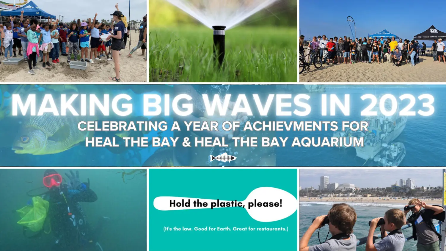
Heal the Bay achieved significant accomplishments in 2023 in safeguarding our waters, preserving biodiversity, and raising awareness about the importance of environmental conservation. Through our collective efforts and with your unwavering support, we worked tirelessly to create cleaner, healthier, and more sustainable coastal waters and watersheds for Los Angeles and beyond from summit to sea. As we reflect on the achievements of this past year, we are thrilled to carry this momentum into the coming year, always aiming to make a lasting difference. Celebrate them with us!
2023 Highlights
Our expertise was sought after, and our work was celebrated.
In 2023, Heal the Bay was honored for decades of commitment to the environment.
The City of Los Angeles officially declared October 20, 2023 “Heal the Bay Day in LA” in recognition of nearly four decades of accomplishments including the 20th anniversary of our Angler Outreach Program as well as our Aquarium.
The 3rd Annual Heal the Bay One Water symposium was convened at Will Rogers State Beach, establishing Heal the Bay as a thought leader among civil engineers, water conservation experts, and local, county, and state legislators.
Heal the Bay was officially appointed to the LA 28 Environmental Sustainability Committee for the 2028 Summer Olympics.
The future of our planet starts with better environmental policy.
Heal the Bay played a pivotal role in successfully advancing policies and legislation for the benefit of water quality, affordability, and coastal ecosystems to ensure a more sustainable Los Angeles region and climate-resilient California.
Heal the Bay,co-sponsored Assembly Bill 1572 (Friedman) alongside the NRDC and the Los Angeles Metropolitan Water District. This new law bans the use of drinking water to irrigate non-functional (purely ornamental) turf on governmental and commercial landscapes; and is expected to save the equivalent amount of water that 780,000 households use in a year.
Heal the Bay advocated for water quality protection at the Boeing Santa Susana Field Laboratory site in Simi Valley. The Los Angeles Regional Water Board voted in October to keep regulations on surface water that flows from this previous industrial site, keeping stringent water quality limits, adding more monitoring, and addressing the potential for surface water pollution to impact groundwater, a huge win in the ongoing battle for water quality protection.
Our policy team worked to legally strengthen and streamline fishing regulations to make fishery enforcement more equitable through Assembly Bill 1611 (Lowenthal). This new Heal the Bay sponsored law was supported by conservationists and fishery regulatory agencies alike as a win-win for both nature and the fishing community.
Heal the Bay co-authored a new (and well-received) Vision 2045 Report and shared it with LA County decision-makers who are tasked with overseeing the ambitious Safe, Clean, Water Program (SCWP). This collaborative “vision” laid out a roadmap of bolder goals, and recommendations to more quickly and definitively reach 2045 SCWP targets.
It Takes a Very Large Village.
This year Heal the Bay published its first Volunteer Impact Report highlighting the accomplishments of our 22,017 volunteers from the 2022 season, which paved the way for the many volunteer successes of 2023.
In 2023, Heal the Bay volunteers collected more than 22,000 pounds of trash and contributing 71,048 hours to protecting our precious watershed and coastal waters!
In September, Heal the Bay mobilized 7,337 volunteers on Coastal Cleanup Day, removing 16,211 pounds of trash (including 429 pounds of recyclables) from greater Los Angeles coastlines and waterways.
Heal the Bay’s work is powered by everyday heroes and Spectrum News highlighted one of our dedicated volunteers.
Sticking a Fork in Plastic at the Source
Recognizing the urgent need to combat plastic pollution, Heal the Bay continues impactful campaigns encouraging individuals and businesses to adopt sustainable practices. For several years, staff has been working with LA City and County to help create legislation aiming to break the harmful plastic cycle. By advocating for reducing single-use plastics and promoting responsible waste management, we took significant steps toward a plastic-free future.
Our “No Bag November” campaign reaffirmed Heal the Bay’s commitment to a plastic-free Los Angeles. Through partnerships and community activations, No Bag November urged Angelenos to say “no” to single-use plastic bags and encouraged everyone to grab their reusable bags instead.
In 2023, the implementation of THREE new laws made big waves for the environment as a means to reduce plastic in our oceans.
As a leader in the Reusable LA Coalition, we co-launched the “Hold the Plastic, please,” campaign to educate businesses and the public about LA City and County plastic bans that Heal the Bay and partners advocated to pass.
Environmental Health IS Public Health
In 2023, Heal the Bay continued its relentless commitment to ocean water and freshwater quality from summit to sea.
Since its launch in 2003, Heal the Bay’s Angler Outreach Program (in partnership with the Environmental Protection Agency) has educated more than 190,000 anglers about which fish are contaminated, and which are safer to eat.
Our annual Beach Report Card released this year remains the gold standard, providing access to the latest water quality information based on levels of fecal-indicator bacterial pollution in the ocean at over 700 beaches. For more than 30 years, our annual report has assigned “A-to-F” letter grades and ranked the “Best and Bummer” lists across beaches from Washington State to Tijuana, Mexico.
The 5th annual River Report Card was also released, ranking freshwater quality and providing grades for 35 freshwater recreation areas in Los Angeles County tested during the summer of 2022. This summer we debuted our upgraded River Report Card with an intuitive letter grading system and celebrated the achievements of our 2023 Summer Stream Team. These two programs are at the forefront of our efforts to keep LA’s waters safe and enjoyable for all.
Conservation and Marine Protection Are Key to Our Mission
Heal the Bay reaffirmed its commitment to biodiversity through both volunteer activations and the tireless efforts of our husbandry, operations, and education Aquarium teams.
Heal the Bay Aquarium plays a pivotal role in species conservation through research, breeding programs, and public awareness campaigns. In 2023, sixteen fish, three swell sharks, and dozens of moon jellies were born at the Aquarium; and our animal care team released five species of protected and rehabilitated marine life including a keystone species, the California Sheephead fish, and a critically endangered Giant Spotted Bass into the Santa Monica Bay. By releasing these animals back into the wild, Heal the Bay continues its mission to protect and support the biodiversity of wild fish populations.
As part of our collective commitment to successful conservation efforts, Heal the Bay Aquarium officially joined the Association of Zoos and Aquariums (AZA) Wildlife Trafficking Alliance. As an official member of US Fish & Wildlife Department’s Wildlife Confiscation Network pilot program, the aquarium is certified to care for the well-being of wildlife confiscated from illegal trade.
Heal the Bay’s Science and Policy Team successfully advocated for state funding to research DDT in 2022-23 and is now working as part of a coalition to lead public meetings and educate Californias on the impacts of DDT on public health and biodiversity.
As a watchdog for Marine Protected Areas, Heal the Bay’s MPA Team is actively contributing and analyzing critical data on California’s first decade-long review that began in 2023. One of the biggest conclusions of the review highlighted the fact that protecting these precious estuaries for the past decade has worked, allowing for flourishing biodiversity, larger populations, and bigger individual animals in these safeguarded areas.
Environmental Justice is a pillar of environmental health.
This year Heal the Bay stood up to big oil and continued to advocate for communities that experience the worst systemic and often immediate impacts of environmental injustice and climate change.
For decades Heal the Bay has advocated alongside organizations like Stand Together Against Neighborhood Drilling to oppose oil drilling in Los Angeles neighborhoods, a practice long seen as an environmental injustice and a public health crisis. In October of 2023, the LA County Regional Planning Commission voted in support of phasing out oil drilling in the Inglewood Oil Field, one of the largest neighborhood oil fields in the country.
In 2023 Heal the Bay publicly endorsed the Campaign for a Safe and Healthy California and will work alongside public health groups, community and faith organizations, and environmental justice leaders from across California to “KEEP THE LAW” (SB 1137) on the November 2024 ballot. This law prohibits new oil wells within 3,200 feet of homes, schools, day care centers, parks, healthcare facilities, and businesses.
Environmental Education, Outreach and Sharing our Passion to Protect What We Love
Education remained a cornerstone of our mission. In 2023, Heal the Bay expanded our outreach program, teaching schools and communities to understand the importance of environmental conservation and the role each individual can play.
Through innovative approaches and interactive science-based programs, educational efforts continued to inspire and inform diverse audiences. The Heal the Bay Aquarium field trip program sponsored 10,285 students from 22 school districts in LA County— 79% were Title 1 schools.
This year, “Coastal Cleanup Education Day” at the Aquarium hosted more than 250 3rd-5th grade students from across Los Angeles County for a day of beach exploration, scientific excursions, pollution education, and hands on learning while having some fun in the sun.
As we look back on 2023, Heal the Bay celebrates a year of accomplishments, resilience, and collaboration. These achievements underscore the collective efforts of our dedicated team, volunteers, and supporters who made a positive impact on the health of our oceans and coastal ecosystems.
Here’s to a future filled with even greater strides toward a sustainable and thriving planet!
Looking to the Future with 2024 in our sights
In 2024, Heal the Bay will enter a bold five-year strategic plan with a focus on protecting and restoring the Los Angeles environment and water. The plan aims to improve water quality, increase access to clean water, and advocate for policies that benefit the environment. We have outlined specific goals and initiatives, such as reducing plastic pollution, restoring wetlands, and engaging communities in environmental education and action.
Thank you for all our supporters both past and present.
This is a developing story and we will update information as new details come to light.
UPDATE: 6:30 PM Pacific Time On April 19, 2023.
The City of LA/LA Sanitation & Environment has responded to the April 7 deadline from the Regional Water Board and did not accept the fine or waive the hearing. They have instead entered into further negotiations with the Regional Water Board. More to come as we receive information.
UPDATE: 6:30 PM Pacific Time On April 6, 2023.
Late last week, the Los Angeles Regional Water Quality Control Board announced a tentative fine of $21.7M to the City of LA for the July 2021 sewage spill at the Hyperion Treatment facility. The fine is based on five categories of violations, including 1) the discharge of 12.5 million gallons of raw sewage to the Santa Monica Bay, 2) failure to perform offshore sampling for 14 days, 3) failure to comply with permit requirements for odors for 80 days, 4) failure to comply with monitoring and permit reporting requirements for 108 days, and 5) violations of water quality limits for 217 days (38 serious and 22 non-serious violations). The City of LA has until tomorrow, April 7, to agree to this fine and waive a hearing on the matter or to request a postponement of the hearing to allow for further deliberations. Even if the City agrees, there will be a 30-day window for public comment. If the City does not agree to the settlement or ask for a postponement, there will be a hearing. While the maximum amount for the fine, based on the violations, could have been over $500B (yes, that’s billion!), $21.7M is actually the largest penalty the LA Regional Water Board has ever proposed for permit violations. We don’t yet know how or where the final fine amount will be allocated but we hope that a majority of it will go to Supplemental Environmental Projects (SEPs), which provide environmental and public health benefits to affected areas and communities. The good news is that LA Sanitation & Environment (LASAN) has taken numeroussteps to ensure this doesn’t happen again by implementing recommendations from an Ad Hoc Advisory Committee of water quality experts from across the country, as detailed in their report that was released in February 2022. Namely, LASAN has installed additional alarms (audio and visual), completed a comprehensive update of protocols for emergency response and notifications, implemented an interagency task force for emergency response actions with LA County, El Segundo and City of LA departments, established a hotline call-in number operated 24/7, conducted equipment tests and procedure practices, installed new equipment, and upgraded existing equipment. Additional improvements that are in-progress or planned include equipment upgrades, development of plans to protect major equipment from flood damage, and more.Heal the Bay will continue to advocate to ensure that the City of LA provides sufficient funding to LASAN for critical upgrades and ongoing operations and maintenance. We will continue to track this issue and provide updates as we get them as well as opportunities for the public to weigh in.
UPDATE: 3:00 PM Pacific Time on April 13, 2022.
According to a new Daily Breeze article, “42 million gallons of sewage entered LA waterways in past 15 years. More than half of the total was spilled in 2021 alone. A nearly catastrophic disaster at the Hyperion Water Reclamation Plant and the sudden collapse of a sewer system in Carson last year combined to make it the worst since the beginning of the data set in April 2007. The two spills, roughly six months and 15 miles apart, led to the total release of 25 million gallons of raw sewage either directly into the ocean or into waterways that empty into it.”
It’s been nearly 8 months since the massive sewage spill from the Hyperion Treatment Plant and two key updates occurred recently.
First, we recently learned that Hyperion Treatment Plant has not been complying with air quality standards since the spill. This is alarming news considering that the plant emits greenhouse gasses hundreds of times more potent than carbon dioxide. While Hyperion is no longer discharging under-treated sewage into the ocean, the environmental impact of the sewage spill continues. We urge regulators to take prompt action and ensure Hyperion’s air emissions are in compliance.
Second, The City of Los Angeles, Board of Public Works assembled an advisory committee composed of government officials, academics, and NGO representatives. Our very own CEO, Shelley Luce, was on the committee. The committee was tasked with conducting an independent assessment of the spill, and their findings were recently released in February in a report along with recommendations for minimizing sewage spill risk in the future.
The report found that a series of missteps led to the sewage spill rather than a single sudden influx of debris that inundated Hyperion’s machinery, which was the original theory. Here is the series of events as we understand them:
The machines (bar screens) that Hyperion uses to remove trash and large items from our waste water became clogged because some of that trash was allowed to cycle back through those machines due to a design failure. It is also important to note that trash should not be flushed down the toilet.
When the trash removal machines became clogged, alarms were triggered, but they were not responded to in time and Hyperion’s headworks facility (building where trash is removed from our wastewater) began to flood.
Once the flooding began, it was too dangerous for workers to open an underground bypass channel that could have relieved the flooding. Opening this channel required workers to lift a large metal barrier out of the ground using a ceiling-mounted crane.
The sewage flowed to other parts of Hyperion, damaging critical equipment and systems, which further hampered their ability to respond to the situation.
Hyperion’s storm drain system, which feeds into the 1-mile ocean outfall, was eventually filled with sewage, resulting in 13 million gallons of sewage spilling into Santa Monica Bay.
The report recommended the following improvements and next steps:
Upgrade the trash removal equipment to reduce or eliminate the chance that trash is sent back through the machinery once it has already been removed from the wastewater.
Improve the alarm functionality by designing an alarm that will be immediately noticed.
Conduct additional staff training and revise protocols for alarm and flooding response.
Conduct additional recruitment to fill jobs in the headworks facility, which is where the flooding began.
We appreciate the creation of this report and we support its recommendations for improvements to Hyperion’s systems and processes. Heal the Bay’s additional recommendations for next steps in light of the report are:
Integrate the advisory committee report recommendations with the 30-day report (initial report released 30 days after the spill) recommendations. We need the findings from both reports combined so that all the information and data for the spill is in one place. Information on impacts to the public (e.g. beach closures, odors, public health impacts, economic impacts) as well as water and air quality violations should be included. And, this will help create one cohesive plan for improving Hyperion.
Prioritize the recommendations from both reports based on their significance and/or ease of correction. And each recommended action should be accompanied by a realistic timeline in which it can be addressed.
Provide stakeholders and the public with regular progress updates as improvements are made to the plant. At the very least, the Hyperion Recovery website should remain active and should be updated with such progress reports.
Heal the Bay is committed to working with LA City Public Works and Sanitation (as well as other agencies and groups) to make sure that the report recommendations are addressed promptly to protect the health and safety of Hyperion’s workers as well as the general public and the environment. Implementation of the recommendations along with the rebuilding of public trust will be paramount as Hyperion transitions to full wastewater recycling by 2035. This transition means that Hyperion will no longer discharge treated water to the ocean, but will instead recycle 100% of its water to provide for a reliable and local source of water in the face of ongoing drought and climate change impacts. Heal the Bay is a strong supporter of this effort to reduce our reliance on imported water as well as reduce impacts to the ocean – we will be tracking the issue closely to ensure that public health is prioritized along with sustainability.
UPDATE: 10:30 am Pacific Time on November 2, 2021.
We have some promising news regarding the Hyperion Treatment Plant. For the past few months, the plant has been operating in a diminished capacity due to the damage it sustained on July 11 that resulted in the discharge of 17 million gallons of raw sewage nearshore (1 mile out). Consequently, LA Sanitation (LASAN)was discharging wastewater from Hyperion Treatment Plant into the ocean (5 miles out) that did not meet regulatory requirements. We now have confirmation that the plant is fully operational according to the Los Angeles Regional Water Quality Control Board (LARWQCB).
After the July 11disaster, LASAN was issued a notice of violation by the LARWQCB for the discharge of raw sewage in violation of their permit, which will likely result in fines. Further, LASAN was required to conduct additional water quality monitoring by the LARWQCB, initially consisting of daily samples taken at multiple locations and depths, 5 miles offshore. In mid-September the LARWQCB approved a request by LASAN to reduce monitoring to three times per week and, just this week, approved LASAN’s request to cease all additional offshore monitoring. The LARWQB made this decision based on the water quality data and the reports that LASAN has been required to submit.We have also reviewed the data provided on Hyperion’s recovery webpage and found that contaminant levels in the wastewater discharged into the ocean do indeed meet regulatory requirements. However, we do have a few lingering concerns about individual events of water quality exceedances over the last month, as well as remaining maintenance work to be done.
We are relieved that Hyperion now appears able to properly treat wastewater before it is discharged into the ocean. However, we still do not know the cause of the flooding and subsequent sewage spill. Heal the Bay is part of an ad hoc group meeting to discuss the causes of the incident and the response by government agencies, and to make recommendations for improvement. The group meets nearly every week with the aim of producing a comprehensive report by the end of the year. Heal the Bay will continue to push for answers from LASAN because we must make sure events like this do not happen in the future. We also look forward to carefully reviewing the report that LASAN must submit to the LARWQB by November 8 as well as tracking and ensuring that there is enforcement of the violations.
UPDATE: 7:00 pm Pacific Time on October 4, 2021.
LA Sanitation recently released a report with an in-depth description of the events that led to the sewage discharge into the Santa Monica Bay on July 11 & 12. Here is a summary of what we learned.
The discharge occurred because the Hyperion Plant’s barscreens (trash filtration devices) clogged leading to a catastrophic flood event at the facility. Raw sewage flooded large swathes of the facility and damaged machinery and infrastructure necessary for the plant to function. Millions of gallons of this sewage were released through the 1-mile outfall and into Santa Monica Bay as an emergency measure to prevent further flooding and the plant going offline completely.
So far, no one has been able to determine the origin of the large amount of debris that clogged the barscreens that day. The flooding also made it impossible for Hyperion to determine the amount of debris that caused the blockages. These are two critical pieces of information for the incident investigation, and we are keeping up the pressure for some answers soon. Fortunately, the minute-by-minute account of July 11 & 12 in Hyperion’s report gives us some clues as to what went wrong that day and how events like this can be prevented in the future:
Hyperion’s barscreens have an automated system that clears blockages when they are detected. According to the report, this feature has never been used by the plant due to “unreliable level sensors.” The barscreens are instead operated manually, and workers clear any blockages that occur. Hyperion stated in the report that this process needs to be assessed and improved.
There is a barscreen bypass system in place at the plant which could have prevented the flooding. Unfortunately, workers at Hyperion were not able to use the bypass system in time – the flooding became too dangerous and they had to evacuate. In the report, Hyperion promised to review standard operating procedures and conduct emergency training for the bypass system.
Hyperion will develop flood risk mitigation strategies for certain facilities and equipment at the plant. This will ensure the plant can operate if a flood event happens in the future. Given the plant’s proximity to the ocean, Hyperion’s operators need to consider tsunami mitigation in their assessment.
While the origin of the barscreen-clogging debris is still a mystery, it is an opportune moment for Hyperion and water advocates to remind the public what can and cannot be flushed down the toilet (only flush bodily waste and toilet paper, nothing else). Hyperion stated that they will increase public education efforts, which Heal the Bay would be willing to assist with as we’ve done in the past.
We appreciate the transparency and data that Hyperion has provided in their report and on their website. Nevertheless, there are still some big questions that need to be answered in addition to the origin of the barscreen debris. Hyperion has not made an official announcement that they are fully operational, and we would appreciate a timeline of when they expect that to happen. The Hyperion Recovery website is still listing some critical process equipment as currently being serviced, and there are reports that the treatment plant is almost fully operational. We are also seeking more information on the quality of the wastewater currently being discharged out the 5-mile outfall.
What was causing the foul odors near Hyperion? We are getting this question a lot, so we wanted to provide some more detail. Flooding at the plant damaged the pumps that move sewage from open-air holding tanks to the secondary processing infrastructure. For three weeks, excessive amounts of sewage built up in the holding tanks while workers repaired the pumps. The odors that have plagued South Bay communities came from these holding tanks. Hyperion stated that they have been processing this backlog of sewage, and air quality will continue to improve. We’ve also learned that Hyperion has ended the air filtration & AC unit reimbursement program for households impacted by the odors.
UPDATE: 10:20 am Pacific Time on September 23, 2021.
Here is what has been going on behind-the-scenes at Heal the Bay as a follow up to the massive sewage spill from the Hyperion plant back in July 2021.
We took a tour of the Hyperion plant to see the extent of damages from the incident, which is still under investigation. We learned about what’s happening to recover Hyperion as efficiently and safely as possible, and we met some of the hardworking people who have the enormous responsibility to treat LA’s wastewater day in and day out. We are working closely with LA Public Works to evaluate existing systems for repairs and upgrades at the plant where needed.
Recent data from the Hyperion 2021 Recovery website shows the effluent coming out of the 5-mile pipe from Hyperion is getting back to within regulatory limits for most water quality measurements. However, bacteria levels at the 5-mile outfall are consistently exceeding health limits, which is alarming. The public has not been provided with a timeline for when water quality improvements are expected. Fortunately, bacteria does not appear to be impacting our beaches – as indicated by beach water quality monitoring. According to the Clean Water Act, Hyperion should be fined for every day it is out of compliance with public health and safety standards. So far it has been 74 days since the spill first occurred.
An engineer points to how high the flooding water was during the catastrophic incident at the Hyperion plant on July 11-12.
When the spill occurred on July 11-12, there was catastrophic flooding within the Hyperion plant. Raw sewage permanently disabled plant electronics that control pumps and other functions at the plant, and equipment had to be replaced. For many weeks the plant could not complete the secondary phase of the treatment process, and the only option was to pump under-treated wastewater into the ocean. The replacement and repairs are mainly done and water quality is mostly back to normal. The elevated bacteria levels at the 5-mile outfall are still an issue and we are pushing the City to determine the cause and fix it as soon as possible.
The City of Los Angeles Sanitation and Environment Department (LASAN) submitted their 30-day action report to the Regional Board and US EPA, and we are reviewing it. We’ll provide an in-depth update about it soon. Recently at the request of LASAN, the Regional Water Board reduced the required sampling from daily to three times per week.
Our team continues to closely monitor water quality with the Beach Report Card and LA County’s Beach Water Quality Advisories website. The good news is, aside from the usual bummers, we’re seeing good grades at most of LA’s beaches for the past month. A couple sites with chronic water quality issues are the Santa Monica Pier and Mother’s Beach in Marina del Rey — coming into contact with the water at these beach areas should generally be avoided, especially by young children, senior citizens, and people who are immunocompromised. Install our free Beach Report Card iOS or Android app so you can have the latest water quality grades in your pocket.
Dr. Shelley Luce, Heal the Bay CEO, is joining a virtual townhall hosted by The Board of Public Works to discuss water quality and health impacts from the Hyperion Water Reclamation Plant sewage spill in the Santa Monica Bay.
Our communities continue to have concerns and questions regarding the impacts of sewage in the ocean. Here we answer the top 5 questions we’ve been hearing on social media.
Where does the sewage magically go, which makes it safe for swimming?
Once the sewage is discharged, it travels where the ocean currents take it – that could be further out to sea, closer to shore, or it may remain in place.
Over time, fecal matter and urine will be consumed by microorganisms. This is not desirable because sewage discharges are not natural and may alter the food chain. The microorganisms consuming sewage may also consume chemicals, pharmaceuticals, and toxins contained within the fecal matter and urine. These chemical compounds might then get transferred up the food chain as other organisms consume the sewage-eating ones. Particulates like plastic and toilet paper may get ingested by larger organisms in the water or the material might settle into the sediment.
When it is deemed “safe to swim” does that mean the amount of toxins could still be above what’s normally acceptable?
Human fecal matter contains many microorganisms that can get humans sick from a single exposure. That is why our beaches are tested regularly for the presence of fecal matter, and it’s why California has strict fecal-indicator bacteria standards. Recreational water quality standards do not take into account other forms of pollution like toxins and chemicals because, in general, it takes many exposures over a long period of time to become sick from toxins and chemicals. Heal the Bay continues to advocate for increased water quality monitoring, especially for “forever chemicals” like PCBs and DDT.
How could this impact dolphins and other animals in the Bay?
We are concerned about all organisms in the Bay, including dolphins, fish, algae, and invertebrates living in the sediment. All organisms have a niche and play a role in maintaining a healthy ocean ecosystem. The sewage discharges will likely change the abundance and distribution of smaller organisms first as they consume the sewage. Those changes to the bottom of the food chain may then impact species that are higher up on the chain like fish and dolphins. The other concern is that chemicals and pharmaceuticals contained in the sewage will also get transferred up the food chain as the sewage-eating microorganisms are consumed by larger organisms.
How often is water quality being tested? Who is conducting these water safety tests?
Right now, the beaches between Ballona Creek and Manhattan Beach are being tested every day. Under normal circumstances, all beaches in the Santa Monica Bay typically get monitored 2-3 times a week in the summer on average. Santa Monica Bay beaches are monitored for recreational water quality by four government agencies: LASAN, LA County Department of Public Health, Sanitation Districts of LA County, and the City of Redondo Beach.
How can we prevent this in the future?
There is an ongoing investigation into the cause of the damage to the Hyperion Treatment Plant in El Segundo, which triggered millions of gallons of raw and partially treated sewage to be released into the Bay. Once we know the cause(s) we can advocate for preventative measures. However, we don’t need an investigation to tell us what is obvious: the public was not sufficiently notified about the sewage discharge into the Santa Monica Bay. Heal the Bay is working to put pressure on LASAN and LA County Department of Public Health to investigate why public notifications were not forthcoming and how they can ensure more expedient public warnings.
Make your voice heard about the recent 17 million gallon raw sewage spill and the ongoing discharges of partially treated sewage into the Bay from Hyperion.
Tell the City of LA your concerns and that you demand they take immediate action to improve the emergency public notification protocols and implement preventative measures so this never happens again.
Act now: The City Council meeting starts at 10am on Tuesday, August 10.
Send in a comment to the Los Angeles City Council hearing tomorrow – use Council File # 21-0839: https://cityclerk.lacity.org/publiccomment/
-or-
Call 1 669 254 5252 and use Meeting ID No. 160 535 8466 and then press #. Press # again when prompted for participant ID. Once admitted into the meeting, press *9 to request to speak.
Watch and listen to the council meeting here:
Cable TV Channel 35 https://clerk.lacity.org/calendar
(213) 621-CITY (METRO)
(818) 904-9450 (VALLEY)
(310) 471-CITY (WESTSIDE)
(310) 547-CITY (SAN PEDRO AREA)
UPDATE: 10:25 am Pacific Time on August 4, 2021.
The City of Los Angeles Sanitation & Environment (LASAN) launched a new webpage that addresses sewage discharge at the Hyperion Plant in El Segundo. It briefly covers the cause of the catastrophic incident and the recovery effort underway.
We want you to be aware of the data table (with multiple tabs) at the bottom of the page. It shows the pollutant levels in the effluent (via sampling results of what Hyperion is discharging from the 5-mile outfall), equipment status, odor monitoring results, offshore monitoring results for bacteria, and links to other data, which don’t appear to be working or filled in yet. “Effluent” is the treated wastewater that Hyperion releases to the ocean. In other words, influent is what comes into the plant (raw sewage and other debris), and effluent is what goes out of the plant (typically treated wastewater that has to meet certain standards).
We will be reviewing the data closely and providing a deeper analysis for you. But, our first impressions are that exceedances (aka violations) are occurring for multiple parameters in the effluent since July 11-12, indicating that LASAN is violating their permit by continuing to discharge inadequately treated sewage into the Bay, and is still not able to fully treat sewage. What is even more concerning is that the levels of certain pollutants appear to be increasing over the last couple of weeks (the weekly average numbers are getting larger). These high levels of total suspended solids (TSS), biochemical oxygen demand (BOD), settleable solids, turbidity, and oil & grease may have long-term negative impacts on marine life and ecosystems.
Our team will provide more information about the pollutants and what the potential impacts could be for the Santa Monica Bay later this week.
Despite this alarming data, recent beach water quality tests have indicated the water in the Santa Monica Bay is safe for human recreation. All beach advisories, except for Avalon Beach on Catalina Island, have been lifted because water samples have not exceeded State water quality standards. This is good news for beachgoers, but we recommend that you always check the latest beach conditions at theLA County Department of Public Health’s website and Heal the Bay’sBeach Report Card.
UPDATE: 8:00 am Pacific Time on August 3, 2021.
LA County Department of Public Health (DPH) released an update last night that ocean water samples collected at the following locations have met State water quality standards and beach advisories have been lifted:
Dockweiler State Beach
Ballona Creek (Near Dockweiler Tower 40)
Culver Blvd storm drain
Imperial Highway storm drain
Westchester storm drain
Pico-Kenter storm drain (Santa Monica Beach)
Topanga Canyon Lagoon (Topanga Canyon Beach in Malibu)
A warning is still in place for Avalon Beach at Catalina Island (50 feet east of the pier). The Department of Public Health continues cautioning all to be careful of swimming, surfing, and playing in this area.
The discharge contains bacteria and viruses as well as organic matter that causes low oxygen levels in ocean waters – the impacts on human health and marine life can be significant and very damaging. LASAN should have notified the public and stakeholders who have been tracking the spill results closely for the last two weeks. We don’t know if LASAN has increased monitoring to assess the impacts of the partially treated discharge – that needed to start immediately – and going forward we need transparency in order to ensure appropriate actions are taking place to assess impacts, protect people and wildlife, and pursue fines and mitigation measures to the maximum extent.
Heal the Bay was founded in the 1980s by local activists who refused to accept partially treated sewage being dumped into the Bay by Hyperion. It’s now 30 plus years later – great progress has been made, but without watchdogs we’re at risk of repeating past mistakes.
The LA Regional Water Quality Control Board has taken immediate action to boost monitoring in the Santa Monica Bay.
Last night we received a notice from the LA Regional Water Quality Control Board (Regional Board) issuing an order to the City of Los Angeles LA Sanitation and Environment (LASAN) Hyperion Treatment Plant to provide monitoring and reporting related to the discharge of sewage on July 11 and 12.
The order details how the flooding at the plant led to non-operational equipment resulting in reduced efficiency of treatment and a reduction in the quality of the discharge from the 5 mile outfall. The order documents that since the initial incident, Hyperion has violated its discharge permit by releasing effluent that is in exceedance of limits for parameters including total suspended solids (TSS), biochemical oxygen demand (BOD), turbidity, and settleable solids.
These exceedances will result in fines – however, they could have negative impacts on human health and the marine environment. We are glad to see that the Regional Board is requiring daily offshore monitoring and submission of daily monitoring and status reports. The offshore monitoring appears to include four stations, each to be tested at three depths (<1m, 15 meters, and at the outfall depth). Testing at these locations must be done for 12 parameters, including bacteria levels, which are indicative of impacts to human health.
The latest advisory from the LA County Department of Public Health (DPH) states that they are continuing to test shoreline bacteria levels daily.Heal the Bay scientists and experts will be reviewing the locations and frequency of testing today by DPH and LASAN to ensure that the frequency and spatial coverage is protective of public health. And we will continue to ask for rapid methods to be used for detection of bacterial pollution – the methods being used now take 18-24 hours to obtain results and then additional time for that information to get to the public. Rapid methods would allow for more real-time results to be available to the public.
The LA County Board of Supervisors and LA City Council members have initiated a full investigation into the 17 million gallon spill and continued discharges from Hyperion.
In addition to the Water Board’s actions outlined above, the LA County Board of Supervisors has requested a full investigation within 30 days (scroll down to our last update on 7/29 for more info). And the LA City Council is demanding a detailed report and action plan too, which includes instructing LASAN to “look for engineering opportunities during repairs to begin transforming the facility to recycle 100% of wastewater as part of the city’s Operation NEXT,” according to the Daily Breeze.
Is it safe to swim in the Bay today?
If you are deciding whether or not you should go into the water at LA’s beaches this weekend, we want to be clear: there are potential health risks at some locations.
Water quality tests from sites across the Bay have indicated high bacteria levels around El Segundo, Dockweiler, and Venice beach areas. These beach areas are under an advisory and should be avoided until tests indicate the water quality is good.
If you are heading to other areas in the Bay, we recommend that you check the latest beach conditions at the LA County Department of Public Health’s website and Heal the Bay’s Beach Report Card (so you can avoid beach areas impacted by bacterial-pollution issues). Conditions can change rapidly, so pay attention to beach postings and remember there is a 24-hour lag between water testing and posted warnings.
Message us on Instagram, Twitter, Facebook or contact us online if you need any help getting started with our Beach Report Card website or app — or if you have any questions or concerns, don’t hesitate to reach out and we’ll do our best to get you an answer.
UPDATE: 11:00 am Pacific Time on July 29, 2021.
One week after the massive raw sewage spill in the Santa Monica Bay from the Hyperion Plant in El Segundo, the LA County Board of Supervisors met and heard an update on what went wrong, particularly related to notification protocols, and what next steps are needed. Heal the Bay staff called in to the hearing to speak on the item, but we were not able to because they cut off public comment after 1 hour for all items on the agenda. We were glad to hear at least three people speak passionately on the issue. We did send in a letter, supporting the motion as well as offering additional recommendations. You can read our letter and other public correspondence on the item here: http://file.lacounty.gov/SDSInter/bos/supdocs/160317.pdf
The agenda item was heard around 3:15pm and included a brief presentation on the expedited report from CityGate that Supervisor Hahn requested right after the massive release of raw sewage. The findings of the report are quite disturbing and highlight multiple failures in communication and notification, primarily by the LA County Department of Public Health (DPH).
Next, Supervisor Hahn asked a series of questions of Dr. Barbara Ferrer (Director, LA County Dept Public Health), Gary Jones (Director, LA County Dept of Beaches & Harbors), and Fernando Boiteux, (Chief, LA County Lifeguard Division). Dr. Ferrer started by apologizing to the Board and the public; she took full responsibility for the failures and stated that DPH has already made fixes and will continue to improve training, processes, and protocols. Dr. Ferrer said that what happened was unacceptable and that it will never happen again. We appreciated hearing this apology and DPH taking responsibility for their actions (or lack of actions) and the commitment to do better.
Supervisor Hahn asked Dr. Ferrer about ensuring that public health – both in the water and in the community – continue to be protected as the Hyperion plant recovers from the major failure and undergoes construction to get back fully online. El Segundo neighborhoods are bearing the brunt of unbearable odors and LASAN is offering vouchers for air conditioners and hotel rooms for those affected. Dr. Ferrer assured Supervisor Hahn that water quality would continue to be tested and that the DPH team would be conducting door-to-door outreach in the community to ensure that affected residents know how to contact them, report odors, and get access to resources.
Gary Jones from Beaches & Harbors and Fernando Boiteux from County Lifeguards also answered questions about when they received notice of the sewage discharge, what could be improved in communications, and how beach closures should ideally proceed.
The motion was passed, which will result in a more in-depth After Action Report to be produced in 30 days. This follow-up report will detail what happened, where the failures occurred, and recommendations for fixing failures and ensuring this never happens again.
Heal the Bay greatly appreciated the updates and the transparency and accountability that the report and hearing provided. We will be actively following this issue and are engaging with Supervisor Hahn’s office and agencies to offer our recommendations and participate in the process. We will continue to hold agencies accountable and ensure that there are appropriate repercussions for the multiple failures that occurred.
A report was released this week, and made public today, about the recent 17-million gallon sewage spill from the Hyperion plant in El Segundo. “The handling of this release and the necessary public notification were failures, the initial report concluded.
The LA County Board of Supervisors will be hearing this expedited report on Tuesday, July 27 starting at 9:30 am. The Board will be voting on a motion to get this update as well as to request a more detailed “After Action” report within 30 days. Heal the Bay will be supporting this motion by sending in a letter and calling in to give oral testimony at the hearing. We will be suggesting additional recommendations, such as implementing rapid testing methods for water quality and tracking the plume through satellite imagery and other methods.
Take action!
Watch the hearing, send in an email or a letter, and try to call in to the hearing to speak (this can be challenging to do as speaking time is limited).
We appreciate Supervisor Hahn’s leadership on this and hope to work collaboratively with County and City agencies to ensure this never happens again. And, if it does, that the public is notified immediately and effectively.
UPDATE: 9:10 pm Pacific Time on July 14, 2021.
This evening the LA County Department of Public Health lifted beach closures at Dockweiler State Beach and El Segundo Beach because water samples taken over the past two days have not shown dangerous levels of fecal-indicator bacteria. Based on these results, it appears safe at most locations in the Santa Monica Bay, but we urge you to exercise caution by regularly checking the LA County Department of Public Health website for water conditions and beach closures at PublicHealth.LACounty.gov/Beach and Heal the Bay’s Beach Report Card.
There are four sites in the Santa Monica Bay that currently do exceed State standards and coming into contact with water at these locations could cause illness – it is unclear if these exceedances are due to the sewage spill, recent rainfall, or something else:
Topanga County Beach at the Topanga Canyon Lagoon
Will Rogers State Beach at the Santa Monica Canyon storm drain
Santa Monica State Beach at the Santa Monica Pier
Manhattan County Beach at the 28th Street storm drain
Heal the Bay won’t let up on pushing for improvements that prevent sewage spills, advance water quality testing methods, and ensure public notifications happen swiftly and equitably. Thanks to everyone in the community for reaching out, voicing concerns, asking questions, staying informed, and most importantly protecting each other by sharing critical updates. This community is strong. It is amazing to see us spring into action. Thank you.
More to come on next steps, so you can take action to hold polluters accountable and to prevent this from happening again.
We have some preliminary good news to share — but don’t rush back to the water quite yet.
Water samples taken on Monday, July 12 by LA City Bureau of Sanitation & the Environment (LASAN) and LA County Department of Public Health (DPH) do not show high levels of fecal indicator bacteria (FIB). FIB, in significant quantities, indicate the presence of harmful pathogens in the water. Samples were taken at numerous locations at the shoreline and offshore, at various depths.
While this is good news, the beaches are still closed and will remain closed until two consecutive days of sampling show safe water quality. So, samples were taken again today and if they show low levels of bacteria, closures will be lifted tomorrow.
These results are very preliminary since the samples were taken Monday morning and early afternoon. Tides, currents and wind continue to move water around and we don’t know where the contamination may have ended up.
We also don’t know what the water quality was before the samples were collected – i.e. on Sunday evening and early Monday morning. It is possible that bacteria levels were higher then, and that people who got in the water were unknowingly exposed to poor water quality.
We appreciate that LASAN and DPH have been forthcoming with us on the results, but we feel strongly that this information should be spread widely to the general public, as early as possible. LA County DPH is responsible for notifying the public of dangerous levels of contamination. Given the significant amount of raw sewage released, nearby beaches should have been closed immediately. Delaying public notification by 12-24 hours is not acceptable.
We have heard from many concerned folx that they were at the beaches on Sunday evening and Monday all day without any knowledge of the spill, or any ability to take precautions. We will be working with City and County agencies to establish protocols that better protect public health. We also urge LASAN and DPH to use rapid methods to detect contamination more quickly. DNA-based lab methods like PCR are readily available and provide reliable results in minutes or hours, rather than the 24-hour process required for traditional bacterial monitoring. Using methods like these, in addition to traditional methods, as long as they are accompanied with good public notification, would help get critical information to our many ocean users much more quickly and could prevent significant harm to LA residents and visitors.
You can check the status of beach closures and conditions on LA County’s recorded information hotline, available 24 hours a day, at 1-800-525-5662. Information about beach closures and conditions is also available online at: PublicHealth.LACounty.gov/Beach.
We will continue to track this issue and keep you informed.
When did the spill occur?
The sewage spill started at 7 pm on 7/11/2021 and stopped at about 5 am on 7/12/2021. We are told by City of LA’s Bureau of Sanitation that the spill was stopped early this morning at around 5 am and all sewage is now being treated normally.
How much was spilled?
We understand 17 million gallons of raw sewage were spilled through the 1-mile outfall, which is directly offshore from the Hyperion Water Reclamation Plant in El Segundo.
Which beaches are impacted?
Currently Dockweiler State Beach and El Segundo Beach are closed to the public. The City of Los Angeles and LA County Department of Public Health are testing beaches and water in the Santa Monica Bay. More information can be found at the LA County Department of Public Health’s website.
What should the public do to protect themselves?
We recommend the public stay out of the water in the Santa Monica Bay until further notice. Also, check the Beach Report Card for the latest ocean water quality alerts in California, and review the River Report Card for water quality information about freshwater swimming holes in Los Angeles County.
What issues does this cause to people and to ocean wildlife?
Bacteria and viruses in raw sewage are extremely dangerous to people and can carry a variety of diseases. Debris such as tampons and plastic trash, when released into the Bay, can harbor bacteria and can cause entanglement of wildlife, but it seems in this case those debris were successfully filtered out of the spill before it made it to the Bay.
Why did this happen?
We understand the inflow to the Hyperion plant in El Segundo was severely clogged and flooded the facility. The sewage left the facility untreated through the 1-mile pipe and outfall.
What is the source and how can we hold them accountable for pollution?
This is fully the responsibility of the City of LA and their Bureau of Sanitation. The City normally does a very good job of containing and fully treating hundreds of millions of gallons of sewage every day – but when spills happen the City must move quickly to warn the public, and must discover and fix the cause to prevent future spills.
How can sewage spills be prevented?
Proper maintenance as well as people not flushing trash items such as plastic trash into the system are the best preventative measures.
How often do sewage spills occur?
The last major sewage spill in Los Angeles County was in 2015. However, smaller sewage spills are not an uncommon occurrence. In 2020 to 2021, seventy-five sewage spills sent a total of 346,888 gallons into rivers, lakes, and streams within Los Angeles County. One 222,542 gallon spill in February 2021 closed all the beaches in Long Beach; this area is monitored by Heal the Bay’s Beach Report Card. A total of 39,621 gallons of sewage were spilled into the Los Angeles River, and 140 gallons were spilled into Las Virgenes Creek; both waterways are monitored by Heal the Bay’s River Report Card.
For more information about sewage spills, visit LA County Department of Public Health’s website.
A view of Big Rock Beach from above / BeachReportCard.org. — It’s National Water Quality Month, and to celebrate we’re sharing with you a little-known LA County beach spot that shines when it comes to water quality.
Big Rock Beach
Big Rock Beach received an A+ in our most recent Beach Report Card—the highest grade a beach can get. Located in Malibu, about 8 ½ miles north of the Santa Monica Pier on PCH, Big Rock Beach has free parking and a coastal access stairway that leads down to the beach.
Lots of rocks mean you may see a tide pool or two, and with views up the coastline, it’s a great place to catch a sunset.
Why is it so Clean?
With less development than more urban shorelines, a largely natural landscape upstream, and only a single storm drain nearby, bacteria levels tend to be low at Big Rock Beach. For the same reasons, beaches in Malibu tend to fare better than beaches in more densely-populated areas, largely due to reduced urban runoff.
The beach is also what we call an “open ocean beach”, meaning it has good water circulation, so any pollutants that do enter the water are quickly flushed away from the shore by waves and currents.
Heal the Bay created The Beach Report Card more than 30 years ago, when beachgoers knew very little about the water quality at their favorite beaches, or the health risks of swimming in polluted waters. With weekly and annual water quality grades based on bacterial pollution for more than 700 beaches from Washington State all the way down to Tijuana, you can know before you go.
Find water quality grades for Big Rock Beach and any other beach you’d like to visit on our free website and app.
Written by Lindsey Jurca. To help keep the beach-going public safe, Heal the Bay created The Beach Report Card over 30 years ago. The Beach Report Card is an important and comprehensive public health tool, providing weekly and annual water quality grades based on bacterial pollution at over 700 beaches from Washington to Tijuana.
Less than 10% of all plastic ever produced has been recycled.
This Plastic-Free July, Reuse Is a Right. Learn why expanding reusable systems is key to reducing plastic pollution, then take action by signing our petition urging LA leaders to support a reusable future for Los Angeles.


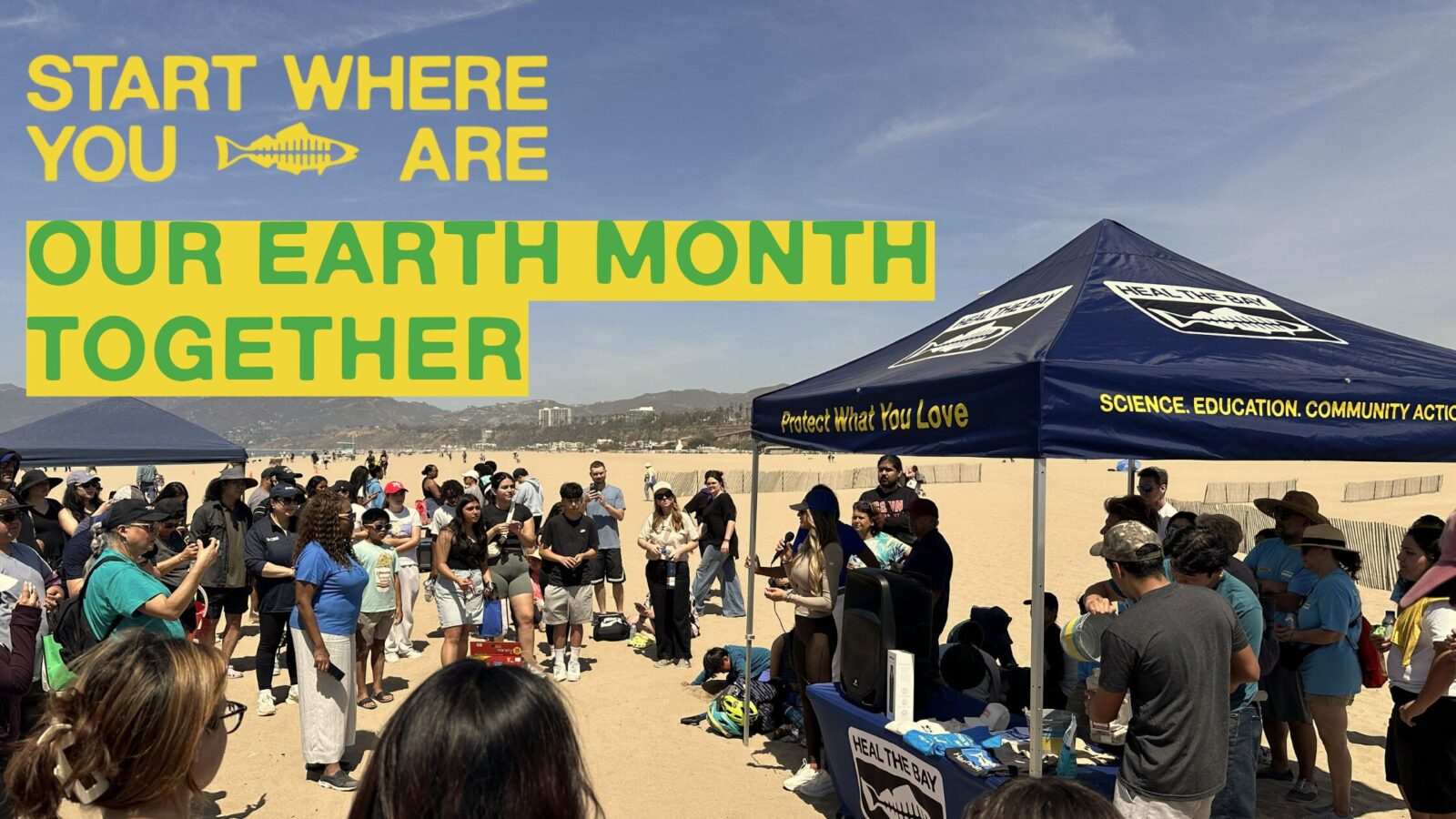

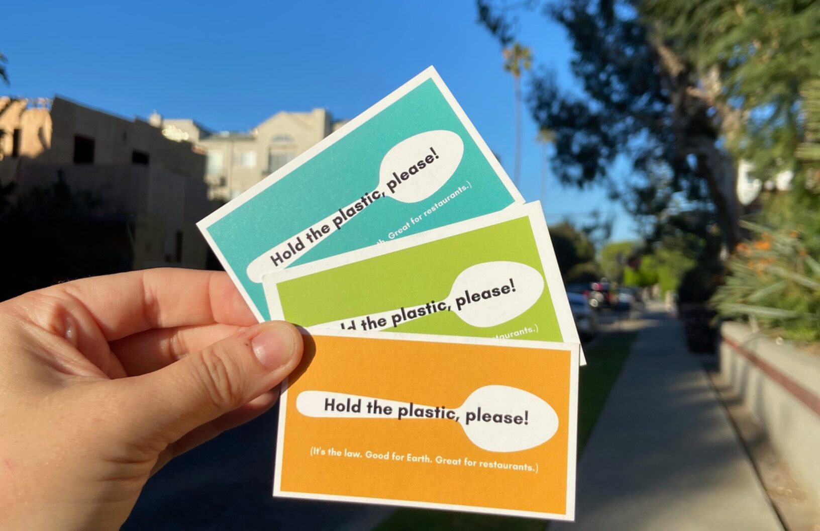 That momentum was carried into policy and everyday action. The Reusable LA coalition launched the all-new Hold the Plastic guide, giving Angelenos an easy way to take plastic reduction into their own hands and look up the latest local laws for restaurants and businesses across the city. Search up the laws that apply to you and your favorite restaurants and discover tools to help businesses reduce single-use plastic waste.
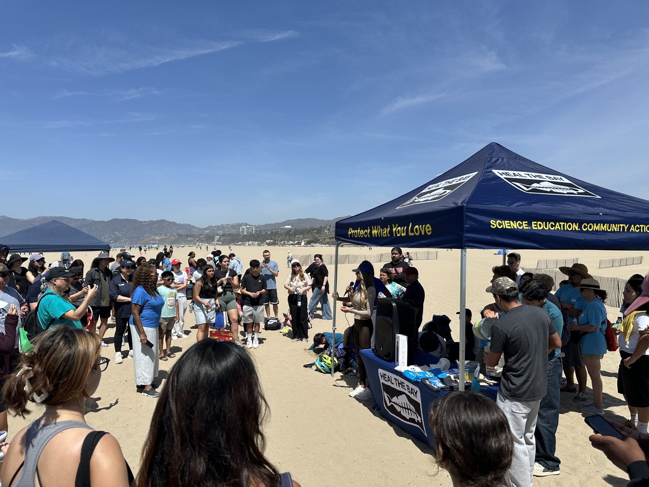 At the April Nothin’ But Sand Beach Cleanup, more than 800 participants gathered at Santa Monica Pier Beach, one of LA’s most iconic (and most polluted) beaches, and removed over 220 pounds of trash. Each piece collected represents one less threat to marine life and a step toward a healthier coastline. There’s a reason why thousands of people across the region have joined Heal the Bay’s clean ups: they’re as impactful as they are fun.