Top

Heal the Bay Blog

Looking for more than water quality? Find more Ash to Action Updates HERE.

SEE OUR THE LATEST POST-FIRE WATER QUALITY UPDATES:

March 28, 2025

Post-fire ocean advisories were just lifted, but is it finally safe to swim in the coastal waters?

March 27, 2025

Heal the Bay’s post-fire water quality data and analysis is live!

March 25, 2025

Watch the Webinar on the most recent Ash to Action updates

March 13, 2025

Read our analysis of the LACDPH & RWQCB data (part 2).

February 28, 2025

Our analysis of the LA County Department of Public Health post-fire water quality data is live.

February 26, 2025 –

Learn about beach safety in the wake of the fires.

February 18, 2025

In late January, Heal the Bay’s staff scientists began collecting ocean-water samples from 10 shoreline sites along the Bay to test for heavy metals, PCBs, asbestos, and other toxins. See our water quality testing timeline

January 29, 2025

Our fire response has just begun. 

UPDATE MARCH 28, 2025

The ocean water advisories along LA’s coast have been lifted, and based on recent data, Heal the Bay is cautiously optimistic that chemical contamination from the fires no longer poses a major risk for beachgoers. Post-fire debris is still a danger. 

Is it finally safe to swim and surf?  This week the Los Angeles County Department of Public Health lifted the ocean water advisories along LA’s coast. Based on data collected in January and February, Heal the Bay is cautiously optimistic that the chemical contamination from the fires does not pose a significant risk for recreation at our local beaches or in our coastal waters. However, the burn area may still pose some risks to beachgoers, swimmers, and surfers. Here’s what we know:
Physical debris is still being observed in the water and along the shore, primarily off the coast of the burn area from Las Flores to Will Rogers Beach. The good news is that LA County Beaches and Harbors is reporting a decrease in the volume of debris washing onto our shores. But because debris can include sharp objects, everyone should continue to use extra caution to avoid anything that looks like wildfire reminants, whether on the sand or in our coastal waters. 
Debris removal has begun on the 300 homes along PCH that were tragically lost in the fires. While this is also great news for the bay, the LA County Department of Public Health has issued a health advisory stating that it is not safe to reside within 250 yards of debris removal because the activity can disturb contaminants and send them into the air and water. This means that recreating within 250 yards of debris removal may pose additional risk to beachgoers, swimmers, and surfers.
If you choose to visit our beaches or get in the water, HTB recommends the following safety precautions:
  • Avoid areas within 250 yards of active debris removal.
  • Wear closed-toe shoes if walking on wet sand, as debris such as broken glass and structural fragments may still wash ashore.
  • Never touch trash or debris with bare hands.
  • Keep children and pets away from debris, especially in wet sand or high tide areas, where contamination risk may be higher.
  • Do not approach injured or distressed wildlife. If you have concerns about a marine mammal, contact the Marine Mammal Care Center at (1-800-39-WHALE).
  • Heal the Bay continues to urge beachgoers to recreate south of Santa Monica at Montana Avenue or north of the fire boundary in Malibu, where impacts are significantly lower. 
  • Avoid eating seafood caught in Santa Monica Bay. Contaminants in the ocean water exceed safe levels for fish consumption. Additionally, the SoCal coast is experiencing a harmful algal bloom, which may pose a risk when consuming locally caught shellfish.
Please use this information to make informed choices for your safety and the well-being of your family and pets. The LA Regional Water Quality Control Board has also published risk-based recreational thresholds and a tool to help beachgoers decide how often they can safely enjoy the coastal waters. Click the link in our bio to view these resources. 
While the beaches are open to the public now, the long-term impacts of wildfire contamination continue to raise concerns. Our January data shows elevated levels of heavy metals in the bay, posing risks to marine life. Heal the Bay continues to investigate the effects of wildfire-related pollutants and bioaccumulation in our coastal ecosystems, but we can’t do it without you.  Visit healthebay.org/donate to support our science, safety, and post-fire recovery work. Together, we can protect what we love. 


UPDATE MARCH 27, 2025

According to water-quality testing results released today by Heal the Bay, local marine life faces significant and ongoing threats from heavy metals that leached into Santa Monica Bay after January’s Palisades wildfires.
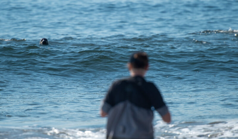
 

PRESS RELEASE 3/27/2025 –Test results from 10 collection sites along the entire length of Santa Monica Bay show that immediately after the fires, water quality at LA’s beaches was much better than expected, diminishing fears about human health impacts from polluted runoff in fire-scarred areas. We cannot definitively say that the water is safe until we have additional data and information about risk-thresholds for recreational contact, but based on the data we have seen to date, we are cautiously optimistic.

However, our analysis indicates that marine mammals, multiple fish populations, and other species further down the food chain are at serious risk from elevated levels of beryllium, copper, chromium, nickel, lead, and other harmful heavy metals and nutrients. 
Silver, arsenic and zinc were also detected above average marine-health limits. Aluminum, iron, and manganese also showed elevated levels, though no marine health limits exist for these metals. In all, Heal the Bay staff scientists and a regional water agency tested for 116 known pollutants at multiple sites in January and February. (Please click here for a detailed analysis of the results, our data spreadsheet, and raw data from the PHYSIS lab

Following heavy seasonal rains, toxic pollutants washed into the intertidal zones from burned structures and scorched earth in the Palisades, Topanga, and Malibu. Waves lapping onto fire-ravaged buildings along Pacific Coast Highway continue to sweep harmful metals into the sea. 

Even at low concentrations, heavy metals can disrupt vital biological processes, damage cells, and impair reproductive and immune functions for marine life. Metals can also be transferred and magnified through the food chain. This impacts the entire food web, which inevitably impacts humans. In short, when animals get sick, humans can get sick, particularly from consuming seafood that has a bioaccumulation of metals in their systems. 

Heal the Bay is urging authorities to expedite the removal of burned-out structures and other fire-related debris from PCH as soon as possible. Unfortunately, some homeowners have been slow to respond to U.S. Army Corps of Engineers’ offers to facilitate debris removal. Roughly 45 shoreline homeowners have opted out of the program, while nearly 100 have not responded at all. Whether or not a homeowner decides to use the US Army Corps of Engineers or a private contractor, it’s imperative that debris removal happens quickly. 

“Every day that hazardous debris remains along the coast, more harmful contaminants flow into the sea,” says Tracy Quinn, President and CEO of Heal the Bay. “If we want to give our marine life a fighting chance, we need that debris removed as soon as possible.” 
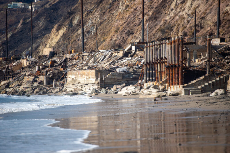
The most concerning findings come from the hardest-hit fire areas, including Topanga Beach, the Big Rock section of Malibu, and Will Rogers State Beach near Pacific Palisades. However, the waters around Santa Monica Pier and Dockweiler State Beach also spiked for heavy metals — suggesting that more studies are needed to understand the movement of contaminants offshore or identify other sources. 

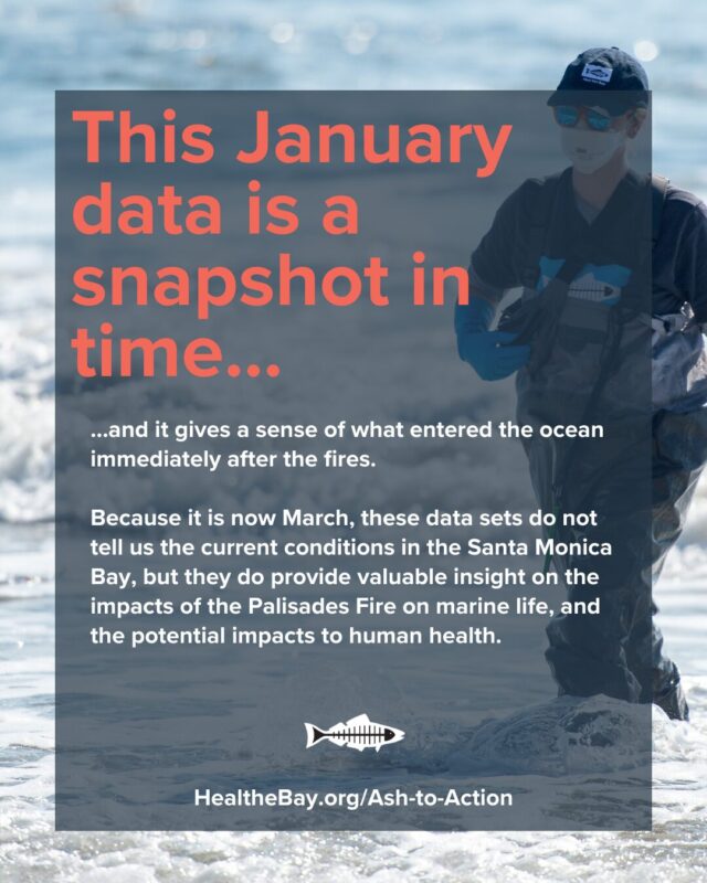
Because it is now March, these data do not tell us the current conditions in Santa Monica Bay, but they do provide valuable insight into the impacts of the Palisades Fire on marine life and the potential impacts on human health. 

Risk tolerance is a personal decision. Here is some information that can help beachgoers decide if, when, and where they may want to enter the ocean.  

  • The contaminants tested seem to be below human health limits for recreational contact for the data where limits could be identified. The Los Angeles Regional Water Quality Control Board is still assessing risk-thresholds, including those for PAH, a harmful organic compound related to fire-scorched debris.  
  • PAHs, the group of contaminants that may be above human health limits, are unlikely to sicken people who swim or surf a few times, but frequent or prolonged exposure may contribute to an increased risk for future chronic health issues.    

Beachgoers should also be careful about walking on the sand, which may contain sharp fire-related debris like nails and broken glass. For the time being, Heal the Bay recommends avoiding beaches within the fire-impacted areas and as far south as Montana Ave in Santa Monica. The Regional Water Quality Control Board has already posted some sand and sediment data for LA’s beaches. We are waiting for the complete test results to post our analysis. Stay tuned.  

The fire and recent marine mammal deaths 

It’s also worth noting the recent uptick in marine mammal beach stranding and deaths in Santa Monica Bay related to domoic acid poisoning. Elevated levels of runoff-related nutrients can contribute to the development of algal blooms in the Bay and accumulate in shellfish. When mammals consume shellfish, they can get sick and die from the neurotoxins produced by certain algae. 

This is the fourth consecutive year of domoic acid outbreaks. The recent fires did create a significant dump of nutrients like sulfate and phosphorous into the ocean, but there is no evidence, yet, of a correlation between the wildfires and the domoic acid outbreak. 

About the testing 
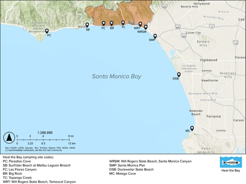
On Jan. 24-25, before the first winter storms came, Heal the Bay staff collected ocean-water samples at 10 shoreline sites across Santa Monica Bay. From Paradise Cove to Malaga Cove, they tested for 116 pollutants. They took samples again on Jan. 28, after heavy rainfall, to better understand how stormwater might carry toxins from the burn zone. 

Processing samples took multiple weeks due to the complexity of sample preparation, the need for precise instrumentation, and the rigorous quality control required. It also took several weeks to receive the data results back from Physis Lab. Then, additional time was needed for Heal the Bay’s Science and Policy Team to analyze and assess the data. 

Staff members from the Los Angeles County Department of Public Health collected water samples on Feb. 18, which Heal the Bay also analyzed for its report. After the intense Feb. 13 storms, testing showed elevated levels of contaminants that do not have established risk-thresholds for recreational contact. Further analysis is required and will be included in an upcoming post. 

Heal the Bay is part of a collaborative task force working with government agencies, researchers, and other nonprofits to better understand the extent of the contamination and how to clean it up efficiently. We will be updating our analysis and sharing the findings in the weeks to come as soon as new data becomes available. 

Heal the Bay is the only organization providing this kind of in-depth analysis of water quality data.

But to continue this important work, we need your support. If you’d like to see more of these efforts, please consider donating.

Every contribution helps!    SUPPORT OUR WORK NOW

Read the Full Scientific Analysis – Published on March 27, 2025

See all of the data that Heal the Bay has compiled – Data
Spreadsheet Published March 27, 2025

See our Raw data from PHYSIS LAB Testing- Published March 27, 2025


UPDATE MARCH 25, 2025

Watch the Webinar for today’s latest Heal the Bay Ash to Action Updates.

Learn about the critical work that Heal the Bay and its academic partners are doing to protect the environment and monitor water quality in Santa Monica Bay.

UPDATE MARCH 13, 2025

The Los Angeles Regional Water Quality Control Board has released its 2025 Post-Fire Water Quality Monitoring results.
“The board has been working with Los Angeles County to monitor ocean water quality since Jan. 22, 2025. Samples are collected regularly at 12 beach sites from La Costa Beach to Dockweiler Beach by the Los Angeles County Department of Public Health. They then are analyzed by the board for metals, nutrients, polychlorinated biphenyls (PBCs) and polycyclic aromatic hydrocarbons (PAHs), which are chemicals that may be found in water runoff based on previous California wildfires.” (Waterboards.ca.gov)

Click here to SEE THEIR RESULTS, the test site map, and stay tuned for their sediment and beach sand sampling results.


UPDATE FEBRUARY 28, 2025

Post-Fire Water Quality in Santa Monica Bay: We reviewed results from the LA County Department of Public Health (DPH).

Recent wildfires in Los Angeles that started on January 07, 2025, have impacted water quality in Santa Monica Bay. To understand the extent of these water quality impacts, we looked for contaminants that are likely to be mobilized after a wildfire, and that pose a risk to human and ecological health when concentrations are elevated; this includes heavy metals, PAHs (polycyclic aromatic hydrocarbons), nutrients, bacteria, and solids that decrease water clarity. Right now, Heal the Bay has data that our staff collected for bacteria and water clarity (referred to as “turbidity”), which have faster processing times and which we can test on-site in the Heal the Bay lab, while other contaminant samples were sent to a contracted lab to process.

While we wait for Heal the Bay’s results for the other contaminants, we reviewed results from the LA County Department of Public Health (DPH), which took samples on January 22, 2025, and January 27, 2025, at beaches from Las Flores State Beach to Dockweiler State Beach. These data points are representative of water quality before and after the first flush rain event, over a month ago. Since then, we have had additional significant rainfall, including nearly two inches of rain on February 13, 2025, which, unfortunately, was not tested by DPH in time to provide wet weather data. Data that are more recent will provide needed insight into overall conditions in our coastal waters. Heal the Bay will continue to provide updates as new data become available.  

Water contact limits do not exist for most of the contaminants of concern associated with wildfires, so to understand potential health risks, we compared results to limits in the CA Drinking Water standards, the CA Ocean Plan (for both human health and marine life), and the Hawai‘i Department of Health Surface Water Action Levels for Marine Habitats (used to assess impacts of the Lahaina Fires). Our initial findings show elevated heavy metals, bacteria, nutrients, and other organic compounds, along with a decline in water clarity, all of which indicate that wildfire runoff does pose a risk to human and ecological health and that contamination is traveling beyond the immediate burn zone. 

Key Findings from January 22 and 27, 2025: 

  • Heavy Metals and Metalloids: Aluminum, iron, selenium, and manganese were elevated above drinking water standards, sometimes as much as 10x the limit. This is not an immediate human health threat, but we urge caution if there is the possibility of ingestion. These four metals, in addition to arsenic, copper, and zinc, also exceeded safety thresholds for marine health, particularly at Will Rogers State Beach and Topanga Beach, posing a health risk to marine life. Even at low concentrations, these metals can disrupt vital biological processes, damage cells, and impair reproductive and immune functions for marine animals.  
  • PAHs (polycyclic aromatic hydrocarbons): PAHs were detected at unsafe levels, based on human health standards in the CA Ocean Plan, at Will Rogers State Beach and Topanga Beach and were not detected at other sites. This poses a site-specific risk to human health within the burn zone.  
  • Nutrients: Elevated phosphorus levels have increased nutrient concentration in Santa Monica Bay, leading to the formation of a persistent brown foam along the shoreline and increasing the risk of algal blooms.  
  • Turbidity & Solids: While turbidity may not pose a direct risk to public health, it can disrupt biological processes for marine life, and water clarity can help to show how far runoff from the burn zone traveled along the coastline. Water clarity declined significantly after rain from Surfrider Beach down to at least Dockweiler Beach, indicating wildfire runoff spread beyond the burn zone. Turbidity levels were consistently good at Paradise Cove (north of the burn zone) and Malaga Cove (just north of Palos Verdes Peninsula), indicating boundaries on the extent of pollution traveling up and down the coastline, but that boundary is not yet clear.  
  • Bacterial Contamination: High bacteria levels were observed near storm drains, worsening after rainfall, following the typical pattern for bacterial pollution in Santa Monica Bay.  

What You Need to Know: 

A day at the beach should never make anyone sick. Heal the Bay is dedicated to protecting public health by sharing water quality information, and we remain concerned about the potential risks associated with post-fire contamination in ocean water and sand. Additionally, hazardous debris, such as nails and pipes, continues to wash ashore, posing a physical risk to beachgoers. 

At this time, Heal the Bay recommends avoiding beaches and ocean water from Las Flores to Santa Monica State Beach and exercising caution at beaches further south, at least to Dockweiler State Beach. While water clarity does improve further south at Malaga Cove, we do not yet have comprehensive data for beaches south of Dockweiler State Beach, so we cannot determine potential health risks. If you visit the beach anywhere in Santa Monica Bay south of Surfrider Beach: 

  • Stay vigilant; look out for sharp debris and avoid picking up objects with bare hands.
  • Keep children and pets from touching or ingesting water or wildfire debris.  
  • Refrain from full-body submersion into the coastal waters in the designated areas, which can lead to accidental ingestion.  

Heal the Bay has collected additional sand and water samples throughout Santa Monica Bay from Paradise Cove down to Malaga Cove. We will share results on our website as soon as those data become available. We urge the Los Angeles County Department of Public Health to enhance transparency in decision-making and ensure all relevant data is made publicly accessible in a timely manner. Until further testing is completed and more information on current water conditions is released, we advise the public to remain cautious when visiting affected beaches.  

UPDATE FEBRUARY 26, 2025

On Monday, February 24, 2025, Heal the Bay learned that the Los Angeles County Department of Public Health (DPH) had stated beachgoers may recreate on the sand in the fire-impacted areas. We also learned that this determination is likely based on only two debris samples taken by Los Angeles County Public Works, one at Topanga Creek and the other at Will Rogers State Beach. These samples were collected to determine the disposal method required to remove the debris, not to determine if it is safe for people to be on the sand. It is alarming that DPH would make this proclamation based on only two data points. While preliminary debris and ocean water quality testing have not shown elevated levels of harmful contaminants attributed to burned household items, the sample size for both water and sand thus far is quite small. At this time, we simply do not have enough information to determine if the sand or water at beaches where debris is present is safe for recreation. Furthermore, dangerous debris such as nails, screws, and pipes continue to wash up on shore, often concealed in sand or near-shore waves, increasing the risk to people playing on our beaches. This is an unprecedented event, and we must wait for the results of additional testing before declaring our beaches safe. We ask for increased transparency from the LA County Department of Public Health in decision making going forward, data used to protect our public health should be available to the public.

For now, Heal the Bay recommends that people avoid beaches (both sand and water) from Las Flores to Santa Monica State Beach and use extra caution on beaches south of Santa Monica. If choosing to go to the beach, watch out for sharp debris, do not pick up debris with your bare hands, and keep a close eye on children and pets to ensure they do not touch or ingest debris.

Heal the Bay and the Regional Water Quality Control Board have each collected sand samples from throughout the burn area, and we are awaiting results. We will share our ocean water and sand testing results on our website as soon as they are available.

Los Angeles County Department of Public Health’s full statement on beach safety: “The ocean water advisory due to fire impacts from Las Flores State Beach to Santa Monica State Beach remains in effect until further notice. Beachgoers may recreate on the sand but continue to be advised to stay away from visible fire debris and to stay out of the ocean water during any posted ocean advisory.”

UPDATE FEBRUARY 18, 2025

We expect results this week from Heal the Bay’s first round of expanded ocean-water quality testing. 

 In late January, Heal the Bay’s staff scientists began collecting ocean-water samples from 10 shoreline sites along the Bay to test for heavy metals, PCBs, asbestos, and other toxins. These harmful pollutants are flowing unchecked to the sea from recent heavy rains and other runoff from burn zones.  We expect results from before and after the “first flush” storm during the week of February 17th and will post them here. 

UPDATE JANUARY 14, 2025

We present the updated timeline detailing our recent water quality assessment activities in the coastal regions affected by the Palisades fire.

  • January 24-25, 2025
    •  Heal the Bay conducted initial pre-rain water quality testing at 10 locations throughout Santa Monica Bay: five within the burn zone, three outside of the burn zone but within the beach advisory zones, and two control sites (one north and one south of the beach advisory zones).
    • Our water quality scientists tested for temperature, turbidity, Fecal Indicator Bacteria, PAHs, PCBs, PFAS, benzene, mercury, and other heavy metals. This sampling involved coordination with the Fire Department and Lifeguards to gain access to the closed burn zone.
  • January 28, 2025:
    • After the January 26 rainstorm, staff took water quality samples again for the same pollutants and at the same locations tested on January 24-25, to compare pre- and post-rain results.
    • Jenny Jay from UCLA joined us for the six northernmost sampling sites to test for metals, antibiotic-resistant bacteria, and nutrients.
  • February 3, 2025: 
    • Heal the Bay staff examined the Beach Report Card on Friday, January 31, 2025, and identified data gaps within the burn zone.
    • Staff went out on Monday, February 3, 2025, to sample the five locations within the burn zone for temperature, turbidity, and Fecal Indicator Bacteria (which we can process ourselves in our lab) to fill those data gaps.
    • On this sample day, journalists from NPR and Spectrum News and the Fire Department’s photography team joined us to document and report on our testing.
    • Heal the Bay staff attended the Post-Fire Coordinated Water Quality Testing Meeting hosted by SCCWRP. While this group aims to establish a working group to coordinate long-term post-fire water quality monitoring (which Heal the Bay will participate in), this meeting addressed urgent needs arising from the weather conditions by identifying who would be conducting sampling that week, where the sampling would occur, and which contaminants would be tested.
  • February 10, 2025: 
    • Heal the Bay returned to the field one last time to support ongoing research, visiting six of our ten original sample sites, from Surfrider Beach at Malibu Lagoon to Will Rogers State Beach at Santa Monica Canyon.
    • An assessment of the BRC on Friday, February 7, 2025, indicated no remaining data gaps, so we did not collect Fecal Indicator Bacteria samples.
    • Instead, this trip was intended to gain access to the burn zone one more time and show our sampling locations to researchers from the Proteocean Lab at USC. They plan to build on our initial testing with weekly sampling for heavy metals, microbial health, and nutrients.
    • Staff from Surfrider also joined us so that we could show them where there is safe access to their regular testing locations within the burn zone.
    • We also collected sand samples at each site from below the high tide line and above the high tide line where the sand was dry (where possible). These samples have been delivered to CSU Northridge, where researchers will test them for heavy metals and PAHs. They will also compare the results from our sand samples to soil samples that they collected within the Eaton Fire burn zone. 

UPDATE JANUARY 29, 2025

Our fire response has just begun. 

Over the past six days, the Heal the Bay Science and Policy Team has been testing water in and out of the burn zones along Santa Monica Bay impacted by the Palisades Fire. 

The Palisade Fire has increased sedimentation and introduced harmful pollutants into our coastal waters, and Heal the Bay is dedicated to understanding the impacts, which is why we are testing for key pollutants that may be transported into Santa Monica Bay due to runoff from the Palisade Fire.  

Not only are we testing for bacteria and turbidity (which we can process in-house), but we are also collecting samples to test for Heavy metals, Mercury, PAHs/PCBs, Benzene, and PFOS/PFOA (two types of PFAS). We collected samples before and after the rain event on January 26, 2025, which will provide a comparative analysis of initial pollutant levels and stormwater runoff effects. 

During a typical rain event, stormwater runoff is considered the most significant source of water pollution. Following the unprecedented wildfires in Los Angeles this past weekend, the “first flush” amplified the pollution – carrying not only higher levels of typical pollutants like oil and grease, trash, plastic, bacteria, and heavy metals but also wildfire debris and other hazardous materials including ash, fire suppressant, household chemicals, car batteries, and more. These contaminants pose significant risks to water quality, marine ecosystems, and public health. 

The team collected water samples from 10 key locations, including areas within the burn zone, adjacent impacted areas, and control sites. 

(NOTE: We were joined in the field by Professor Jennifer Jay of UCLA, and there may be additional data from agency offices like the LA County Department of Public Health, that will also contribute to the very limited water quality dataset for understanding the impacts of the Palisades Fire.)  

Heal the Bay is one of only a few organizations doing this water quality testing in the wake of these devastating fires. Still, great science is collaborative, and our team is excited to be one of the only nonprofits contributing to this initial and limited data set. Every bit of data will help us understand the long-term impacts of this unprecedented fire season. 

Our findings will be shared as soon as possible to inform the public about potential environmental and public health risks. We will also contribute to coordinated monitoring efforts that will inform policymakers and guide future mitigation and response efforts. 

While our samples are being processed to help us understand what is in our coastal waters, we strongly urge everyone to avoid contact with ocean water and to refrain from walking on the beach, as fire debris runoff may contain toxic or carcinogenic chemicals. The LA County Department of Public Health has issued Ocean Water Closures from Las Flores State Beach to Santa Monica State Beach, with additional Beach Advisories issued as far north as Surfrider Beach at Malibu Lagoon and south to Dockweiler State Beach at World Way, all of which will remain in effect until further notice.  Your health and safety are our top priority—thank you for doing your part to protect yourself and our environment. 

 There are so many people to thank for making this work happen, but we will start with a huge thanks to Dan Murphy of the LA Fire Department for helping coordinate access to the burn zone, Los Angeles County Lifeguards and to our Heal the Bay sampling team (Dr. Tania Pineda-Enriquez PhD, Annelisa Moe, Naomi Meurice, Zoë Collins, and Vicente Villaseñor).  

Key Terms: 

PAHs = polycyclic aromatic hydrocarbons, volatile organic compounds associated with oil/grease 

PCBs = Polychlorinated biphenyls, chemicals used in industrial / commercial products  (PCBs stopped being produced in the 70s, so a legacy chemical) 

PFASs = Per- and polyfluoroalkyl substances, forever chemicals (manmade chemicals that do not breakdown ) used to make waterproof, nonstick, and flame-resistant products.
SUPPORT OUR WORK


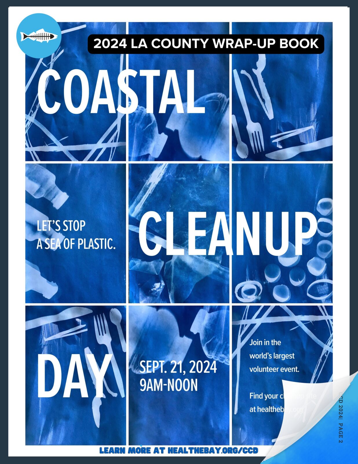
Check out the full 2024 Coastal Wrap-Up Book:

DOWNLOAD THE 2024 WRAP-UP BOOK


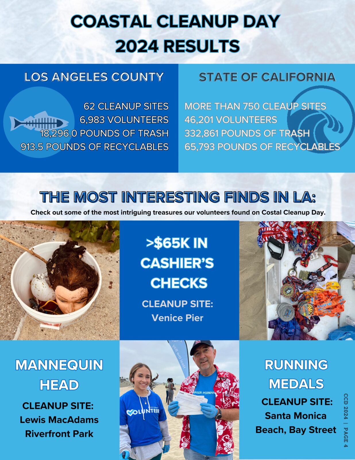
Check out our Coastal Cleanup Day Highlight Stats! 

Updated September 27, 2024, 3:00 PM

Los Angeles County Numbers (Heal the Bay Sites)

  • 6,983 Volunteers cleaned
  • 62 Sites,
  • Removing 19,209.47 Pounds of trash from our coastline and waterways!

According to the California Coastal Commission as of 5PM 9/24 with 50% reporting (including Heal the Bay)

  • According to the California Coastal Commission, more than 250,000 pounds of trash was removed on the 2024 California Coastal Cleanup Day. The event took place on September 21, 2024, and nearly 29,000 volunteers participated. 

Thank you to all who joined Heal the Bay in Los Angeles County on Coastal Cleanup Day 2024, and a special thank you to our 2024 Coastal Cleanup Day Sponsors:


The only thing our Water Quality Scientists love more than “Safe Clean Water”, is love! Here’s Heal the Bay’s list of the cuddliest spots for couples, friends, first dates, and everything in between, along the local California shoreline.

Forget crowded restaurants and overpriced (environmentally unfriendly) roses: Unveil the perfect Valentine’s Day with sparkling waters and sandy toes! ️

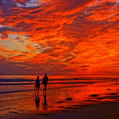
This year, ditch tradition and escape with your someone special to a breathtaking beach paradise right here in Southern California. Picture yourselves strolling along the shore at sunset, the sky ablaze with color. Sounds pretty dreamy, right?

But wait, there’s more! We’re not just talking about beaches. We’ve curated a list of secluded, romantic havens (including beaches, lakes, and rivers) with A+ water quality ratings and positive environmental impacts that will warm the heart and beckon for exploration. No murky waves or questionable cleanliness here – just lovely local waterside wonders perfect for making unforgettable memories.

Whether you crave classic California sunsets or romantic river staycations, our list has the perfect destination for your love story, adventure with a friend, or self-love solo escape into the outdoors. So, pack your beach bag, grab your sweetheart, and get ready to dive into a Valentine’s Day unlike any other!

Ready to discover your ideal romantic beach escape? Your next friendly freshwater getaway? The perfect LA lakeside love nest? Scroll down and let the adventure begin!

Note: Many of these beaches contain hikes, PV trails, bike paths and pathways that may have recently closed due to land movement and recent storm events. Please check the Los Angelese County Park and Recreation website before visiting any trails and heed any closure signs.  
Here are the top spots we love for love (and their great Beach Report Card water quality grades too!):

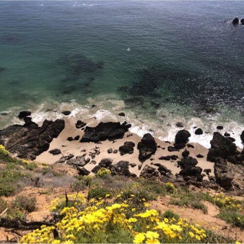
Point Dume State Beach and Natural Preserve, Malibu

Source: Heal the Bay MPA Watch Team (https://healthebay.org/mpa/)

What we love about it:Prepare to be mesmerized by two miles of scenic bluff trails at Point Dume State Beach and Nature Preserve. Whether you’re seeking a romantic stroll hand-in-hand or an invigorating hike, these trails offer breathtaking ocean views encircling a Marine Protected Area where wildlife thrives. Parking is a breeze at Point Dume. A conveniently located lot sits right next to the preserve, and additional free parking options are available along Westward Beach Rd. and Grasswood Ave. This accessibility makes Point Dume ideal for beach lovers, hikers, and anyone seeking a nature escape. 
What to do here: Embark on diverse hiking trails, each offering unique perspectives. Look out for curious sea lions sunning themselves on the bluffs below, playful dolphins flitting through the waves, and, during their December-April migration, magnificent gray whales breaching in the distance. Witness the thrill of surfers riding the waves on the north side or (when safe to do so) delve deeper into the underwater estuary with snorkeling or scuba diving. Point Dume even caters to adrenaline enthusiasts with its popular rock-climbing spots. Prepare for an abundance of onshore and offshore recreational activities!

Water Quality/Water quality improvement elements:  Rest assured, the water quality at Point Dume is pristine. According to our Beach Report Card, it boasts an A+ rating, signifying excellent water quality and guaranteeing a safe environment for swimming, sunbathing, and exploring.


Ginger Rogers Beach, Malibu

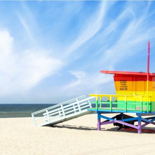
Source: https://smmirror.com/2023/05/lifeguard-towers-at-will-rogers-beach-to-be-painted-with-pride-colors/

What we love about it:Love knows no bounds, and neither should your Valentine’s Day celebration! Escape the ordinary and head to Ginger Rogers Beach, a cherished haven for Los Angeles’s vibrant LGBTQ+ community since the 1960s. Embrace the ocean breeze on this special stretch of Will Rogers Beach, just 15 miles from West Hollywood. Accessibility is a breeze: convenient parking, a dedicated bike path, and the Santa Monica Blue Bus 9 stopping nearby ensure stress-free arrival. So, ditch the traditional and celebrate your love in a vibrant, welcoming atmosphere where every couple shines just as brightly as the California sun.

What to do here: Proudly stroll hand-in-hand along the shore with laughter echoing amidst volleyball games, and maybe even join one of the spontaneous beachside dance parties this spot is known for as the sun sets. Celebrating “big love” with your whole crew? Don’t forget to take some group selfies at the #Pride Flag Lifeguard Station. Whether you’re seeking sun-kissed relaxation or playful competition, Ginger Rogers Beach offers something for every love story.

Water Quality/Water quality improvement elements:This beach boasted an A+ rating on January 21st, 2024, but check the Beach Report Card app for real-time updates as recent storms may impact water quality. (beachreportcard.org)

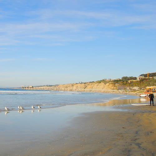
Torrey Pines, San Diego

Source: Dan_H, flickr

What we love about it: Torrey Pines State Beach has picturesque views of the San Diego coastline and the adjacent Torrey Pines State Reserve is filled with little trails leading down to the shore. We recommend that you only take marked trails and watch your footing, but the views are worth the adventure.

What to do here: We love the Torrey Pines Trail to Black’s Beach in the morning for a beautiful way to start your day. Fair warning: some nudists like to visit this beach as well.

Water Quality: The only sampling site at Torrey Pines is at the Los Penasquitos Lagoon outlet. That site received good grades in our most recent annual Beach Report Card.


La Jolla, San Diego

Source: Wikipedia Commons

What we love about it: This spot is great for lovers and families alike, with plenty of adventure to be had by all ages.

What to do here: This is the perfect spot for a SUP (stand-up paddleboard) adventure, snorkeling, kayaking, or even just a picturesque walk along the beach. For stunning ocean views over dinner, check out the Marine Room at the La Jolla Beach and Tennis Club.

Water Quality: La Jolla Shores received great grades in our annual report last year.


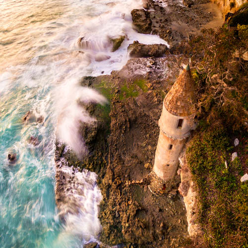
Victoria Beach, Orange County

Source: Daniel Peckham, Flickr

What we love about it: Straight out of a fairy tale, this shoreline spot is guarded by La Tour, a 60-foot castle-inspired tower.  Built in 1926, the structure provided beach access for a home on the cliff above.

What to do here: Looking to be someone’s knight in shining armor? Look no further. To get here, walk to the north end of Victoria Beach in Laguna Beach, around the bluff, and past another sandy section of beach. (This is a privately owned structure, so while you can walk up to it, please do not try to go inside or climb on the structure.)

Water Quality: Victoria Beach received A+’s across the board in our last annual report.


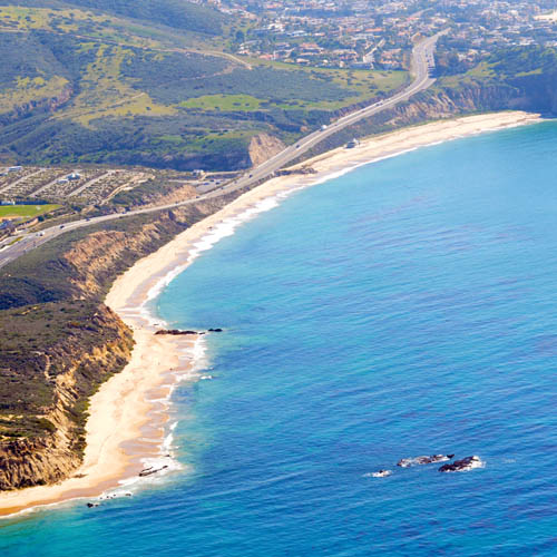
Crystal Cove State Park, Orange County

Source: Wikipedia Commons

What we love about it: With such a long swath of open sandy shores, this is an ideal spot for a romantic seaside stroll, or perhaps for a love-inspired photoshoot.

What to do here: If you’re looking for post-beach walk eats with an ocean view, the Beachcomber Café is a fun option.

Water Quality: Crystal Cove has great water quality in the summer or whenever the weather has been dry. Given the buckets of rain we have (thankfully) gotten this year, make sure to heed any beach posting signs you may see.


Palos Verdes Peninsula, Los Angeles

Source: Mark Esguerra, The Marke’s World

What we love about it: We love the PV areas so much, that we had to lump the whole peninsula together as one of our top locations. Palos Verdes wraps around from the base of the South Bay down to San Pedro and features beautiful neighborhoods, coastal trails, clean beaches, and tidepool adventures.

What to do here: For those seeking marine biology-inspired adventures, plan your visit during low tide to explore the tidepools at Abalone Cove. For a scenic hike and a secluded rocky beach, don’t miss Palos Verdes Bluff Cove. 

Water Quality: Seeking a beach escape with guaranteed sparkling waters? Look no further than Abalone Cove Shoreline Park, a jewel nestled within the Palos Verdes Peninsula. Not only is Abalone Cove recognized as an Honor Roll beach, signifying top-notch amenities and impeccable upkeep, but the entire Palos Verdes Peninsula boasts an A+ rating on our Beach Report Card, assuring pristine water quality for swimming, sunbathing, and creating unforgettable memories.


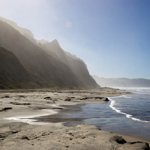
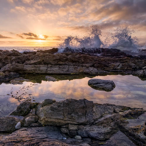
El Matador State Beach, Malibu

Source: Elliot McGucken, 500px

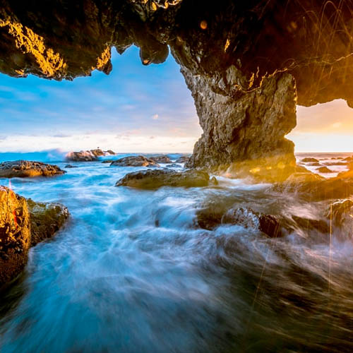
What we love about it: El Matador Beach is characterized by dramatic cliffs, hidden coves, and even secret sea caves, evoking the atmosphere of a Hollywood romance scene. Whether you’re igniting a new flame or spending time with a longtime partner, El Matador is sure to kindle your passion. Keep in mind that accessing the beach requires descending stairs. 

What to do here: Explore the dramatic landscape, take Instagram-worthy photos, find little hideaway spots for you and your date to share secret kisses, and wrap up your evening with a gorgeous sunset view. Please note that parking can cause a little heartache as spaces are limited. 

Water Quality: Beyond the captivating rock formations and breathtaking scenery, El Matador Beach boasts another hidden gem: impeccably clean, A+-rated water quality. As recognized by our Beach Report Card, this Honor Roll beach guarantees safe, clean, sparkling waves perfect for a day at the beach.


Arroyo Burro, Santa Barbara

Source: Damian Gadal, flickr

What we love about it: Santa Barbara is the perfect little getaway for a weekend of romance. If you’re looking for some time together to rest, rejuvenate, and rekindle the fire, Santa Barbara is the perfect place.

What to do here: We love Arroyo Burro for a sunset walk, and with plenty of parking and restroom access it’s a stress-free beach walk experience.

Water Quality: Arroyo Burro has great water quality in the summer or whenever it has been dry enough that the creek hasn’t been breached. Make sure to heed any beach posting signs you may see if you’re feeling like taking a dip. But if the creek is flowing, be sure to stick to the sand over the waves.


Freshwater Sites

Madrona Marsh, Torrance

Source Safe Clean Water Team (https://healthebay.org/safecleanwater/)

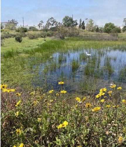
What we love about it: More than just a mall neighbor, Madrona Marsh is a vibrant ecosystem thriving in the heart of Torrance. This beautiful seasonal wetland boasts unique vernal pools teeming with diverse life, from fascinating birds and insects to curious animals and aquatic wonders. Escape the hustle and bustle by venturing onto the multiple trails that weave through the pools and wetlands, immersing yourself in nature’s tranquility.  

What to do here: It’s a wonderful place to take a walk with a loved one and enjoy nature. Slow down, soak in the vibrant hues of California poppies and sunflowers and become captivated by the symphony of birdsong. Let the serenity of the marsh wash over you as you reconnect with nature and each other.

Water Quality/Water quality improvement elements: Beyond its beauty, Madrona Marsh plays a vital role in environmental sustainability. The marsh uses nature-based solutions to treat stormwater from the surrounding neighborhood! Water is pumped into a modular wetland system where it is cleaned using a pre-filtration chamber, biofiltration with vetiver (a non-invasive perennial grass) that removes pollutants, and then the filtered water is pumped to wetlands at the marsh. 


L.A. River at Benedict St. in Frogtown, Los Angeles

2023 Heal the Bay Stream Team

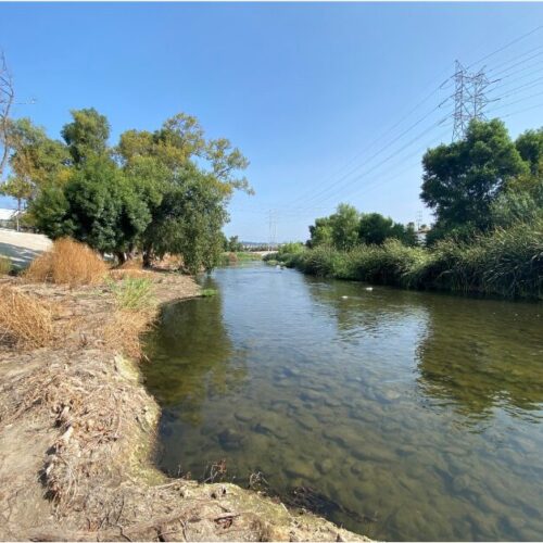
What we love about it:  No need to kiss this frog to turn it into the “prince” of Valentine’s Day destinations. Frogtown, nestled between the bustling I-5 and the vibrant LA River, is a vibrant neighborhood. Chic outdoor cafes beckon with the aroma of freshly brewed coffee, perfect for cozy hand-holding moments. Imagine the gentle murmur of conversation blending with the soft city breeze, setting the stage for an unforgettable date. (Heal the Bay would like to acknowledge that gentrification has taken place here and would like to pay respect to the original neighborhood landmarks and communities).

What to do here:  Embark on a hand-in-hand adventure along the picturesque LA River Greenway Trail. Cycle leisurely side-by-side, weaving through sun-dappled paths and enjoying the refreshing green spaces. If a slower pace beckons, find a quiet spot by the river’s edge, to sip a coffee from a nearby cafe and watch the water flow serenely next to your loved one. we advise against entering the water right now and outside of the open recreation season (May-Sept), but the scenic backdrop guarantees a picture-perfect memory. 

Water Quality/Water quality improvement elements:During the 2023 summer Stream season, the L.A. River at Benedict St. achieved an impressive A+ rating on the River Report Card, confirming its excellent water quality permitted recreational activities during designated open seasons.


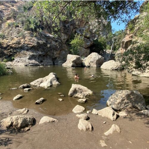
 Rock Pool, Malibu Creek State Park 

Source: 2023 Heal the Bay Stream Team (https://healthebay.org/2023-water-quality-successes-river-report-card-upgrade-and-summer-stream-team/)


What we love about it:  Nestled roughly 1.5 miles from the parking lot, the journey itself to Rock Pool is a shared adventure. Prepare to be mesmerized by the picturesque surroundings – towering trees and lush greenery frame the crystal-clear waters. Trust us, the entrance fee is completely worth it. 

What to do here: The swimming hole at this location is of considerable depth, perfect for a refreshing dip after a lengthy hike. After an exhilarating dip, spread out a cozy picnic under the shade of the trees or simply relax and dip your feet in the water.

Water Quality/Water quality improvement elements: This natural haven earned an A+ on the 2023 Summer River Report Card, signifying excellent water quality, guaranteeing a refreshing and safe escape for your love story. 


Parks

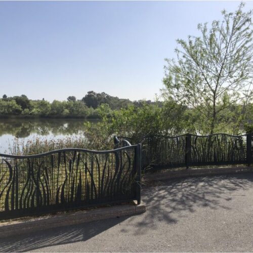
Machado Lake in Ken Malloy Regional Park, Harbor City 

Source: Safe Clean Water Team (https://healthebay.org/safecleanwater/)

What we love about it: This natural lake isn’t just a body of water; it’s a vibrant ecological hub and a haven for recreation within the sprawling Ken Malloy Harbor Regional Park. This impressive park, one of the largest in Los Angeles, boasts a remarkable diversity of habitats, including Machado Lake itself, a seasonal freshwater marsh, a thriving riparian woodland, and even a nonnative grassland.

What to do here:  Imagine your children giggling on the play structures, laughter filling the air during a family picnic at the designated tables, or the thrill of spotting diverse wildlife species. Fishing enthusiasts can try their luck with catch-and-release fishing, adding to the diverse activities available. You might even hear whispers of Reggie, the resident alligator who once called the lake home (trust us, Google him – you won’t be disappointed!). 

Water Quality/Water quality improvement elements:  Thanks to renovations originally funded by Prop O and other initiatives, the lake’s water treatment systems were revitalized to effectively remove pollutants like trash, bacteria, and even oil and grease. Now, thanks to the Safe, Clean Water Program, regular upkeep ensures the continued health of this vital ecosystem.


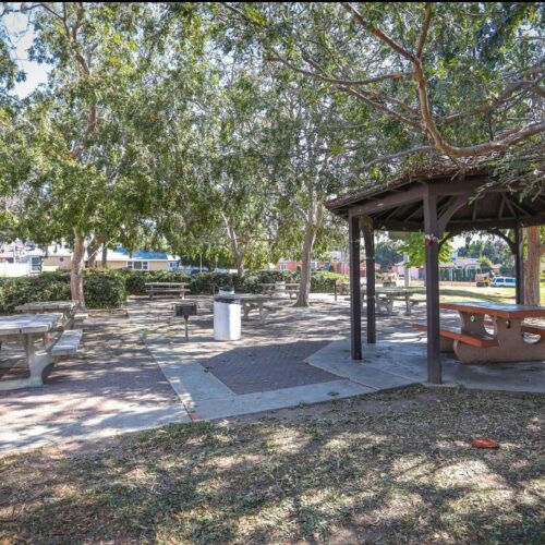
Ladera Park, Los Angeles

Source: https://parks.lacounty.gov/ladera-park/

What we love about it:More than just a park, Ladera is a testament to sustainable practices and community connection where you can make a love connection. Thanks to funding from the Safe, Clean Water Program, this park has implemented smart solutions (like infiltration wells) to capture and permeate stormwater and non-stormwater runoff, ensuring a healthier environment for everyone. Here rainwater nourishes native plants instead of flowing into polluted waterways.  Stroll hand-in-hand with your favorite environmentalist through paths marked with educational signage or enjoy lunch in this living classroom for visitors of all ages. The perfect outdoor date for those committed to each other, and sustainability.

What to do here: This park has it all – areas for parties and barbeques, playgrounds, sports areas, walking paths, and lots of large sycamore trees. Wildlife abounds and there are frequently western bluebirds, hawks, and more.  

Water Quality/Water quality improvement elements:  The impact goes beyond the park’s boundaries. By capturing and treating over half a million gallons of stormwater annually, Ladera Park significantly reduces harmful pollutants like bacteria and metals from entering nearby waterways. This contributes to a cleaner Centinela Creek, Ballona Creek, and ultimately, the ocean, benefiting countless species and the entire community.


Looking for beaches outside of SoCal? See our previous blog and check out recent water quality with Heal the Bay’s Beach Report Card.

Heal the Bay’s Beach Report Card is the only comprehensive analysis of coastline water quality in California. We grade more than 700 beaches weekly from Oregon to the Mexico border, assigning an A to F grade based on the health risks of swimming or surfing at that location.

Special thanks to the romantics on our Science, Outreach, and Water Quality Team:

Dr. Katherine Pease, Science, and Policy Director; Dr. Alison Xunyi Wu, Water Quality Data Specialist; Dr. Tania Pineda-Enriquez, Water Quality Data and Policy Associate Specialist; Nancy Shrodes, Senior Watershed Specialist, South Santa Monica Bay; Jillian Marshall, Communications Manager; and Leslie Griffin, former chief water quality scientist Heal the Bay. 


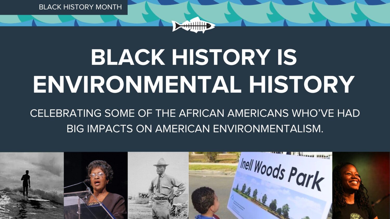
Take time to commemorate this Black History Month and learn about the African American environmentalists who helped shape our environmental history.

Advocating for Environmental justice is a pillar of Heal the Bay’s decades-long mission, but environmental justice cannot exist without racial justice. The historical reality is staggering: Black communities in the US have borne the brunt of pollution, climate change, and limited access to green spaces. This systemic injustice demands immediate action.

But amidst the struggle, hope emerges. Let’s celebrate some Black luminaries in the environmental movement who have paved the way for a brighter future. These inspiring leaders have created invaluable space and opportunities, empowering the next generation of young Black voices fighting for a just and sustainable planet.

Enjoy our micro-museum and let it inspire a more profound journey into the history of environmental justice and its pioneers.

Please view our list of resources, including a list of non-profit organizations established to engage and serve local black communities and beyond and events to continue your education and celebration of Black History Month!

THE HISTORY OF BLACK HISTORY MONTH


MEET SOME BLACK LUMINARIES

Black leaders in both the American environmental justice and environmentalist movement.

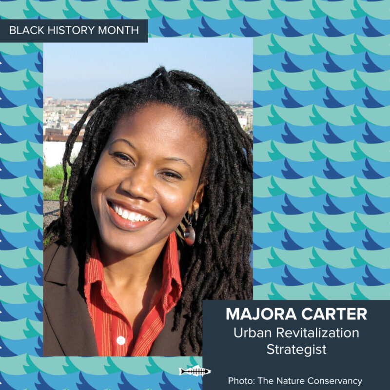
Majora Carter

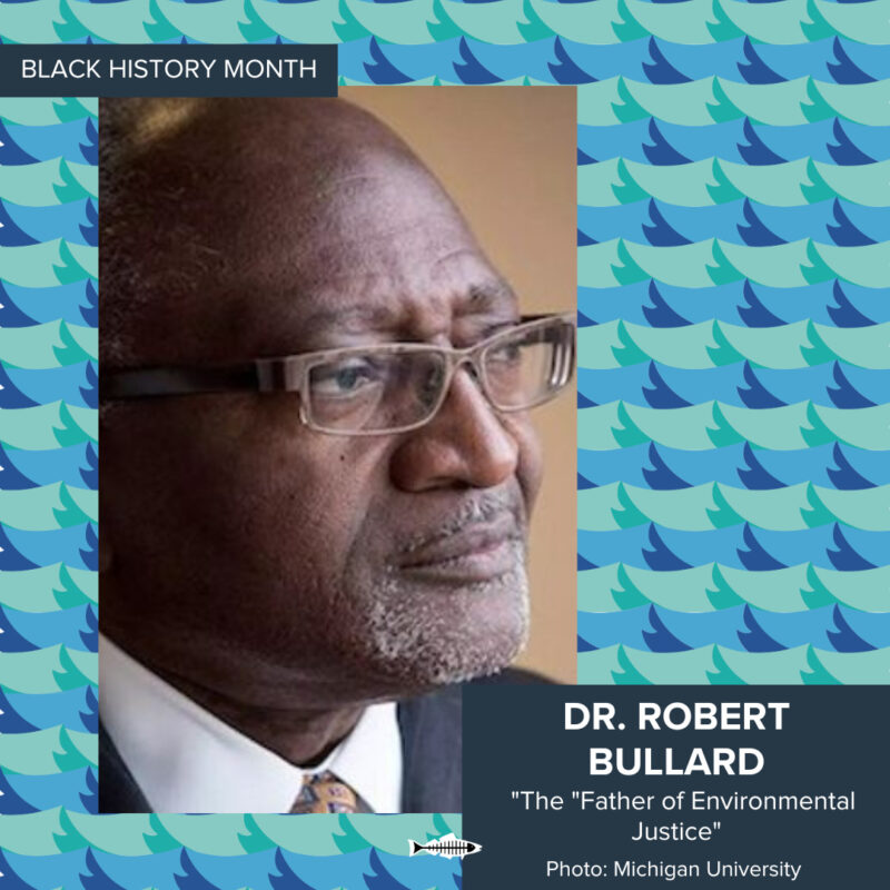
Dr. Robert Bullard

Inell Woods

Charles Young

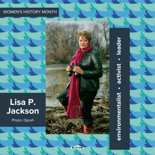
Lisa P Jackson

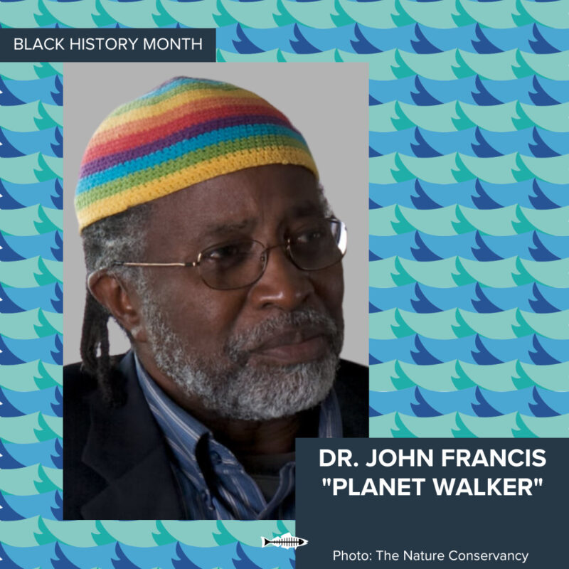
Dr. John Francis

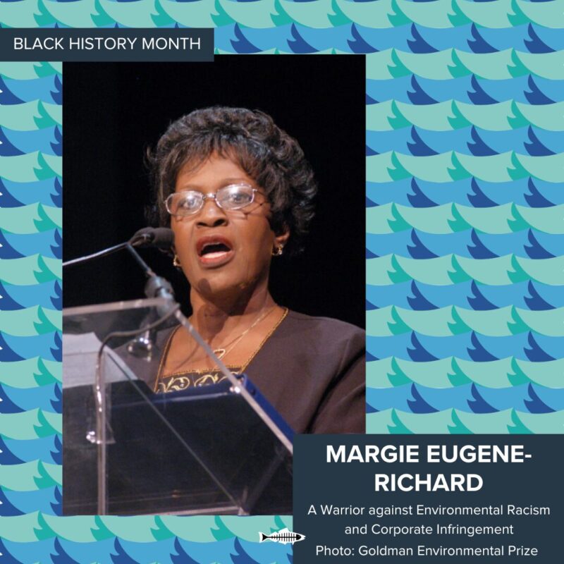
Margie Eugene-Richard

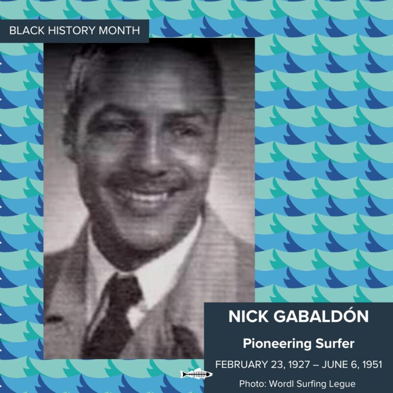
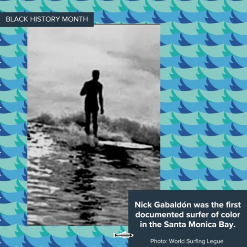
Nick Gabaldón

MAJORA CARTER

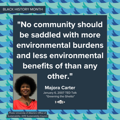
Majora Carter’s impact transcends titles from South Bronx activist to national changemaker. More than just an award-winning strategist and broadcaster, she’s a John D. and Katherine T. McArthur Foundation Genius Grant” recipient whose groundbreaking work redefined urban renewal, environmental protection, and restoration. In the 1990s, she ignited hope in her community by transforming a mere $10k grant into South Bronx’s first waterfront park in 60 years, a testament to her unwavering belief that “no community should shoulder more burdens than benefits.”

This wasn’t just a park; it was a catalyst. Carter went on to found Sustainable South Bronx, empowering residents to reclaim their environmental rights and fight for green spaces. Today, her Majora Carter Group continues this legacy, equipping low-income communities across the US with the tools and strategies to build healthier, revitalized environments, fostering prosperity and resilience.

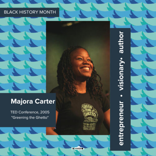
Inspired? Dive deeper into Carter’s journey through her powerful TED Talk “Greening the Ghetto” and learn more about her fight for environmental justice.

Majora Carter: Greening the ghetto | TED Talk

#Enviornmentaljustice history is still being made. #Black history is environmental history.


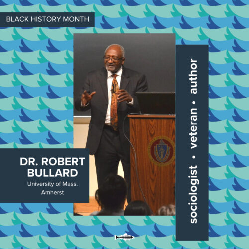
DR. ROBERT BULLARD

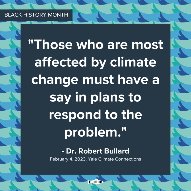
Dr. Robert D. Bullard, a sociologist and American academic, is regarded as the “father of environmental justice.” His decades of leadership as an advocate and educator continue to shape the future of environmental equity for marginalized communities.

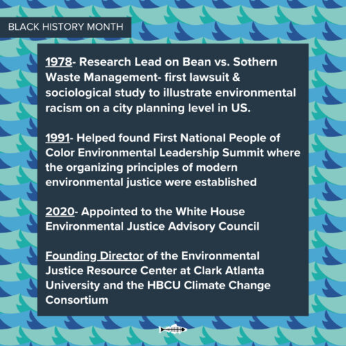
From Marine Corps sergeant to “father of environmental justice,” Dr. Robert D. Bullard’s life is a testament to tireless advocacy and groundbreaking research. After serving his country, Bullard dedicated himself to academia, earning degrees in government studies (Alabama A&M), an M.A. in sociology at Atlanta University (Clark Atlanta University), and culminating in a Ph.D. (Iowa State University). His dedication bore fruit in the 1978 landmark Bean vs. Southern Waste Management lawsuit, where he led research exposing the discriminatory placement of toxic waste facilities near communities of color. His findings revealed that “Black neighborhoods were the predominant site for most of the solid waste disposal sites in Houston, yet they represented only 25% of the total population,” and that race was the “driving force behind this environmental injustice.”

His research, later published in Solid Waste Sites and the Black Houston Community,” sparked national outrage and became the first major study to document environmental racism.

Bullard’s impact extends far beyond one case. He co-founded the First National People of Color Environmental Leadership Summit, fostering collaboration and establishing core principles of the modern environmental justice movement. These principles were championed by Bullard at the federal level, influencing the Clinton administration’s Executive Order on environmental justice and earning him a recent appointment to the White House Environmental Justice Advisory Council under President Biden.


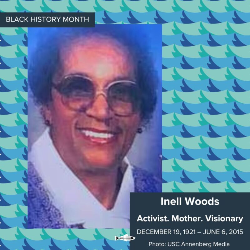
INELL WOODS

Community activism and environmental justice go hand-in-hand.

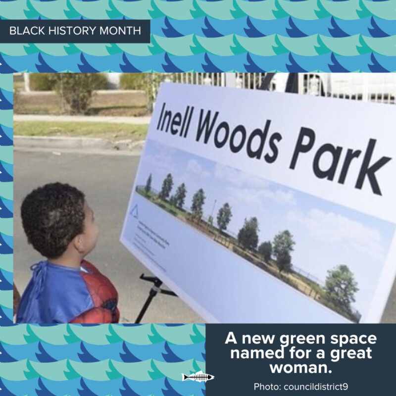
Although Woods was not primarily known for environmental work, this tireless community activist who championed fairness and inclusion for South LA will soon have her legacy etched in green space. After a decade of dedicated work on the part of Heal the Bay, local government officials, and the community itself, the empty lot that once encouraged the very disparities that often impact inner-city communities of color across the street from her long-time home will finally become a “safe green space” bearing the name “Inell Woods Park.”

More than just a park, this space embodies the values Mrs. Woods fought for throughout her life. From rallying for seniors and organizing meal programs to advocating for green spaces in neighborhoods like the South LA community of Green Medows, she understood the interconnectedness of community well-being and environmental justice.

Recognizing this connection, the park itself is designed with sustainability in mind. Native plants will reduce long-term potable water needs, and shade trees will be added as a crucial step in addressing the urban heat island effect that disproportionately impacts regional communities of color like South LA.

Beyond aesthetics, Inell Woods Park is a testament to community activism’s power and ability to create lasting positive change. As South LA’s first “stormwater park,” the space was designed to capture rainwater, and a Permavoid system will be used to treat stormwater. The park’s innovative stormwater system is designed to reuse 16,000 gallons of water, starkly contrasting traditional irrigation methods and showcasing a commitment to environmental responsibility.

This long-awaited space is more than just a park; it’s a symbol of hope, resilience, and a thriving future for South LA, forever intertwined with the legacy of Mrs. Inell Woods.

At the future park’s community awareness event in 2022, City Councilman Price took time to commemorate the namesake of the site: “I am honored to name our newest park Inell Woods, in honor of a community champion who spent her life advocating for fairness, inclusion and ensuring the South L.A. community was supported,” Price said. “This park is the community’s gift to Mrs. Woods and the tremendous legacy she has left behind.”


After ten years of work, plans have been finalized to break ground on this space in the Spring of 2024. Learn more about the park: Inell Woods Park 2024 Fact Sheet


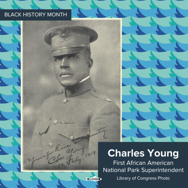
CHARLES YOUNG

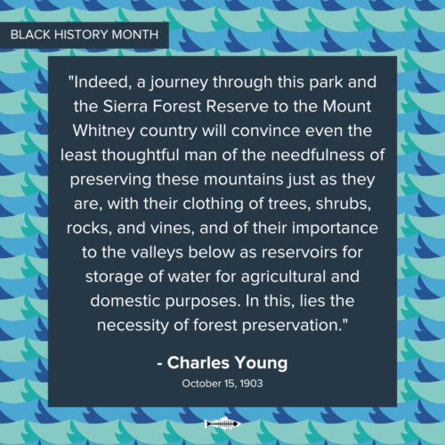
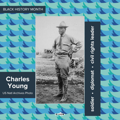
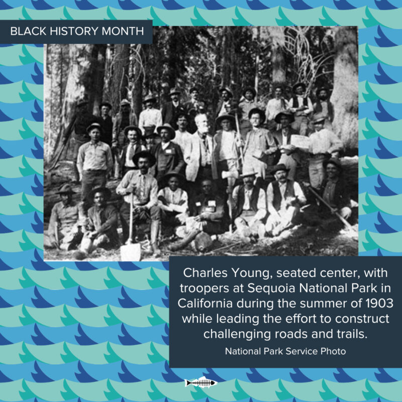
Charles Young was the highest-ranking African-American commanding officer in the United States Army from 1894 until his death in 1922. He also served as the first African-American superintendent of a national park, overseeing Sequoia and [Kings Canyon] National Parks while commanding a troop of Buffalo Soldiers in the years before the creation of the National Park Service.

Born to enslaved parents in Kentucky in 1864, Young’s parents, Gabriel and Arminta Young, moved to Ripley, Ohio, in 1866 with their two-year-old son Charles to improve their prospects after the Civil War. In 1889, Charles Young was the third African American to graduate from West Point.

Colonel Charles Young’s story and leadership are symbolic of the experience of the Buffalo Soldiers during difficult and racially tense times.

In 1866, the Congress established six all-black regiments, later consolidated to four, to help rebuild the country after the Civil War and to patrol the remote western frontier.

“The Buffalo Soldiers were an important part of the early history of America’s national parks. Before Congress created the National Park Service in 1916, the U.S. Army was critical in administering several parks. The Army sent the Buffalo Soldiers to manage Yosemite, [Kings Canyon], and Sequoia National Parks in California. The Buffalo Soldiers blazed early park trails, built roads, produced maps, drove out trespassing livestock, extinguished fires, monitored tourists, and kept poachers and loggers at bay.”

– An excerpt from A PROCLAMATION OF THE ESTABLISHMENT OF THE CHARLES YOUNG BUFFALO SOLDIERS NATIONAL MONUMENT BY THE PRESIDENT OF THE UNITED STATES OF AMERICA


LISA P. JACKSON

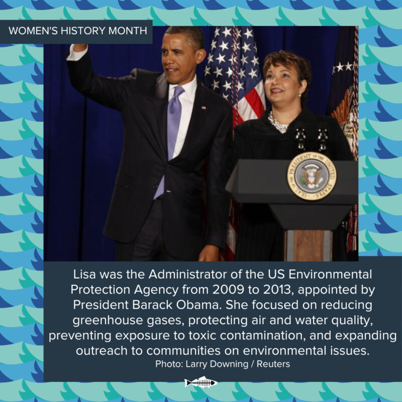
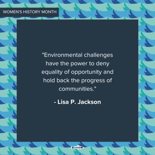
Lisa P. Jackson, the first African-American EPA Administrator, has created a powerful legacy for Black History Month and beyond. She has spent her career breaking barriers, championed critical environmental advancements during her tenure with the EPA (2009-2013), and was featured on Time magazine’s 2010 and 2011 lists of the “100 Most Influential People in the World”. There is so much she has done and continues to do to protect our planet!

“During her tenure from 2009 to 2013, Administrator Lisa P. Jackson focused on seven priorities for EPA’s future: taking action on climate change; improving air quality; cleaning up our communities; protecting America’s waters; assuring the safety of chemicals; expanding the conversation on environmentalism and working for environmental justice; and building stronger state and tribal partnerships.” (EPA.GOV)

Jackson tackled climate change head-on, paving the way for EPA action with her 2009 endangerment finding on greenhouse gases. Her focus extended beyond improving air quality, cleaning communities, protecting waterways, and ensuring chemical safety. She didn’t just talk the talk – she implemented clean air standards and a groundbreaking clean cars program, leading to more fuel-efficient vehicles.

But Jackson’s impact goes deeper. She prioritized environmental justice, empowering historically underrepresented communities and strengthening protections for vulnerable groups. This legacy of action, inclusion, and progress makes her a true inspiration for environmental movements everywhere.


DR. JOHN FRANCIS 

The collision of two oil tankers and the subsequent environmental destruction wrought by this infamous oil spill sent Dr. John Francis, known as “Planetwalker,” on a remarkable journey that transformed him into a renowned conservationist, educator, and bestselling author. After witnessing the devastating San Francisco Bay oil spill in 1971, Francis made a radical choice: he walked. For 22 years, he shunned motorized vehicles, traversing the US and Latin America on foot, all while earning a Ph.D. in Land Management.

But his commitment went beyond movement. He took a powerful 17-year vow of silence to amplify environmental awareness, breaking it only on Earth Day 1990. From then on, Dr. Francis dedicated himself to conservation, becoming an influential voice in policy and education.

His achievements are as impressive as his journey. He is the National Geographic Society’s first Education Fellow, a UN Environment Program Goodwill Ambassador, and an acclaimed author. He even played a crucial role in crafting oil spill regulations after the Exxon Valdez disaster, earning recognition from the U.S. Department of Transportation.

Dr. Francis’ story isn’t just about walking; it’s about action. He inspires us to challenge norms, speak up for our planet, and dedicate ourselves to creating a more sustainable future.


MARGIE EUGENE-RICHARD

In Norco, Louisiana, the predominantly Black community of Old Diamond found itself squeezed between a Shell Chemical plant and an oil refinery. Fear of accidents and the harsh reality of elevated cancer, congenital disabilities, and respiratory issues were everyday life. These stemmed from decades of environmental contamination.

 After years of being subjected to these environmental risks and following her sister’s death from a rare bacterial infection, Margie Richard founded the Concerned Citizens of Norco (CCN) in the early 1990s. This environmental justice group demanded a solution: fair resettlement. Years of tireless leadership, including commissioning a community-based air quality study, finally paid off. In 2002, CCN secured a historic agreement with Shell, leading to the relocation of Old Diamond residents to safer communities.

 Margie Richard’s unwavering efforts made her a pioneer of the environmental justice movement. In 2004, she became the first African-American to receive the prestigious Goldman Environmental Prize, a testament to her impact.

Margie Eugene-Richard (1941-present) is a powerhouse in environmental justice. Her campaign to stop significant corporations from polluting her family home led to one of the most significant environmental lawsuits in recent history.


NICK GABOLDÓN

Amidst the discriminatory Jim Crow era, Santa Monica Beach reflected the harsh reality of divided shores. “Inkwell Beach,” a meager 200-foot zone restricted to Black beachgoers, served as Nick Gabaldon’s unlikely launching pad. Here, he defied boundaries, teaching himself to surf on a borrowed lifeguard’s paddleboard, carving his name as the first documented African American Latinx surfer of Santa Monica Bay.

But Nick’s spirit couldn’t be confined by ropes or prejudices. Undeterred by the lack of a car, he embarked on 12-mile paddle journeys to Malibu, the epicenter of West Coast surfing. Despite being the only Black surfer, he found acceptance among the predominantly white community.

Then, on June 5th, 1951, tragedy struck. Nick, drawn by the allure of an eight-foot swell, paddled his usual 12 miles to ride the mythic Malibu Pier righthander. After catching a legendary wave, he attempted a daring maneuver – shooting the pier itself. Sadly, his board was found, but his body wouldn’t resurface until days later. Nick, at just 24, lost his life to the sea’s unpredictable power.

Eerily prescient, Nick had penned a poem titled “Lost Lives” for his Santa Monica City College literary magazine six days before his fatal attempt. Its haunting lines echoed the ocean’s dark allure:

The sea vindictive, with waves so high
For men to battle and still they die.
Many has it taken to its bowels below;

Without regard it thus does bestow
Its laurels to unwary men.

Nick Gabaldón, the trailblazing surfer, left behind a legacy not just of his skill, but of his courage and spirit, forever etched in the waves of history.

RESOURCES

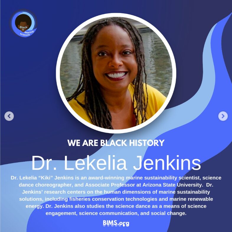
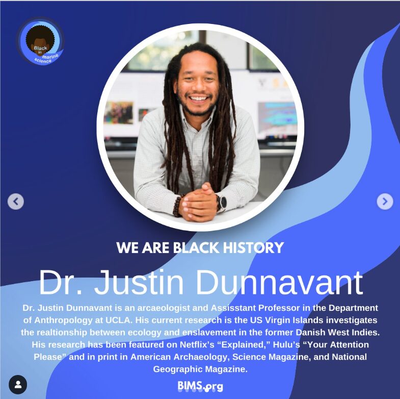
The “Black in Marine Science” Spotlight

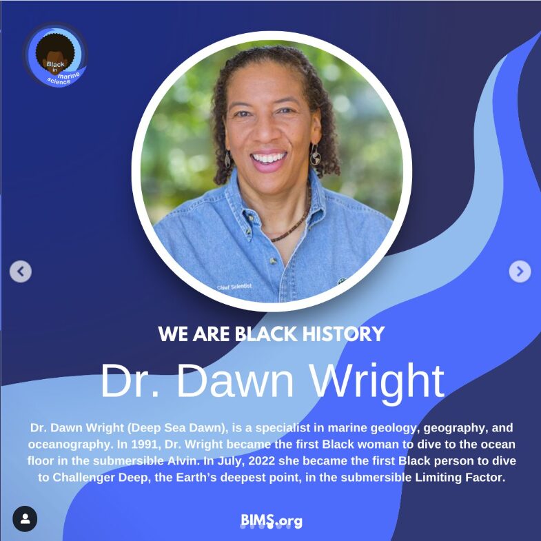
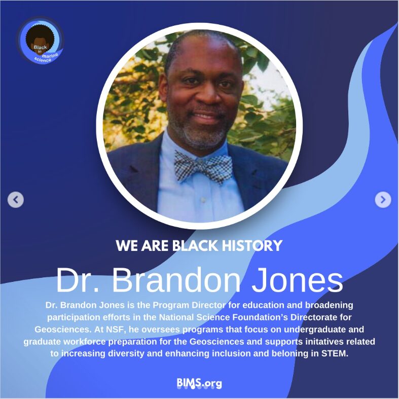
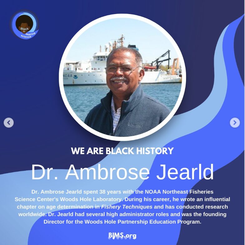
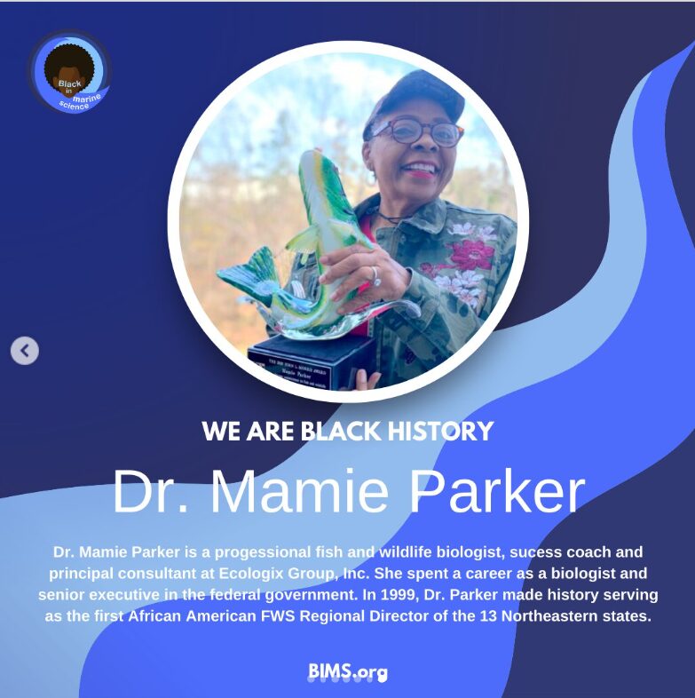
Swipe through the Black in Marine Science List of “6 Black Marine Scientists You Should Know About“. Follow @blackinmarinescience  to learn more about this “premier organization aimed to celebrate Black marine scientists, spread environmental awareness, and inspire the next generation of scientific thought leaders.”

Get Engaged- Check out this list of Black History Celebrations and activations in Los Angeles.

Get Activated Download this list of  Non-profit Organizations established to engage and serve local black communities and beyond.


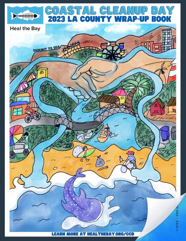
Check out the full 2023 Coastal Wrap-Up Book:

DOWNLOAD THE 2023 WRAP-UP BOOK


Check out our Coastal Cleanup Day Highlight Stats! 

Updated September 27, 2023, 3:00 PM

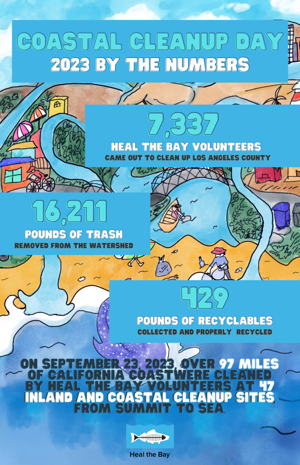
Coastal Cleanup Day 2023 Stats

Los Angeles County Numbers (Heal the Bay Sites)

  • 47 Cleanup Sites Reported
  • 7, 337 volunteers
  • 1, 646 volunteers who brought their own cleanup supplies
  • 16,211 pounds of trash
  • 429 pounds of recycling
  • 97.5 miles of beach, river, underwater, and neighborhoods sites cleaned.
  • 15 Inland Cleanups, 31 Coastal Cleanups, 2 Dive Cleanups

According to the California Coastal Commission as of 5PM 9/24 with 50% reporting (including Heal the Bay)

  • 25,570 volunteers participated statewide.
  • Those volunteers picked up 126,605 pounds of trash at cleanup sites all along California.
  • An additional 7,041 pounds of recyclable materials were collected. 
  • A total of 133,645 pounds or 67 tons of refuse were removed from watersheds all over California. 

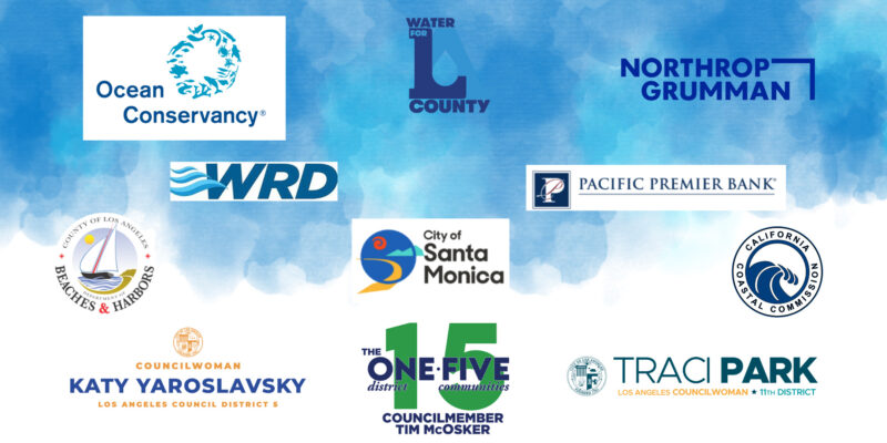
Thank you to all who joined Heal the Bay in Los Angeles County on Coastal Cleanup Day 2023, and a special thank you to our 2023 Coastal Cleanup Day Sponsors:

A Wave of gratitude for our 2023 Coastal Cleanup Day Sponsors

2023 Coastal Cleanup Day Sponsors:

Pacific Premier Bank @pacificpremierbank

Ocean Conservancy @oceanconservancy

Water Replenishment District @wrdsocal

City of Santa Monica @cityofsantamonica

Department of Beaches and Harbors, Los Angeles County @lacdbh

California Coastal Commission @coastalcommission

Northrop Grumman @northropgrumman

Water for LA @waterforla

Councilwoman Traci Park (Council District 11) @councilwomantracipark

Councilmember Tim McOsker (Council District 15)

Councilwoman Katy Yaroslavsky (Council District 5) @cd5losangeles


Long-time friend of Heal the Bay, and former Board Member, Nancy Akers passed away in December 2022, leaving behind an impressive legacy of social consciousness and environmental stewardship.

Heal the Bay will be forever grateful for the generosity, entrepreneurship and environmental stewardship of former Board Member Nancy Akers. When the Akers Family launched one of the country’s first certified organic cotton clothing lines, O Wear, they partnered with Heal the Bay to create the organization’s first branded organic cotton t-shirt, and an important relationship was born. Nancy served as a member of Heal the Bay’s Board of Directors for more than a decade as both the Vice President of Marketing and co-Chair of the Bring Back the Beach gala where Nancy became friends with Heal the Bay founder, Dorothy Green, who she loved dearly.

“It was wonderful to work so closely with Nancy for over a decade.  Her boundless energy, determination, passion, leadership and marketing expertise were so critical to Heal the Bay’s success. She will be sorely missed. ” – Mark Gold

Nancy’s creativity, perseverance, and passion for the environment earned her awards and accolades from Heal the Bay, the United Nations Environment Program, and President Clinton’s Council On the Environment for her many sustainability efforts.

Throughout her career, Nancy’s wide variety of philanthropical achievements reached across both social and environmental nonprofit worlds touching many lives through her tireless work. She served on the Board of Directors for The Dallas Children’s Theatre; And notably, she has a long and impressive career with American Women in Radio and TV (AWRT), as President of the LA Chapter of American Women in Radio and TV, as well as the Vice President of Programming and Professional Development for the National Chapter in New York. She was also a member of the National Chapter Board of Directors, and At-Large-Trustee of the Foundation of AWRT and directed the first American National TV campaign to address Women’s Rights in the workplace for CBS and AWRT.

Nancy will be missed dearly by her husband George, daughter Deirdre, son Christopher and her loyal canine companion Kristy.

Heal the Bay will continue to honor her legacy and years of success in its commitment to making the coastal waters and watersheds of Greater Los Angeles safe, healthy, and clean.


Cigarette filters made from single-use plastic are a huge environmental problem, butt (pun intended), upcoming California legislation offers the first steps toward a solution.

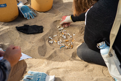
Cigarette Butts are the #1 thing we find at our Nothin’ But Sand Beach Cleanups.

Heal the Bay cleanup volunteers have removed a total of 953,756 cigarette butts from beaches in Los Angeles since 2008. Although we are proud of this impact, the pollution problem is never-ending and what is especially concerning is that the filters in cigarettes are made from plastic, which never goes away. Cigarette butts are not only the most prevalent thing we find on our beach cleanups, they are the most littered item on Earth. For an item so small, they have a massive negative impact on marine habitats.

Not People Friendly, Not Planet Friendly

But aren’t cigarette filters an important public health and safety measure? Contrary to popular belief cigarette filters do not offer health protections. In 1964 the Surgeon General judged cigarette filters to be useless in reducing harm to the average smoker and the health benefits of filters have been called “fraudulent” by the World Health Organization.

Cigarette filters are unhealthy for fish and wildlife too. When cigarette butts with filters are thrown onto the street, they make their way through the storm drain system that flows out to the ocean, carrying the chemicals and toxins found in cigarettes with them. About 90% of filters are made from plastic and end up as micro-plastics in our ocean, which have infiltrated the food web, from fish to humans. Butt, a plan to take single-use plastic filters out of the equation is on the horizon.

Butt, a change is coming!

This year, The Smoking Waste Pollution Prevention Act looks to phase out the sale of single-use, non-rechargeable vaping devices and cigarette/cigar “filters” in California. When our state makes big moves toward change it gives other states the opportunity to follow and before you know it there could be nation-wide change. Use your voice to bring this change to California first. How can you help?

Call or email your California Legislators and ask them to vote YES on AB 1690 at the Assembly Health Committee on March 29 (it takes 3 minutes).

  1. Find your rep here: Find Address (ca.gov)
  2. Call your rep and say:
    1. My name is (your name).
    2. I live (state the city you live in).
    3. I want you to vote YES on AB 1690!
  3. Email your rep and say:
    1. My name is (your name).
    2. I live in (city you live in).
    3. I want you to vote YES on AB 1690

Or download this long form email template you can customize and send a message to your assembly member that could make a huge impact.

Download Email Template

Put an end to butts on the beach (the bad kind!)

Spread the word and share what you’ve learned on social media using the hashtags #AB1690, #CircularEconomy, and #CAMustLEAD! Most people have no idea that cigarette butts are so detrimental to the environment, but when we share what we know we can empower others to help make change.