Escrito por Steve Lopez de LA Times — translado del Inglés por Heal the Bay
Nelson Chabarria dice que su amor para la química empezó en una clase en la preparatoria de Los Ángeles, pero no tenía la oportunidad de seguir una carrera. Su familia necesitaba ayuda en pagar las facturas, y se puso a trabajar en el distrito de la costura, pero nunca dejó su sueño de ser químico.
No perdió las ganas de lograr su sueño, y ahora tiene 34 y está comenzando su segundo año de estudiar la tecnología química en L.A. Trade Tech. Su trabajo del verano lo ha convencido de seguir una carrera en la ciencia ambiental.
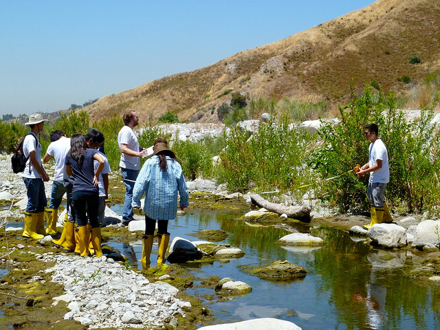
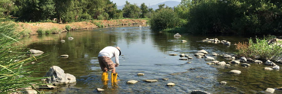
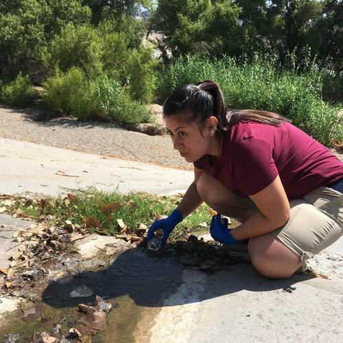
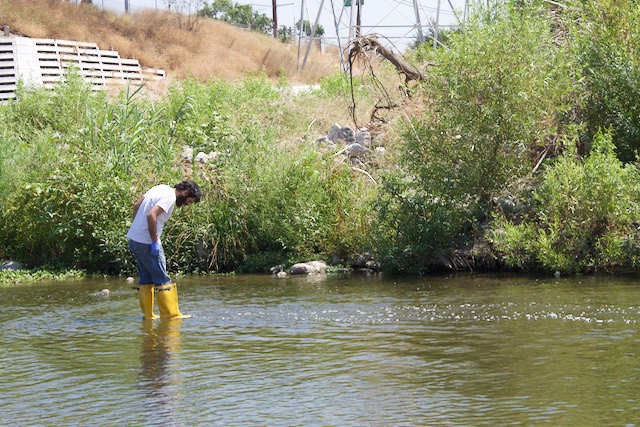
Un día de la semana pasada, Chris estaba de pie en el medio del río de Los Ángeles, cerca de Frogtown, el agua hasta la cima de sus botas. Llevaba puesto guantes de caucho, tenía un recipiente de vidrio, y pasaba con cuidado sobre piedras resbaladizas.
“¿Aquí?” Chris preguntó a Katherine Pease, la científica de las cuencas hidrográficas de Heal the Bay.
Chris llenó la botella con el agua del río, volvió para la orilla del río y dejó la muestra en hielo para prepararla para pruebas en el laboratorio.
Planes Grandes, Pero También Grandes Problemas.
Los Ángeles tiene planes grandes para revitalizar unas 11 millas del río en los siguientes años, el precio cual comenzó en unos mil millones ha aumentado ha 1.6 mil millones.
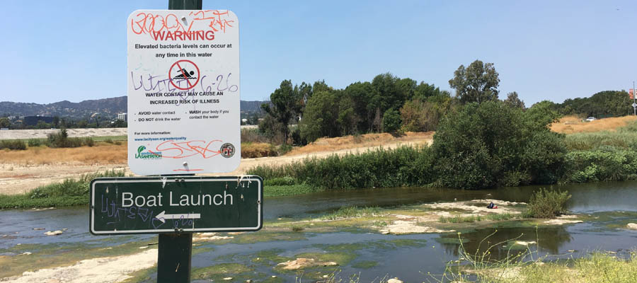
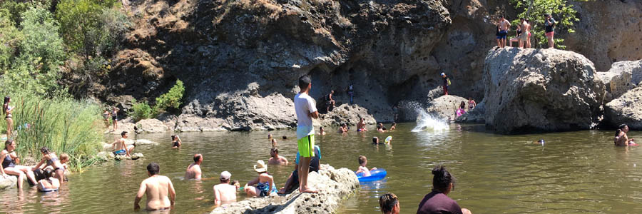
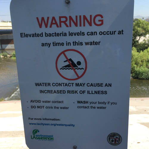
¿Pero está el agua suficiente limpia para el uso recreativo o para atraer a la gente que vive y trabaja en la orilla de lo que es nada más que un canal de drenaje para escorrentía urbana y de residuales tratados?
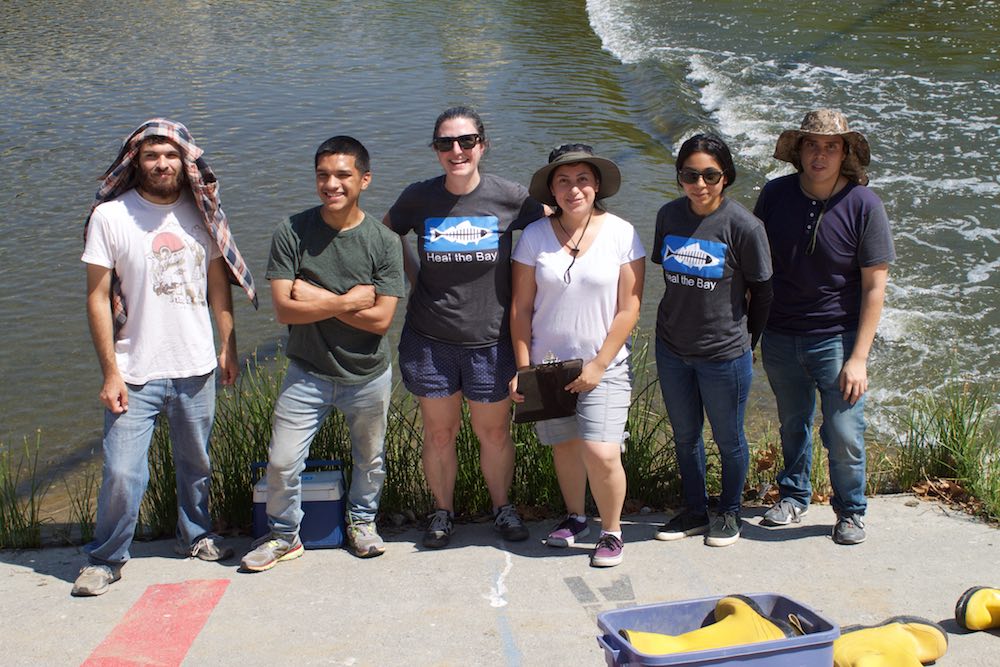
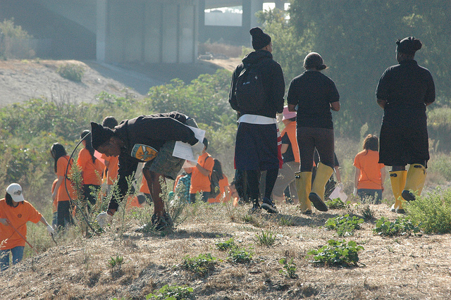
Heal the Bay es reconocido por ser una de las fuerzas impulsoras de mejorar la calidad del agua del mar en el golfo de Santa Monica, dando notas (A-B-C-D-F) a las playas. Durante los últimos tres años, la organización ha recogido muestras de la cuenca Sepúlveda y tres locales del uso recreativo en el río en el valle Elysian. El sistema que utiliza es una de tres colores, verde, amarillo, y rojo. El rojo significa las áreas que tienen las más bacterias dañinas. Los resultados cambian cada semana.
Pease dice que la calidad de agua ha mejorado un poco, pero sin coherencia y no por todo el río. Este verano la cuenca Sepúlveda tiene marcado muchas áreas rojas y en el valle Elysian, en las áreas de Frog Spot and Rattlesnake Park, tiene marcado amarillo. Pease, en un informe del año pasado, dijo que el nivel alto de las bacterias “indica un riesgo de infecciones del oído, enfermedades respiratorias y enfermedades gastrointestinales para la gente que tiene contacto con el agua.”
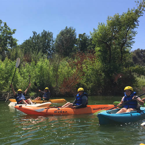
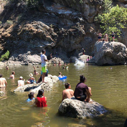
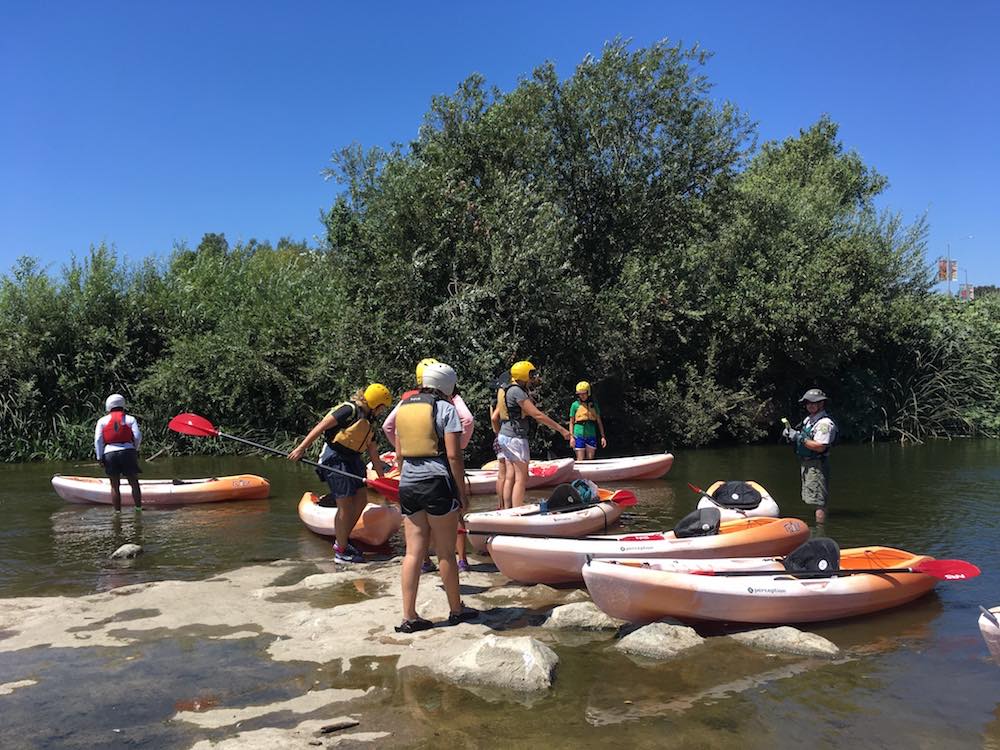
“No quiero decir que no debes hacer kayaking en el río — lo hice yo el año pasado y lo recomiendo. Tampoco no es de tener miedo de andar por las orillas del río y ver los animales y plantas que viven ahí. Solo hay una cosa que recordar– si esta en contacto con el agua se debe lavar las manos,” dice Pease.
“Yo realmente haría kayaking,” dice James Alamillo, quien ayuda a mantener la operación de monitorizar el río con Heal the Bay, “pero no nadaría o no vadearía en el agua.”
Aguas Peligrosos, No Aguas de Bañar
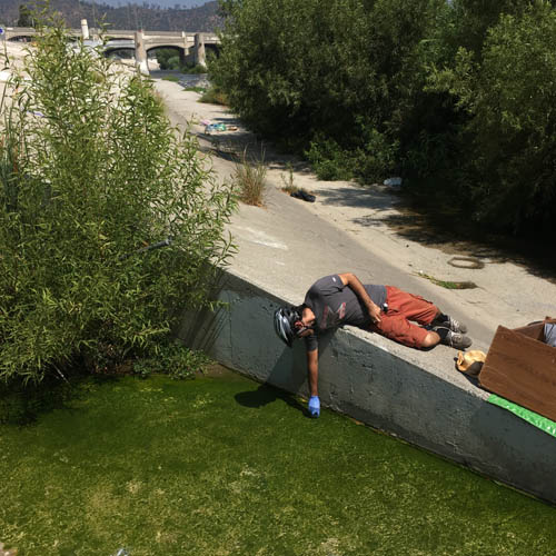
El equipo de monitorizar siempre ve a individuos indigentes utilizando las aguas del río como un área recreativa.
Especialmente no se debe entrar en el agua cerca de desagües que echan escorrentías contaminadas en el canal central. Puede ser que usted no espera cascadas ni gotas de los desagües en el medio de un verano seco en Los Ángeles, pero agua fluye todos los días y las noches en algunos lugares.
“El volumen de agua es increíble,” dijo Alamillo, mostrando una cascada cerca de Fletcher Street Bridge.
La cascada fluyó con mucha fuerza. El agua ha cambiado, de estar limpio, de estar jabonosa, y de estar marrón. Alamillo y los demás han comprobado las calles alrededor del río para encontrar el origen de la contaminación, pero en vano.
Pease dijo que el uso excesivo del agua es el primer sospechoso, tanto como el lavado de los coches. Se estima que 100 millones de galones de escorrentía contaminada pasa por los desagües del condado del LA por todos los días en el verano, llevando excrementos de animales, pesticidas, productos químicos, aceites y basura hasta el mar. Alamillo recogió un contenedor plástico de una prescripción para marihuana y me dijo que descartes así son tan comunes por el río LA como las bolsas de plástico eran por el arroyo de Compton cuando pasamos yo y ella hace muchos años.
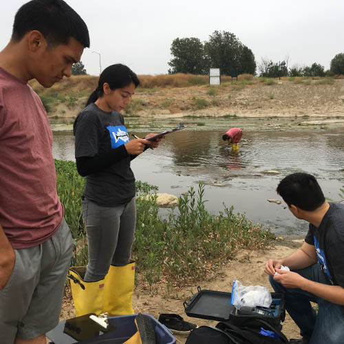
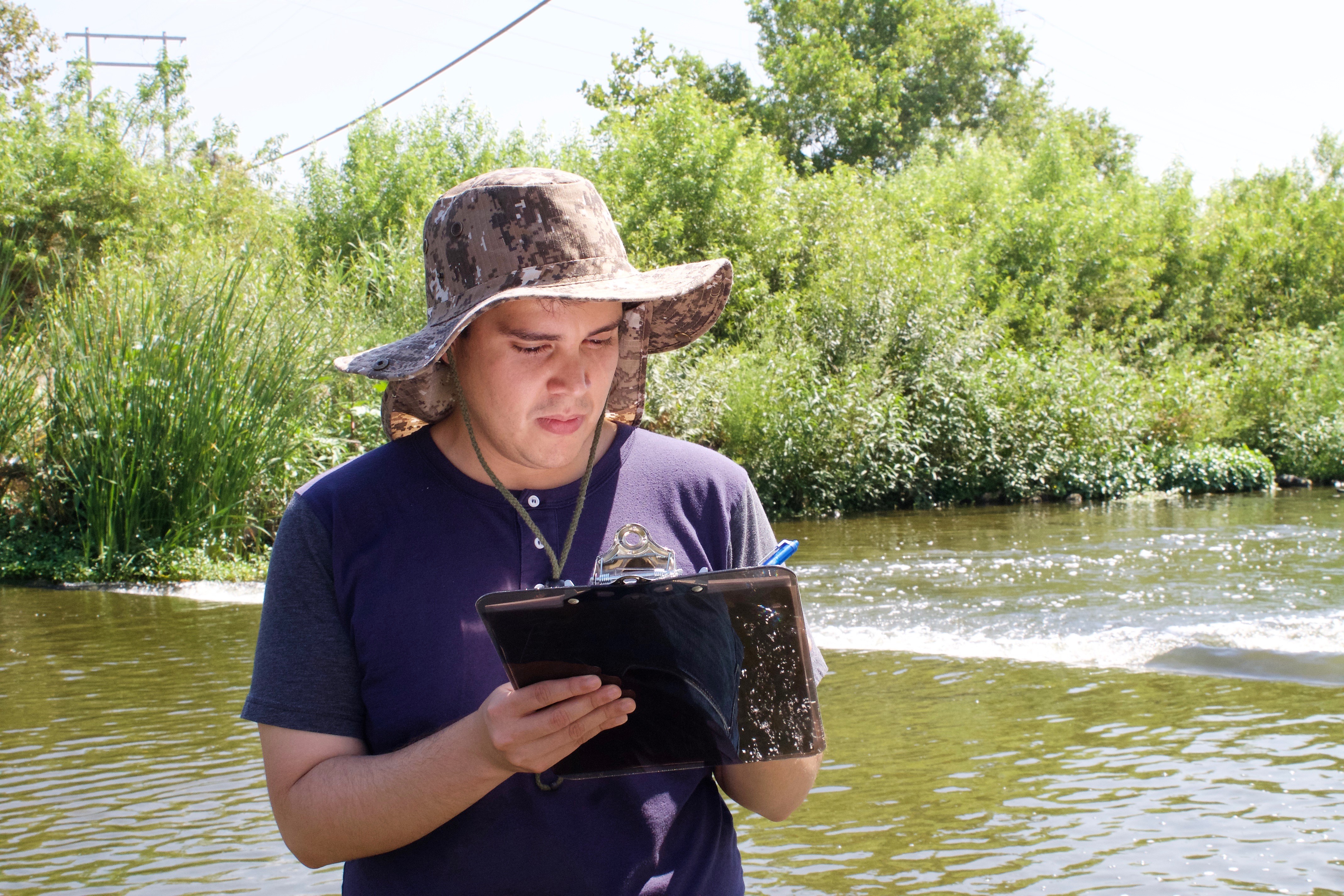
En la semana pasada, en mi segundo día con el equipo de monitorizar, el equipo montaba en bicicleta por las riberas por el norte del río. Recogieron muestras de tres desagües entre Fletcher Drive y Harbor Freeway. Todas de aquellas muestras tenía E. coli y Enterococcus que son bacterias de fecales inductores, lo que no nos sorprendió.
En el primer desagüe había un carro de compras lleno de excrementos y papel higiénico. Un hombre sin casa, que vive en una ciudad campamento debajo de la carretera 2, y tiene cuatros gatos en correas, dijo que alguna de la gente que vive por ahí usa el desagüe como un baño.
Los otros dos desagües no parecían mejor, uno de ellos era una cascada que llegó hasta el río y sus riberas. Un joven sin casa, que se llama Abraham, acabó de bañarse en el río y estaba secando su ropa en la ribera. Hay gente sin casa muriéndose en las calles y bañándose en el río, es obvio que tenemos que hacer algo más.
La ciudad de Los Ángeles y los oficiales del condado tiene mucho que resolver en los meses y en los años que vienen. Tienen que entender lo que es el río, lo que podría y debería ser, como se debe limpiarlo y cómo lograr de pagar por su revitalización. Esas decisiones son cada vez más importantes porque está subiendo las estimaciones y no podemos esperar mucho ayuda de Washington. De hecho, el programa de monitorizar el río está pagado por un subsidio del EPA, lo cual es una agencia federal que está en peligro de recortes masivos.
El potencial para un oasis urbano
El río, históricamente, estaba seco por nueve o diez meses del año, pero ahora fluye por todo el año porque millones de galones de residuales tratados son emitidos diariamente en el canal, y llegan hasta el mar.
Prefiramos de hacer kayaking todo el año en agua tratado y escorrentía, o invertir en proyectos de la recuperación del agua para afrontar mejor sequía, o diseñar un compromiso viable.
El potencial para un oasis urbano por el centro de Los Ángeles es grande, ¿pero incluirán o desplazaran a los cuales viven cerca del rio y el desarrollo comercial para la construcción?
No tengo todas las respuestas, pero puede ser que los estudiantes de L.A. Trade Tech, los cuales son los que están monitorizando el río, nos ayudarán a descubrirlas. Nelson Chabarria quiere ser un inspector normativo medioambiental. Los otros estudiantes, Vanessa Granados, Christopher Zamora, y John Silva me dijeron que quieren seguir carreras en Ciencias del medio ambiente, geoquímica o ámbitos relacionados.
Ellos saben, mejor que muchos otros, el gran potencial del río tanto como los desafíos de mantener y limpiarlo. El río nos precede y sigue aquí, navegando los cambios que hemos hechos.