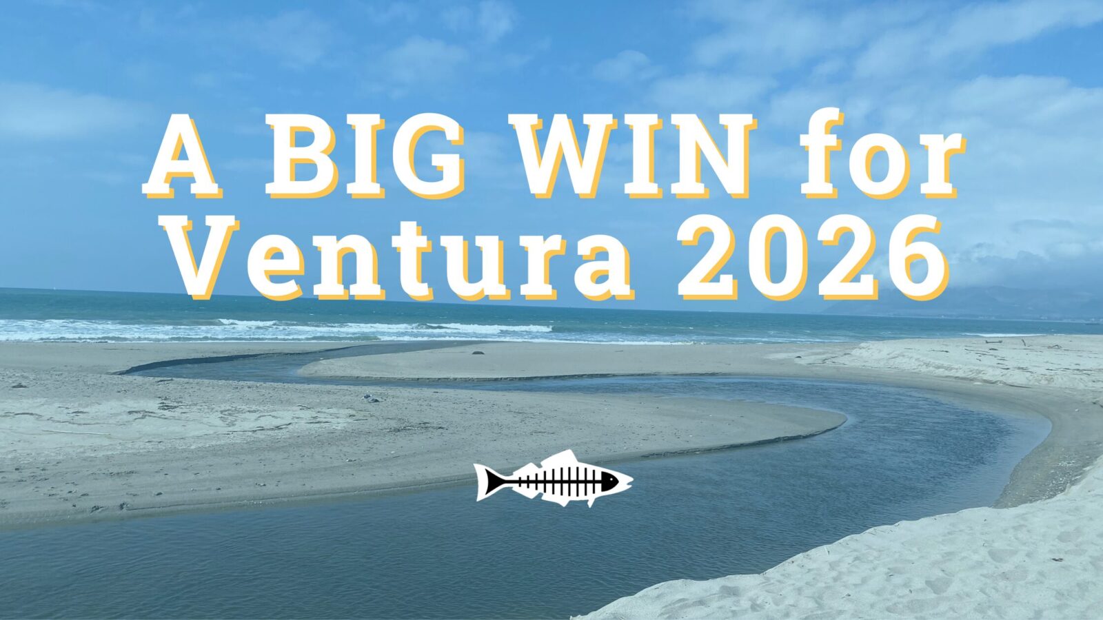
Heal the Bay is ecstatic to announce A BIG WIN for the coast!
For years, treated wastewater from the Ventura Water Reclamation Facility flowed directly into the Santa Clara River Estuary, one of Southern California’s most important and sensitive coastal ecosystems.
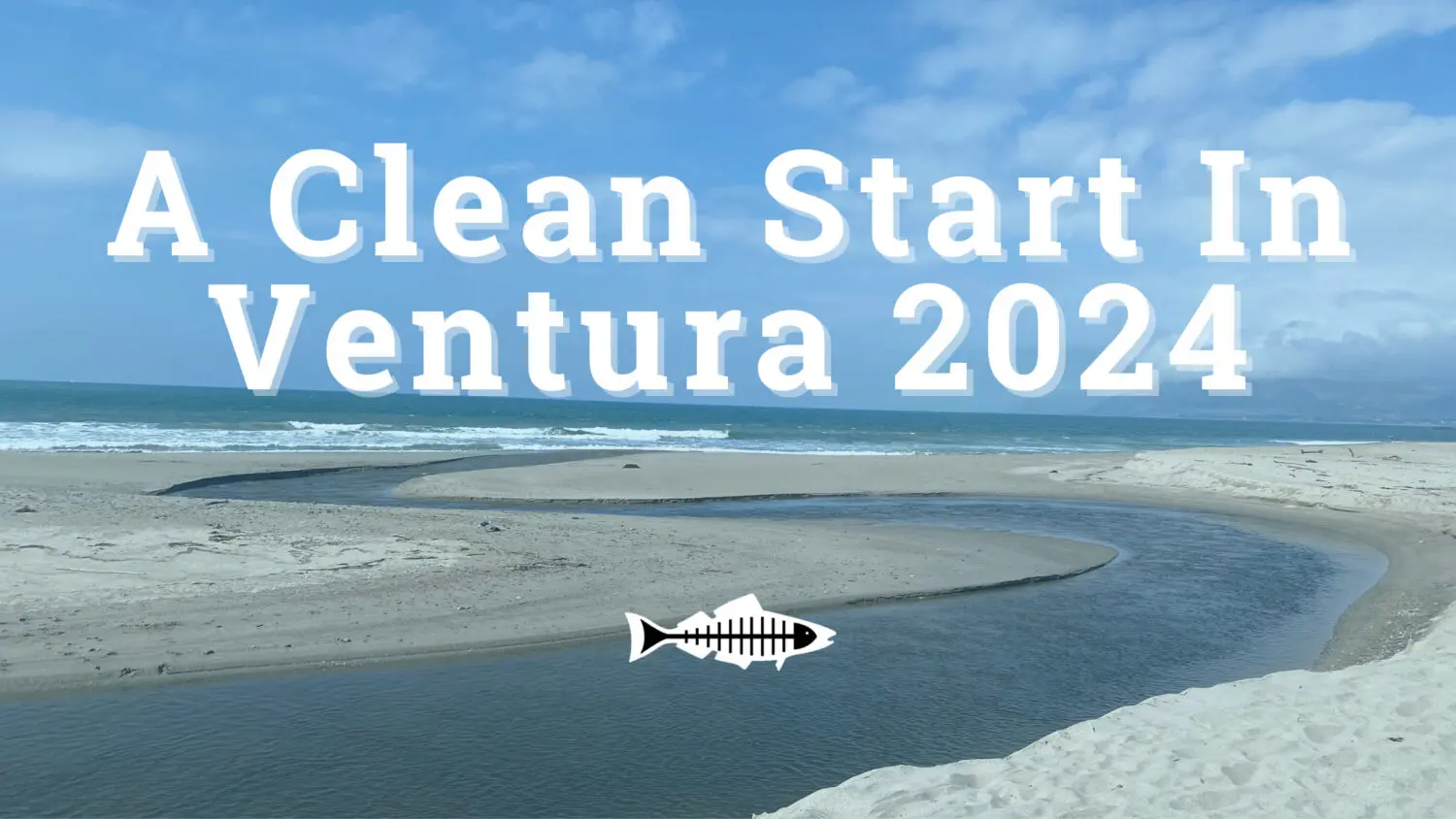
As of January 7, 2025, that changed. With the launch of Phase 1A of the wastewater recycling project called VenturaWaterPure, water is now being diverted away from the estuary, marking a major step toward healthier habitats and a sustainable local water supply for the City of Ventura.
This milestone is the result of decades of collaborative advocacy led by Heal the Bay and the Wishtoyo Chumash Foundation’s Ventura Coastkeeper Program, with the City of Ventura becoming a strong partner in delivering this outcome.
Why should Angelenos care? Because ecosystems are connected. The Santa Clara River flows to the ocean and provides critical habitat for protected species like the tidewater goby and snowy plover. Protecting these ecosystems helps shape water quality and strengthen regional climate resilience across Southern California.
Cleaner water and healthier habitats are a win for everyone, and proof that long-term environmental advocacy works. Ventura’s progress on water recycling puts the region more than a decade ahead of Los Angeles, showing what’s possible now and what remains at stake as LA delays action on our own water recycling efforts.
Read our 2024 Update: A Clean Start In Ventura
Heal the Bay and Wishtoyo Chumash Foundation have been collaborating to reduce impacts to the Santa Clara River Estuary from the Ventura Water Reclamation Facility since 2011, following a legal settlement (consent decree) with the City of Ventura. After more than a decade of scientific studies, bureaucratic negotiations, infrastructure planning, and a lengthy permitting process, we are excited that the VenturaWaterPure project is moving forward. The project will provide a net benefit to the estuary by reducing discharge of treated wastewater from the facility, which has a multitude of negative impacts on water and habitat quality in the estuary.
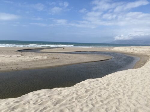
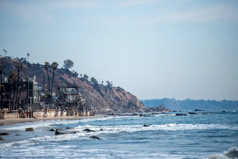
The Santa Clara River Estuary outlet to the ocean
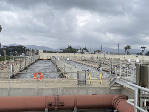
The Ventura Water Reclamation facility
On December 15, 2024, Heal the Bay joined our consent decree partners along with Secretary of the Interior Deb Haaland and Principal Deputy Assistant Secretary for Water and Science Michael Brain, to celebrate this water recycling and ecosystem restoration project.
Heal the Bay’s Associate Director, Science & Policy (Water Quality) Annelisa Moe (left) attends the VenturaWaterPure press conference.
Under CA State law, discharging treated wastewater is considered an unreasonable use of that water, and is therefore illegal, unless it provides an environmental benefit. Unfortunately, based on conclusions from a Science Panel and Technical Advisory Committee, treated wastewater flow into the naturally brackish Santa Clara River Estuary does not benefit the ecosystem, but actually negatively affects it in a variety of ways:
Decreases salinity variability, which is favorable for invasive species
Increases levels of nitrate and other nutrients leading to low dissolved oxygen levels, which is harmful to the entire ecosystem
Heightens the water level in the estuary leading to local flooding at McGrath State Park and unseasonal estuary berm breach events, which impedes public access and is harmful to native and listed species
So the City of Ventura has committed to dramatically reduce their discharge to the estuary and limit nutrient loading in any remaining discharge through the VenturaWaterPure project. The project also offers a co-benefit of up to 1.76 billion gallons of new recycled water supply for the City of Ventura by 2032. This supports the human right to water using an approach that is environmentally protective and affordable, especially when compared to other methods such as importing water, or using ocean water desalination.
Heal the Bay will continue to work closely with Wishtoyo Chumash Foundation and City of Ventura to ensure the transition to reduced discharge is protective of the estuary, that the new brine discharge to the ocean is done responsibly using the best available technology, and that the existing treatment ponds (which currently serve as important bird habitat) remain protected as part of the final VenturaWaterPure project.
Support Heal the Bay’s mission to protect public health through clean water policy:
In late January, Heal the Bay’s staff scientists began collecting ocean-water samples from 10 shoreline sites along the Bay to test for heavy metals, PCBs, asbestos, and other toxins. See our water quality testing timeline
The ocean water advisories along LA’s coast have been lifted, and based on recent data, Heal the Bay is cautiously optimistic that chemical contamination from the fires no longer poses a major risk for beachgoers. Post-fire debris is still a danger.
Is it finally safe to swim and surf? This week the Los Angeles County Department of Public Health lifted the ocean water advisories along LA’s coast. Based on data collected in January and February, Heal the Bay is cautiously optimistic that the chemical contamination from the fires does not pose a significant risk for recreation at our local beaches or in our coastal waters. However, the burn area may still pose some risks to beachgoers, swimmers, and surfers. Here’s what we know:
Physical debris is still being observed in the water and along the shore, primarily off the coast of the burn area from Las Flores to Will Rogers Beach. The good news is that LA County Beaches and Harbors is reporting a decrease in the volume of debris washing onto our shores. But because debris can include sharp objects, everyone should continue to use extra caution to avoid anything that looks like wildfire reminants, whether on the sand or in our coastal waters.
Debris removal has begun on the 300 homes along PCH that were tragically lost in the fires. While this is great news for the bay, there may be a risk to human health within 250 yards of debris removal activity. The LA County Department of Public Health has issued a health advisory stating that it is not safe to reside within 250 yards of debris removal because the activity can disturb contaminants and send them into the air and water. Out of an abundance of caution, Heal the Bay would like to highlight that recreating within 250 yards of debris removal may also pose additional risk to beachgoers, swimmers, and surfers.
If you choose to visit our beaches or get in the water, HTB recommends the following safety precautions:
Avoid areas within 250 yards of active debris removal.
Wear closed-toe shoes if walking on wet sand, as debris such as broken glass and structural fragments may still wash ashore.
Never touch trash or debris with bare hands.
Keep children and pets away from debris, especially in wet sand or high tide areas, where contamination risk may be higher.
Do not approach injured or distressed wildlife. If you have concerns about a marine mammal, contact the Marine Mammal Care Center at (1-800-39-WHALE).
Heal the Bay continues to urge beachgoers to recreate south of Santa Monica at Montana Avenue or north of the fire boundary in Malibu, where impacts are significantly lower.
Avoid eating seafood caught in Santa Monica Bay. Contaminants in the ocean water exceed safe levels for fish consumption. Additionally, the SoCal coast is experiencing a harmful algal bloom, which may pose a risk when consuming locally caught shellfish.
Please use this information to make informed choices for your safety and the well-being of your family and pets. The LA Regional Water Quality Control Board has also published risk-based recreational thresholds and a tool to help beachgoers decide how often they can safely enjoy the coastal waters.
While the beaches are open to the public now, the long-term impacts of wildfire contamination continue to raise concerns. Our January data shows elevated levels of heavy metals in the bay, posing risks to marine life. Heal the Bay continues to investigate the effects of wildfire-related pollutants and bioaccumulation in our coastal ecosystems, but we can’t do it without you. Visit healthebay.org/donate to support our science, safety, and post-fire recovery work. Together, we can protect what we love.
UPDATE MARCH 27, 2025
**New data has become available since March 27. An update is coming soon.
According to water-quality testing results released today by Heal the Bay, local marine life faces significant and ongoing threats from heavy metals that leached into Santa Monica Bay after January’s Palisades wildfires.
PRESS RELEASE 3/27/2025 –Test results from 10 collection sites along the entire length of Santa Monica Bay show that immediately after the fires, water quality at LA’s beaches was much better than expected, diminishing fears about human health impacts from polluted runoff in fire-scarred areas. We cannot definitively say that the water is safe until we have additional data and information about risk-thresholds for recreational contact, but based on the data we have seen to date, we are cautiously optimistic.
However, our analysis indicates that marine mammals, multiple fish populations, and other species further down the food chain are at serious risk from elevated levels of beryllium, copper, chromium, nickel, lead, and other harmful heavy metals and nutrients.
Silver, arsenic and zinc were also detected above average marine-health limits. Aluminum, iron, and manganese also showed elevated levels, though no marine health limits exist for these metals. In all, Heal the Bay staff scientists and a regional water agency tested for 116 known pollutants at multiple sites in January and February. (Please click here for a detailed analysis of the results, our data spreadsheet, and raw data from the PHYSIS lab.
Following heavy seasonal rains, toxic pollutants washed into the intertidal zones from burned structures and scorched earth in the Palisades, Topanga, and Malibu. Waves lapping onto fire-ravaged buildings along Pacific Coast Highway continue to sweep harmful metals into the sea.
Even at low concentrations, heavy metals can disrupt vital biological processes, damage cells, and impair reproductive and immune functions for marine life. Metals can also be transferred and magnified through the food chain. This impacts the entire food web, which inevitably impacts humans. In short, when animals get sick, humans can get sick, particularly from consuming seafood that has a bioaccumulation of metals in their systems.
Heal the Bay is urging authorities to expedite the removal of burned-out structures and other fire-related debris from PCH as soon as possible. Unfortunately, some homeowners have been slow to respond to U.S. Army Corps of Engineers’ offers to facilitate debris removal. Roughly 45 shoreline homeowners have opted out of the program, while nearly 100 have not responded at all. Whether or not a homeowner decides to use the US Army Corps of Engineers or a private contractor, it’s imperative that debris removal happens quickly.
“Every day that hazardous debris remains along the coast, more harmful contaminants flow into the sea,” says Tracy Quinn, President and CEO of Heal the Bay. “If we want to give our marine life a fighting chance, we need that debris removed as soon as possible.”
The most concerning findings come from the hardest-hit fire areas, including Topanga Beach, the Big Rock section of Malibu, and Will Rogers State Beach near Pacific Palisades. However, the waters around Santa Monica Pier and Dockweiler State Beach also spiked for heavy metals — suggesting that more studies are needed to understand the movement of contaminants offshore or identify other sources.
Because it is now March, these data do not tell us the current conditions in Santa Monica Bay, but they do provide valuable insight into the impacts of the Palisades Fire on marine life and the potential impacts on human health.
Risk tolerance is a personal decision. Here is some information that can help beachgoers decide if, when, and where they may want to enter the ocean.
The contaminants tested seem to be below human health limits for recreational contact for the data where limits could be identified. The Los Angeles Regional Water Quality Control Board is still assessing risk-thresholds, including those for PAH, a harmful organic compound related to fire-scorched debris.
PAHs, the group of contaminants that may be above human health limits, are unlikely to sicken people who swim or surf a few times, but frequent or prolonged exposure may contribute to an increased risk for future chronic health issues.
Beachgoers should also be careful about walking on the sand, which may contain sharp fire-related debris like nails and broken glass. For the time being, Heal the Bay recommends avoiding beaches within the fire-impacted areas and as far south as Montana Ave in Santa Monica. The Regional Water Quality Control Board has already posted some sand and sediment data for LA’s beaches. We are waiting for the complete test results to post our analysis. Stay tuned.
The fire and recent marine mammal deaths
It’s also worth noting the recent uptick in marine mammal beach stranding and deaths in Santa Monica Bay related to domoic acid poisoning. Elevated levels of runoff-related nutrients can contribute to the development of algal blooms in the Bay and accumulate in shellfish. When mammals consume shellfish, they can get sick and die from the neurotoxins produced by certain algae.
This is the fourth consecutive year of domoic acid outbreaks. The recent fires did create a significant dump of nutrients like sulfate and phosphorous into the ocean, but there is no evidence, yet, of a correlation between the wildfires and the domoic acid outbreak.
About the testing
On Jan. 24-25, before the first winter storms came, Heal the Bay staff collected ocean-water samples at 10 shoreline sites across Santa Monica Bay. From Paradise Cove to Malaga Cove, they tested for 116 pollutants. They took samples again on Jan. 28, after heavy rainfall, to better understand how stormwater might carry toxins from the burn zone.
Processing samples took multiple weeks due to the complexity of sample preparation, the need for precise instrumentation, and the rigorous quality control required. It also took several weeks to receive the data results back from Physis Lab. Then, additional time was needed for Heal the Bay’s Science and Policy Team to analyze and assess the data.
Staff members from the Los Angeles County Department of Public Health collected water samples on Feb. 18, which Heal the Bay also analyzed for its report. After the intense Feb. 13 storms, testing showed elevated levels of contaminants that do not have established risk-thresholds for recreational contact. Further analysis is required and will be included in an upcoming post.
Heal the Bay is part of a collaborative task force working with government agencies, researchers, and other nonprofits to better understand the extent of the contamination and how to clean it up efficiently. We will be updating our analysis and sharing the findings in the weeks to come as soon as new data becomes available.
Heal the Bay is the only organization providing this kind of in-depth analysis of water quality data.
But to continue this important work, we need your support. If you’d like to see more of these efforts, please consider donating.
Watch the Webinar for today’s latest Heal the Bay Ash to Action Updates.
Learn about the critical work that Heal the Bay and its academic partners are doing to protect the environment and monitor water quality in Santa Monica Bay.
UPDATE MARCH 13, 2025
The Los Angeles Regional Water Quality Control Board has released its 2025 Post-Fire Water Quality Monitoring results.
“The board has been working with Los Angeles County to monitor ocean water quality since Jan. 22, 2025. Samples are collected regularly at 12 beach sites from La Costa Beach to Dockweiler Beach by the Los Angeles County Department of Public Health. They then are analyzed by the board for metals, nutrients, polychlorinated biphenyls (PBCs) and polycyclic aromatic hydrocarbons (PAHs), which are chemicals that may be found in water runoff based on previous California wildfires.” (Waterboards.ca.gov)
Post-Fire Water Quality in Santa Monica Bay: We reviewed results from the LA County Department of Public Health (DPH).
Recent wildfires in Los Angeles that started on January 07, 2025, have impacted water quality in Santa Monica Bay. To understand the extent of these water quality impacts, we looked for contaminants that are likely to be mobilized after a wildfire, and that pose a risk to human and ecological health when concentrations are elevated; this includes heavy metals, PAHs (polycyclic aromatic hydrocarbons), nutrients, bacteria, and solids that decrease water clarity. Right now, Heal the Bay has data that our staff collected for bacteria and water clarity (referred to as “turbidity”), which have faster processing times and which we can test on-site in the Heal the Bay lab, while other contaminant samples were sent to a contracted lab to process.
While we wait for Heal the Bay’s results for the other contaminants, we reviewed results from the LA County Department of Public Health (DPH), which took samples on January 22, 2025, and January 27, 2025, at beaches from Las Flores State Beach to Dockweiler State Beach. These data points are representative of water quality before and after the first flush rain event, over a month ago. Since then, we have had additional significant rainfall, including nearly two inches of rain on February 13, 2025, which, unfortunately, was not tested by DPH in time to provide wet weather data. Data that are more recent will provide needed insight into overall conditions in our coastal waters. Heal the Bay will continue to provide updates as new data become available.
Water contact limits do not exist for most of the contaminants of concern associated with wildfires, so to understand potential health risks, we compared results to limits in the CA Drinking Water standards, the CA Ocean Plan (for both human health and marine life), and the Hawai‘i Department of Health Surface Water Action Levels for Marine Habitats (used to assess impacts of the Lahaina Fires). Our initial findings show elevated heavy metals, bacteria, nutrients, and other organic compounds, along with a decline in water clarity, all of which indicate that wildfire runoff does pose a risk to human and ecological health and that contamination is traveling beyond the immediate burn zone.
Key Findings from January 22 and 27, 2025:
Heavy Metals and Metalloids: Aluminum, iron, selenium, and manganese were elevated above drinking water standards, sometimes as much as 10x the limit. This is not an immediate human health threat,but we urge caution if there is the possibility of ingestion. These four metals, in addition to arsenic, copper, and zinc, also exceeded safety thresholds for marine health, particularly at Will Rogers State Beach and Topanga Beach, posing a health risk to marine life. Even at low concentrations, these metals can disrupt vital biological processes, damage cells, and impair reproductive and immune functions for marine animals.
PAHs (polycyclic aromatic hydrocarbons): PAHs were detected at unsafe levels, based on human health standards in the CA Ocean Plan, at Will Rogers State Beach and Topanga Beach and were not detected at other sites. This poses a site-specific risk to human health within the burn zone.
Nutrients: Elevated phosphorus levels have increased nutrient concentration in Santa Monica Bay, leading to the formation of a persistent brown foam along the shoreline and increasing the risk of algal blooms.
Turbidity & Solids: While turbidity may not pose a direct risk to public health, it can disrupt biological processes for marine life, and water clarity can help to show how far runoff from the burn zone traveled along the coastline. Water clarity declined significantly after rain from Surfrider Beach down to at least Dockweiler Beach, indicating wildfire runoff spread beyond the burn zone. Turbidity levels were consistently good at Paradise Cove (north of the burn zone) and Malaga Cove (just north of Palos Verdes Peninsula), indicating boundaries on the extent of pollution traveling up and down the coastline, but that boundary is not yet clear.
Bacterial Contamination: High bacteria levels were observed near storm drains, worsening after rainfall, following the typical pattern for bacterial pollution in Santa Monica Bay.
What You Need to Know:
A day at the beach should never make anyone sick. Heal the Bay is dedicated to protecting public health by sharing water quality information, and we remain concerned about the potential risks associated with post-fire contamination in ocean water and sand. Additionally, hazardous debris, such as nails and pipes, continues to wash ashore, posing a physical risk to beachgoers.
At this time, Heal the Bay recommends avoiding beaches and ocean water from Las Flores to Santa Monica State Beach and exercising caution at beaches further south, at least to Dockweiler State Beach. While water clarity does improve further south at Malaga Cove, we do not yet have comprehensive data for beaches south of Dockweiler State Beach, so we cannot determine potential health risks. If you visit the beach anywhere in Santa Monica Bay south of Surfrider Beach:
Stay vigilant; look out for sharp debris and avoid picking up objects with bare hands.
Keep children and pets from touching or ingesting water or wildfire debris.
Refrain from full-body submersion into the coastal waters in the designated areas, which can lead to accidental ingestion.
Heal the Bay has collected additional sand and water samples throughout Santa Monica Bay from Paradise Cove down to Malaga Cove. We will share results on our website as soon as those data become available. We urge the Los Angeles County Department of Public Health to enhance transparency in decision-making and ensure all relevant data is made publicly accessible in a timely manner. Until further testing is completed and more information on current water conditions is released, we advise the public to remain cautious when visiting affected beaches.
UPDATE FEBRUARY 26, 2025
On Monday, February 24, 2025, Heal the Bay learned that the Los Angeles County Department of Public Health (DPH) had stated beachgoers may recreate on the sand in the fire-impacted areas. We also learned that this determination is likely based on only two debris samples taken by Los Angeles County Public Works, one at Topanga Creek and the other at Will Rogers State Beach. These samples were collected to determine the disposal method required to remove the debris, not to determine if it is safe for people to be on the sand. It is alarming that DPH would make this proclamation based on only two data points. While preliminary debris and ocean water quality testing have not shown elevated levels of harmful contaminants attributed to burned household items, the sample size for both water and sand thus far is quite small. At this time, we simply do not have enough information to determine if the sand or water at beaches where debris is present is safe for recreation. Furthermore, dangerous debris such as nails, screws, and pipes continue to wash up on shore, often concealed in sand or near-shore waves, increasing the risk to people playing on our beaches. This is an unprecedented event, and we must wait for the results of additional testing before declaring our beaches safe. We ask for increased transparency from the LA County Department of Public Health in decision making going forward, data used to protect our public health should be available to the public.
For now, Heal the Bay recommends that people avoid beaches (both sand and water) from Las Flores to Santa Monica State Beach and use extra caution on beaches south of Santa Monica. If choosing to go to the beach, watch out for sharp debris, do not pick up debris with your bare hands, and keep a close eye on children and pets to ensure they do not touch or ingest debris.
Heal the Bay and the Regional Water Quality Control Board have each collected sand samples from throughout the burn area, and we are awaiting results. We will share our ocean water and sand testing results on our website as soon as they are available.
Los Angeles County Department of Public Health’s full statement on beach safety: “The ocean water advisory due to fire impacts from Las Flores State Beach to Santa Monica State Beach remains in effect until further notice. Beachgoers may recreate on the sand but continue to be advised to stay away from visible fire debris and to stay out of the ocean water during any posted ocean advisory.”
UPDATE FEBRUARY 18, 2025
We expect results this week from Heal the Bay’s first round of expanded ocean-water quality testing.
In late January, Heal the Bay’s staff scientists began collecting ocean-water samples from 10 shoreline sites along the Bay to test for heavy metals, PCBs, asbestos, and other toxins. These harmful pollutants are flowing unchecked to the sea from recent heavy rains and other runoff from burn zones. We expect results from before and after the “first flush” storm during the week of February 17th and will post them here.
UPDATE JANUARY 14, 2025
We present the updated timeline detailing our recent water quality assessment activities in the coastal regions affected by the Palisades fire.
January 24-25, 2025
Heal the Bay conducted initial pre-rain water quality testing at 10 locations throughout Santa Monica Bay: five within the burn zone, three outside of the burn zone but within the beach advisory zones, and two control sites (one north and one south of the beach advisory zones).
Our water quality scientists tested for temperature, turbidity, Fecal Indicator Bacteria, PAHs, PCBs, PFAS, benzene, mercury, and other heavy metals. This sampling involved coordination with the Fire Department and Lifeguards to gain access to the closed burn zone.
January 28, 2025:
After the January 26 rainstorm, staff took water quality samples again for the same pollutants and at the same locations tested on January 24-25, to compare pre- and post-rain results.
Jenny Jay from UCLA joined us for the six northernmost sampling sites to test for metals, antibiotic-resistant bacteria, and nutrients.
February 3, 2025:
Heal the Bay staff examined the Beach Report Card on Friday, January 31, 2025, and identified data gaps within the burn zone.
Staff went out on Monday, February 3, 2025, to sample the five locations within the burn zone for temperature, turbidity, and Fecal Indicator Bacteria (which we can process ourselves in our lab) to fill those data gaps.
On this sample day, journalists from NPR and Spectrum News and the Fire Department’s photography team joined us to document and report on our testing.
Heal the Bay staff attended the Post-Fire Coordinated Water Quality Testing Meeting hosted by SCCWRP. While this group aims to establish a working group to coordinate long-term post-fire water quality monitoring (which Heal the Bay will participate in), this meeting addressed urgent needs arising from the weather conditions by identifying who would be conducting sampling that week, where the sampling would occur, and which contaminants would be tested.
February 10, 2025:
Heal the Bay returned to the field one last time to support ongoing research, visiting six of our ten original sample sites, from Surfrider Beach at Malibu Lagoon to Will Rogers State Beach at Santa Monica Canyon.
An assessment of the BRC on Friday, February 7, 2025, indicated no remaining data gaps, so we did not collect Fecal Indicator Bacteria samples.
Instead, this trip was intended to gain access to the burn zone one more time and show our sampling locations to researchers from the Proteocean Lab at USC. They plan to build on our initial testing with weekly sampling for heavy metals, microbial health, and nutrients.
Staff from Surfrider also joined us so that we could show them where there is safe access to their regular testing locations within the burn zone.
We also collected sand samples at each site from below the high tide line and above the high tide line where the sand was dry (where possible). These samples have been delivered to CSU Northridge, where researchers will test them for heavy metals and PAHs. They will also compare the results from our sand samples to soil samples that they collected within the Eaton Fire burn zone.
UPDATE JANUARY 29, 2025
Our fire response has just begun.
Over the past six days, the Heal the Bay Science and Policy Team has been testing water in and out of the burn zones along Santa Monica Bay impacted by the Palisades Fire.
The Palisade Fire has increased sedimentation and introduced harmful pollutants into our coastal waters, and Heal the Bay is dedicated to understanding the impacts, which is why we are testing for key pollutants that may be transported into Santa Monica Bay due to runoff from the Palisade Fire.
Not only are we testing for bacteria and turbidity (which we can process in-house), but we are also collecting samples to test for Heavy metals, Mercury, PAHs/PCBs, Benzene, and PFOS/PFOA (two types of PFAS). We collected samples before and after the rain event on January 26, 2025, which will provide a comparative analysis of initial pollutant levels and stormwater runoff effects.
During a typical rain event, stormwater runoff is considered the most significant source of water pollution. Following the unprecedented wildfires in Los Angeles this past weekend, the “first flush” amplified the pollution – carrying not only higher levels of typical pollutants like oil and grease, trash, plastic, bacteria, and heavy metals but also wildfire debris and other hazardous materials including ash, fire suppressant, household chemicals, car batteries, and more. These contaminants pose significant risks to water quality, marine ecosystems, and public health.
The team collected water samples from 10 key locations, including areas within the burn zone, adjacent impacted areas, and control sites.
(NOTE: We were joined in the field by Professor Jennifer Jay of UCLA, and there may be additional data from agency offices like the LA County Department of Public Health, that will also contribute to the very limited water quality dataset for understanding the impacts of the Palisades Fire.)
Heal the Bay is one of only a few organizations doing this water quality testing in the wake of these devastating fires. Still, great science is collaborative, and our team is excited to be one of the only nonprofits contributing to this initial and limited data set. Every bit of data will help us understand the long-term impacts of this unprecedented fire season.
Our findings will be shared as soon as possible to inform the public about potential environmental and public health risks. We will also contribute to coordinated monitoring efforts that will inform policymakers and guide future mitigation and response efforts.
While our samples are being processed to help us understand what is in our coastal waters, we strongly urge everyone to avoid contact with ocean water and to refrain from walking on the beach, as fire debris runoff may contain toxic or carcinogenic chemicals. The LA County Department of Public Health has issued Ocean Water Closures from Las Flores State Beach to Santa Monica State Beach, with additional Beach Advisories issued as far north as Surfrider Beach at Malibu Lagoon and south to Dockweiler State Beach at World Way, all of which will remain in effect until further notice. Your health and safety are our top priority—thank you for doing your part to protect yourself and our environment.
PCBs = Polychlorinated biphenyls, chemicals used in industrial / commercial products (PCBs stopped being produced in the 70s, so a legacy chemical)
PFASs = Per- and polyfluoroalkyl substances, forever chemicals (manmade chemicals that do not breakdown ) used to make waterproof, nonstick, and flame-resistant products.
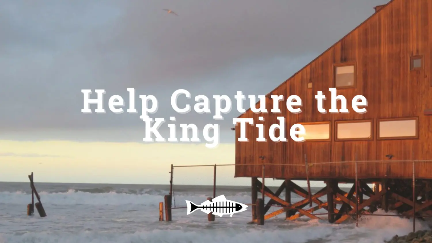
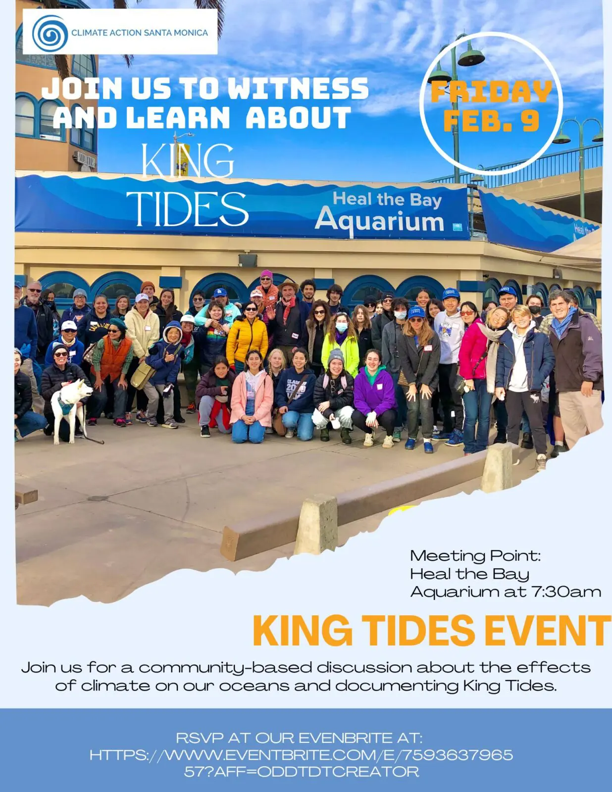
Join community scientists in California to observe and document the King Tides on December 13, 2024. This extreme high tide event provides a glimpse of what we face with climate-driven sea level rise. Your images will contribute to a better understanding of how to adapt to and combat the climate crisis.Get a glimpse of last winter’s King Tide.
UPDATED FEBRUARY 1, 2024
Capture the King Tide this December!
King Tides are a wave phenomenon that can only be witnessed a few times a year when the high tide is at its highest and the low tide is at its lowest. These extreme tides only come to shore when the moon is closest to the Earth and when the Earth is closest to the Sun. King Tides can teach California so much about the changing coastline, if their impact can be captured.
This February, Heal the Bay is calling on all local beach lovers to hit the sand and help us document these extreme tides. Taking pictures and recording this natural phenomenon can help climate scientists predict the future of California’s coastline in preparation of impending sea level rise, which is the first step toward adapting for and combating the climate crisis. Last year your observations were vital to prepare Los Angeles for a future affected by climate change and we need your help once again.
The second King Tides event of this season will occur on:
Instructions from the CA Coastal Commission:
1) Find your local high tide time for one of the King Tides dates.
2) Visit the shoreline on the coast, bay, or delta.
3) Be aware of your surroundings to ensure you are safe and are not disturbing any animals.
4) Make sure your phone’s location services are turned on for your camera and then take your photo. The best photos show the water level next to familiar landmarks such as cliffs, rocks, roads, buildings, bridge supports, sea walls, staircases, and piers.
5) Add your photo to the King Tides map either by uploading it via the website or by using the Survey123 app.
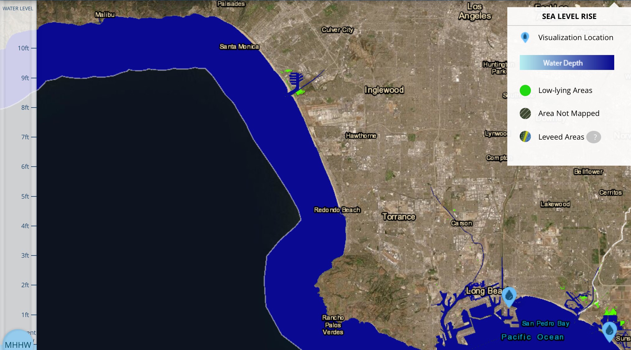
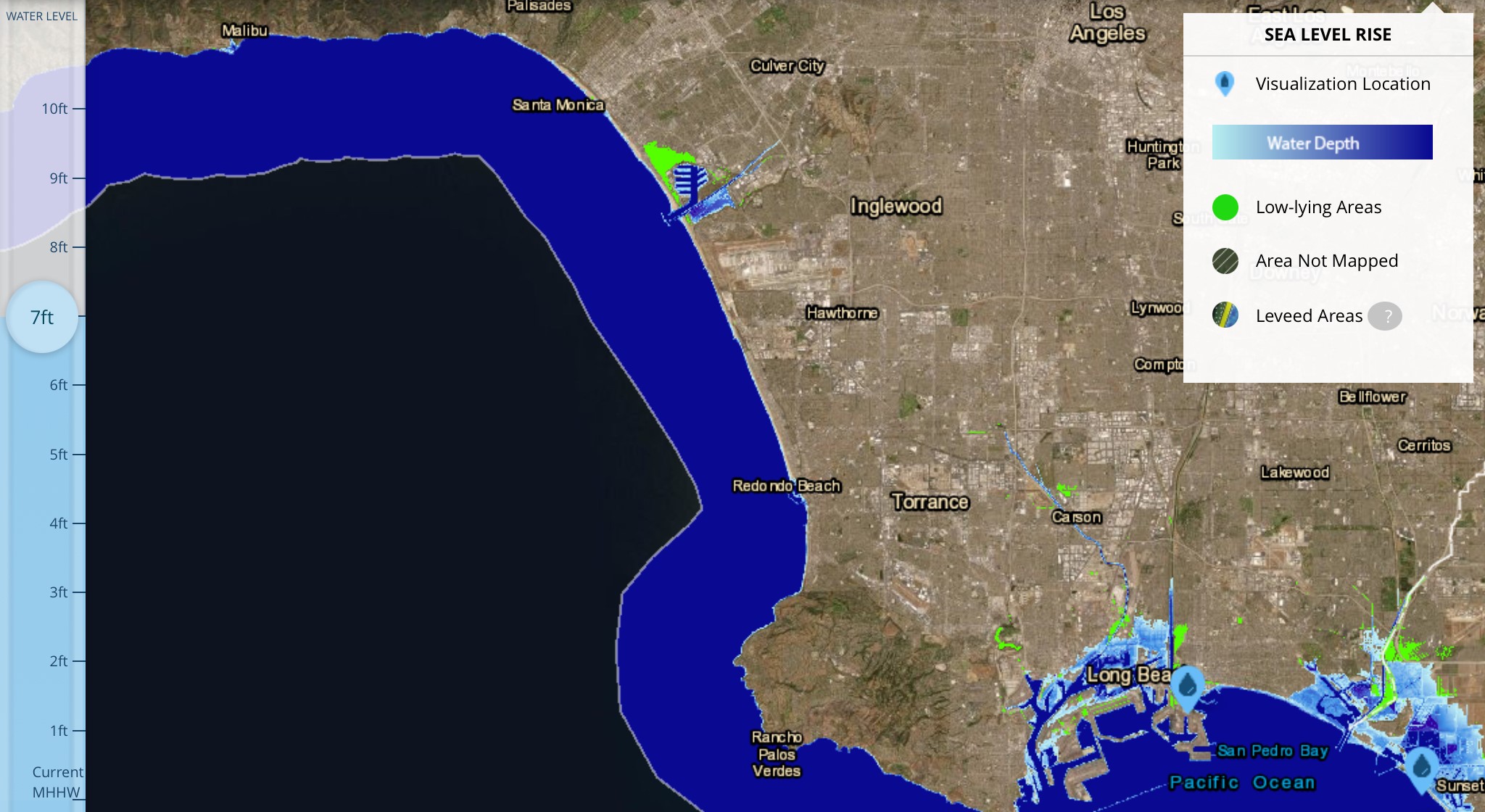
Sea Level Rise
Before we get into the details of this year’s King Tides event, let’s begin with the larger context of sea level rise. Humans are polluting Earth’s atmosphere with greenhouse gases (GHGs) like CO2, primarily through the burning of fossil fuels, driving average global temperatures up at an unprecedented rate.
Oceans have helped to buffer this steady pollution stream by absorbing 90% of our excess heat and 25% of our CO2 emissions. This, among myriad impacts, has increased sea temperatures, causing ocean water to expand. The combination of ocean water expansion and new water input from the melting of landlocked glaciers results in rapid sea level rise.
Santa Monica Beach Current
Santa Monica Beach Sea Level Rise 2ft
Santa Monica Beach Sea Level Rise 7 Ft
Ports Current Sea Level
Ports Sea Level Rise 7ft
Marina Del Rey Current Sea Level
Marina Del Rey Sea Level Rise 7ft
Take a look at images from the NOAA Sea Level Rise Viewer. Light blue shows areas expected to flood consistently as sea levels rise. Bright green shows low-lying areas vulnerable to flooding from groundwater upwelling as seawater intrusion increases.
According to the 2021 Intergovernmental Panel on Climate Change (IPCC) Report, sea level will rise 2 feet by 2100 even if efforts are made to lower GHG emissions, and possibly as much as 7 feet by 2100 if we continue with “business as usual” (i.e., burning fossil fuels at the current unsustainable rate). Rapid sea level rise threatens beach loss, coastal and intertidal habitat loss, seawater intrusion into our groundwater supply (which could contaminate our drinking water supply and cause inland flooding from groundwater upwelling), as well as impacts from flooding or cliff erosion on coastal infrastructures like roads, homes, businesses, power plants and sewage treatment plants—not to mention nearby toxic sites.
Here's a sea level rise problem we should all think more about: Toxic sites that could flood + expose nearby residents to dangerous chemicals.
Ocean tides on Earth are caused by the gravitational pull of the moon (and the sun, to a lesser extent) on our oceans. When the moon is closest to Earth along its elliptical orbit, and when the moon, earth, and sun are aligned, gravitational pull compounds, causing extreme high and low tides called Perigean-Spring Tides or King Tides. These extreme tides provide a glimpse of future sea level rise.
In fact, King Tides in Southern California this December and January are expected to be 2-3 feet higher than normal high tides (and lower than normal low tides), providing a clear snapshot of what the regular daily high tides will likely be by 2100.
Surfider Beach Third Point, Malibu (Photo by CA Coastal Commission)
Broad Beach, Malibu in 2016 (Photo by LA Waterkeeper)
(Top to bottom) Low, Medium, High Tides at Carbon Beach, January 8-10 2013
What is being done
Many coastal cities in California have developed Local Coastal Programs in coordination with the CA Coastal Commission to address sea level rise. The Coastal Commission is also developing new sea level rise guidance for critical infrastructure, recently released for public review. Unfortunately, if we continue with “business as usual,” the rate of sea level rise will occur much more quickly than we can adapt to it, which is why we need bold global action now to combat the climate crisis and limit sea level rise as much as possible.
What you can do
Motivated people like you can become community scientists by submitting King Tides photographs the weekend of December 23 and 24, 2022 to contribute to the digital storytelling of sea level rise. These photos are used to better understand the climate crisis, to educate people about the impacts, to catalog at-risk communities and infrastructure, and plan for mitigation and adaptation. Join the Coastal Commission in their CA King Tides Project!
Get involved in #KingTides events
Instructions from the CA Coastal Commission:
1) Find your local high tide time for one of the King Tides dates.
2) Visit the shoreline on the coast, bay, or delta.
3) Be aware of your surroundings to ensure you are safe and are not disturbing any animals.
4) Make sure your phone’s location services are turned on for your camera and then take your photo. The best photos show the water level next to familiar landmarks such as cliffs, rocks, roads, buildings, bridge supports, sea walls, staircases, and piers.
5) Add your photo to the King Tides map either by uploading it via the website or by using the Survey123 app.
In the Los Angeles area? Here are some areas we expect will have noticeable King Tides:
In Palos Verdes, we recommend: Pelican Cove, Terrenea Beach, White Point Beach, and Point Fermin. In Malibu, we suggest: Paradise Cove, Westward Beach, Broad Beach, El Pescador State Beach, and Leo Carrillo State Beach.
Written by Annelisa Moe. As a Coastal and Marine Scientist for Heal the Bay, Annelisa works to keep our oceans and marine ecosystems healthy and clean by advocating for strong legislation and enforcement both locally and statewide. She focuses on plastic pollution, marine protected areas, sustainable fisheries, and climate change related issues.
Heal the Bay and Wishtoyo Chumash Foundation have been collaborating to reduce impacts to the Santa Clara River Estuary from the Ventura Water Reclamation Facility since 2011, following a legal settlement (consent decree) with the City of Ventura. After more than a decade of scientific studies, bureaucratic negotiations, infrastructure planning, and a lengthy permitting process, we are excited that the VenturaWaterPure project is moving forward. The project will provide a net benefit to the estuary by reducing discharge of treated wastewater from the facility, which has a multitude of negative impacts on water and habitat quality in the estuary.
The Santa Clara River Estuary outlet to the ocean
The Ventura Water Reclamation facility
On December 15, 2024, Heal the Bay joined our consent decree partners along with Secretary of the Interior Deb Haaland and Principal Deputy Assistant Secretary for Water and Science Michael Brain, to celebrate this water recycling and ecosystem restoration project.
Heal the Bay’s Associate Director, Science & Policy (Water Quality) Annelisa Moe (left) attends the VenturaWaterPure press conference.
Under CA State law, discharging treated wastewater is considered an unreasonable use of that water, and is therefore illegal, unless it provides an environmental benefit. Unfortunately, based on conclusions from a Science Panel and Technical Advisory Committee, treated wastewater flow into the naturally brackish Santa Clara River Estuary does not benefit the ecosystem, but actually negatively affects it in a variety of ways:
Decreases salinity variability, which is favorable for invasive species
Increases levels of nitrate and other nutrients leading to low dissolved oxygen levels, which is harmful to the entire ecosystem
Heightens the water level in the estuary leading to local flooding at McGrath State Park and unseasonal estuary berm breach events, which impedes public access and is harmful to native and listed species
So the City of Ventura has committed to dramatically reduce their discharge to the estuary and limit nutrient loading in any remaining discharge through the VenturaWaterPure project. The project also offers a co-benefit of up to 1.76 billion gallons of new recycled water supply for the City of Ventura by 2032. This supports the human right to water using an approach that is environmentally protective and affordable, especially when compared to other methods such as importing water, or using ocean water desalination.
Heal the Bay will continue to work closely with Wishtoyo Chumash Foundation and City of Ventura to ensure the transition to reduced discharge is protective of the estuary, that the new brine discharge to the ocean is done responsibly using the best available technology, and that the existing treatment ponds (which currently serve as important bird habitat) remain protected as part of the final VenturaWaterPure project.
Support Heal the Bay’s mission to protect public health through clean water policy:
Join community scientists in California to observe and document the King Tides on February 9, 2024. This extreme high tide event provides a glimpse of what we face with climate-driven sea level rise. Your images will contribute to a better understanding of how to adapt to and combat the climate crisis.Get a glimpse of last winter’s King Tide.
UPDATED FEBRUARY 1, 2024
Capture the King Tide this February!
King Tides are a wave phenomenon that can only be witnessed a few times a year when the high tide is at its highest and the low tide is at its lowest. These extreme tides only come to shore when the moon is closest to the Earth and when the Earth is closest to the Sun. King Tides can teach California so much about the changing coastline, if their impact can be captured.
This February, Heal the Bay is calling on all local beach lovers to hit the sand and help us document these extreme tides. Taking pictures and recording this natural phenomenon can help climate scientists predict the future of California’s coastline in preparation of impending sea level rise, which is the first step toward adapting for and combating the climate crisis. Last year your observations were vital to prepare Los Angeles for a future affected by climate change and we need your help once again.
Don’t want to face the big wave alone? Come capture the King Tide with other climate community members during the February phenomenon.
FREE King Tides EVENT @ Heal the Bay Aquarium with Climate Action Santa Monica
Date: February 9, 2024
Time: 7:30 am -9:30 am
Address: Heal the Bay Aquarium 1600 Ocean Front Walk Santa Monica, CA 90401 – Base of Santa Monica Beach Pier (by the bike path)
Head to Heal the Bay Aquarium for a King Tide community science event lead by Climate Action Santa Monica. Hit the beach and help document the King Tide by capturing pictures of this ocean phenomenon alongside community and climate scientists as part of the California King Tides Project. This phenomenon will be FUN FOR THE WHOLE FAMLIY! Join in the community discussion and discover the relationship between sea level rise and climate change alongside students and other climate community members.
Instructions from the CA Coastal Commission:
1) Find your local high tide time for one of the King Tides dates.
2) Visit the shoreline on the coast, bay, or delta.
3) Be aware of your surroundings to ensure you are safe and are not disturbing any animals.
4) Make sure your phone’s location services are turned on for your camera and then take your photo. The best photos show the water level next to familiar landmarks such as cliffs, rocks, roads, buildings, bridge supports, sea walls, staircases, and piers.
5) Add your photo to the King Tides map either by uploading it via the website or by using the Survey123 app.
PUBLISHED DECEMBER 13, 2022
Sea Level Rise
Before we get into the details of this year’s King Tides event, let’s begin with the larger context of sea level rise. Humans are polluting Earth’s atmosphere with greenhouse gases (GHGs) like CO2, primarily through the burning of fossil fuels, driving average global temperatures up at an unprecedented rate.
Oceans have helped to buffer this steady pollution stream by absorbing 90% of our excess heat and 25% of our CO2 emissions. This, among myriad impacts, has increased sea temperatures, causing ocean water to expand. The combination of ocean water expansion and new water input from the melting of landlocked glaciers results in rapid sea level rise.
Santa Monica Beach Current
Santa Monica Beach Sea Level Rise 2ft
Santa Monica Beach Sea Level Rise 7 Ft
Ports Current Sea Level
Ports Sea Level Rise 7ft
Marina Del Rey Current Sea Level
Marina Del Rey Sea Level Rise 7ft
Take a look at images from the NOAA Sea Level Rise Viewer. Light blue shows areas expected to flood consistently as sea levels rise. Bright green shows low-lying areas vulnerable to flooding from groundwater upwelling as seawater intrusion increases.
According to the 2021 Intergovernmental Panel on Climate Change (IPCC) Report, sea level will rise 2 feet by 2100 even if efforts are made to lower GHG emissions, and possibly as much as 7 feet by 2100 if we continue with “business as usual” (i.e., burning fossil fuels at the current unsustainable rate). Rapid sea level rise threatens beach loss, coastal and intertidal habitat loss, seawater intrusion into our groundwater supply (which could contaminate our drinking water supply and cause inland flooding from groundwater upwelling), as well as impacts from flooding or cliff erosion on coastal infrastructures like roads, homes, businesses, power plants and sewage treatment plants—not to mention nearby toxic sites.
Here's a sea level rise problem we should all think more about: Toxic sites that could flood + expose nearby residents to dangerous chemicals.
Ocean tides on Earth are caused by the gravitational pull of the moon (and the sun, to a lesser extent) on our oceans. When the moon is closest to Earth along its elliptical orbit, and when the moon, earth, and sun are aligned, gravitational pull compounds, causing extreme high and low tides called Perigean-Spring Tides or King Tides. These extreme tides provide a glimpse of future sea level rise.
In fact, King Tides in Southern California this December and January are expected to be 2-3 feet higher than normal high tides (and lower than normal low tides), providing a clear snapshot of what the regular daily high tides will likely be by 2100.
Surfider Beach Third Point, Malibu (Photo by CA Coastal Commission)
Broad Beach, Malibu in 2016 (Photo by LA Waterkeeper)
(Top to bottom) Low, Medium, High Tides at Carbon Beach, January 8-10 2013
What is being done
Many coastal cities in California have developed Local Coastal Programs in coordination with the CA Coastal Commission to address sea level rise. The Coastal Commission is also developing new sea level rise guidance for critical infrastructure, recently released for public review. Unfortunately, if we continue with “business as usual,” the rate of sea level rise will occur much more quickly than we can adapt to it, which is why we need bold global action now to combat the climate crisis and limit sea level rise as much as possible.
What you can do
Motivated people like you can become community scientists by submitting King Tides photographs the weekend of December 23 and 24, 2022 to contribute to the digital storytelling of sea level rise. These photos are used to better understand the climate crisis, to educate people about the impacts, to catalog at-risk communities and infrastructure, and plan for mitigation and adaptation. Join the Coastal Commission in their CA King Tides Project!
Get involved in #KingTides events
Instructions from the CA Coastal Commission:
1) Find your local high tide time for one of the King Tides dates.
2) Visit the shoreline on the coast, bay, or delta.
3) Be aware of your surroundings to ensure you are safe and are not disturbing any animals.
4) Make sure your phone’s location services are turned on for your camera and then take your photo. The best photos show the water level next to familiar landmarks such as cliffs, rocks, roads, buildings, bridge supports, sea walls, staircases, and piers.
5) Add your photo to the King Tides map either by uploading it via the website or by using the Survey123 app.
In the Los Angeles area? Here are some areas we expect will have noticeable King Tides:
In Palos Verdes, we recommend: Pelican Cove, Terrenea Beach, White Point Beach, and Point Fermin. In Malibu, we suggest: Paradise Cove, Westward Beach, Broad Beach, El Pescador State Beach, and Leo Carrillo State Beach.
Written by Annelisa Moe. As a Coastal and Marine Scientist for Heal the Bay, Annelisa works to keep our oceans and marine ecosystems healthy and clean by advocating for strong legislation and enforcement both locally and statewide. She focuses on plastic pollution, marine protected areas, sustainable fisheries, and climate change related issues.
The LA Regional Water Board approved an agreement for one of the nation’s most polluted sites. Concerns about transparency, accountability, and loopholes in this agreement leave the public vulnerable to continued contamination from the Santa Susana Field Lab.
LATEST UPDATE OCTOBER 19, 2023
We called for accountability. The Regional Board listened.
In August 2022, The Los Angeles Regional Water Board approved an agreement with Boeing to eventually consider removal of water quality regulations at their highly contaminated Santa Susana Field Lab (SSFL) site, formerly known as Rocketdyne, located in the hills above Simi Valley. This would only happen after soil cleanup has been completed, and after they have proven that surface water runoff from the site is clean. That proof of whether runoff is clean, however, depends on how well it is regulated – we don’t know what we don’t check for. The Los Angeles Regional Water Board voted today on updated regulation of runoff from SSFL, keeping the most stringent water quality limits, adding even more monitoring, and addressing the potential for surface water pollution to contaminate local groundwater through stormwater holding ponds. In this action, the Board has ensured that, if and when they consider removing regulation at this site at some future time, we can be sure that it would not happen at the expense of public and environmental health. There will also be publicly accessible quarterly reports on Boeing’s soil cleanup efforts at the site moving forward, which will help to keep Boeing accountable. Thank you to the Regional Board for using your authority to ensure protections for these lands and water resources!
UPDATE AUGUST 11, 2022
THE REGIONAL WATER QUALITY CONTROL BOARD VOTED ON AUGUST 11 to approve an agreement concerning Boeing’s highly contaminated Santa Susana Field Lab, formerly known as Rocketdyne, located in the hills above Simi Valley. The agreement sets up a process by which Boeing will eventually be able to remove its water quality regulations after cleanup has been completed, and after they have proven that runoff from the site is clean. Heal the Bay attended the 10-hour-long August 11 hearing and, while we fully support cleanup, we voiced our concerns that this agreement would not adequately protect water quality or public health and asked for a postponement to make improvements to the plan. We also raised concerns with the process — the agreement was made behind closed doors, the public was not able to submit written comments, and the only opportunity to speak was at the hearing. Due to an overwhelming turnout from members of the public, input at the hearing had to be further reduced from the typical 3 minutes to 1 minute and cut off completely at 5pm.
Both Boeing and the Regional Board claimed that this agreement was necessary for Boeing to commit to the required cleanup work, and that a delay in approval of the agreement would only delay the cleanup efforts. Stakeholders were put in an unfair position, threatened with delayed cleanup if we did not support an agreement that we had remaining concerns about. However, the blame for delays should not be placed on stakeholders and community members; these concerns and objections are not what is slowing down the process — Boeing has yet to even start a cleanup that was supposed to be completed back in 2017. As community member Marie Mason mentioned to me at the hearing, “If Boeing wanted to do the right thing, they would have done it 20 years ago,” and could have avoided the impacts of pollution and contamination exposure during that time. Further, the cleanup plan itself also raised concerns (see more on this in the next section) and while the decision before the Board was not specifically on the cleanup plan, the cleanup and the agreement are inextricably linked, and approval of the agreement meant a de facto approval of the cleanup plan.
Despite the overwhelming call for either a no vote or a delay, the Board unanimously approved the agreement, with minor edits. Heal the Bay will remain engaged on this issue because the bottom line is that cleanup to a level that is fully protective of human and ecological health needs to happen as soon as possible.
The history of contamination at the Santa Susana Field Lab
Boeing, NASA, and the Department of Energy own the Santa Susana Field Lab (SSFL) site, where industrial activities were conducted from 1949 to 2006 to test rocket engines and nuclear reactors. This site contains high levels of contamination from these past activities, which have negatively affected the ecosystem, the groundwater, and the surface water that runs off the site, as well as the communities that rely on those water resources. Additionally, SSFL is located on top of a hill, which means that runoff from the site flows downhill into the community to the north in Simi Valley, feeds into the headwaters of the Arroyo Simi waterway, and feeds into theheadwaters of the Los Angeles River. Contamination from this site affects the entire LA Region, but the impacts are felt most severely in local communities.
In 2007, the California Department of Toxic Substances Control (DTSC) set requirements to fully clean up the contaminated soils at SSFL by 2017. But after decades of litigation and delays (led by Boeing), we are now five years after that deadline, and the cleanup has barely even begun. The longer we wait for Boeing to clean up their mess, the longer our ecosystems and communities are exposed to the contamination. In fact, the 2018 Woolsey fire remobilized existing contamination, leading to 57 distinct surface water violations in a single wet season. Had the cleanup been completed by 2017, as originally required, these violations would not have occurred. To add insult to injury, nearly all of Boeing’s fines associated with those violations were waived. Members of the community are the ones paying the price. According to a study by epidemiologist Hal Morgenstern of the University of Michigan, “the incidence rate [of cancer] was more than 60% greater among residents living within 2 miles of SSFL than among residents living more than 5 miles from SSFL.”
To avoid additional delays, CalEPA announced in May 2022 that a new cleanup settlement had been negotiated over the past several years between DTSC and Boeing, with an agreement that Boeing would not sue over this one. However, with no opportunity for public engagement, or even public comment, stakeholders have been left with so much uncertainty surrounding the new cleanup requirements. Community groups, non-governmental organizations, and even municipal legal consultants have reviewed the final cleanup agreement. These expert reviews have revealed a number of contamination limits altered in the latest version, and there is uncertainty on whether these changes are based on the best available science.
The agreement between Boeing and the Regional Board
The LA Regional Water Quality Control Board, which regulates only the surface water runoff at this site, drafted an agreement (also known as a Memorandum of Understanding or MOU) with Boeing to outline how Boeing can eventually remove its water quality regulations. The MOU requires Boeing to complete the soil cleanup as required by DTSC, and conduct modeling and monitoring to prove that surface water runoff is clean. The Regional Board believes that this MOU provides an extra safety measure, setting additional milestones to protect surface water quality, even if the cleanup agreement is flawed.
Although we agree with this in theory, the MOU can only offer this type of reinforcement for surface water quality protection if significant changes were made to the agreement language. Unfortunately, the Regional Board offered no opportunity for written comment on the MOU. Luckily, Heal the Bay was able to attend the hearing in person and provide our full statement in writing to the Board members, even if our verbal comments were cut short.
To address remaining concerns about the agreement, we asked the Regional Board to commit to providing a period for written public comments on the monitoring program to show whether surface water runoff is clean.
We recommended that the MOU must ensure regulation of past industrial activity, not just of future construction activity.
While the MOU had the potential to provide assurances for protection of surface water, the potential was not there for groundwater. We urged the Regional Board to reclaim regulatory authority of groundwater to ensure that the long-term quality of both surface water and groundwater at this site were sufficiently protective of human and ecological health.
If buried contaminated soil is left behind under the DTSC cleanup requirements, an earthquake or another fire followed by flooding could re-mobilize buried contamination. We demanded that the MOU include a statement to ensure that the responsible parties would have to address any and all remaining contaminated soil so long as they pose a risk to human or ecological health.
“This MOU is an opportunity to provide a backstop to protect surface water quality even if there are flaws in the cleanup agreement. However, the MOU can only offer this type of reinforcement if some changes are made… To ensure that our concerns are addressed, we request that the Regional Board commit now, within the language of the MOU, to providing a period for written public comments on the monitoring program.” – Elana Nager, Heal the Bay
Heal the Bay Policy Intern, Elana Nager, provides public testimony at the August 11, 2022 Hearing of the Los Angeles Regional Water Quality Control Board concerning the Santa Susana Field Lab Memorandum of Understanding.
In response to Heal the Bay’s comments, the Regional Board did commit to our recommendation #1, to provide a period for written public comments on the monitoring program — a program that will determine whether the cleanup was successful. We have remaining concerns about how rigorous that monitoring program will be, but by securing a public review we will at least get the chance to address those concerns later on.
Additionally, in response to pressure from Heal the Bay and a community-based coalition (including Parents against Santa Susana Field Lab, Physicians for Social Responsibility, Committee to Bridge the Gap, and Public Employees for Environmental Responsibility), the Regional Board took our recommendation #2 and removed one small word – “or” – from the agreement. This small change will require permit coverage for stormwater discharges associated with past industrial activity, and permit coverage for stormwater discharges associated with construction, as needed for any future cleanup activity. Originally, permit coverage could have only addressed construction activity, which would have been insufficient.
“We request that the ‘or’ in this statement be removed… Coverage must be specifically related to past industrial activity. One word makes a world of a difference.”
– Prince Takano, Heal the Bay
Heal the Bay Policy Intern, Prince Takano, provides public testimony at the August 11, 2022 Hearing of the Los Angeles Regional Water Quality Control Board concerning the Santa Susana Field Lab Memorandum of Understanding.
Although Board Member Christiansen attempted to include provisions for all of Heal the Bay’s recommendations, our two biggest concerns about re-mobilization of contaminated soil and pollution of groundwater were ultimately left unaddressed. In fact, when the Regional Board asked DTSC to address these concerns, DTSC Director Williams responded simply that groundwater will be monitored, and that the geology at this site is complicated. There was no additional discussion.
Even with the severely limited public process, significant remaining concerns, and the hundreds of voices asking for a either a no vote or a delay (including surprising testimony from former Regional Board Chair Lawrence Yee, who attended as a member of the public to ask the Board to reject the agreement), the Regional Board unanimously approved the MOU, with minor edits.
Where do we go from here?
The few small changes to the MOU do ensure a better public process moving forward, but do not ensure that this MOU will protect surface water quality or public health. However, we might have another chance to hold Boeing accountable for contaminated surface water runoff through their current water quality regulations (or discharge permit), which is up for renewal right now and will be upheld until cleanup is complete and they have proven that surface runoff is clean. There will be another Regional Board meeting later this year to discuss that permit. Heal the Bay will be there advocating for a strong permit that is protective of water quality not only in runoff from the site, but also runoff on the site, which can infiltrate into the ground and further contaminate the soils and groundwater. Stay tuned for more information about that meeting, and how you can join Heal the Bay to hold Boeing accountable.
EDITOR NOTE: Since the publishing of this blog post, the Regional Board has reached out to Heal the Bay to clarify that the reduced speaking time offered during the hearing was a direct result of the unusually large turnout from members of the public. The article has been updated to acknowledge these conditions.
Written by Annelisa Moe. As a Heal the Bay Water Quality Scientist, Annelisa helps to keep L.A. water clean and safe by advocating for comprehensive and science-based water quality regulation and enforcement. Before joining the team at Heal the Bay, she worked with the Regional Water Quality Control Board in both the underground storage tank program and the surface water ambient monitoring program.
In Part 1 of our 3-part series, Commit to Conservation, Heal the Bay Water Quality Scientist Annelisa explains how smart water practices like recycling and conservation can help ensure the human right to water and the rights of nature, even as California becomes more arid.
MANY FOLKS LIVING IN CALIFORNIA are all too familiar with drought, because it seems like we are always in one. I was born and raised in California, so drought conditions have been a part of my life for as long as I can remember. I learned to turn off the faucet while I brushed my teeth, to limit my showers to 5 minutes or less, and to never let a drop of water go to waste. Many California residents have gotten really good at conserving water when drought is in the news, but we are not as familiar with the why behind it all, so those good water practices often fall away as soon as we get some rain. Unfortunately, one good rainstorm — or even a few — is not enough to end a drought, nor is it enough to prepare for the next one. Drought cycles have always occurred in California, and they continue to worsen as the climate crisis persists, due in part to a process called aridification that is making our dry years even drier. What we consider “normal” is constantly shifting, and then we still get periods of drought on top of that. In this blog, we will start to explore the why behind all of our conservation efforts, and what that means for Los Angeles’ water future.
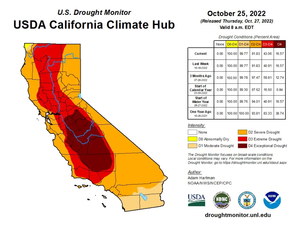
A map of drought conditions in California, as of October 18, 2022. This map shows exceptional drought conditions (the highest level of drought severity) in the Central Valley. All of California is experiencing some level of drought conditions, and the majority of California is experiencing severe, extreme, or exceptional drought conditions. Source: U.S. Department of Agriculture
Water Management in Los Angeles
Where does LA Water come from? Source: Know the Flow / Heal the Bay
Roughly 80% of LA’s water is imported from hundreds of miles away in the Northern Sierra Nevada mountain range and San Francisco Bay Delta via the CA Aqueduct, the Eastern Sierra and Owens Valley via the LA Aqueduct, and the Rocky Mountains via the Colorado River Aqueduct. Most of this imported water starts as snowpack in the mountains. In fact, California’s water system was designed so that the snowpack would be our biggest reservoir, with the Sierra Nevada (which translates to snow-covered mountains in Spanish) alone holding 30% of California’s water. The snow would build up in the winter, and then slowly melt over the spring to fill reservoirs, recharge groundwater aquifers, and flow through our aqueducts so that we have water supply when we need it most in the summer and fall, at which time the cycle would start all over again.
While we continue to take water from critical ecosystems like the Bay Delta, Owens Valley, and Colorado River Delta, which also need that snowmelt, we flush away the water that is available to us locally. Even in dry weather, 10 million gallons of water flow through Los Angeles’ stormdrain system and out to the ocean every single day just from nuisance flow (e.g., broken sprinklers, washing cars, hosing down driveways). And then, when we do get rain, that flow number surges with stormwater runoff, averaging 100 billion gallons of water wasted each year, when it could instead be captured and put to beneficial use. In addition, hundreds of millions of gallons of treated water is discharged from our wastewater treatment plants each day. Some of this treated water flows to the ocean through rivers and streams, and at least some of this flow may be needed to provide critical habitat for ecosystem health. But the treated water that is discharged directly to the ocean provides no beneficial purpose.
To learn more about the LA Aqueduct and its effects on local peoples and ecosystems, watch The Aqueduct Between Us, directed by AnMarie Mendoza from the Gabrieleno-Tongva Tribe.
Water Resources in Los Angeles Change with the Climate
Climate change is happening now. We are seeing and feeling the effects every day with relentless record-breaking heat waves, floods, fire seasons, and droughts. We already experience what is called weather whiplash: dramatic swings between extreme weather patterns. Climate change continues to intensify these swings, so our dry years are hotter and drier, and our wet years are even more intense. More frequent dry years and hotter temperatures drive demand for water up (it takes more water to irrigate crops and landscapes), depleting water supply. Evaporation also takes its toll by pulling water from reservoirs and even taking moisture up from the land, which weakens ecosystem health and actually makes it harder for the land to absorb water when it does rain. Add longer and more intense droughts into that mix, and it is clear that California is becoming more dry (or arid) over time. This process is called aridification, and the trend will only increase as human-accelerated climate change continues.
Low flow in the Colorado River, Source: Vicki Devine / Center for Biological Diversity
Critically low snowpack in California. Source: Stephanie Elam / CNN
Despite this dire news, it does still rain in Los Angeles. Looking ahead, we actually expect to get thesame volume of rain locally on average as we have in recent history, but it will fall less often through heavier downpours. In addition, our dwindling snowpack reservoirs are melting faster each year. We do not currently have the infrastructure in place to capture that higher level of runoff from intense storms and fast snowmelt. This all means that more water will flow back to the ocean rather than being stored as snowpack, or infiltrated into groundwater reservoirs. Some people have suggested that more surface reservoirs are the answer, but they are excessively expensive. Much of the stored water would be lost to evaporation, and quite frankly, we have already dammed most of the rivers in CA. So we must rethink how we manage water to make the most of the resources we do have left.
Water Management in Los Angeles Must Change, Too
While we will continue to experience aridification and weather whiplash, we can still adapt to this hotter, drier future. To do this, conservation cannot only happen in response to a drought designation, but it must be a way of life. The good news is that there are local and sustainable solutions that individuals can do at home (indoor and outdoor) and systemic changes that we can push for together to be water wise.
We can source enough water locally to support our water needs and drastically reduce our reliance on imported water. This can be done through improving water conservation/efficiency both regionally and at home, groundwater cleanup, stormwater capture, and wastewater purification, without turning to expensive, energy intensive, and environmentally harmful practices such as ocean water desalination. Additionally, there is an opportunity to use nature-based solutions that capture and infiltrate water naturally to support overall ecosystem health, which, in turn, can help to mitigate the impacts of the climate crisis, among myriad additional benefits. In this way we can ensure the human right to water so people can stay safe and healthy, and respect therights of nature by keeping our ecosystems thriving.
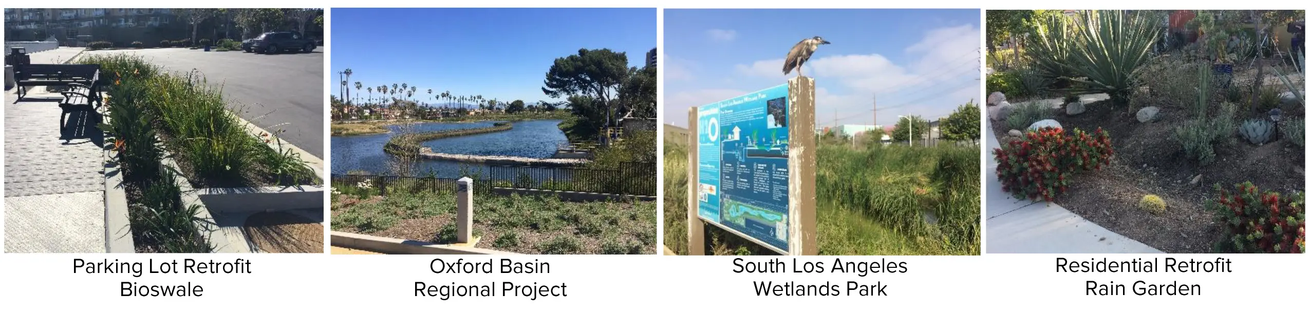
Nature-based solutions for stormwater capture. Source: Heal the Bay
Do What You Can When You Can – Stay Informed
Issues of California’s dwindling water supply, increased demand, and uncertain reliability can feel overwhelming. But we are not powerless in this climate crisis. We can all take the Climate Challenge to do what we can when we can. Start today and focus on “what we learn” — or whatever resonates with you. You can stay informed. Heal the Bay can help.
Over the next six months, Heal the Bay will be exploring what it means to live in an arid state, and what climate change, drought, and aridification mean for our water future. We will share solutions and opportunities for advancing water efficiency to become more water wise at home and as a community through collective and regional action. Stay tuned for more content!In the meantime…
💥ASK THE EXPERTS: What do you want to know? Ask our staff scientists any questions you have about aridification, drought, and water conservation. Your answer may be featured in an upcoming blog post or video from Heal the Bay.
Written by Annelisa Moe. As a Heal the Bay Water Quality Scientist, Annelisa helps to keep L.A. water clean and safe by advocating for comprehensive and science-based water quality regulation and enforcement. Before joining the team at Heal the Bay, she worked with the Regional Water Quality Control Board in both the underground storage tank program and the surface water ambient monitoring program.
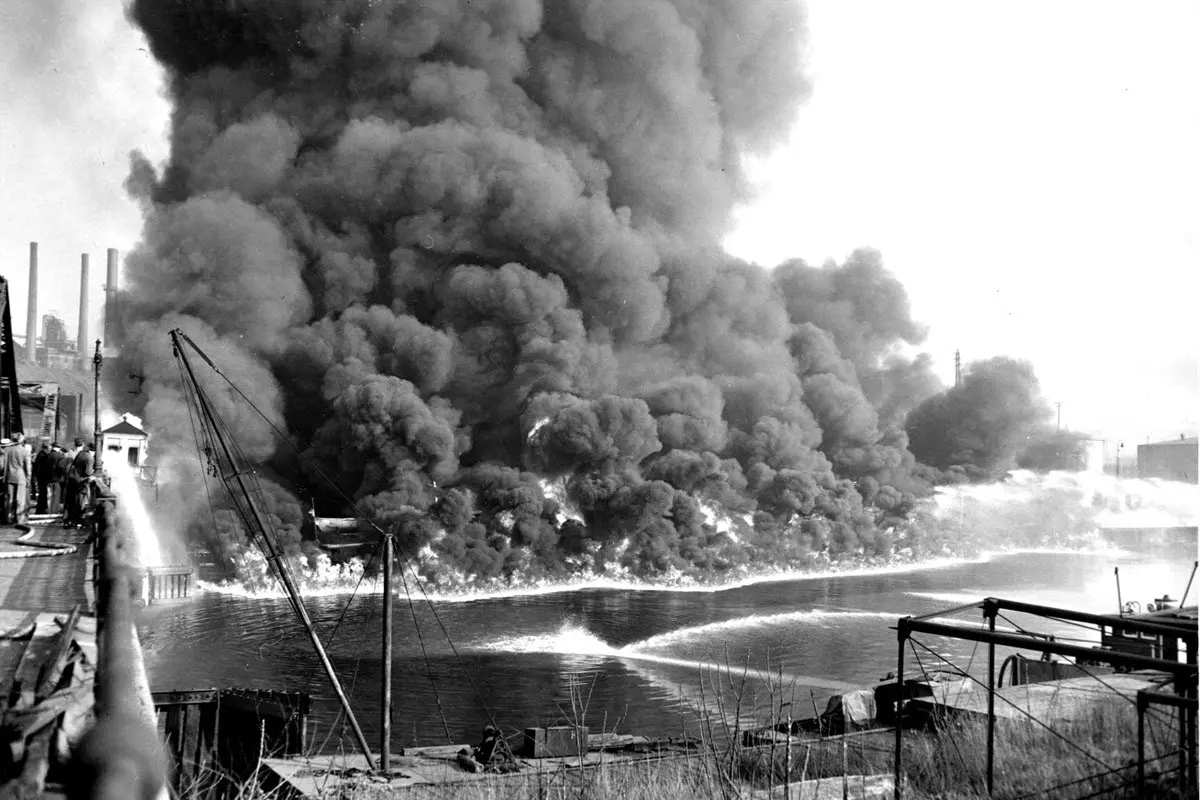
The Clean Water Act revolutionized water protection law and has resulted in multiple cleanup success stories. However, as of March 2022, the goals of the Clean Water Act are not being met, and there is still much work to be done to achieve fishable, swimmable, drinkable water across the US.
LIVING IN A WATER-SCARCE region like Southern California, I hear this a lot: Water is life! And more than that, the quality of water affects the quality of life for humans, the environment, ecosystems, and, of course, the waters themselves. The US federal government recognized this decades ago, and created the first major federal law in the US to address water pollution, called the 1948 Federal Water Pollution Control Act. However, this policy was ineffective owing to a lack of oversight and enforceability. Public pressure following a series of environmental plights (including the Cuyahoga River catching on fire) forced the US to reconsider its approach, leading to the 1972 Clean Water Act (CWA) Amendment. This amendment, among many upgrades, gave the EPA more regulatory control to enforce clean water requirements and achieve swimmable, fishable, drinkable water.
The CWA protects areas designated as Waters of the US (WOTUS) including streams, rivers, lakes, estuaries, and wetlands. Waters of the US are designated with various beneficial uses such as water supply, navigation, recreation, fishing, habitat, etc. In California, new designation categories are being added now for Tribal Cultural and Subsistence Fishing beneficial uses. The Los Angeles Regional Water Quality Control Board, which reports to the EPA, enforces the federal Clean Water Act locally by determining the Total Maximum Daily Load (TMDL) of pollution that a waterway can handle while still supporting its beneficial uses, and then regulating discharge to stay below that contamination limit. For more information on the structure of the CWA, check out Heal the Bay’s Clean Water Act Knowledge Drop.
Initially, the CWA aimed to achieve pollution-free waters by 1985. Unfortunately, that goal was not met. While this innovative water protection law has resulted in a number of water quality success stories, there is still much work to be done. In fact, as of March 2022, about half of US waterways remain impaired. According to a report from the Environmental Integrity Project, California unfortunately ranked first in the US for most river and stream miles listed as impaired for drinking water, and third for fish consumption.
a) b)
Maps of (a) California and (b) the Los Angeles Region, showing impaired waterways in dark green and unimpaired waterways in light green. Available at: California 2020-2022 Integrated Report
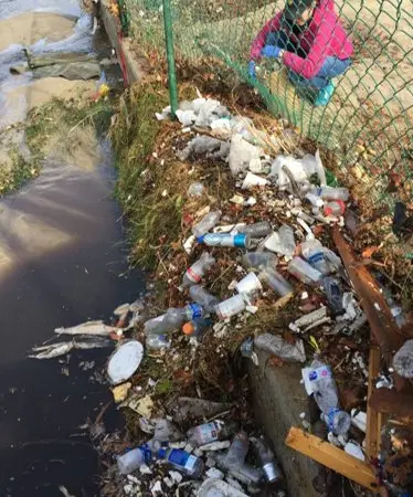
The Los Angeles Region alone has 210 total waterways listed as impaired by pollution in 2022, and since many of those waterways are impaired for more than one pollutant, there are a total of 877 listings in LA. Fifty-four of these listings are related to trash pollution, even though LA was one of the first regions to adopt “zero trash” regulations.
Santa Monica Bay is one of the waterways of LA listed as impaired by trash pollution and the Bay, along with the watersheds that drain into it and the beaches that line it, need care, protection, and advocacy. On Saturday, October 15, 2022, 366 Heal the Bay volunteers took to Will Rogers State Beach, just north of Santa Monica, for one of the biggest Nothin’ But Sand Beach cleanups of the year. In just under two hours, over 145lbs of trash were cataloged and removed from the shore. Thank you to all our volunteers who came out to help keep our precious coastline clean.
<
►
>
PHOTO SET: Hundreds of volunteers support Heal the Bay’s October Nothin’ But Sand Beach Cleanup in honor of the Clean Water Act 50 Year Anniversary. A special thanks to our cleanup sponsors Subaru and Audacy. Photos by Bria Royal / Heal the Bay
PHOTO: Heal the Bay staff member, Forest Leigh, inspecting trash pollution after a first flush event. Photo by Katherine Pease / Heal the Bay
Despite the remaining pollution in our waters, the Supreme Court is considering changes to the definition of WOTUS, which could leave many waters unprotected under the CWA. But there are also many folks working hard towards swimmable, fishable, drinkable water for all. The EPA rereleased its 2022-2032 Vision for achieving CWA goals. The 2022-2023 Vision aims to maximize coordination through partnerships to plan and prioritize opportunities for holistic watershed protection, restoration, and data analysis; and it includes new focus areas for environmental justice, climate change, tribal water quality, and program development, as well as an increase to overall program capacity. Heal the Bay and other NGOs will continue to advocate for water quality projects and comprehensive and science-based water quality regulation under the CWA.
50 years after the Clean Water Act was established, California’s waterways still need the protection and attention of all those who can help. Discover all the ways you can make an impact. Register to attend Heal the Bay Volunteer Orientation and help us make strides for the next 50 years.
Written by Annelisa Moe. As a Heal the Bay Water Quality Scientist, Annelisa helps to keep L.A. water clean and safe by advocating for comprehensive and science-based water quality regulation and enforcement. Before joining the team at Heal the Bay, she worked with the Regional Water Quality Control Board in both the underground storage tank program and the surface water ambient monitoring program.
Are you ready to advocate for your community? Your region? Your planet? Share your passion with decision-makers using this “how-to” on crafting and delivering written and oral comments. Annelisa Moe, Water Quality Scientist at Heal the Bay (who’s given her fair share of public testimony on local environmental issues) shares tips on how to make public comments and advocate for clean water.
Have you ever wanted to make a real impact on an issue you care about? Maybe you want to discuss getting safer bike lanes, smaller trash bins, or clean water for your community.
One great way to connect with policymakers and officials is by submitting public comments. Heal the Bay regularly submits written and oral comments and over the years, we have seen the direct positive impacts of our advocacy on decision making organizations like the Los Angeles Regional Water Quality Control Board, LA City Council, CA Coastal Commission, CA Fish & Game Commission, LA County Board of Supervisors, and many more.
Here is Heal the Bay’s Step-by-Step guide on how you can write up and deliver your public comments to advocate for the change you want to see in the world. You have valuable experiences and information to provide to decision-makers and you have everything it takes to become a powerful advocate for the changes you want to see in your community. Let’s get started.
Annelisa Moe, Water Quality Scientist at Heal the Bay and advocate for water quality regulation, shares her thoughts at MS4 Permit hearing last summer. Before joining Heal the Bay, Moe worked with the Regional Water Quality Control Board.
Step I: Identify Your Influencer
The first step toward constructing the perfect public comment is identifying the right decision-maker to engage. This could include influencers from a wide variety of public offices, from Neighborhood Council Members to Senators. These decision-makers want to hear from the public, especially from constituents like you, and oftentimes this input informs their initiatives.
Step II: Gather Information
Every decision-maker (State Board, Committee, Senator, Council Member, etc.) will have their preferred way for you to sign up to speak or send in written comments, and it can be pretty confusing – even for professionals who give public comments for a living! Once you identify who you want to communicate with, look online for the following:
A meeting agenda for the Council or Committee you are interested in
Detailed information on how to submit written or oral comments
Deadlines on written comments and time limits for oral comments
Contact information for an elected official or decision-making body.
Written comments could be a more formal written letter, or something a little less formal like an email or online submission. No matter what the format is, these seven basic elements provide a good place to start:
Address the decision-maker, and introduce yourself
State what you are commenting on and why (provide an agenda # if applicable)
Provide a personal story or anecdote
Add in stats, facts, and figures (if you have them)
End stating your position again and thanking the decision-maker(s) for the opportunity to comment
Ask a peer to proofread your comment and edit for spelling, grammar, consistent spacing, and font type
Emphasize importance by repeating certain phrases, or by adding bold, italics, or underline effects to your text (sparingly)
Keep in mind that you do not have to write a novel. A comment of any length can have an impact, especially if you write in your voice and get creative. It doesn’t matter if there is a small error or something that you missed; the important part is that you are sharing your opinion and your passion with people and organizations who can influence big decisions.
Perhaps you’d rather show up in person (or virtually, as is common these days) to a meeting and speak directly to the decision-makers. A little bit of prep work can help here, too.
The public comment period at most meetings is usually time-limited, and that time can range anywhere from 1 to 5 minutes. To make sure you do not run out of time, or leave out some important information, we recommend writing out your comments to reference while you speak.
Write out a full script and read your comment word for word or use bullet points to guide your comments more naturally. In either case, your oral comment should include the same seven basic elements as a written comment (review in the written comments section above).
Be sure to practice saying your comment aloud with a timer to get comfortable and ensure you are under the time limit. It can be helpful to do this with a friend who is willing to listen and provide feedback. Try to make sure you are familiar with the platform on which the meeting will be hosted (e.g. Zoom, WebEx), how to give public comments at your specific meeting, and if and when you might need to register for that meeting. When it comes time to give your comment at the meeting, remember to be clear and concise, take your time and breathe, annunciate, and speak more slowly than you think you need to (we all tend to speed up when we are nervous).
To hear a (rather exceptional) example, listen to this comment by a high school student (and former Club Heal the Bay member) Bella Wash at a Regional Water Board meeting, concerning their decision on the regional stormwater permit.
Step IV: Submit Your Comment
When you use your voice to advocate for change our policymakers listen, and you don’t have to do it alone. You can inspire others in your community to use their voices and public comments to improve the world around you and as always Heal the Bay is here to help empower you! Contact Heal the Bay when you need help and jumpstart your journey as an advocate today.
Raise your Voice This July
The Regional Board is currently updating their regulation of toxic pollution (including DDT) in Dominguez Channel, Los Angeles Harbor, and Long Beach Harbor. Public comments will be accepted until July 26. Heal the Bay is wading through all of the details now–so stay tuned for more information in the next few weeks!
Another ocean water desalination plant has been proposed for construction in Huntington Beach. This project has also been opposed by the environmental community and by the public for years. Poseidon will be applying for a coastal development permit to build their ocean water desalination plant with the CA Coastal Commission. This meeting was originally scheduled for Thursday, March 17, 2022. However, the meeting has been postponed, and no new date has been announced yet. Keep an eye out – we’ll let you know when it gets rescheduled.
UPDATE 2/10/2022
Two critical decisions were made in 2021 to protect LA’s coastal waters from the negative impacts of large-scale ocean water pumping. All too often, we see exemptions, extensions, and approvals for projects that threaten our coastal waters, but the tides may be turning!
Previous extension approvals allowed the Redondo Beach Once Through Cooling Facility to avoid fees associated with years of water quality violations; a trend that ended with this Regional Board Vote. And, LA County’s West Basin Board of Directors voted to terminate a massive ocean desalination project proposed for El Segundo in a shocking step forward for protecting coastal waters.
Are these victories signs of systemic change? And what can Californians do to keep this trend of transformation going while combating large-scale industrial interests that are dangerous to our environment and public health?
Let’s jump into what we mean by ‘ocean water pumping’ and how these two coastal project decisions uphold the Clean Water Act, which is celebrating its 50th Anniversary this year.
Protecting the Santa Monica Bay from Harmful Industrial Water Pumping
Industrial water use includes the large-scale pumping (or “intake”) of ocean water and it has severe negative impacts on the health of our coastal waters. The intake of ocean water threatens sea life with impingement (being sucked up against an intake pipe) and entrainment (being sucked up into an intake pipe), both of which can cause serious injury or death. The Clean Water Act of 1972, celebrating its 50th anniversary this year, requires the Environmental Protection Agency to regulate this pumping to minimize those negative impacts.
At the end of 2021, two critical decisions were made right here in Los Angeles, that support these Clean Water Act regulations by limiting industrial ocean water intake and holding those who continue to use it accountable.
Rejection of Extension Request from the Redondo Beach AES Power Plant and Once-Through Cooling Facility
Seabirds and Pinnipeds are just a few species that can be affected by the Once-Through Cooling process used in locations like Redondo Beach (King Harbor / Dana Murry )
Once-Through Cooling (OTC) is a process used by power generating facilities to cool down generators using water. Most of these facilities, especially in California, are located along the coast, positioned to use ocean water. But this kind of large-scale ocean water intake is what threatens sea life with impingement and entrainment. After the water is used, it is usually released back into the ocean, but oftentimes at a higher temperature and with pollutants from the equipment, causing possible water quality violations and concerns for coastal wildlife.
OTC was first recognized as a threat to California’s fisheries, estuaries, bays, and coastal waters in 2005, leading to the approval of a Statewide OTC Policy in 2010. Heal the Bay was one of many stakeholders that worked together to craft the requirements of the OTC Policy. One major compromise was the long time schedule, giving all OTC facilities 10+ years to either shut down or transition away from OTC operations. Now that we are finally approaching those deadlines, we are seeing many of these OTC facilities asking for extensions beyond the original 10+ year grace period.
Over the last two years, the Redondo Beach OTC Facility has requested two separate extensions for operation. Despite opposition from environmental groups and Redondo Beach Mayor Brand, the State Board approved both, allowing the Redondo Beach OTC Facility to continue operations through December 31, 2023. The Redondo Beach Facility then requested an extension (referred to as a Time Schedule Order) from the Regional Water Quality Control Board to essentially waive any fees for water quality violations of the OTC wastewater they release during this time.
On December 9, 2021, the Regional Water Board voted 3-1 to deny this request after hearing clear opposition from NGOs like Heal the Bay, as well as from representatives from the City of Redondo Beach. This was the first time in years that the Regional Board has denied any Time Schedule Order request. The Redondo Beach Facility is still allowed to operate, but they are no longer exempt from fines associated with their contaminated OTC wastewater discharges. If the vote had gone the other way, it would have provided a clear and easy path for additional operational extensions. This critical decision by the Regional Water Board will help to protect water quality by putting pressure on the Redondo Beach Facility to shut down their OTC operations by the new December 31, 2023 deadline.
Termination of the West Basin Ocean Water Desalination Project
Desalination, or the process of sucking in seawater and removing the salt to convert it to freshwater, might initially seem like a logical way to get more freshwater for Southern California. But ocean water desalination has many negative impacts on the environment, and the truth is that we do not need it. Although Southern California does face consistent drought conditions, we can source enough water locally to support all of our water needs without ocean water desalination by focusing on smart water practices like water conservation, recycling efforts, and stormwater capture. One of the myriad problems with desalination is the ocean water intake process, which poses the same impingement and entrainment threat as OTC operations.
The West Basin Municipal Water District had proposed an ocean water desalination plant in El Segundo, intending to reuse decommissioned OTC piping to intake ocean water. This project has been hotly contested for decades, with strong opposition from the environmental community (including Heal the Bay) as well as from the public, because it is the most expensive and energy-intensive way to obtain fresh water and simply does not make sense for Southern California.
At a meeting of the West Basin Board of Directors on December 23, 2021, the Board voted 3-2 to terminate the ocean water desalination project, after hearing from 25 members of the public speaking in opposition to the project. Many factors contributed to this decision including a report from West Basin proving that ocean water desalination is not needed to meet water supply demands for LA. But a final vote from Board Member Houston, quoting the fact that there is no longer public support for the project, broke the tie.
Upholding the Clean Water Act to protect our water, ecosystems, and communities
West Basin’s decision to terminate its ocean water desalination project stopped new industrial intake from affecting our coastal waters and stopped an unnecessary, expensive, and energy-intensive system from being built. The Regional Water Board’s decision to deny the Redondo Beach Facility Time Schedule Order provides extra incentive for the Facility to stop intake operations and to shut down the inefficient, fossil fuel burning Redondo Beach Facility altogether. Both decisions protect coastal waters, ecosystems, and communities in Santa Monica Bay and uphold the Clean Water Act by minimizing the negative impacts of industrial intakes.
Save the Date to Advocate Against Ocean Water Desalination
Both decisions were swayed by public demand for safe and clean water, but we cannot stop here. To shift the tides so that public and environmental protection becomes the standard, we need more decisions like these. You can help to advocate against ocean water desalination and demand safe and clean water for all.
Another ocean water desalination plant has been proposed for construction in Huntington Beach. This project has also been opposed by the environmental community and by the public for years. Poseidon will be applying for a coastal development permit to build their ocean water desalination plant with the CA Coastal Commission on Thursday, March 17, 2022. Check out this Fact Sheet from the CA Coastal Commission for more information or engage with our partners at Orange County Coastkeeper to advocate against ocean water desalination.
UPDATED NOTE: As of February 28, 2022 the March 17, 2022 meeting has been postponed and no new date has been announced.
Sunflower Sea Star: Saving Animals From Extinction Webinar
Discover how one species can change everything. This webinar explores the effort to restore the sunflower sea star, how aquaculture is helping bring it back, and why its return is critical to rebuilding California’s kelp forests. Plus, simple ways you can be part of the solution.
You don’t need to be a scientist to help—just a place to start.