Top

Heal the Bay Blog

Category: Malibu / Pacific Palisades

Looking for more than water quality? Find more Ash to Action Updates HERE.

SEE OUR THE LATEST POST-FIRE WATER QUALITY UPDATES:

March 28, 2025

Post-fire ocean advisories were just lifted, but is it finally safe to swim in the coastal waters?

March 27, 2025

Heal the Bay’s post-fire water quality data and analysis is live!

March 25, 2025

Watch the Webinar on the most recent Ash to Action updates

March 13, 2025

Read our analysis of the LACDPH & RWQCB data (part 2).

February 28, 2025

Our analysis of the LA County Department of Public Health post-fire water quality data is live.

February 26, 2025 –

Learn about beach safety in the wake of the fires.

February 18, 2025

In late January, Heal the Bay’s staff scientists began collecting ocean-water samples from 10 shoreline sites along the Bay to test for heavy metals, PCBs, asbestos, and other toxins. See our water quality testing timeline

January 29, 2025

Our fire response has just begun. 

UPDATE MARCH 28, 2025

The ocean water advisories along LA’s coast have been lifted, and based on recent data, Heal the Bay is cautiously optimistic that chemical contamination from the fires no longer poses a major risk for beachgoers. Post-fire debris is still a danger. 

Is it finally safe to swim and surf?  This week the Los Angeles County Department of Public Health lifted the ocean water advisories along LA’s coast. Based on data collected in January and February, Heal the Bay is cautiously optimistic that the chemical contamination from the fires does not pose a significant risk for recreation at our local beaches or in our coastal waters. However, the burn area may still pose some risks to beachgoers, swimmers, and surfers. Here’s what we know:
Physical debris is still being observed in the water and along the shore, primarily off the coast of the burn area from Las Flores to Will Rogers Beach. The good news is that LA County Beaches and Harbors is reporting a decrease in the volume of debris washing onto our shores. But because debris can include sharp objects, everyone should continue to use extra caution to avoid anything that looks like wildfire reminants, whether on the sand or in our coastal waters. 
Debris removal has begun on the 300 homes along PCH that were tragically lost in the fires. While this is also great news for the bay, the LA County Department of Public Health has issued a health advisory stating that it is not safe to reside within 250 yards of debris removal because the activity can disturb contaminants and send them into the air and water. This means that recreating within 250 yards of debris removal may pose additional risk to beachgoers, swimmers, and surfers.
If you choose to visit our beaches or get in the water, HTB recommends the following safety precautions:
  • Avoid areas within 250 yards of active debris removal.
  • Wear closed-toe shoes if walking on wet sand, as debris such as broken glass and structural fragments may still wash ashore.
  • Never touch trash or debris with bare hands.
  • Keep children and pets away from debris, especially in wet sand or high tide areas, where contamination risk may be higher.
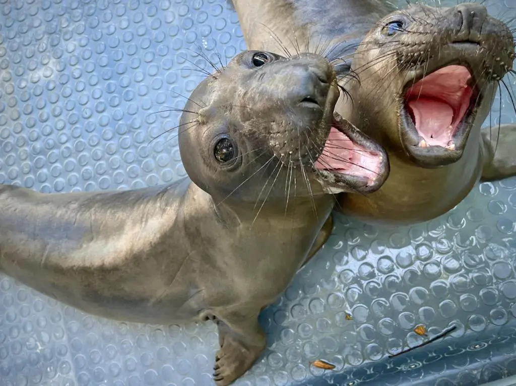
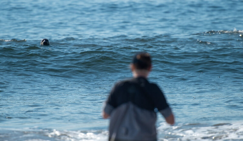
  • Do not approach injured or distressed wildlife. If you have concerns about a marine mammal, contact the Marine Mammal Care Center at (1-800-39-WHALE).
  • Heal the Bay continues to urge beachgoers to recreate south of Santa Monica at Montana Avenue or north of the fire boundary in Malibu, where impacts are significantly lower. 
  • Avoid eating seafood caught in Santa Monica Bay. Contaminants in the ocean water exceed safe levels for fish consumption. Additionally, the SoCal coast is experiencing a harmful algal bloom, which may pose a risk when consuming locally caught shellfish.
Please use this information to make informed choices for your safety and the well-being of your family and pets. The LA Regional Water Quality Control Board has also published risk-based recreational thresholds and a tool to help beachgoers decide how often they can safely enjoy the coastal waters. Click the link in our bio to view these resources. 
While the beaches are open to the public now, the long-term impacts of wildfire contamination continue to raise concerns. Our January data shows elevated levels of heavy metals in the bay, posing risks to marine life. Heal the Bay continues to investigate the effects of wildfire-related pollutants and bioaccumulation in our coastal ecosystems, but we can’t do it without you.  Visit healthebay.org/donate to support our science, safety, and post-fire recovery work. Together, we can protect what we love. 


UPDATE MARCH 27, 2025

According to water-quality testing results released today by Heal the Bay, local marine life faces significant and ongoing threats from heavy metals that leached into Santa Monica Bay after January’s Palisades wildfires.


PRESS RELEASE 3/27/2025 –Test results from 10 collection sites along the entire length of Santa Monica Bay show that immediately after the fires, water quality at LA’s beaches was much better than expected, diminishing fears about human health impacts from polluted runoff in fire-scarred areas. We cannot definitively say that the water is safe until we have additional data and information about risk-thresholds for recreational contact, but based on the data we have seen to date, we are cautiously optimistic.

However, our analysis indicates that marine mammals, multiple fish populations, and other species further down the food chain are at serious risk from elevated levels of beryllium, copper, chromium, nickel, lead, and other harmful heavy metals and nutrients. 

Silver, arsenic and zinc were also detected above average marine-health limits. Aluminum, iron, and manganese also showed elevated levels, though no marine health limits exist for these metals. In all, Heal the Bay staff scientists and a regional water agency tested for 116 known pollutants at multiple sites in January and February. (Please click here for a detailed analysis of the results, our data spreadsheet, and raw data from the PHYSIS lab

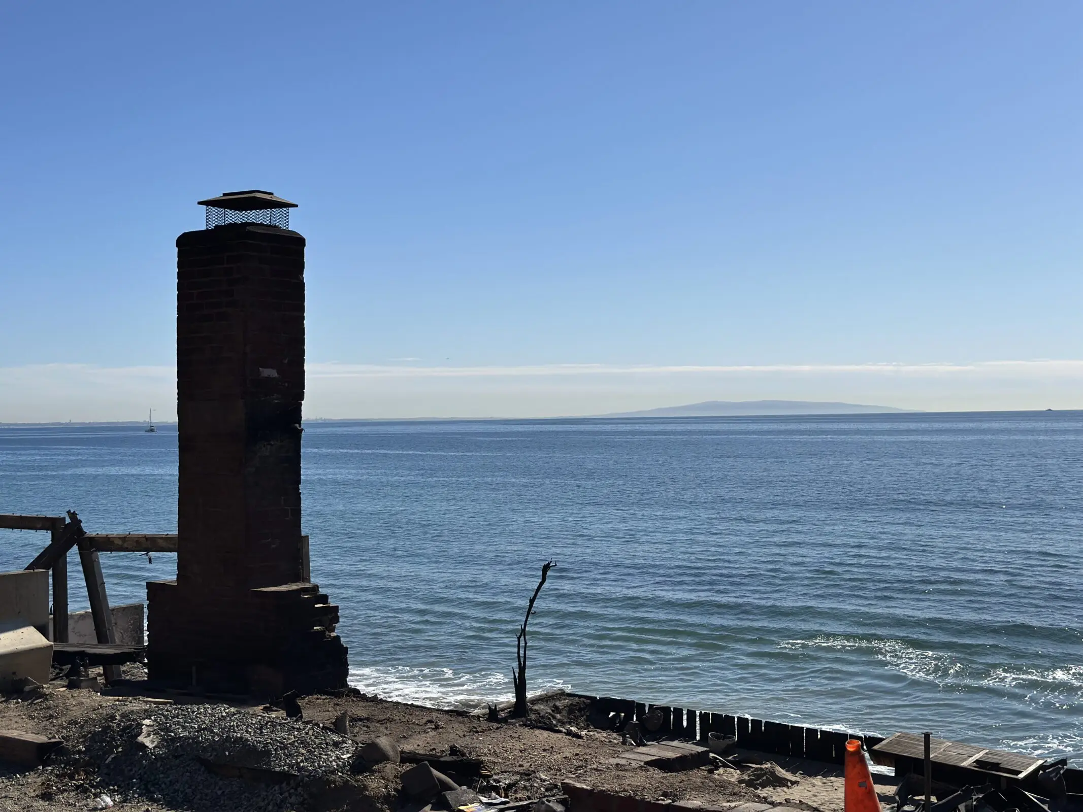
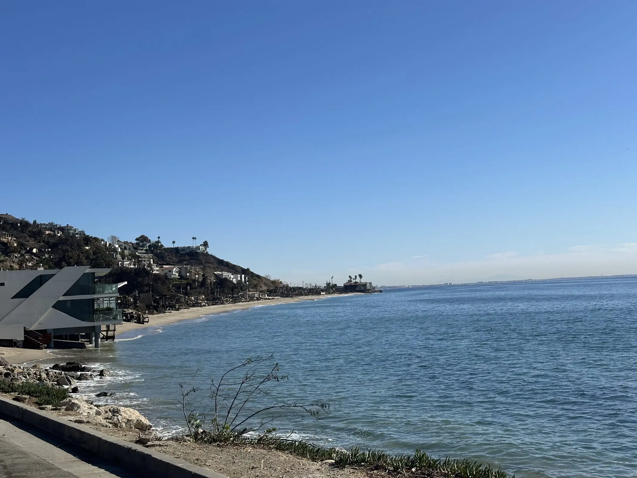
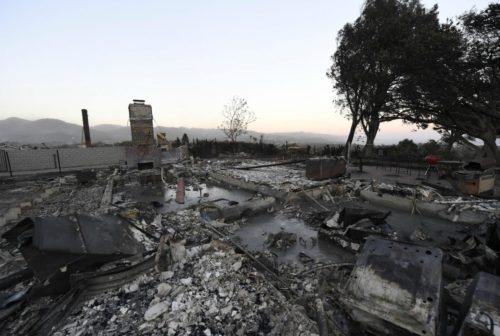
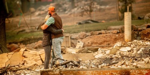
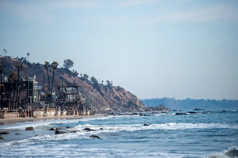
Following heavy seasonal rains, toxic pollutants washed into the intertidal zones from burned structures and scorched earth in the Palisades, Topanga, and Malibu. Waves lapping onto fire-ravaged buildings along Pacific Coast Highway continue to sweep harmful metals into the sea. 

Even at low concentrations, heavy metals can disrupt vital biological processes, damage cells, and impair reproductive and immune functions for marine life. Metals can also be transferred and magnified through the food chain. This impacts the entire food web, which inevitably impacts humans. In short, when animals get sick, humans can get sick, particularly from consuming seafood that has a bioaccumulation of metals in their systems. 

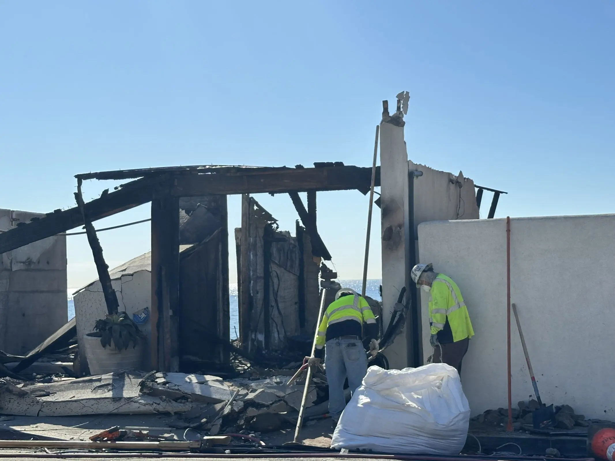
Heal the Bay is urging authorities to expedite the removal of burned-out structures and other fire-related debris from PCH as soon as possible. Unfortunately, some homeowners have been slow to respond to U.S. Army Corps of Engineers’ offers to facilitate debris removal. Roughly 45 shoreline homeowners have opted out of the program, while nearly 100 have not responded at all. Whether or not a homeowner decides to use the US Army Corps of Engineers or a private contractor, it’s imperative that debris removal happens quickly. 

“Every day that hazardous debris remains along the coast, more harmful contaminants flow into the sea,” says Tracy Quinn, President and CEO of Heal the Bay. “If we want to give our marine life a fighting chance, we need that debris removed as soon as possible.” 

The most concerning findings come from the hardest-hit fire areas, including Topanga Beach, the Big Rock section of Malibu, and Will Rogers State Beach near Pacific Palisades. However, the waters around Santa Monica Pier and Dockweiler State Beach also spiked for heavy metals — suggesting that more studies are needed to understand the movement of contaminants offshore or identify other sources. 

Because it is now March, these data do not tell us the current conditions in Santa Monica Bay, but they do provide valuable insight into the impacts of the Palisades Fire on marine life and the potential impacts on human health. 

Risk tolerance is a personal decision. Here is some information that can help beachgoers decide if, when, and where they may want to enter the ocean.  

  • The contaminants tested seem to be below human health limits for recreational contact for the data where limits could be identified. The Los Angeles Regional Water Quality Control Board is still assessing risk-thresholds, including those for PAH, a harmful organic compound related to fire-scorched debris.  
  • PAHs, the group of contaminants that may be above human health limits, are unlikely to sicken people who swim or surf a few times, but frequent or prolonged exposure may contribute to an increased risk for future chronic health issues.    

Beachgoers should also be careful about walking on the sand, which may contain sharp fire-related debris like nails and broken glass. For the time being, Heal the Bay recommends avoiding beaches within the fire-impacted areas and as far south as Montana Ave in Santa Monica. The Regional Water Quality Control Board has already posted some sand and sediment data for LA’s beaches. We are waiting for the complete test results to post our analysis. Stay tuned.  

The fire and recent marine mammal deaths 

It’s also worth noting the recent uptick in marine mammal beach stranding and deaths in Santa Monica Bay related to domoic acid poisoning. Elevated levels of runoff-related nutrients can contribute to the development of algal blooms in the Bay and accumulate in shellfish. When mammals consume shellfish, they can get sick and die from the neurotoxins produced by certain algae. 

This is the fourth consecutive year of domoic acid outbreaks. The recent fires did create a significant dump of nutrients like sulfate and phosphorous into the ocean, but there is no evidence, yet, of a correlation between the wildfires and the domoic acid outbreak. 

About the testing 

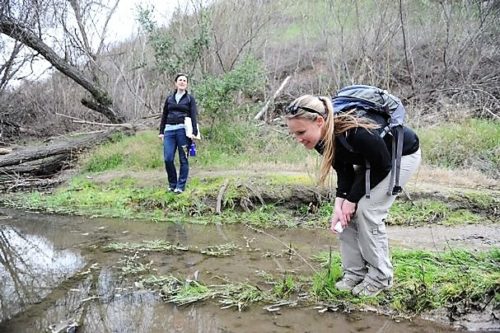
On Jan. 24-25, before the first winter storms came, Heal the Bay staff collected ocean-water samples at 10 shoreline sites across Santa Monica Bay. From Paradise Cove to Malaga Cove, they tested for 116 pollutants. They took samples again on Jan. 28, after heavy rainfall, to better understand how stormwater might carry toxins from the burn zone. 

Processing samples took multiple weeks due to the complexity of sample preparation, the need for precise instrumentation, and the rigorous quality control required. It also took several weeks to receive the data results back from Physis Lab. Then, additional time was needed for Heal the Bay’s Science and Policy Team to analyze and assess the data. 

Staff members from the Los Angeles County Department of Public Health collected water samples on Feb. 18, which Heal the Bay also analyzed for its report. After the intense Feb. 13 storms, testing showed elevated levels of contaminants that do not have established risk-thresholds for recreational contact. Further analysis is required and will be included in an upcoming post. 

Heal the Bay is part of a collaborative task force working with government agencies, researchers, and other nonprofits to better understand the extent of the contamination and how to clean it up efficiently. We will be updating our analysis and sharing the findings in the weeks to come as soon as new data becomes available. 

Heal the Bay is the only organization providing this kind of in-depth analysis of water quality data.

But to continue this important work, we need your support. If you’d like to see more of these efforts, please consider donating.

Every contribution helps!    SUPPORT OUR WORK NOW

Read the Full Scientific Analysis – Published on March 27, 2025

See all of the data that Heal the Bay has compiled – Data
Spreadsheet Published March 27, 2025

See our Raw data from PHYSIS LAB Testing- Published March 27, 2025


UPDATE MARCH 25, 2025

Watch the Webinar for today’s latest Heal the Bay Ash to Action Updates.

Learn about the critical work that Heal the Bay and its academic partners are doing to protect the environment and monitor water quality in Santa Monica Bay.

UPDATE MARCH 13, 2025

The Los Angeles Regional Water Quality Control Board has released its 2025 Post-Fire Water Quality Monitoring results.

“The board has been working with Los Angeles County to monitor ocean water quality since Jan. 22, 2025. Samples are collected regularly at 12 beach sites from La Costa Beach to Dockweiler Beach by the Los Angeles County Department of Public Health. They then are analyzed by the board for metals, nutrients, polychlorinated biphenyls (PBCs) and polycyclic aromatic hydrocarbons (PAHs), which are chemicals that may be found in water runoff based on previous California wildfires.” (Waterboards.ca.gov)

Click here to SEE THEIR RESULTS, the test site map, and stay tuned for their sediment and beach sand sampling results.


UPDATE FEBRUARY 28, 2025

Post-Fire Water Quality in Santa Monica Bay: We reviewed results from the LA County Department of Public Health (DPH).

Recent wildfires in Los Angeles that started on January 07, 2025, have impacted water quality in Santa Monica Bay. To understand the extent of these water quality impacts, we looked for contaminants that are likely to be mobilized after a wildfire, and that pose a risk to human and ecological health when concentrations are elevated; this includes heavy metals, PAHs (polycyclic aromatic hydrocarbons), nutrients, bacteria, and solids that decrease water clarity. Right now, Heal the Bay has data that our staff collected for bacteria and water clarity (referred to as “turbidity”), which have faster processing times and which we can test on-site in the Heal the Bay lab, while other contaminant samples were sent to a contracted lab to process.

While we wait for Heal the Bay’s results for the other contaminants, we reviewed results from the LA County Department of Public Health (DPH), which took samples on January 22, 2025, and January 27, 2025, at beaches from Las Flores State Beach to Dockweiler State Beach. These data points are representative of water quality before and after the first flush rain event, over a month ago. Since then, we have had additional significant rainfall, including nearly two inches of rain on February 13, 2025, which, unfortunately, was not tested by DPH in time to provide wet weather data. Data that are more recent will provide needed insight into overall conditions in our coastal waters. Heal the Bay will continue to provide updates as new data become available.  

Water contact limits do not exist for most of the contaminants of concern associated with wildfires, so to understand potential health risks, we compared results to limits in the CA Drinking Water standards, the CA Ocean Plan (for both human health and marine life), and the Hawai‘i Department of Health Surface Water Action Levels for Marine Habitats (used to assess impacts of the Lahaina Fires). Our initial findings show elevated heavy metals, bacteria, nutrients, and other organic compounds, along with a decline in water clarity, all of which indicate that wildfire runoff does pose a risk to human and ecological health and that contamination is traveling beyond the immediate burn zone. 

Key Findings from January 22 and 27, 2025: 

  • Heavy Metals and Metalloids: Aluminum, iron, selenium, and manganese were elevated above drinking water standards, sometimes as much as 10x the limit. This is not an immediate human health threat, but we urge caution if there is the possibility of ingestion. These four metals, in addition to arsenic, copper, and zinc, also exceeded safety thresholds for marine health, particularly at Will Rogers State Beach and Topanga Beach, posing a health risk to marine life. Even at low concentrations, these metals can disrupt vital biological processes, damage cells, and impair reproductive and immune functions for marine animals.  
  • PAHs (polycyclic aromatic hydrocarbons): PAHs were detected at unsafe levels, based on human health standards in the CA Ocean Plan, at Will Rogers State Beach and Topanga Beach and were not detected at other sites. This poses a site-specific risk to human health within the burn zone.  
  • Nutrients: Elevated phosphorus levels have increased nutrient concentration in Santa Monica Bay, leading to the formation of a persistent brown foam along the shoreline and increasing the risk of algal blooms.  
  • Turbidity & Solids: While turbidity may not pose a direct risk to public health, it can disrupt biological processes for marine life, and water clarity can help to show how far runoff from the burn zone traveled along the coastline. Water clarity declined significantly after rain from Surfrider Beach down to at least Dockweiler Beach, indicating wildfire runoff spread beyond the burn zone. Turbidity levels were consistently good at Paradise Cove (north of the burn zone) and Malaga Cove (just north of Palos Verdes Peninsula), indicating boundaries on the extent of pollution traveling up and down the coastline, but that boundary is not yet clear.  
  • Bacterial Contamination: High bacteria levels were observed near storm drains, worsening after rainfall, following the typical pattern for bacterial pollution in Santa Monica Bay.  

What You Need to Know: 

A day at the beach should never make anyone sick. Heal the Bay is dedicated to protecting public health by sharing water quality information, and we remain concerned about the potential risks associated with post-fire contamination in ocean water and sand. Additionally, hazardous debris, such as nails and pipes, continues to wash ashore, posing a physical risk to beachgoers. 

At this time, Heal the Bay recommends avoiding beaches and ocean water from Las Flores to Santa Monica State Beach and exercising caution at beaches further south, at least to Dockweiler State Beach. While water clarity does improve further south at Malaga Cove, we do not yet have comprehensive data for beaches south of Dockweiler State Beach, so we cannot determine potential health risks. If you visit the beach anywhere in Santa Monica Bay south of Surfrider Beach: 

  • Stay vigilant; look out for sharp debris and avoid picking up objects with bare hands.
  • Keep children and pets from touching or ingesting water or wildfire debris.  
  • Refrain from full-body submersion into the coastal waters in the designated areas, which can lead to accidental ingestion.  

Heal the Bay has collected additional sand and water samples throughout Santa Monica Bay from Paradise Cove down to Malaga Cove. We will share results on our website as soon as those data become available. We urge the Los Angeles County Department of Public Health to enhance transparency in decision-making and ensure all relevant data is made publicly accessible in a timely manner. Until further testing is completed and more information on current water conditions is released, we advise the public to remain cautious when visiting affected beaches.  

UPDATE FEBRUARY 26, 2025

On Monday, February 24, 2025, Heal the Bay learned that the Los Angeles County Department of Public Health (DPH) had stated beachgoers may recreate on the sand in the fire-impacted areas. We also learned that this determination is likely based on only two debris samples taken by Los Angeles County Public Works, one at Topanga Creek and the other at Will Rogers State Beach. These samples were collected to determine the disposal method required to remove the debris, not to determine if it is safe for people to be on the sand. It is alarming that DPH would make this proclamation based on only two data points. While preliminary debris and ocean water quality testing have not shown elevated levels of harmful contaminants attributed to burned household items, the sample size for both water and sand thus far is quite small. At this time, we simply do not have enough information to determine if the sand or water at beaches where debris is present is safe for recreation. Furthermore, dangerous debris such as nails, screws, and pipes continue to wash up on shore, often concealed in sand or near-shore waves, increasing the risk to people playing on our beaches. This is an unprecedented event, and we must wait for the results of additional testing before declaring our beaches safe. We ask for increased transparency from the LA County Department of Public Health in decision making going forward, data used to protect our public health should be available to the public.

For now, Heal the Bay recommends that people avoid beaches (both sand and water) from Las Flores to Santa Monica State Beach and use extra caution on beaches south of Santa Monica. If choosing to go to the beach, watch out for sharp debris, do not pick up debris with your bare hands, and keep a close eye on children and pets to ensure they do not touch or ingest debris.

Heal the Bay and the Regional Water Quality Control Board have each collected sand samples from throughout the burn area, and we are awaiting results. We will share our ocean water and sand testing results on our website as soon as they are available.

Los Angeles County Department of Public Health’s full statement on beach safety: “The ocean water advisory due to fire impacts from Las Flores State Beach to Santa Monica State Beach remains in effect until further notice. Beachgoers may recreate on the sand but continue to be advised to stay away from visible fire debris and to stay out of the ocean water during any posted ocean advisory.”

UPDATE FEBRUARY 18, 2025

We expect results this week from Heal the Bay’s first round of expanded ocean-water quality testing. 

 In late January, Heal the Bay’s staff scientists began collecting ocean-water samples from 10 shoreline sites along the Bay to test for heavy metals, PCBs, asbestos, and other toxins. These harmful pollutants are flowing unchecked to the sea from recent heavy rains and other runoff from burn zones.  We expect results from before and after the “first flush” storm during the week of February 17th and will post them here. 

UPDATE JANUARY 14, 2025

We present the updated timeline detailing our recent water quality assessment activities in the coastal regions affected by the Palisades fire.

  • January 24-25, 2025
    •  Heal the Bay conducted initial pre-rain water quality testing at 10 locations throughout Santa Monica Bay: five within the burn zone, three outside of the burn zone but within the beach advisory zones, and two control sites (one north and one south of the beach advisory zones).
    • Our water quality scientists tested for temperature, turbidity, Fecal Indicator Bacteria, PAHs, PCBs, PFAS, benzene, mercury, and other heavy metals. This sampling involved coordination with the Fire Department and Lifeguards to gain access to the closed burn zone.
  • January 28, 2025:
    • After the January 26 rainstorm, staff took water quality samples again for the same pollutants and at the same locations tested on January 24-25, to compare pre- and post-rain results.
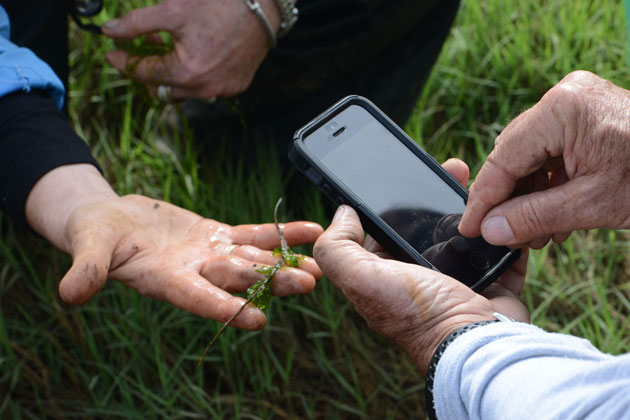
    • Jenny Jay from UCLA joined us for the six northernmost sampling sites to test for metals, antibiotic-resistant bacteria, and nutrients.
  • February 3, 2025: 
    • Heal the Bay staff examined the Beach Report Card on Friday, January 31, 2025, and identified data gaps within the burn zone.
    • Staff went out on Monday, February 3, 2025, to sample the five locations within the burn zone for temperature, turbidity, and Fecal Indicator Bacteria (which we can process ourselves in our lab) to fill those data gaps.
    • On this sample day, journalists from NPR and Spectrum News and the Fire Department’s photography team joined us to document and report on our testing.
    • Heal the Bay staff attended the Post-Fire Coordinated Water Quality Testing Meeting hosted by SCCWRP. While this group aims to establish a working group to coordinate long-term post-fire water quality monitoring (which Heal the Bay will participate in), this meeting addressed urgent needs arising from the weather conditions by identifying who would be conducting sampling that week, where the sampling would occur, and which contaminants would be tested.
  • February 10, 2025: 
    • Heal the Bay returned to the field one last time to support ongoing research, visiting six of our ten original sample sites, from Surfrider Beach at Malibu Lagoon to Will Rogers State Beach at Santa Monica Canyon.
    • An assessment of the BRC on Friday, February 7, 2025, indicated no remaining data gaps, so we did not collect Fecal Indicator Bacteria samples.
    • Instead, this trip was intended to gain access to the burn zone one more time and show our sampling locations to researchers from the Proteocean Lab at USC. They plan to build on our initial testing with weekly sampling for heavy metals, microbial health, and nutrients.
    • Staff from Surfrider also joined us so that we could show them where there is safe access to their regular testing locations within the burn zone.
    • We also collected sand samples at each site from below the high tide line and above the high tide line where the sand was dry (where possible). These samples have been delivered to CSU Northridge, where researchers will test them for heavy metals and PAHs. They will also compare the results from our sand samples to soil samples that they collected within the Eaton Fire burn zone. 

UPDATE JANUARY 29, 2025

Our fire response has just begun. 

Over the past six days, the Heal the Bay Science and Policy Team has been testing water in and out of the burn zones along Santa Monica Bay impacted by the Palisades Fire. 

The Palisade Fire has increased sedimentation and introduced harmful pollutants into our coastal waters, and Heal the Bay is dedicated to understanding the impacts, which is why we are testing for key pollutants that may be transported into Santa Monica Bay due to runoff from the Palisade Fire.  

Not only are we testing for bacteria and turbidity (which we can process in-house), but we are also collecting samples to test for Heavy metals, Mercury, PAHs/PCBs, Benzene, and PFOS/PFOA (two types of PFAS). We collected samples before and after the rain event on January 26, 2025, which will provide a comparative analysis of initial pollutant levels and stormwater runoff effects. 

During a typical rain event, stormwater runoff is considered the most significant source of water pollution. Following the unprecedented wildfires in Los Angeles this past weekend, the “first flush” amplified the pollution – carrying not only higher levels of typical pollutants like oil and grease, trash, plastic, bacteria, and heavy metals but also wildfire debris and other hazardous materials including ash, fire suppressant, household chemicals, car batteries, and more. These contaminants pose significant risks to water quality, marine ecosystems, and public health. 

The team collected water samples from 10 key locations, including areas within the burn zone, adjacent impacted areas, and control sites. 

(NOTE: We were joined in the field by Professor Jennifer Jay of UCLA, and there may be additional data from agency offices like the LA County Department of Public Health, that will also contribute to the very limited water quality dataset for understanding the impacts of the Palisades Fire.)  

Heal the Bay is one of only a few organizations doing this water quality testing in the wake of these devastating fires. Still, great science is collaborative, and our team is excited to be one of the only nonprofits contributing to this initial and limited data set. Every bit of data will help us understand the long-term impacts of this unprecedented fire season. 

Our findings will be shared as soon as possible to inform the public about potential environmental and public health risks. We will also contribute to coordinated monitoring efforts that will inform policymakers and guide future mitigation and response efforts. 

While our samples are being processed to help us understand what is in our coastal waters, we strongly urge everyone to avoid contact with ocean water and to refrain from walking on the beach, as fire debris runoff may contain toxic or carcinogenic chemicals. The LA County Department of Public Health has issued Ocean Water Closures from Las Flores State Beach to Santa Monica State Beach, with additional Beach Advisories issued as far north as Surfrider Beach at Malibu Lagoon and south to Dockweiler State Beach at World Way, all of which will remain in effect until further notice.  Your health and safety are our top priority—thank you for doing your part to protect yourself and our environment. 

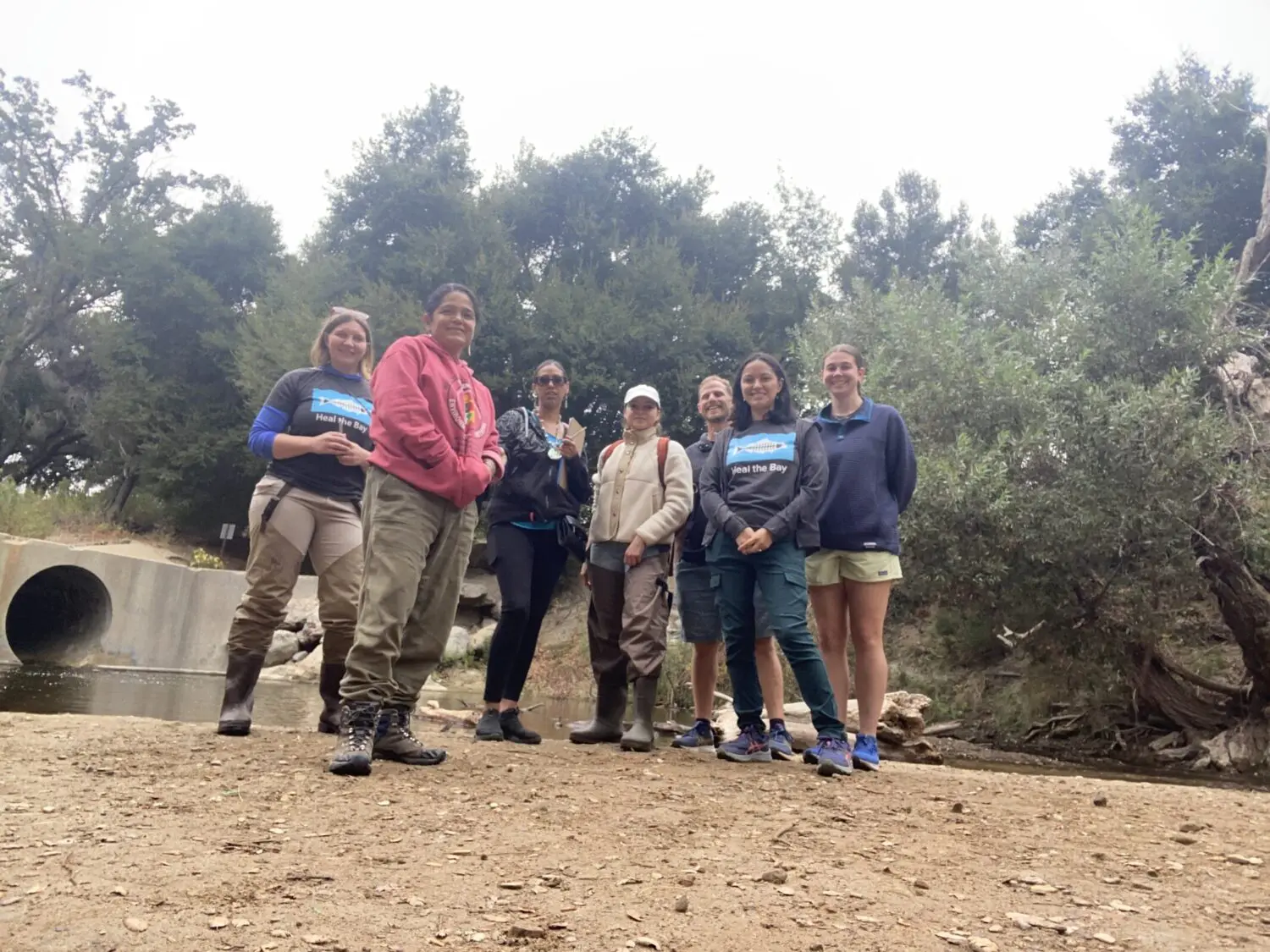
 There are so many people to thank for making this work happen, but we will start with a huge thanks to Dan Murphy of the LA Fire Department for helping coordinate access to the burn zone, Los Angeles County Lifeguards and to our Heal the Bay sampling team (Dr. Tania Pineda-Enriquez PhD, Annelisa Moe, Naomi Meurice, Zoë Collins, and Vicente Villaseñor).  

Key Terms: 

PAHs = polycyclic aromatic hydrocarbons, volatile organic compounds associated with oil/grease 

PCBs = Polychlorinated biphenyls, chemicals used in industrial / commercial products  (PCBs stopped being produced in the 70s, so a legacy chemical) 

PFASs = Per- and polyfluoroalkyl substances, forever chemicals (manmade chemicals that do not breakdown ) used to make waterproof, nonstick, and flame-resistant products.

SUPPORT OUR WORK


Heal the Bay strongly disagrees with the selection of State land in close proximity to Topanga Creek and Lagoon as the US EPA’s Palisades Fire hazardous material staging area, where materials will be sorted and repackaged before they are sent to permitted waste collection facilities. The site chosen is an area of cultural and ecological significance, and we stand with the surfers, swimmers, and local communities concerned about the potential for harm to this precious ecosystem.

UPDATE: February 26, 2025 -The first phase of removing wildfire debris is over. What happens to those collection sites?  (Daily News)

UPDATE: February 12, 2025 – Heal the Bay’s Associate Director of Science and Policy, Annelisa Moe, toured the EPA hazardous waste sorting and storage sites at Topanga Creek and Will Rogers State Beach with Supervisor Lindsey Horvath, the EPA, and FEMA.

UPDATE: January 31, 2025 – Initial Takeaways from the EPA Hazardous Waste Site at Topanga Beach & FAQ (below)

For the record, Heal the Bay was NOT consulted on the site selection ahead of time. 

Soon after we learned about the site selection, we asked to meet with US EPA officials to express our concerns and learn what measures were being taken to protect Topanga Creek and Lagoon. That meeting occurred on Thursday, January 30, 2025, at 4:30 p.m.

At our meeting with EPA, we learned that operations have already begun on the Topanga site, reducing the likelihood that we can get EPA & FEMA to select a different location (although we still pushed). Between the Palisades and Eaton fires, this is the largest operation the EPA emergency response team has had to clean up since they began this work in 2015. In addition, they have been tasked by the current Federal Administration to complete the work in 30 days, a time constraint that has left the region with few options.

We are fighting to ensure that the EPA implements sufficient measures to prevent contaminants from coming into contact with the bare soils or leaving the site and impacting critical waterways. In addition to what the EPA has proposed (see EPA’s FAQ), Heal the Bay asks for water testing in Topanga Creek and Lagoon. We have also asked to be permitted access to the site to observe operations and the implementation of measures meant to prevent harmful chemicals from leaving the site. We are waiting to hear back on both of these.

Although we strongly disagree with the site EPA and FEMA have chosen, speedy removal of hazardous wastes from the burn areas IS ESSENTIAL. Right now, the hazardous waste in the burn areas is uncontained and exposed to the elements, with almost no measures in place to prevent it from being blown by the wind or entering our ocean when it rains again. There are no good choices here, but in our opinion, hazardous materials left exposed at burned structures pose a greater threat to water quality and ecosystem health than they will at an EPA sorting site where multiple containment measures are in place. If the EPA will not or cannot move the hazardous waste staging area from the Topanga location, we demand that they take extra precautions to prevent stormwater from running onto the site, contaminated runoff from leaving the site, and contaminated dust from being blown from the site into waterways. Please join us in asking for water quality sampling to be added to the BMP protocol.

Here are the biggest takeaways from our meeting with the EPA:

What does the EPA look for in a staging site?  

  • When looking for a hazardous material staging site, the EPA team needs at least five acres of flat land located near a roadway suitable for trucks to enter and exit.  
  • The EPA could not start cleaning efforts until a space was selected and prepared. 

Why was Topanga Lagoon chosen as the site location? 

  • EPA did recon with Cal Fire, and the Topanga Lagoon site met the basic logistical requirements for space and access. The state approved EPA use of the Topanga location. 
  • According to the EPA, other proposed sites were either rejected by City of LA and LA County officials or already used by other emergency response teams.  
  • Heal the Bay has requested a list of other sites considered by the EPA.  

Will additional locations be needed to remove all of the hazardous waste entirely? 

  • For the Palisades Fire response, EPA anticipates the need for more staging areas, maybe an additional 25 acres. 
  • The EPA is currently searching for other staging areas, and Heal the Bay has requested to be part of that decision-making process. 

What has taken place on the site to date? 

  • The property was burned, so EPA cleared it of burned debris, then built berms around it and added straw wattles to prevent water from entering or leaving the site.  
  • Secondary containment and plastic lining have been implemented to prevent direct contact of hazardous materials with the soils on site. 
  • The EPA took soil samples before the cleanup activity commenced and will sample again once the cleanup activity is complete.  (NOTE: Heal the Bay has requested a list of contaminants tested to ensure the sampling plan is sufficient).  
  • The cleanup team monitors the air for particulates, volatile organic compounds (VOCs), radiation, and wind indicators for weather tracking. 
  • The cleanup team has started electric car battery recovery for the Palisades area, de-energizing them in the Topanga staging area to be recycled.  

What safety precautions will EPA take to protect the environment? 

  • See EPA FAQ 
  • Heal the Bay asked about additional BMPs (Best Management Practices) for the expected rain. EPA Public Information Officer Rusty Harris-Bishop has agreed to update us as more information becomes available. 
  • Heal the Bay has also requested that the EPA conduct water quality monitoring in the nearby creek and Lagoon.  
  • The EPA has explained that they have not had any issues with staging areas in past emergencies, including the Lahaina fires. 

When will they start accepting hazardous waste? 

  • As of January 30, they have already started collecting lithium-ion batteries (from electric cars). 
  • Larger-scale work is scheduled to begin January 31, 2025. 

When will they be done? 

  • This is a temporary staging area, and although the Palisades Fire was an unprecedented event, the plan is for the site work to be completed by the end of February 2025 (30 days).  

Where will the hazardous waste be sent? 

  • Materials are taken to the staging area to sort and re-pack for final shipping to permitted hazardous waste facilities that are in good standing.  
  • The facilities have not been determined yet.  
  • Determining specific locations will depend on what the EPA team finds and how much material is collected. Still, our understanding is that the waste will likely be transported out of state. 

Can EPA move the staging to another location? 

  • Attempting to move locations would cause delays in removing the hazardous waste from within the burn zone where it is currently exposed to the elements, which is the biggest concern. 

What is more dangerous to the environment: Creating the staging area near an ecologically sensitive area or slowing removal? 

  • Slowing down removal is likely more dangerous for the environment because there are few measures to prevent the waste in the burn areas from entering waterways and the ocean. 

Is the EPA planning to test the water quality? 

  • No water quality testing is planned

Does Heal the Bay have water quality testing recommendations?

  • Yes, our Water Quality Team recommends that the EPA test for the following:  
    • Chronic and Acute Toxicity  
    • Basic water quality parameters (e.g., turbidity, pH, dissolved Oxygen, and temperature) 
    • Total Suspended Solids 
    • Heavy Metals (e.g., lead, arsenic, mercury, chromium and cadmium) 
    • Volatile organic compounds  (e.g., Benzene) 
    • Polycyclic aromatic hydrocarbons (PAHs) 
    • Polychlorinated biphenyls (PCBs) 
    • Per- and poly-fluoroalkyl substances (PFAS) 
    • Oil and Grease 
    • Total Organic Carbon 
    • FIB (i.e., E. coli, total coliforms, and enterococcus) 
    • Dioxins 
    • Ammonium 
    • Phosphates 
    • Sulfates 
    • Asbestos 
    • Microplastics 
    • Radionuclides 

Has the EPA started a cleanup operation in response to the Eaton Fire? 

  • They have started cleanup operations in Eaton. 

Will Heal the Bay continue to monitor the situation at Topanga Lagoon?

  • Yes, and Heal the Bay will continue to push for the opportunity to conduct a site visit in the coming days to observe the BMPs in action.


The latest news about the Palisades fire and its impact on ocean-water quality and beach access in L.A. County.

During natural disasters, residents seek three things: community support, goodwill, and up-to-date information. To that end, Los Angeles County leaders invited Heal the Bay science and outreach staff to attend an emergency meeting Thursday morning at the Palisades Fire incident command center at Zuma Beach.

Department officials from L.A. County Fire and Beaches & Harbors asked Heal the Bay to help disseminate accurate updates to the public about how the catastrophic fires affect beach access and ocean water quality.

Here’s what we learned:

Stay away from burn zones and evacuated areas in the Palisades, Topanga, and Malibu areas.

Residents and those who love these areas are naturally curious about the status of homes, commercial structures, and favorite natural places. Command officials understand that people want to return to the areas as soon as possible. However, public safety dictates that fire and evacuation zones remain off-limits until emergency crews clear neighborhoods of downed power lines, roadway debris, lingering hot spots, and other hazards. Officials were unable to give a timetable for when residents may return or when PCH will reopen, but a brief tour by Heal the Bay staff indicates it will be weeks until residents can go back.

There is no public access to any L.A. County beaches in the fire or evacuation zones, roughly north of the Santa Monica Pier to County Line.

If you are a surfer looking to score empty waves, don’t even think about it. Multiple National Guard checkpoints are in place, ensuring that only emergency responders, utility workers, media, and essential workers are allowed on PCH. If you think you might be able to talk your way past checkpoints to tour impacted areas, you are mistaken. All beach parking lots from Will Rogers to Zuma are unavailable to the public, as they are being used as staging areas for emergency crews. All other beaches in L.A. County remain open to the public. But caution is urged, given compromised air quality along County shorelines.

Avoid water contact at any beaches from Malibu’s Surfrider Beach to Dockweiler State Beach near LAX.

The Los Angeles County Department of Public Health has issued an ocean advisory that warns residents to avoid any water contact at these beaches. The firestorms and efforts to beat them down have created massive amounts of runoff, which may contain toxic chemicals and dangerous debris. All that polluted water eventually sloughs off to the Bay. The advisory will remain in effect until three days after fire-fighting operations end.

As of Thursday morning, the Palisades Fire was only 22% contained. Heal the Bay has not determined yet if the County’s Public Health unit will be posting warning signs at impacted beaches. To view a map of impacted locations and get more information, click here. We advise the public to visit Heal the Bay’s Beach Report Card to get updated information on beaches, as well as the Department of Public Health to learn about the latest water-quality details.

Water quality testing of local beaches will continue at sites that are still accessible to sampling agencies.

Water quality samples for fecal indicator bacteria are collected and tested by three government agencies every week at 85 sites in Los Angeles County. Once the results have been processed (after 24 hours), the public is notified when a beach exceeds pollution standards by warnings, advisories, or closures of the affected beaches. These weekly samples form the basis of Heal the Bay’s weekly A-to-F Beach Report Card.

Due to the fires, access to some beaches has been restricted, and some water-quality sampling has been interrupted until further notice. However, local departments will continue their testing to the best of their ability, including many of the 41 beaches where the Department of Public Health has advised beach users to avoid water contact—assuming these sites remain accessible in the weeks to come.

Water quality testing needs to expand beyond monitoring fecal bacteria to include testing for heavy metals, PCBs, nitrates, and other harmful compounds.

Water quality degradation following a fire varies greatly depending on the intensity and duration of the fire and the characteristics of the affected ecosystem. One of the primary effects is the alteration of vegetation coverage, which reduces the natural barriers that slow water runoff after a storm event. This leads to increased soil erosion and sediment transportation into nearby water bodies.

Rainfall can exacerbate these effects by compacting the soil and increasing overland flow, amplifying erosion and pollutant transport. With many homes, businesses, cars, and other manufactured items burning so close to the coast, we are particularly concerned about sediment, trash, and debris washing into the ocean.

During our tour, Heal the Bay staff saw hundreds of burned-out structures on the ocean side of PCH, with high tide waves surging within feet of the twisted, charred wreckage. Sediment can contain high levels of nutrients like phosphorus and nitrogen that, in excess, are harmful to marine ecosystems and can create algal blooms. They may also contain chemicals, heavy metals, and other harmful substances that burned in the fires. Recent reports indicate that the presence of so much plastic in modern homes has significantly contributed to more toxic infernos.

Heal the Bay does not have the capacity to conduct any water quality testing aside from compiling bacterial data and informing the public when it is safe to enter the water. UPDATE 1/30/2025

On January 24, 2025, the Heal the Bay Science and Policy Team began testing water in and out of the burn zones along Santa Monica Bay impacted by the Palisades Fire. 

Not only did we test for bacteria and turbidity (which we can process in-house), but we also collected samples to test for Heavy metals, Mercury, PAHs/PCBsBenzene, and PFOS/PFOA (two types of PFAS). We collected samples before and after the rain event on January 26, 2025, which will provide a comparative analysis of initial pollutant levels and stormwater runoff effects. 

The Palisade Fire has increased sedimentation and introduced harmful pollutants into our coastal waters, and Heal the Bay is dedicated to understanding the impacts, which is why we are testing for key pollutants that may be transported into Santa Monica Bay due to runoff from the Palisade Fire.  

We strongly urge the County of L.A. and any other municipalities to test for the presence of additional contaminants, such as heavy metals, PCBs, nitrates, and other unhealthy compounds. These pollutants can be harmful to humans and aquatic species, and given the extensive firefighting that has occurred directly adjacent to the coastline, these pollutants will be present for months to come.

In the interview below with USA Today, Annelisa Moe, Associate Director of Science, Policy, and Water Quality, discusses some of the long-term risks to coastal ecosystems and water quality.

We will continue to provide water quality information each week on the BRC website, so beach users and freshwater recreational users can make informed decisions.

Note: We will continue to consult with County officials on a daily basis to update this post. We will send alerts on our social media platforms when we receive new information about water quality, public health and beach access.


From the desk of the Heal the Bay Water Quality Team. 

Heal the Bay recently hosted the Sacred Places Institute for Indigenous Peoples for a day of hands-on water quality testing and training to share our knowledge on the contaminants in LA’s freshwater, test for pollutants, and assess the ecosystem to protect public health. This partnership combined scientific methods with Indigenous traditions, creating a captivating day of cross-organizational knowledge sharing that promised to unveil new insights and foster a more profound respect for diverse perspectives.

Incorporating Indigenous perspectives is so important when it comes to environmental science. Indigenous communities and organizations often possess deep, localized knowledge of their environment, including an intricate understanding of water systems and changes over time. This legacy knowledge can significantly enhance the accuracy and completeness of water quality data and is an opportunity to learn more about the cultural and spiritual values of the area’s original inhabitants, and to help see water as more than just a resource.

Diving into the Current

Following an insightful morning filled with presentations and lively discussions, we convened at Malibu Creek State Park to measure the water’s turbidity, temperature, and other environmental factors. We donned our signature “Stream Team” boots and protective gear to wade “knee-deep” into the process of assessing the creek’s water quality.  It was the perfect opportunity to put theory into practice and to demonstrate firsthand how water quality impacts our environment.

Heal the Bay staff shared insights into our Stream Team’s process to tests for fecal indicator bacteria, explaining how these pollutants signal ecosystem and public health risks and how this science informs both our Beach Report Card and River Report Card. Members of Sacred Places Institute shared the historical and cultural significance of water, reflecting on Indigenous water stewardship in the LA area, past and present, and highlighted the ongoing work to restore urban waterways.

At Las Virgenes Creek, before we started our fieldwork, Sacred Places Institute’s Land, Water, and Climate Justice Director Jessa Calderon (of the Tongva, Chumash, and Yoeme Nations) began with a prayer to honor nature. She sought permission to collect a water sample and waited for the land and water to indicate consent—an important step in ensuring that our work was in harmony with the environment. With no signs of refusal from the land, we proceeded to collect water samples. This approach underscores the importance of integrating Indigenous perspectives into water quality testing programs, where the land isn’t just a resource, but a partner in the process.

Reflecting on the training, Sacred Places Institute said: “Participating in the Heal the Bay water quality testing training validated the continued need for local and state stringent water policy regulations and enforcement as one way to keep waterways free from industrial development contamination and stormwater runoff. Moreover, it reinforced the need for water back to local Native Nations as the inherent guardians of local waterways and as an effort to reintroduce the traditional caretaking knowledge for water as a means to help bring it back to balance.

Back to the Lab Again

After collecting samples, we headed back to the Heal the Bay lab. Tests revealed low E. coli levels but elevated Enterococci and total coliforms, which are other types of bacteria found in the intestines of humans and animals. While E. coli levels were low and typically a primary concern for water contamination, the elevated levels of Enterococci and total coliforms suggest that there may still be a potential health risk for people who come into contact with the water. These bacteria are indicators of fecal contamination, which could pose a risk of illness, especially if someone swallows contaminated water or has open cuts.

The Why Behind the Work

We were honored to be able to share our knowledge and learn so much from our long time partners at Sacred Places Institute. By blending our scientific methods and Indigenous knowledge, we deepen our understanding and strengthen Heal the Bay’s commitment to safe, clean water for all. Support our mission to protect LA’s waterways.


The only thing our Water Quality Scientists love more than “Safe Clean Water”, is love! Here’s Heal the Bay’s list of the cuddliest spots for couples, friends, first dates, and everything in between, along the local California shoreline.

Forget crowded restaurants and overpriced (environmentally unfriendly) roses: Unveil the perfect Valentine’s Day with sparkling waters and sandy toes! ️

This year, ditch tradition and escape with your someone special to a breathtaking beach paradise right here in Southern California. Picture yourselves strolling along the shore at sunset, the sky ablaze with color. Sounds pretty dreamy, right?

But wait, there’s more! We’re not just talking about beaches. We’ve curated a list of secluded, romantic havens (including beaches, lakes, and rivers) with A+ water quality ratings and positive environmental impacts that will warm the heart and beckon for exploration. No murky waves or questionable cleanliness here – just lovely local waterside wonders perfect for making unforgettable memories.

Whether you crave classic California sunsets or romantic river staycations, our list has the perfect destination for your love story, adventure with a friend, or self-love solo escape into the outdoors. So, pack your beach bag, grab your sweetheart, and get ready to dive into a Valentine’s Day unlike any other!

Ready to discover your ideal romantic beach escape? Your next friendly freshwater getaway? The perfect LA lakeside love nest? Scroll down and let the adventure begin!

Note: Many of these beaches contain hikes, PV trails, bike paths and pathways that may have recently closed due to land movement and recent storm events. Please check the Los Angelese County Park and Recreation website before visiting any trails and heed any closure signs.  

Here are the top spots we love for love (and their great Beach Report Card water quality grades too!):

Point Dume State Beach and Natural Preserve, Malibu

Source: Heal the Bay MPA Watch Team (https://healthebay.org/mpa/)

What we love about it:Prepare to be mesmerized by two miles of scenic bluff trails at Point Dume State Beach and Nature Preserve. Whether you’re seeking a romantic stroll hand-in-hand or an invigorating hike, these trails offer breathtaking ocean views encircling a Marine Protected Area where wildlife thrives. Parking is a breeze at Point Dume. A conveniently located lot sits right next to the preserve, and additional free parking options are available along Westward Beach Rd. and Grasswood Ave. This accessibility makes Point Dume ideal for beach lovers, hikers, and anyone seeking a nature escape. 

What to do here: Embark on diverse hiking trails, each offering unique perspectives. Look out for curious sea lions sunning themselves on the bluffs below, playful dolphins flitting through the waves, and, during their December-April migration, magnificent gray whales breaching in the distance. Witness the thrill of surfers riding the waves on the north side or (when safe to do so) delve deeper into the underwater estuary with snorkeling or scuba diving. Point Dume even caters to adrenaline enthusiasts with its popular rock-climbing spots. Prepare for an abundance of onshore and offshore recreational activities!

Water Quality/Water quality improvement elements:  Rest assured, the water quality at Point Dume is pristine. According to our Beach Report Card, it boasts an A+ rating, signifying excellent water quality and guaranteeing a safe environment for swimming, sunbathing, and exploring.


Ginger Rogers Beach, Malibu

Source: https://smmirror.com/2023/05/lifeguard-towers-at-will-rogers-beach-to-be-painted-with-pride-colors/

What we love about it:Love knows no bounds, and neither should your Valentine’s Day celebration! Escape the ordinary and head to Ginger Rogers Beach, a cherished haven for Los Angeles’s vibrant LGBTQ+ community since the 1960s. Embrace the ocean breeze on this special stretch of Will Rogers Beach, just 15 miles from West Hollywood. Accessibility is a breeze: convenient parking, a dedicated bike path, and the Santa Monica Blue Bus 9 stopping nearby ensure stress-free arrival. So, ditch the traditional and celebrate your love in a vibrant, welcoming atmosphere where every couple shines just as brightly as the California sun.

What to do here: Proudly stroll hand-in-hand along the shore with laughter echoing amidst volleyball games, and maybe even join one of the spontaneous beachside dance parties this spot is known for as the sun sets. Celebrating “big love” with your whole crew? Don’t forget to take some group selfies at the #Pride Flag Lifeguard Station. Whether you’re seeking sun-kissed relaxation or playful competition, Ginger Rogers Beach offers something for every love story.

Water Quality/Water quality improvement elements:This beach boasted an A+ rating on January 21st, 2024, but check the Beach Report Card app for real-time updates as recent storms may impact water quality. (beachreportcard.org)

Torrey Pines, San Diego

Source: Dan_H, flickr

What we love about it: Torrey Pines State Beach has picturesque views of the San Diego coastline and the adjacent Torrey Pines State Reserve is filled with little trails leading down to the shore. We recommend that you only take marked trails and watch your footing, but the views are worth the adventure.

What to do here: We love the Torrey Pines Trail to Black’s Beach in the morning for a beautiful way to start your day. Fair warning: some nudists like to visit this beach as well.

Water Quality: The only sampling site at Torrey Pines is at the Los Penasquitos Lagoon outlet. That site received good grades in our most recent annual Beach Report Card.


La Jolla, San Diego

Source: Wikipedia Commons

What we love about it: This spot is great for lovers and families alike, with plenty of adventure to be had by all ages.

What to do here: This is the perfect spot for a SUP (stand-up paddleboard) adventure, snorkeling, kayaking, or even just a picturesque walk along the beach. For stunning ocean views over dinner, check out the Marine Room at the La Jolla Beach and Tennis Club.

Water Quality: La Jolla Shores received great grades in our annual report last year.


Victoria Beach, Orange County

Source: Daniel Peckham, Flickr

What we love about it: Straight out of a fairy tale, this shoreline spot is guarded by La Tour, a 60-foot castle-inspired tower.  Built in 1926, the structure provided beach access for a home on the cliff above.

What to do here: Looking to be someone’s knight in shining armor? Look no further. To get here, walk to the north end of Victoria Beach in Laguna Beach, around the bluff, and past another sandy section of beach. (This is a privately owned structure, so while you can walk up to it, please do not try to go inside or climb on the structure.)

Water Quality: Victoria Beach received A+’s across the board in our last annual report.


Crystal Cove State Park, Orange County

Source: Wikipedia Commons

What we love about it: With such a long swath of open sandy shores, this is an ideal spot for a romantic seaside stroll, or perhaps for a love-inspired photoshoot.

What to do here: If you’re looking for post-beach walk eats with an ocean view, the Beachcomber Café is a fun option.

Water Quality: Crystal Cove has great water quality in the summer or whenever the weather has been dry. Given the buckets of rain we have (thankfully) gotten this year, make sure to heed any beach posting signs you may see.


Palos Verdes Peninsula, Los Angeles

Source: Mark Esguerra, The Marke’s World

What we love about it: We love the PV areas so much, that we had to lump the whole peninsula together as one of our top locations. Palos Verdes wraps around from the base of the South Bay down to San Pedro and features beautiful neighborhoods, coastal trails, clean beaches, and tidepool adventures.

What to do here: For those seeking marine biology-inspired adventures, plan your visit during low tide to explore the tidepools at Abalone Cove. For a scenic hike and a secluded rocky beach, don’t miss Palos Verdes Bluff Cove. 

Water Quality: Seeking a beach escape with guaranteed sparkling waters? Look no further than Abalone Cove Shoreline Park, a jewel nestled within the Palos Verdes Peninsula. Not only is Abalone Cove recognized as an Honor Roll beach, signifying top-notch amenities and impeccable upkeep, but the entire Palos Verdes Peninsula boasts an A+ rating on our Beach Report Card, assuring pristine water quality for swimming, sunbathing, and creating unforgettable memories.


El Matador State Beach, Malibu

Source: Elliot McGucken, 500px

What we love about it: El Matador Beach is characterized by dramatic cliffs, hidden coves, and even secret sea caves, evoking the atmosphere of a Hollywood romance scene. Whether you’re igniting a new flame or spending time with a longtime partner, El Matador is sure to kindle your passion. Keep in mind that accessing the beach requires descending stairs. 

What to do here: Explore the dramatic landscape, take Instagram-worthy photos, find little hideaway spots for you and your date to share secret kisses, and wrap up your evening with a gorgeous sunset view. Please note that parking can cause a little heartache as spaces are limited. 

Water Quality: Beyond the captivating rock formations and breathtaking scenery, El Matador Beach boasts another hidden gem: impeccably clean, A+-rated water quality. As recognized by our Beach Report Card, this Honor Roll beach guarantees safe, clean, sparkling waves perfect for a day at the beach.


Arroyo Burro, Santa Barbara

Source: Damian Gadal, flickr

What we love about it: Santa Barbara is the perfect little getaway for a weekend of romance. If you’re looking for some time together to rest, rejuvenate, and rekindle the fire, Santa Barbara is the perfect place.

What to do here: We love Arroyo Burro for a sunset walk, and with plenty of parking and restroom access it’s a stress-free beach walk experience.

Water Quality: Arroyo Burro has great water quality in the summer or whenever it has been dry enough that the creek hasn’t been breached. Make sure to heed any beach posting signs you may see if you’re feeling like taking a dip. But if the creek is flowing, be sure to stick to the sand over the waves.


Freshwater Sites

Madrona Marsh, Torrance

Source Safe Clean Water Team (https://healthebay.org/safecleanwater/)

What we love about it: More than just a mall neighbor, Madrona Marsh is a vibrant ecosystem thriving in the heart of Torrance. This beautiful seasonal wetland boasts unique vernal pools teeming with diverse life, from fascinating birds and insects to curious animals and aquatic wonders. Escape the hustle and bustle by venturing onto the multiple trails that weave through the pools and wetlands, immersing yourself in nature’s tranquility.  

What to do here: It’s a wonderful place to take a walk with a loved one and enjoy nature. Slow down, soak in the vibrant hues of California poppies and sunflowers and become captivated by the symphony of birdsong. Let the serenity of the marsh wash over you as you reconnect with nature and each other.

Water Quality/Water quality improvement elements: Beyond its beauty, Madrona Marsh plays a vital role in environmental sustainability. The marsh uses nature-based solutions to treat stormwater from the surrounding neighborhood! Water is pumped into a modular wetland system where it is cleaned using a pre-filtration chamber, biofiltration with vetiver (a non-invasive perennial grass) that removes pollutants, and then the filtered water is pumped to wetlands at the marsh. 


L.A. River at Benedict St. in Frogtown, Los Angeles

2023 Heal the Bay Stream Team

What we love about it:  No need to kiss this frog to turn it into the “prince” of Valentine’s Day destinations. Frogtown, nestled between the bustling I-5 and the vibrant LA River, is a vibrant neighborhood. Chic outdoor cafes beckon with the aroma of freshly brewed coffee, perfect for cozy hand-holding moments. Imagine the gentle murmur of conversation blending with the soft city breeze, setting the stage for an unforgettable date. (Heal the Bay would like to acknowledge that gentrification has taken place here and would like to pay respect to the original neighborhood landmarks and communities).

What to do here:  Embark on a hand-in-hand adventure along the picturesque LA River Greenway Trail. Cycle leisurely side-by-side, weaving through sun-dappled paths and enjoying the refreshing green spaces. If a slower pace beckons, find a quiet spot by the river’s edge, to sip a coffee from a nearby cafe and watch the water flow serenely next to your loved one. we advise against entering the water right now and outside of the open recreation season (May-Sept), but the scenic backdrop guarantees a picture-perfect memory. 

Water Quality/Water quality improvement elements:During the 2023 summer Stream season, the L.A. River at Benedict St. achieved an impressive A+ rating on the River Report Card, confirming its excellent water quality permitted recreational activities during designated open seasons.


 Rock Pool, Malibu Creek State Park 

Source: 2023 Heal the Bay Stream Team (https://healthebay.org/2023-water-quality-successes-river-report-card-upgrade-and-summer-stream-team/)


What we love about it:  Nestled roughly 1.5 miles from the parking lot, the journey itself to Rock Pool is a shared adventure. Prepare to be mesmerized by the picturesque surroundings – towering trees and lush greenery frame the crystal-clear waters. Trust us, the entrance fee is completely worth it. 

What to do here: The swimming hole at this location is of considerable depth, perfect for a refreshing dip after a lengthy hike. After an exhilarating dip, spread out a cozy picnic under the shade of the trees or simply relax and dip your feet in the water.

Water Quality/Water quality improvement elements: This natural haven earned an A+ on the 2023 Summer River Report Card, signifying excellent water quality, guaranteeing a refreshing and safe escape for your love story. 


Parks

Machado Lake in Ken Malloy Regional Park, Harbor City 

Source: Safe Clean Water Team (https://healthebay.org/safecleanwater/)

What we love about it: This natural lake isn’t just a body of water; it’s a vibrant ecological hub and a haven for recreation within the sprawling Ken Malloy Harbor Regional Park. This impressive park, one of the largest in Los Angeles, boasts a remarkable diversity of habitats, including Machado Lake itself, a seasonal freshwater marsh, a thriving riparian woodland, and even a nonnative grassland.

What to do here:  Imagine your children giggling on the play structures, laughter filling the air during a family picnic at the designated tables, or the thrill of spotting diverse wildlife species. Fishing enthusiasts can try their luck with catch-and-release fishing, adding to the diverse activities available. You might even hear whispers of Reggie, the resident alligator who once called the lake home (trust us, Google him – you won’t be disappointed!). 

Water Quality/Water quality improvement elements:  Thanks to renovations originally funded by Prop O and other initiatives, the lake’s water treatment systems were revitalized to effectively remove pollutants like trash, bacteria, and even oil and grease. Now, thanks to the Safe, Clean Water Program, regular upkeep ensures the continued health of this vital ecosystem.


Ladera Park, Los Angeles

Source: https://parks.lacounty.gov/ladera-park/

What we love about it:More than just a park, Ladera is a testament to sustainable practices and community connection where you can make a love connection. Thanks to funding from the Safe, Clean Water Program, this park has implemented smart solutions (like infiltration wells) to capture and permeate stormwater and non-stormwater runoff, ensuring a healthier environment for everyone. Here rainwater nourishes native plants instead of flowing into polluted waterways.  Stroll hand-in-hand with your favorite environmentalist through paths marked with educational signage or enjoy lunch in this living classroom for visitors of all ages. The perfect outdoor date for those committed to each other, and sustainability.

What to do here: This park has it all – areas for parties and barbeques, playgrounds, sports areas, walking paths, and lots of large sycamore trees. Wildlife abounds and there are frequently western bluebirds, hawks, and more.  

Water Quality/Water quality improvement elements:  The impact goes beyond the park’s boundaries. By capturing and treating over half a million gallons of stormwater annually, Ladera Park significantly reduces harmful pollutants like bacteria and metals from entering nearby waterways. This contributes to a cleaner Centinela Creek, Ballona Creek, and ultimately, the ocean, benefiting countless species and the entire community.


Looking for beaches outside of SoCal? See our previous blog and check out recent water quality with Heal the Bay’s Beach Report Card.

Heal the Bay’s Beach Report Card is the only comprehensive analysis of coastline water quality in California. We grade more than 700 beaches weekly from Oregon to the Mexico border, assigning an A to F grade based on the health risks of swimming or surfing at that location.

Special thanks to the romantics on our Science, Outreach, and Water Quality Team:

Dr. Katherine Pease, Science, and Policy Director; Dr. Alison Xunyi Wu, Water Quality Data Specialist; Dr. Tania Pineda-Enriquez, Water Quality Data and Policy Associate Specialist; Nancy Shrodes, Senior Watershed Specialist, South Santa Monica Bay; Jillian Marshall, Communications Manager; and Leslie Griffin, former chief water quality scientist Heal the Bay. 


On warmer days when people are spending time outdoors in Los Angeles, Heal the Bay is there too, collecting water samples from rivers, creeks, and streams. Our River Report Card has issued water quality grades for freshwater recreation sites throughout LA County since 2017. The grades are based on levels of bacterial pollution in the water, and help the public make informed decisions about whether it’s safe to swim there. Local college students (our ‘Stream Team’) collect water samples from Malibu Creek State Park and the LA River in the San Fernando Valley and north of Downtown.

In the summer of 2021 we expanded our program to the lower reaches of the LA River, so now our River Report Card covers the entire extent of the LA River! Funding for this expansion came from the Watershed Conservation Authority. We partnered with California State University Long Beach (CSULB) and would like to give a major shout-out and thank you to Dr. Varenka Lorenzi and Dr. Christine Whitcraft from CSULB who dedicated their time and resources to facilitating the program.

This fantastic achievement would not be possible without the hard work of our Lower LA River Stream Team, which is composed of five students from CSULB and Long Beach City College (LBCC).

We asked the students to share their thoughts on the work they did this past summer – read on to hear their voices and what this experience meant to them.

 Sarah Valencia

“Throughout my entire experience with the Stream Team I learned so much about the activity surrounding the LA River. So many locals come out to enjoy the River and the space it has to offer. It made me realize how precious the River is to so many hidden communities and local families. Unfortunately, our samples collected from the lower part of the LA River yielded large amounts of E. coli and Enterococcus (which indicates the presence of fecal pollution). The River was not suitable or safe for any kind of in-water activities, so seeing locals try to catch fish or bathe in the water made our work feel needed and long overdue.

I grew up in Bell, California, just about a block from Riverfront Park. I remember hanging out by the River with friends, so I feel connected to the River in that it is part of my community and childhood. Joining the Stream Team helped me look at the LA River through different lenses. I can now see how the River is an integral part of the ecosystem there especially as we move closer to the ocean where the River ends. Animals were always a fun sight. We’d randomly find a snake, turtle, frog, and countless dogs. Each field day was its own new adventure.

I hope to continue my education in environmental science by attending graduate school so that I can take my knowledge and studies into helping watershed conservation and communities. I believe that the work the Stream Team does will prompt legislatures, other conservation groups, and the community to support efforts into watershed conservation and protecting the LA River for all its communities.”


Sarah Kambli

“I was so excited to have the opportunity to work as part of the Stream Team this summer. Originally a Marine Biology major, I switched to Environmental Science & Policy in the fall of 2019 and while I was excited at the new prospect, I wasn’t entirely sure what exactly this field would have in store for me. Cue the Stream Team! When I heard about this opportunity, I was so excited and jumped at the chance to apply, and I was absolutely elated when I got the position. I’ve always felt a connection to Nature, especially water, so to be able to get down into the River and study it was so exciting!

This project meant a lot to me in many ways. Scientifically, I was able to get some hands-on experience by collecting and analyzing samples. I was able to use some of the skills I learned in previous Science classes that, while enjoyable, I really struggled with. So, it really made me feel good to see that I was able to pull from some of that knowledge and put it to practical use, despite my previous difficulties. I gained so much confidence in myself through working both in the field and in the lab, and this experience showed me a potential road that I am excited to continue down after school. I’m still not completely sure what I want to do when I’m finished, but I know I want to work with ocean conservation; having this experience will really help me with that goal in the future.

On a personal level, this project also meant a lot to me. Like a lot of people, COVID has been very difficult for me. My entire family lives over a thousand miles away in the middle of the country, so I felt the forced isolation especially hard. When I joined the Stream Team, though, and got to work with these amazing young women, I felt myself come alive again. The five of us all got along exceptionally well from the start, and we worked seamlessly as a team. Besides amazing teammates, I made four wonderful friends that I foresee being in my life for many years down the road.”


Monet Pedrazzini

“Early morning air carries sounds of sweeping trucks on the 710 that mimic ocean waves, a foreshadowing of the eventual pelagic destiny of the Lower LA River runoff. We, the Stream Team, trudge in our waders and boots while taking note of cyclists and weekly algae bloom, watching dragonflies during the summer, and counting trash bags or shopping carts that decorate the concrete-floored watershed. Each site has its own expression of local flora, fauna, and activity. Families push strollers on the bike trail past the scattered duckweed and litter on the slopes of Riverfront Park’s riparian bank while Audubon Society members stake out at Willow (the furthest downstream site) to view Canadian geese or California terns taking a rest from migration commutes. As a part of Los Angeles history from early colonization to its present physical intertwinement that starts in Canoga Park, the LA River’s broad ecosystem spans time as well as the landscape with understatement. Shooting through downtown LA generally unnoticed and ending in Long Beach, it runs through and by us each day. The myth of nature as other erodes as we collect samples, commuting downstream, amongst the biodiversity and legacy of the LA River. We, as humans, are as much a part of this once wild river that’s laden with society’s trashy fingerprint as it is a part of us, as the watershed cycle flushes away our cityscape toxins like urban kidneys. Our connection is integrated, even interdependent.

Participating in routine, weekly visits cultivated an intimate relationship with each site, allowing us to more acutely observe seasonal shifts and differences in weather or time of day as patterns of the ecosystem. We learned to correlate these fluctuations with our lab analysis, excitedly putting into practice empirical observation along with the scientific method as we discovered the disappointing, but not so surprising, high levels of bacteria present in the River. This was each of our introductions to scientific field and lab work. Our worst fear was to feel intimidated, talked down to, or not smart enough to be there. Being an all-female team with varying abilities and backgrounds felt radically inclusive according to our understanding of the culture of STEM. With Heal the Bay’s encouraging support and example of relearning inclusivity in STEM, we intentionally empowered each other with compassionate accommodation that highlighted each member’s contributing strengths. Learning to practice consistency in standardized data collection and interpretive analysis as well as utilize unfamiliar lab equipment as a team allowed us to be more present, confident, and welcomed in the realm of science, transforming the fearful, projected legacy of competition into collaboration.

These embracing qualities have been so important to each of us as our initiating experience with scientific research. The opportunity to engage with science without feeling judged or insecure not only maintained a wholesome environment but has worked to affirm my own capacity, ability, and confidence to pursue a professional career in the STEM fields. Furthermore, as a Latinx, Long Beach native, relating data specific to my local ecosystems to the overarching narrative of climate change and environmental justice is a priority. Given this, my goal is to utilize my degree to advocate for Indigenous Land reclamation and stewardship in the process of decolonization along with environmental advocacy while continuing to nourish inclusivity in STEM. Working with Heal the Bay on the Lower LA River Stream Team has provided an incredible launching pad of curiosity, partnership, empowerment, and insight into the praxis of scientific pursuits. My experience with the LA River will always be a deep, personal reminder of the poetic resiliency and adaptive character of nature, moving me to remember that nature is not only all around us but more so, we have merely built ourselves around nature.”


Melissa Zelaya

“My time spent learning about the Lower LA River these last few months has been incredibly informative and inspirational. I was lucky to be part of the Stream Team which included a wonderful array of individuals that I learned from each day. Also training under Luke and meeting a community of like-minded individuals has been fuel to my already blazing need to work towards the health and protection of our natural environment.

I discovered that to understand the importance of monitoring the Lower LA River is to understand the importance of all the connecting waterways. The seriousness of a rainfall washing through these connecting channels bringing all the waste of our city to the ocean is one of the reasons it is instrumental in seeking ways we can make better changes. Not only were we able to see firsthand what rainfall does to the River but we were also able to quantify the difference it makes in our data. Monitoring the Lower LA River was challenging at times. Even though it holds the title of a river and is used recreationally, what we noted was a heavily impacted area not held to safe health standards. The qualitative data we recorded revealed that there is movement of birds as well as local activity using this area as recreational pathways. We saw fishes, insects, algae, vegetation, and life in and near the River. Our mission to the River was for the entirety. To advocate for those who cannot speak for themselves and to show the results of our current standing so that we can see positive improvements of the natural aspect of this area.

The direction of my personal and professional life has always been intertwined. As a first generation Latina college student, it was exciting being able to come home and explain to my parents the work I was doing in the River. My passion for my study came from their encouragement and compassion. I want to use my time and voice in ways that can be beneficial to the community and in the protection of the environment. I felt privileged to be able to do work that I loved at this point in my educational career. In addition, knowing that I would be gaining experience working with Heal the Bay who commits their time and resources to public health, climate action and education has been rewarding. I want to continue in this path that has been nothing but fulfilling. In educating others, as others have educated me. To advocate for an equitable future and use my training in ways that are going to help our diverse community flourish. I’ve been able to grow my confidence as well as knowledge of what it means to be a scientist thanks to an encouraging group putting work every day to see a better tomorrow.”


Jasmine Sandoval

“Hi, my name is Jasmine Sandoval and I had an amazing time being a part of the Stream Team this summer/fall! I am currently working on my Bachelor’s in Environmental Science and Policy, minor in Geology, and GIS certificate at Cal State University of Long Beach so this opportunity was right up my alley. During this time, I learned a lot about how to use lab equipment, how to set up, clean up, and perform testing on water samples, and how to take proper samples that would not introduce any bias or obstruct the sample as a whole. I also learned how to properly record data that is being collected! Working with the entire Stream Team has been such a blessing as the colleagues I worked with helped create such a fun, supportive, and respectful work environment. This whole experience has been so meaningful to me as it has helped me see how capable I am as a person, how much I love the field I am getting into, and how much work there is to be done that I can be involved in. I will take everything I learned from this and apply it to my future endeavors and for that I am truly grateful!”


The Stream Team will be back to issuing water quality grades next summer. In the meantime, keep an eye out for our annual River Report Card, which will be released in late spring 2022. Here’s our last report from 2020.


Photo credit: Ashlee Malyar, Marine Mammal Volunteer

Heal the Bay MPA Watch intern, Alex Preso, saw a distressed seal pup while conducting beach surveys, and helped it get the care it needed by alerting the California Wildlife Center. Alex shares what happened, plus the “Do’s” and Don’t’s” of helping a marine mammal in distress.


At first I thought it was a piece of driftwood on the beach… it was actually a distressed seal pup.

On Wednesday, March 18, I was taking surveys for Heal the Bay’s MPA Watch Program on El Pescador Beach in Malibu. As I was making my way along the beach, I noticed what looked like a washed-up log in the distance. As I moved closer, I realized that it was actually a small seal. The seal was lying on its back, barely moving, and was thin with wrinkled skin. It looked noticeably uncomfortable and I immediately suspected that something was wrong.

Sometimes a seal pup like this one simply struggles to survive on its own after separating from its mother, but there are also a variety of human impacts that can cause a marine mammal to be in distress. 

1) First, plastic debris in the ocean or on beaches poses a significant threat to marine mammals. When ingested, these animals cannot digest the plastic, so it stays in their bodies. This plastic can leach harmful chemicals into their bodies or even block their digestive tract, leading to starvation and malnourishment. Heal the Bay is working to combat this through our plastic pollution and beach cleanup programs. These programs aim not only to help remove plastic from our oceans, but also to keep this harmful marine debris from entering our oceans in the first place.

2) Second, overfishing of important food sources for marine mammals limits available nourishment and puts these animals at risk. Heal the Bay’s sustainable fisheries work aims to maintain healthy fisheries so that these animals have abundant food sources.

3) Third, loss of habitat can endanger marine mammals. Heal the Bay’s MPA program helps to monitor protected areas that are critically important to protecting these habitats, so that these animals have safe places to live, reproduce, and find food.

4) Fourth and finally, poor water quality can cause marine mammals to become sick. Polluted water can cause a variety of health issues for marine mammals, including bacterial, viral, and parasitic infections. Heal the Bay’s water quality work aims to prevent harmful bacteria, toxins, and other pollutants from ending up in the ocean and endangering marine life.

Heal the Bay is doing what we can to prevent these threats to marine mammals, but while these issues persist, it is important that we all keep an eye out for stranded marine mammals on our local beaches.

But even if you see a seal on the beach, how can you tell if it is in danger or simply catching some rays?

Many people don’t know how to tell if an animal like this is actually in trouble, let alone what actions to take if it is distressed. When I encountered this young seal, I saw many other people walking along the beach, barely taking notice of the animal.

Here is are some clear signs that a marine mammal is in distress and in need of help:

  • visible entanglement in trash or fishing gear
  • visible malnourishment or open wounds
  • a young pup without an adult nearby
  • erratic behavior 

Fortunately, you don’t need to be an expert to help a seal in need. If you suspect that a marine mammal may be in distress, always call the appropriate rescue hotline. It is better to have the rescue crew come to the beach to find a healthy animal than to leave an animal in distress without help. The numbers to call vary by location and are listed below.

Here are a few things to avoid if you find a distressed marine mammal:

  • DO NOT touch or approach the animal
  • DO NOT attempt to return the animal to the water 
  • DO NOT pour water on the animal
  • DO NOT attempt to move the animal

If you wouldn’t want someone to do it to you while you’re sunbathing on the beach, chances are the animal wouldn’t like it either. Marine mammals intentionally seek out dry land when they are in distress so that they can rest and soak up the sun.

What you should do if you find a distressed marine mammal:

  • DO stay approximately 50 feet away
  • DO call the appropriate rescue hotline
  • DO take a picture of the animal
  • DO try to pinpoint the animal’s location
  • DO wait near the animal until the rescue crew arrives

The number for the rescue hotline varies by location, but any of them can connect you to the correct region if you do not have the right number. 

  • For animals found in San Pedro up to Pacific Palisades (including all beaches between them) – call Marine Animal Rescue # 1-800-399–4253 [WHALE]
  • For animals found in Malibu – call the California Wildlife Center # 310-458–9453 [WILD]
  • For animals found in Long Beach – call Long Beach Animal Control # 562-570–7387

When you call the hotline, they will ask you to send a photo of the animal as well as its location. Try to be as precise as possible so that they can save time and arrive at the animal directly.

In this instance, I called the Malibu number. Then I waited with the seal for about 30 minutes until the rescue crew arrived at the beach. While waiting, I was careful to keep my distance from the seal and ensured that other passersby did so as well. When the crew arrived, they expertly loaded the seal into a crate and took him back to their facility for rehabilitation.

Loading seal into crate
<
>

Later, I learned that this animal was a 12 week old elephant seal pup that was badly malnourished. He had shrunk back down to his birth weight of about 75 pounds when he should have been closer to 300 pounds. They named him “Yellow” because they used a yellow marker to make an identifying mark on him while in their care.

The California Wildlife Center (CWC) is permitted by the National Oceanic and Atmospheric Administration (NOAA) to provide rehabilitative care to seals and sea lions. They will rehabilitate Yellow and help him gain the necessary body weight and skills to better fend for himself before returning him to the wild. All of the animals they rescue stay in their facility temporarily, as their mission is to rehabilitate and return marine mammals to the wild where they belong. 

For Yellow, the outlook is bright and he is expected to be released back into the wild in May. This instance just goes to show that a chance encounter on the beach can be the difference between life and death for a marine mammal. It was for Yellow.


Photo credit: Ashlee Malyar, Marine Mammal Volunteer


Support our work:

DONATE TO HEAL THE BAY

VOLUNTEER WITH HEAL THE BAY


November wildfires in California exacted a terrible toll, from the horrific devastation of the Camp Fire up north to the destruction wreaked by blazes in the greater Malibu area. Here we provide a detailed FAQ about how the Woolsey Fire affected the Santa Monica Mountains area, what the future holds for our region’s largest natural space, and what it all means for the Bay.

How bad is the damage in the Woolsey Fire burn areas from an ecological point of view?

The Woolsey fire burned nearly 97,000 acres and the nearby Hill Fire in Ventura County scorched approximately 4,500 acres. Three lives and many structures were sadly lost. Habitat and open space also suffered big losses; 88% of the land in the Santa Monica Mountains National Recreation Area (SMMNRA) owned by the National Park Service burned. This total does not include land owned by partner agencies — such as State Parks, which is also considered part of the SMMNRA; however, many of those areas also burned.

Chaparral in Southern California’s coastal zones is adapted to fire, but the frequency at which wildfires are occurring is not natural. Humans cause an estimated 95% of California’s blazes. Fires can be harmful to plants, animals, and the ecosystem.

Thick black smoke and heavy flames from the Woolsey fire burn out of control in the mountains in Malibu on Sunday, November 11. (Photo by Gene Blevins)

Plant species and communities adapt to typical fire patterns over time; if that cycle changes in frequency or intensity, we may expect to see longer recovery times. Habitats often cannot recover on their own. For instance, if its seed bank is destroyed by a very intense inferno, the native plant community may not be able to regenerate. After fires, invasive species may proliferate. One plant community may convert to another less biodiverse or complex zone.

Blazes also have big impacts on streams; they change the physical state of the waterway through increased inputs of sediment. For instance, after a fire, and particularly after a rain, deep pools in streams will be filled in with sediment. These changes can last for many years until the sediment is pushed out, which only occurs after many large storms.

Map of burned area from http://www.fire.ca.gov/

What about recreation? What are near-term impacts for visitors to area State Parks and State Beaches?

Many recreational areas are closed. Be sure to check for the latest updates before you head to them.

SMMNRA: Many structures burned:  most of Western Town in Paramount Ranch; Peter Strauss Ranch; part of the NPS/UCLA LA Kretz Field Station; luckily, the Anthony C. Beilenson Interagency Visitor Center at King Gillette Ranch was spared but remains closed. The NPS recommends hiking at Rancho Sierra Vista/Satwiwa and at Cheeseboro and Palo Comado Canyons until other areas are opened.

State Parks & Beaches: Malibu Creek and Leo Carrillo State Parks sit in the burn area. They lost structures and remain closed. Structures lost at Malibu Creek State Park include: employee residences, the historic Sepulveda Adobe, the Red House, the M.A.S.H. set, Hope Ranch (also known as the White Oak Barn) and the Reagan Ranch. Structures lost at Leo Carrillo State Park include: the visitor center, sector office, employee residences, three lifeguard towers, Leo Shop structures, the Junior Lifeguard Complex, and several restrooms. Point Mugu and Topanga State Parks were not in the immediate fire zone but remain closed. The Woolsey fire burned El Matador Beach, and part of the Robert H. Meyer Memorial State Beach, which remains closed. La Piedra and El Pescador are closed but did not burn. Malibu Lagoon and Point Dume State Beaches also remained out of the fire’s path but are closed.

Check on the status of State Parks and Beaches here: https://www.parks.ca.gov

Check on road closures here: https://dpw.lacounty.gov/roadclosures/

What happened to all the animals that lived there?

Many larger more mobile animals likely escaped immediate danger, such as deer, coyotes, bobcats, and mountain lions. In fact, the beloved mountain lions of the Santa Monica Mountains fared pretty well; of the 13 tracked via radio-collars by SMMNRA wildlife biologists, 12 have been confirmed as alive and moving. Unfortunately, #P74 is now presumed dead. Much of the cats’ needed habitat is gone, their food sources are reduced, and the remaining habitat will likely be unable to accommodate the large home ranges that they all require. Smaller less mobile animals likely suffered more direct losses than larger animals. However, all animals face the ongoing long-term impacts of habitat and food loss and increased competition.

Animals that live in streams face additional challenges, particularly as sediment and toxins enter the water after rains. The endangered red-legged frog requires deep pools with year-round water; the NPS has been successfully reintroducing red-legged frogs to a few locations throughout the Santa Monica Mountains. However, a rainfall in a burned area can bring significant amounts of sediment into these pools, filling them in completely and obliterating the frog’s habitat. Luckily, the source population for the red-legged frogs survived the Woolsey fire but ongoing vigilance will be required to ensure their survival.

How long will it take for the area to recover?

A biologist from the SMMNRA told the LA Times that it will take 10-20 years for the area to recover ecologically. Restoration activities, such as planting native plants and trees and removal of invasive species, will likely be needed in many areas. It will likely take significant time for the animal populations to reestablish themselves. Ongoing and new research will be key to monitoring the health of the ecosystems and success in recovery.

How will water quality be affected? What are the biggest dangers?

Fires can have significant detrimental effects on water quality. A forest or brush fire can exacerbate natural processes, such as the leaching of organic material and nutrients from soil, by removing stabilizing vegetation and increasing the potential for sediment runoff into waterways. Additionally, the concentrated brominated flame retardants used to contain and extinguish these fires are toxic and persistent, with long-term effects on water quality, aquatic life, and plant life.

While many of the immediate environmental impacts of a fire are local, atmospheric contamination from the fire plume can travel very long distances and redeposit toxic particulate matter on land or in waterways in other parts of the state and even in other parts of the U.S. Recent fires in California have caused unprecedented loss of private property, which means that the particulate matter in the fire plumes include the chemicals that are used or stored in our homes, offices and automobiles. This includes the metals and chemicals used to construct a building, the fuel from cars, cleaning supplies, other chemicals stored in garages, and much more.

What are the potential effects on water quality when rains – and possibly flooding and mudslides – come?

Stormwater is well known to be a major source of pollution in our waterways, particularly during a “first flush” event. After a storm, pollutants that have settled on the ground are washed into our rivers, lakes and ocean. After a fire, pollution on the ground is increased by the deposition of toxic particulate matter from the fire plume. Rain washes brominated flame retardants and the rest of this contamination into our waterways.

Fires can also cause more runoff, which means less natural filtration to remove contaminants from the environment. Blazes can destabilize the ground beneath us in some areas by removing vegetation, but it can also harden natural surfaces in other areas. This can occur simply through drying out healthy soil into a hardpan. Some plants, when burned, can leave behind a waxy residue creating a water repellent barrier (from KPCC).  This combination of enhanced natural processes, the presence of new toxic chemicals and increased erosion and runoff can cause toxic water conditions, detrimental to environmental, aquatic and public health.

Why are the Santa Monica Mountains important to our local environment?

The Santa Monica Mountains provide critical habitat and open space in close proximity to urban Los Angeles. Los Angeles is located in a biodiversity hotspot; this means that we have more species of plants and animals here compared to many other areas of the country and world. Many plants and animals thrive here and nowhere else, and unfortunately, development and other human impacts threatens this bio-diversity. The Santa Monica Mountains National Recreation Area is the world’s largest urban national park and the area provides an incredible opportunity for Angelenos to experience and connect with the natural world.

How is the health of the coastal mountains related to the health of the Bay?

Healthy watersheds and healthy coastal waters are inextricably linked. Heal the Bay has long worked in the Santa Monica Mountains. (You can see some of our scientists at work in the photo below.)  In 1998, we started our Stream Team community science program to assess the health of the Malibu Creek Watershed (the largest watershed in the Santa Monica Mountains and second largest draining to Santa Monica Bay). For 15 years, we conducted monthly water quality monitoring at  12 sites throughout the mountains. We also removed stream barriers and invasive species. In 2013, we published a comprehensive report on the State of the Malibu Creek Watershed. Every summer, we continue to monitor the water quality at popular freshwater swimming holes in Malibu Creek State Park. The land use, management, and way we treat the Santa Monica Mountains and all watersheds directly impacts the health of our local waters for humans and wildlife.

How can we all help people that live in fire-ravaged areas?

STAY INFORMED by following the official sources for disaster relief and recovery resources, including how to donate, upcoming volunteering opportunities, urgent safety information and more:

HOST PEOPLE IN NEED of emergency housing through Airbnb. Many people have been displaced and a roof over their heads along with a warm meal can help with health and wellness, as well as provide the temporary security and comfort people need to get back on their feet.

CONTINUE HELPING days, weeks and months after the disaster occurs. Give blood. Sign up to be a disaster relief volunteer or an environmental educator. Host a fundraiser. Whatever it is you can do, keep it up!

How can people help with the restoration of these natural places?

It is too early to start restoration work right now. Once needs have been better assessed, check out these great organizations and resources for ways to get involved:

SAMO Fund This nonprofit supports the preservation and enjoyment of the SMMNRA; their Outdoors calendar lists great opportunities by many organizations.

SMMNRA  Our local National Recreation Area also offers direct volunteer opportunities.

Mountains Restoration Trust   MRT has long been a partner with Heal the Bay. MRT suffered the loss of its plant nursery in the fire but we know the group will continue to do great work of habitat restoration and removal of invasive crayfish from local streams.

TreePeople  The organization works to restore areas of the Santa Monica Mountains by planting native plants and trees, caring for them, and removing invasive species.

Will this happen again?

Unfortunately, catastrophic fire events are likely to happen again in California. Gov. Jerry Brown aptly noted “This is the new abnormal, and this new abnormal will continue.”  Experts from all fields, including CAL FIRE Director Ken Pimlott, agree that climate change is creating conditions in many parts of the world that make fires in California more likely and more severe. The Fourth National Climate Assessment estimates that the amount of acres burned by fires each year will almost double by 2060.

What is the direct connection to climate change, if any?

It would be inaccurate to say that climate change is the cause of these wildfires in California. However, the impacts of climate change have produced the ideal conditions for record breaking fires. Globally, we have seen 16 of the last 17 years documented as the hottest years on record. With climate change, we anticipate longer periods of drought, followed by heavy precipitation events in California — a weather whiplash, so to speak. We recently experienced the worst drought in California’s history, followed by a very wet winter in 2016-17. While it gave us an incredible super bloom that we could see from outer space, it also ended up leaving behind a lot of dead fuel as the record-breaking temperatures and drought conditions resumed. As a result, we have witnessed 4 of the top 20 largest fires in California  in the last two years. And 15 of the 20 these blazes have occurred since 2002. The Camp Fire, however, is the most destructive by a long shot. And unfortunately, when floods follow fire, dangerous mudslides can result.

How can we better prepare to reduce the risk of this happening again?

In the long term, the best way to reduce the risk of fires is to address the effects of climate change by reducing our greenhouse gas emissions and returning our environment to a more natural system (with healthy soils, healthy vegetation and a healthy aquatic ecosystem) that can sequester carbon. This will ensure that the conditions we are experiencing today do not get worse. And there any many small changes that everyone can make at home to help reach this goal, like using public or active transportation, making sure that your home is energy-efficient, and planting new vegetation.

However, we know all too well this these fires are not a future issue, but a risk that we face today. So what can we do today to protect ourselves, our loved ones and our property? The California Wildland Fire Coordinating Group has some tips, at PreventWildfireCA.org, including campfire safety, debris burning, and equipment use. And Cal FIRE has released a guide called Prepare for Wildfire, with instructions on how to put in fire-safe landscaping and create an evacuation plan.


(Photo by: Jessica Weinberg McClosky)

Heal the Bay is taking part in the third annual City Nature Challenge! The competition runs from April 27-30, so you can make observations the entire weekend.

The City Nature Challenge is a four-day competition between major cities to see who can make the most observations of nature, identify a variety of species, and engage their residents in a BioBlitz. This year, over 60 cities are competing on six continents.

Heal the Bay is hosting a BioBlitz at Malibu Lagoon State Beach, which is part of a region with high biodiversity and high risk of habitat loss. Malibu Lagoon is a tidal lagoon, and one of the few wetland habitats in Southern California. The lagoon has faced tremendous pressure from development in the surrounding area causing the ecosystem to become impaired. From 2012-2013, Malibu Lagoon underwent a substantial habitat restoration, which makes it a fascinating area to study for theBioBlitz.

We are primarily using the iNaturalist app in thisBioBlitz, though submissions are also accepted through Instagram, Twitter, Facebook, and email. The iNaturalist app is easy to use: snap a photo of wildlife and animals and it will make species ID suggestions for you. If none of them fit, upload the photo and members of the community will make recommendations for you. Remember to use the hashtag  #NatureinLA when posting on social media or email your observations to nature@nhm.org.

Join Heal the Bay for ourBioBlitz on April 28th! We will begin with an overview of the City Nature Challenge, iNaturalist, and a brief beach cleanup to incorporate site stewardship into our biodiversity project. The event begins at 1pm and ends at 4pm with a raffle for all participants. During that span of time, the tide in the lagoon will be lowering and we’ll search for sea stars, anemones, and chitons in the tide pools. If you can, please download the iNaturalist app before arriving at our cleanup. More info can be found at inaturalist.org.

RSVP TO BIOBLITZ


plastic straws malibu ban

This week the City of Malibu took California a step closer to the sipping point by enacting an ordinance banning the distribution of polymer and bioplastic plastic straws. The new law also prohibits local establishments from giving out plastic and bioplastic stirrers and cutlery.

Restaurants have until June 1 this year to transition to more sustainable products, such as paper or metal straws and bamboo forks, knives, and spoons.

Let’s pause here – just for a flippin’ moment – and JUMP FOR JOY at this momentous win!

Plastic straws suck

Beverage-related items account for roughly 40% of the trash in our environment. Heal the Bay has long campaigned to curb the plastic plague through our beach cleanups, helping establish zero trash policies to protect local waterways, defending California’s hard-fought plastic bag ban, and advocating for other local and statewide policies to require greener alternatives to commonly littered plastic items.

Over the past 15 years, Heal the Bay volunteers have removed nearly 100,000 straws from beach cleanups throughout L.A. County. That’s 100,000 straws too many. So in response to this staggering local trend, we ran a Strawless Summer campaign last summer, partnering with businesses and encouraging Angelenos and visitors to forego the plastic straw.

Start sipping and stop sucking

Our ultimate goal was for restaurants and cities to become aware of the local plastic pollution problem and recognize how simple it is to be solution-oriented and transition to a straws-upon-request approach where straws aren’t given out freely, but instead, customers have to ask for them (much like we do for water in California). So, we were thrilled that the City of Malibu not only is moving to straws-upon-request, but also making it a requirement that restaurants only provide environmentally friendly, non-plastic cutlery, straws, and stirrers.

What’s the deal with bioplastics?

Some may wonder about why bioplastics are included in the ban. Although they are largely made from greener source-products than petroleum, like sugar cane and corn starch, they provide litter and waste management challenges. Bioplastic products don’t readily break down in rivers, creeks and the ocean; instead they require the high heat and bacteria provided by industrial composting facilities to decompose.

Strawless forever

We found through our Strawless Summer campaign, businesses and their customers are generally on board with green business practices, especially when it makes both environmental and economic sense.

The report issued by the City of Malibu to evaluate policy options and alternatives found that the cost difference between plastic and more sustainable alternatives is minimal – it’s only about $.01 more per straw for paper straws.

Thank you Malibu, for helping L.A. to stop sucking. Who is next?