Top

Heal the Bay Blog

Category: Locations

Escrito por Steve Lopez de LA Times — translado del Inglés por Heal the Bay

Nelson Chabarria dice que su amor para la química empezó en una clase en la preparatoria de Los Ángeles, pero no tenía la oportunidad de seguir una carrera. Su familia necesitaba ayuda en pagar las facturas, y se puso a trabajar en el distrito de la costura, pero nunca dejó su sueño de ser químico.

No perdió las ganas de lograr su sueño, y ahora tiene 34 y está comenzando su segundo año de estudiar la tecnología química en L.A. Trade Tech. Su trabajo del verano lo ha convencido de seguir una carrera en la ciencia ambiental.

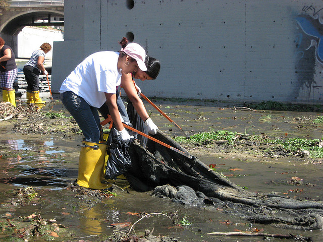
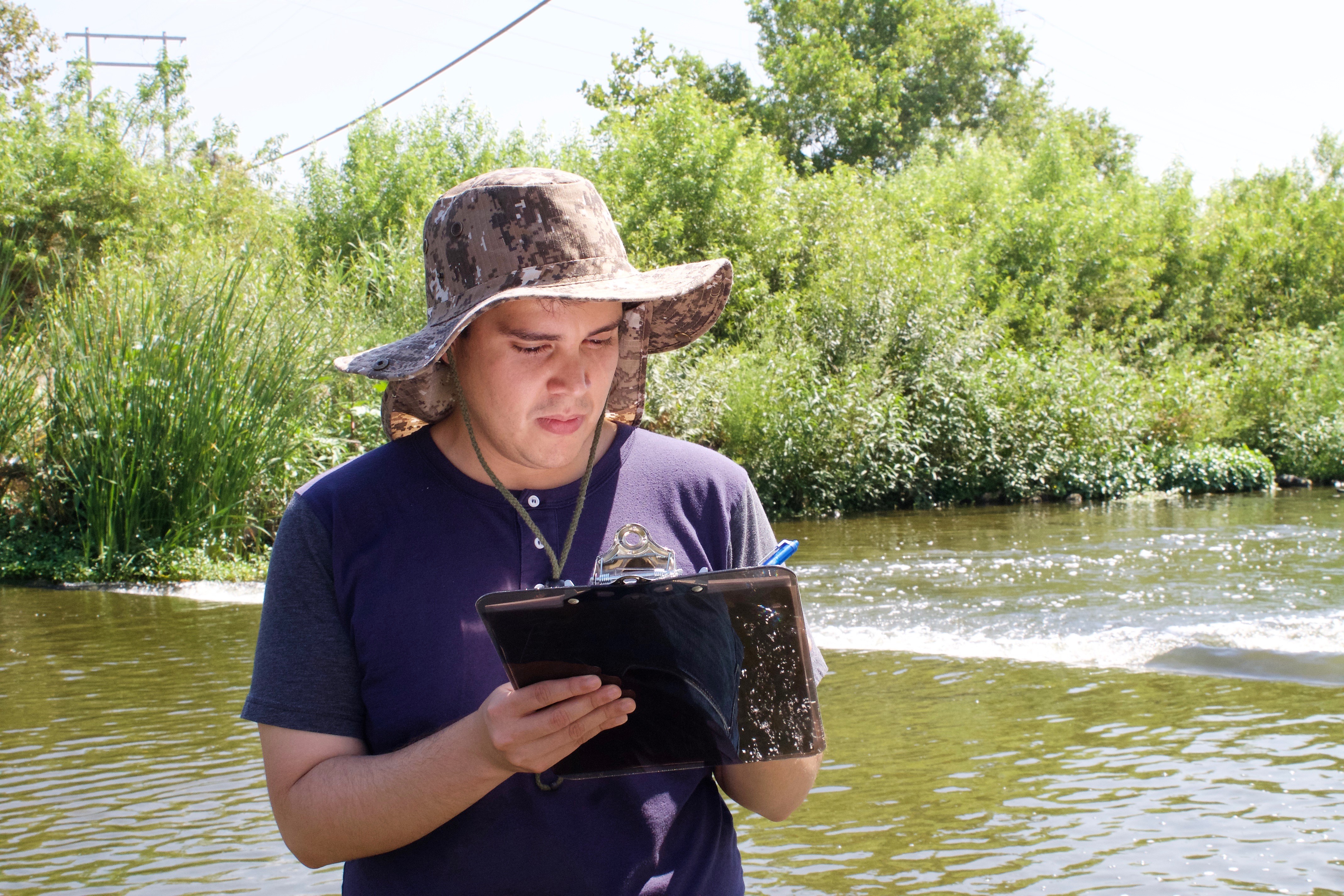
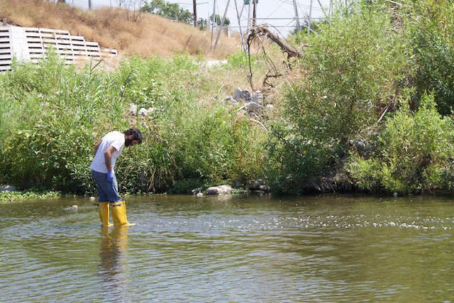
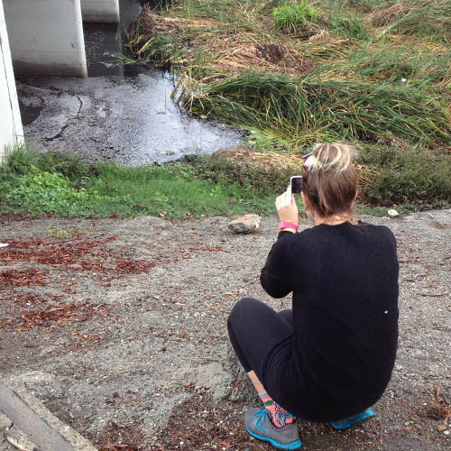
Un día de la semana pasada, Chris estaba de pie en el medio del río de Los Ángeles, cerca de Frogtown, el agua hasta la cima de sus botas. Llevaba puesto guantes de caucho, tenía un recipiente de vidrio, y pasaba con cuidado sobre piedras resbaladizas.

“¿Aquí?” Chris preguntó a Katherine Pease, la científica de las cuencas hidrográficas de Heal the Bay.

Chris llenó la botella con el agua del río, volvió para la orilla del río y dejó la muestra en hielo para prepararla para pruebas en el laboratorio.


Planes Grandes, Pero También Grandes Problemas.

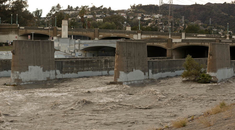
Los Ángeles tiene planes grandes para revitalizar unas 11 millas del río en los siguientes años, el precio cual comenzó en unos mil millones ha aumentado ha 1.6 mil millones.

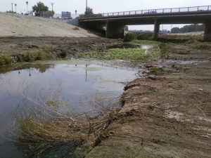
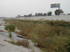
¿Pero está el agua suficiente limpia para el uso recreativo o para atraer a la gente que vive y trabaja en la orilla de lo que es nada más que un canal de drenaje para escorrentía urbana y de residuales tratados?

Heal the Bay es reconocido por ser una de las fuerzas impulsoras de mejorar la calidad del agua del mar en el golfo de Santa Monica, dando notas (A-B-C-D-F) a las playas. Durante los últimos tres años, la organización ha recogido muestras de la cuenca Sepúlveda y tres locales del uso recreativo en el río en el valle Elysian. El sistema que utiliza es una de tres colores, verde, amarillo, y rojo. El rojo significa las áreas que tienen las más bacterias dañinas. Los resultados cambian cada semana.

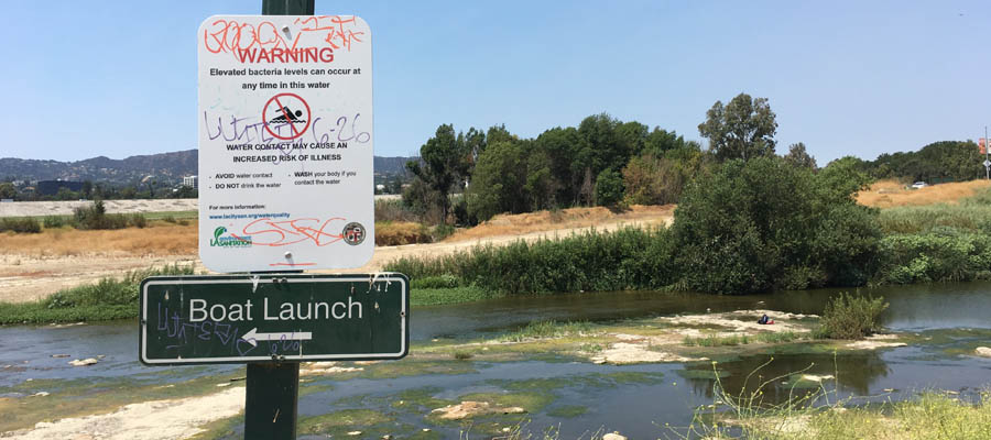
Pease dice que la calidad de agua ha mejorado un poco, pero sin coherencia y no por todo el río. Este verano la cuenca Sepúlveda tiene marcado muchas áreas rojas y en el valle Elysian, en las áreas de Frog Spot and Rattlesnake Park, tiene marcado amarillo. Pease, en un informe del año pasado, dijo que el nivel alto de las bacterias “indica un riesgo de infecciones del oído, enfermedades respiratorias y enfermedades gastrointestinales para la gente que tiene contacto con el agua.”

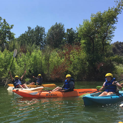
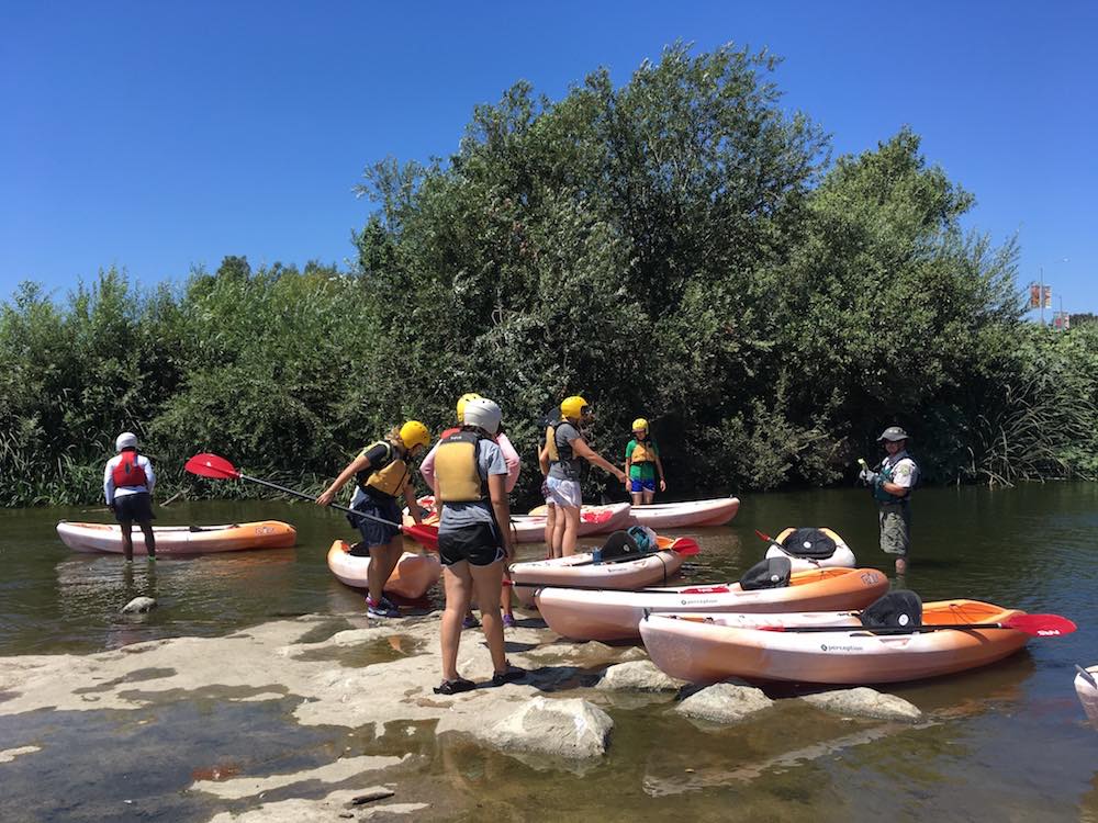
“No quiero decir que no debes hacer kayaking en el río — lo hice yo el año pasado y lo recomiendo. Tampoco no es de tener miedo de andar por las orillas del río y ver los animales y plantas que viven ahí. Solo hay una cosa que recordar– si esta en contacto con el agua se debe lavar las manos,” dice Pease.

“Yo realmente haría kayaking,” dice James Alamillo, quien ayuda a mantener la operación de monitorizar el río con Heal the Bay, “pero no nadaría o no vadearía en el agua.”

Aguas Peligrosos, No Aguas de Bañar

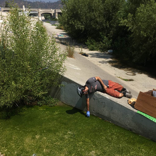
El equipo de monitorizar siempre ve a individuos indigentes utilizando las aguas del río como un área recreativa.

Especialmente no se debe entrar en el agua cerca de desagües que echan escorrentías contaminadas en el canal central. Puede ser que usted no espera cascadas ni gotas de los desagües en el medio de un verano seco en Los Ángeles, pero agua fluye todos los días y las noches en algunos lugares.

“El volumen de agua es increíble,” dijo Alamillo, mostrando una cascada cerca de Fletcher Street Bridge.

La cascada fluyó con mucha fuerza. El agua ha cambiado, de estar limpio, de estar jabonosa, y de estar marrón. Alamillo y los demás han comprobado las calles alrededor del río para encontrar el origen de la contaminación, pero en vano.

Pease dijo que el uso excesivo del agua es el primer sospechoso, tanto como el lavado de los coches. Se estima que 100 millones de galones de escorrentía contaminada pasa por los desagües del condado del LA por todos los días en el verano, llevando excrementos de animales, pesticidas, productos químicos, aceites y basura hasta el mar. Alamillo recogió un contenedor plástico de una prescripción para marihuana y me dijo que descartes así son tan comunes por el río LA como las bolsas de plástico eran por el arroyo de Compton cuando pasamos yo y ella hace muchos años.


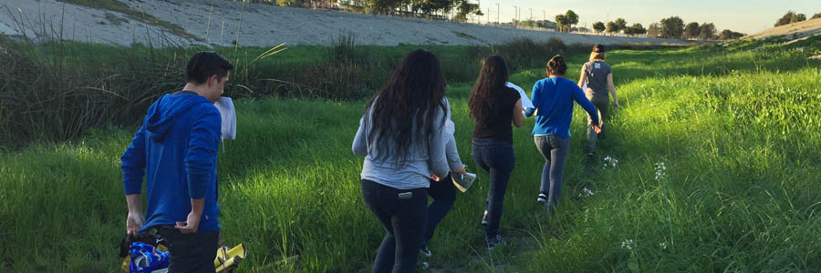
En la semana pasada, en mi segundo día con el equipo de monitorizar, el equipo montaba en bicicleta por las riberas por el norte del río. Recogieron muestras de tres desagües entre Fletcher Drive y Harbor Freeway. Todas de aquellas muestras tenía E. coli y Enterococcus que son bacterias de fecales inductores, lo que no nos sorprendió.

En el primer desagüe había un carro de compras lleno de excrementos y papel higiénico. Un hombre sin casa, que vive en una ciudad campamento debajo de la carretera 2, y tiene cuatros gatos en correas, dijo que alguna de la gente que vive por ahí usa el desagüe como un baño.

Los otros dos desagües no parecían mejor, uno de ellos era una cascada que llegó hasta el río y sus riberas. Un joven sin casa, que se llama Abraham, acabó de bañarse en el río y estaba secando su ropa en la ribera. Hay gente sin casa muriéndose en las calles y bañándose en el río, es obvio que tenemos que hacer algo más.

La ciudad de Los Ángeles y los oficiales del condado tiene mucho que resolver en los meses y en los años que vienen. Tienen que entender lo que es el río, lo que podría y debería ser, como se debe limpiarlo y cómo lograr de pagar por su revitalización. Esas decisiones son cada vez más importantes porque está subiendo las estimaciones y no podemos esperar mucho ayuda de Washington. De hecho, el programa de monitorizar el río está pagado por un subsidio del EPA, lo cual es una agencia federal que está en peligro de recortes masivos.

LA River Kayaking

El potencial para un oasis urbano

El río, históricamente, estaba seco por nueve o diez meses del año, pero ahora fluye por todo el año porque millones de galones de residuales tratados son emitidos diariamente en el canal, y llegan hasta el mar.

Prefiramos de hacer kayaking todo el año en agua tratado y escorrentía, o invertir en proyectos de la recuperación del agua para afrontar mejor sequía, o diseñar un compromiso viable.

El potencial para un oasis urbano por el centro de Los Ángeles es grande, ¿pero incluirán o desplazaran a los cuales viven cerca del rio y el desarrollo comercial para la construcción?

No tengo todas las respuestas, pero puede ser que los estudiantes de L.A. Trade Tech, los cuales son los que están monitorizando el río, nos ayudarán a descubrirlas. Nelson Chabarria quiere ser un inspector normativo medioambiental. Los otros estudiantes, Vanessa Granados, Christopher Zamora, y John Silva me dijeron que quieren seguir carreras en Ciencias del medio ambiente, geoquímica o ámbitos relacionados.

Ellos saben, mejor que muchos otros, el gran potencial del río tanto como los desafíos de mantener y limpiarlo. El río nos precede y sigue aquí, navegando los cambios que hemos hechos.

LA River Monitoring Team


Attention citizen scientists and naturalists, it’s time to charge your mobile devices. Our watershed scientist Katherine Pease is inviting you to BioBlitz with her for a few hours on Saturday, Aug. 26.

Compton Creek is a small gem of green and blue, bisected by noisy freeways, crumbling parking lots, aging shopping malls and a high-rise casino. Amid all this urban scrabble, a soft-bottomed section of the creek thrives.

Most people don’t know this earthen-bottomed half-mile stretch even exists. And some might argue that “gem” is too generous a term for this L.A. River tributary. But we see it as a forgotten jewel – a glimpse of what greater L.A.’s inland waterways used to be and a symbol of what we can hopefully bring back on a larger scale.

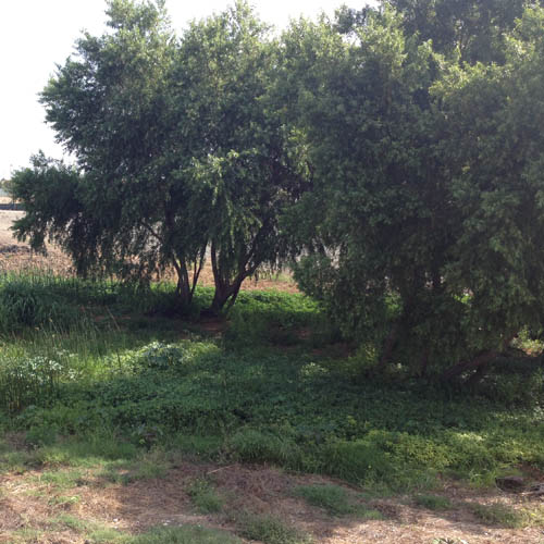
There are drooping willow trees, reeds, frogs, swarms of dragonflies, California ground squirrels and even majestic kites (a type of bird) flying overhead. There is also trash, a lot of it, and pollutants that can’t be seen with the naked eye: bacteria, metals and nutrients. But there is that glimmer of hope. Plants and animals persist here, and now it’s our job to find out what’s there and to protect it.

So we’re inviting you to a blitz. A BioBlitz to be exact.

On Saturday, Aug. 26, you can join scientists and experts from Heal the Bay and the Natural History Museum of Los Angeles County in searching for wildlife and documenting it with your smartphone.

We’ll be spending three hours snapping pictures of the local flora and fauna, uploading the images to our growing catalogue of L.A.’s wildlife via the iNaturalist app.

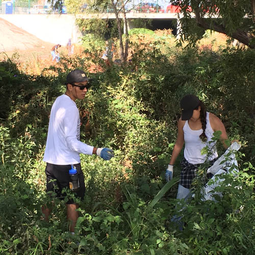
You don’t need to be a scientist to participate – you just have to observe what is around you! In addition to looking for plants and animals, we will be picking up trash in and around the creek, which ultimately drains into the Pacific Ocean near Long Beach.

The data we collect will better inform restoration and revitalization of the Los Angeles River watershed. A revitalization plan for the Lower L.A. River is being formulated by the Lower L.A. River Revitalization Plan Working Group. As a member of this effort, Heal the Bay is fighting for better access, improved water quality and restored ecological habitats in the Lower L.A. River. Having data on the current conditions of biodiversity in Compton Creek helps set a baseline so we can establish goals for what we would like to see in the coming years.

This BioBlitz is part of two greater efforts in the Los Angeles area to document, protect and improve biodiversity and habitats.

First, the Los Angeles City Council, championed by councilmember Paul Koretz, recently passed a motion to protect and improve biodiversity in Los Angeles. Heal the Bay has been involved in this effort and sees this BioBlitz in Compton Creek as a way to understand the nature that exists all around us in greater Los Angeles.

The second push is the city of Compton’s revival of the Compton Creek Task Force. The Task Force is focused on creating stewardship opportunities along the creek, educating residents and visitors about its importance. The group will also help implement the city’s Compton Creek Regional Garden Park Master Plan, which includes restoring the earthen-bottom portion of Compton Creek.

If you ever thought about becoming a citizen scientist, this is an ideal opportunity to get started. Last year, we hosted similar events in the Ballona Wetlands and Malibu Lagoon. Dozens of volunteers made a big difference in our ongoing restoration work by creating a record of what they saw each morning.

You can register with us for the event here.


Lo más importante aquí en Heal the Bay es la calidad de agua y la salud pública. Creemos que usted tiene el derecho de saber de la calidad de agua en las zonas recreativas de aguas dulces, antes de llegar, especialmente si usted tiene planes de visitarlas.

Nuestro nuevo programa del verano convierte lo que creemos en acción. Vamos a probar, analizar, e informar en la calidad de agua en dentro de las cuencas del río Los Ángeles, el arroyo de Malibu, y el río San Gabriel. Lo que queremos lograr es simple: facultar que ustedes puedan hacer decisiones informadas y reduzca el riesgo de enfermarse.

De momento, estamos monitorizando los niveles de las bacterias dañinas en varias locales de agua dulces cerca de zonas recreativas populares, en colaboración del L.A. County Department of Public Health, el Council of Watershed Health, el Los Angeles River Watershed Monitoring Program, el City of Los Angeles Department of Sanitation, y el San Gabriel Regional Watershed Monitoring Program. Las áreas de monitorizar el río de Los Ángeles están en zonas recreativas designadas en que algunas actividades son permitidas durante el verano (kayaking o pescar, pero no nadar); los otros locales son todos lugares populares para nadar.

Comprueba nuestro mapa para ver los últimos resultados de la calidad de agua:

¿Que significa tienen las pruebas?

La Agencia de Protección Ambiental de Estados Unidos y el Departamento Regional de Control de Calidad del Agua se han fijado el máximo para un nivel aceptable de bacterias dañinas en agua. Cada semana nuestro mapa está actualizado con los últimos resultados de prueba, incluyendo el número de veces el nivel de las bacterias supera el límite en las cuencas nuestras. Cuanto mayor es el número de excesos, cuanto mayor es el riesgo de enfermarse en aquello sitio. Entonces el verde significa el riesgo menor y el rojo significa en el riesgo mayor.

Un desglose

  • Si un sitio tiene zero excesos, tiene una marca verde, lo cual significa el riesgo menor.
  • Si un sitio es hasta la mitad o menos del límite de excesos, tiene una marca amarilla.
  • Si un sitio tiene más de la mitad permitida de excesos, tiene una marca roja, lo cual significa el riesgo mayor.
  • Las marcas grises no tienen datos.

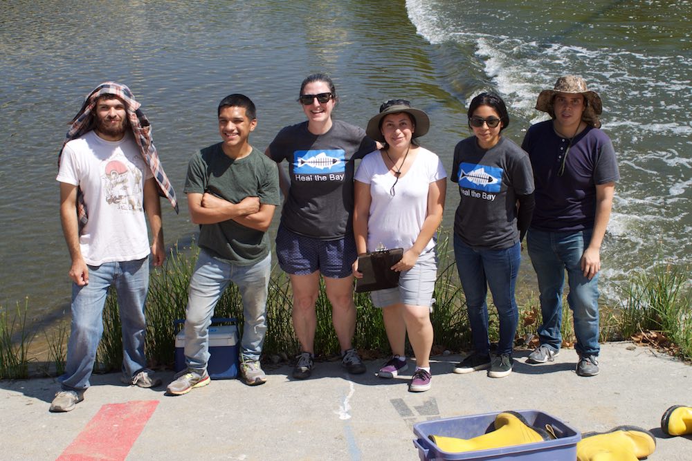
Heal the Bay ha monitorizado la calidad del agua en el arroyo del Malibu desde 2014 y la calidad del río Los Ángeles desde 2015. En 2016, ganamos el subsidio del US EPA Urban Waters. Gracias a esto subsidio, hemos lanzado un programa único de monitorizar agua dulce en asociación con una universidad local. El programa está organizado por nuestra científica Katherine Pease y estamos formando a cinco estudiantes de Los Angeles Trade Technical College “LATTC” para monitorizar las condiciones del río Los Ángeles. También estamos trabajando con dos pasantes en el apoyo del arroyo Malibu.


Hoy empezamos de publicar notas de la calidad de agua de las zonas recreativas de agua dulce que existan aquí en Los Ángeles. Nuestra científica Dr. Katherine Pease nos explica por qué este labor es importante y nos habla de la gente interesante que nos está ayudando de completarla.

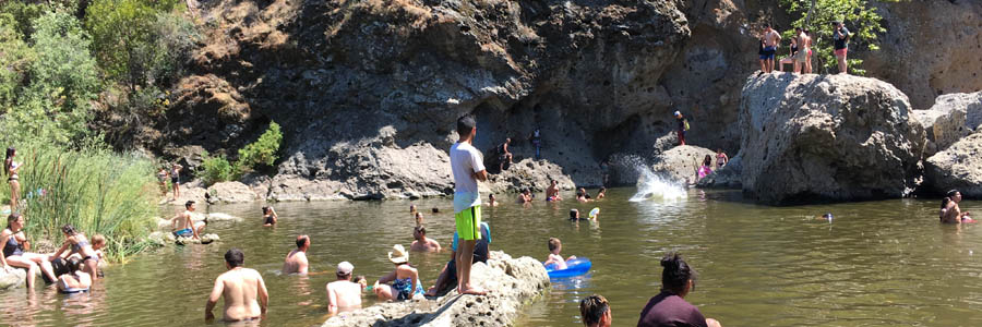
El verano pasado, Heal the Bay publicó un estudio importante de la calidad de agua que mostró que la contaminación por las bacterias seguían asolando al río Los Ángeles en una manera crónica y a largo plazo. Nuestro estudio ha demostrado que las zonas recreativas de agua dulce, que son cada vez más populares, padecen de la mala calidad de agua y presentan riesgos para la gente que visita aquellas zonas de agua dulce para pescar, nadar, o hacer kayaking.

Los hallazgos eran una causa de preocupación, pero también nos dieron una oportunidad. Después de que los publicaron, la pública se renovaron su interés en el río Los Ángeles y inspiró un plan para la revitalización de las aguas de L.A., que cuesta hasta mil millones.

Aprovechamos del estudio y se inspiró en nuestro trabajo en proteger la salud pública por proporcionar un reporte de la calidad de agua en nuestras playas, hemos comprometido de publicar notas de la calidad de agua en los ríos por todo Los Ángeles.

Hoy revelamos el reporte del río, un nuevo instrumento en línea que permite a nuestros usuarios comprueba los niveles de las bacterias dañinas en hasta doce zonas recreativas de agua dulce, de Malibu hasta Frogtown, de Encino hasta Atwater Village.

Empezamos en 2014 a monitorizar a las zonas recreativas del interior. Primero, monitorizábamos las pozas en las Montañas de Santa Mónica, se agregaron luego otros sitios del río Los Ángeles en 2015. Para asegurar que la gente pueda ver todos estos sitios cuales son seguros, publicamos todo en un blog semanal.

El público tiene acceso a nuestro programa, ya ampliada, en los mapas online para comprobar las calificaciones de la calidad de agua (verde, amarilla, o roja) en su zona recreativa preferida. Actualizaremos el reporte dos veces a la semana, cada lunes y miércoles. Los datos de las pruebas por los niveles de las bacterias vienen del personal mismo de Heal the Bay, complementado por pruebas hechas por la ciudad de Los Ángeles y Council for Watershed Health como parte de Los Ángeles River Watershed Monitoring Program (LARWMP).

Nuestro informe de la calidad del agua en el río Los Ángeles ganó mucho atención el año pasado, mejorando en la conciencia pública sobre los problemas de la cualidad de agua en el río.

Entre los cambios positivos:

  • El Departamento de Salud Pública de Los Ángeles ya tiene un sitio de web dedicado a las zonas recreativas de agua dulce.
  • Otras agencias ya hacen pruebas por la calidad de agua en el río por el programa de LARWMP (Antes era sólo nosotros, Heal the Bay, que hicimos pruebas de las zonas recreativas de la Valle Elysian).
  • El saneamiento de la ciudad de Los Ángeles pusó avisas por todo el río de Los Ángeles que le recomendaron Heal the Bay y El Departamento de Salud Pública de Los Ángeles.

En otro cambio positivo, Heal the Bay contrató estudiantes de las universidades locales para realizar este trabajo.

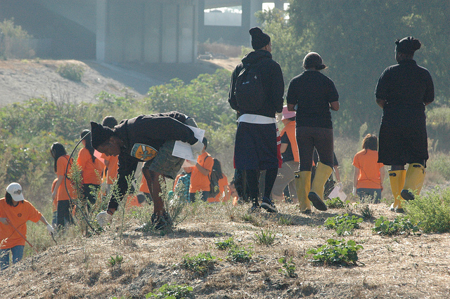
A través de un subsidio, trabajamos con Los Angeles Trade Technical College, una universidad técnica en el centro de Los Ángeles. Este verano cinco estudiantes de LATTC han unido nuestro equipo para aprender la ciencia de monitorizar la calidad de agua y defendiendo las protecciones del medio ambiente — desde el río de su ciudad.


El entusiasmo que nos han traído los estudiantes para el río es contagioso, y sus raíces y experiencias diferentes nos han traído una perspectiva nueva para nuestro trabajo. (Se puede leer de todos ellos aqui). El entrenamiento subraya el compromiso de Heal the Bay para que la gente que trabaje en la ciencia de medio ambiente sea variada y pueda ayudar a desarrollar los futuros líderes de nuestra región.

Enfocamos en las experiencias de estos estudiantes por todo el verano en nuestro blog y por nuestros canales sociales — compruebe lo que nos dicen de su experiencia.

Los estudiantes se encargan con una labor importante: encontrar de donde viene la polución que está en el río. Es una pregunta importante, no sólo para la gente por el cauce del río sino también para la gente que usa el mar. La gran mayoría de la polución que afecta a nuestras playas llega ahí de los ríos.

Para encontrar los orígenes de la polución, los estudiantes andan en bicicleta por toda el Valle Elysian para identificar y probar los pluviales.

La realización de monitorizar este trabajo es fascinante – conseguimos datos importantes y nos presenta la oportunidad de acercarnos al río. Cada semana vemos a la gente usando el río para las actividades recreativas como nadar, pescar, y hacer kayaking sino también para las necesidades humanas básicas como bañarse y limpiar la ropa.

Áreas que tienen agua corriente ofrecen la gente y sus perros un descanso del calor del verano. Sirven la gente sin hogar como un lugar donde se puede bañar. También son los sitios primeros dañados por los residuos urbanos contaminantes que luego dañará a la gente, el hábitat, y la vida silvestre en los ríos y en el mar también.

Son observaciones tristes, pero también tenemos noticias buenas. Cada vez hay más gente conectando con la naturaleza y descubriendo el oasis en Los Ángeles urbano. Muchos de los lugares del interior tienen una calidad buena de agua y sus residentes son determinados de proteger sus aguas.

Alentamos que ustedes vuelvan para nuestro sitio de web, que pasen para las zonas recreativas, aprendan de la calidad de agua, y aprendan lo que ustedes pueden hacer para mejorar la calidad de agua aquí en Los Ángeles.

Si usted está pensando en ir a las zonas recreativas de agua dulce, pasen por nuestra página de FAQ para informarles de las zonas recreativas y la calidad de agua.


Today we begin publishing regular water quality grades for freshwater recreational zones across greater L.A. Staff scientist Dr. Katherine Pease explains why the work is so important, and some interesting people helping us do it.

Last summer, Heal the Bay released a landmark study of water quality that showed that bacterial pollution continues to plague the L.A. River on a chronic, long-term basis. Our scientific report demonstrated that increasingly popular recreation zones suffered from poor water quality, and posed health risks for the growing number of people fishing, swimming and kayaking its waters.

The findings were a cause for concern, but also served as an opportunity – given all the renewed interest about the L.A. River and a $1 billion revitalization plan for L.A.’s central water body.

Building on that study and our longtime work to protect public health by providing weekly water quality grades at California beaches, Heal the Bay this year committed to regular water quality monitoring in rivers throughout greater L.A.

Today, we take the wraps off our River Report Card, a new online tool that lets users check for harmful bacteria levels at nearly a dozen freshwater recreational zones, stretching from Malibu to Frogtown, from Encino to Atwater Village.

We began monitoring inland recreational areas in 2014, starting with swimming holes in the Santa Monica Mountains, and adding sites in the L.A. River in 2015. To make sure people could see whether these popular spots are clean and safe, we posted the test results online in a weekly blog.

With our expanded River Report Card, the public can use our online map to check out water-quality ratings (green, yellow, or red) at their favorite summer spot. We will update the grades twice a week, every Monday and Wednesday. The data come from bacteria testing by Heal the Bay staff, supplemented by testing by the City of Los Angeles and Council for Watershed Health as part of the Los Angeles River Watershed Monitoring Program (LARWMP).

Our report on the L.A. River water quality garnered quite a bit of attention last year, leading to improvements in public awareness about water quality issues in the River.

Among the positive changes:

  • The L.A. County Department of Public Health now has a webpage devoted to Fresh Water Swim Areas
  • Additional agencies now test at recreation sites in the L.A. River through the LARWMP program (Heal the Bay was previously the only group testing the Elysian Valley recreation sites)
  • L.A. City Sanitation has posted new signs along the L.A. River about water quality that Heal the Bay and L.A. County Department of Public Health recommended

In another positive development, Heal the Bay has recruited some local students to conduct this work.

Under an EPA grant, we’re partnering with Los Angeles Trade Technical College, a public community college in downtown Los Angeles. Five LATTC students have joined our field staff for the summer, to learn the science of water quality monitoring and the art of advocating for environmental protections – starting with the River in their own backyards.

The enthusiasm that these students bring to the River is contagious, and their varied backgrounds and experiences bring broad new perspectives to our watershed work. (You can read more about them here.) The training underscores Heal the Bay’s commitment to diversifying the ranks of environmental science and developing future leaders in our region.

We will highlight their voices and experiences over the rest of the summer through Heal the Bay’s blog and social media channels – check back often to hear what they have to say!

These students have been charged with an important task: identifying where pollution is entering the L.A. River. It’s an important question, not only for people along the banks of the River, but for ocean users as well. The vast majority of pollution at our beaches is carried there via rivermouths and stormdrain outfalls.

To pinpoint these nasty pollution sources, the LATTC students are biking along the L.A. River in the Elysian Valley to identify and sample flowing stormdrains.

Conducting this monitoring is fascinating – we get important data, and the opportunity to be up-close and personal with the River. Every week we see people using the river for recreational activities like fishing, wading and kayaking but also for basic human needs, such as bathing and washing clothes.

Areas with flowing water provide people and their dogs respite from the oppressive summer heat. They serve homeless encampments as a place to freshen up or bathe. They are also ground zero for the often-polluted urban runoff that harms people, habitat and wildlife in the rivers as well as downstream at the beach.

These are sobering observations, but there is good news too. More people are connecting with nature and discovering their own freshwater oases in urban L.A. And many inland locations have good water quality. Residents are working to protect these special places and keep them healthy and safe.

We encourage you to check back here often, explore your local water bodies, learn about water quality, and learn what you can do to improve the health of your watershed.

If you are thinking about getting out on the water, please check out our FAQ about recreation and water quality issues along the L.A. River.

We are lucky to live in sunny Los Angeles where millions of tourists and locals converge along the lovely shores of the Santa Monica Bay to enjoy paradise. It’s a mixed bag on the beach, where hordes of visitors come to bathe and sun themselves. Why? Well, they know just how good we have it.

Yep, they want a piece of the Angeleno culture, and the beach, and our Bay. If you haven’t been out to the beach yet, well may I suggest you hop on the Metro, or your bike, or drive down for a visit. You’re not going to regret it, especially since we have so much happening underwater too. On your next visit to the beach you may be lucky enough to encounter a local that most people miss altogether.

Sharks are swimming along the shores of this Bay and they are swimming alongside you and those fine visitors that come to live the California dream. In fact, there are more than 20 different species of sharks1 that inhabit or visit these waters. One of my favorites sharks to see in the summertime is the leopard shark. An elegant fish, the leopard shark is gray with spots and saddle-bars, usually reaching a length of five feet or so. They like to school with their kin and other sharks like smooth greyhounds, eating small fish, octopus and crustaceans along the shallows.

A leopard shark swims through kelp.

Another favorite is the horn shark. You might see these sharks if you are snorkeling around the rocky shores of Point Dume or off of Palos Verdes. At three and a half feet long, this squat nosed fish has two pokey spines (not venomous) at each dorsal fin – an adaptation for protection. Since they hatch from an egg, measuring a mere six inches, those spiny horns protect this cute little shark from halibut and other marine predators. To be honest, they are so cute that sometimes when I see them diving, I cannot resist reaching out and giving them a kiss for good luck. Another local favorite is the swell shark, a small shark that protects itself by swallowing an enormous amount of water to protect itself from being swallowed – like a swimming watermelon! Their eggs are sometimes found washed on shore but if you want to get a close-up look, I invite you to visit Heal the Bay’s Santa Monica Pier Aquarium. The Aquarium has several eggs on display where you can witness the tiny embryos growing into tiny shark pups.

A horn shark swims along the ocean floor. Photo by Scott Gietler.

One of my favorite sea animals to see is the white shark, lovingly known as “the Landlord.” I have been lucky enough to swim with and surf with a few small white sharks and it seems like each year we are seeing more and more of them. Why are there white sharks in SoCal and why so many? Well, we are probably witnessing something really special because the coast of southern California is like a nursery. These white sharks are here because food is available and they like to eat small fish, like stingrays. We have been working hard to protect white sharks and maybe this is the positive result of all of our conservation efforts. Let’s hope so because this fish is a very important indicator of how well our oceans are faring. As a top predator, we expect that their recovery is indicative of an improving food web and ecosystem. It is still early to be absolutely sure but I do hope that we continue to see improvements in their population and in the health of our fisheries.

I am proud to work for Heal the Bay because I know that the work we have done over the past three decades has improved the life of our local sharks and is helping to restore and protect our unique and fragile ecosystem. We started our work in the 1980s by improving water quality in our watersheds and our Bay. That work continues daily, and we have expanded healing efforts by supporting and ushering in a network of Marine Protect Areas (MPAs) all along our coast. MPAs function like underwater parks, where marine life can live free from fishing pressure, promoting more growth, reproduction and species diversity.

We’ve worked alongside many of our colleagues and communities to pass a statewide ban on the possession and sale of shark fins. Shark finning is a cruel and destructive practice that is decimating shark populations worldwide. At our Aquarium, we teach tens of thousands of students and visitors about sharks, debunking the myths and providing the facts so that everyone can do their part to help sharks.

We still have a great deal of work to do. We need to keep eliminating plastics and other pollution from our ocean, we need to continue to educate our communities on how to be healthy in order to keep our seas and beaches healthy and we need to continue our love affair with nature. All this starts with you. Join us at Heal the Bay as a volunteer or a member, and join us in the fight to protect our environment.

You, your family and friends need a good day at the beach. If you’re lucky, maybe you will see a shark. Regardless, you live in paradise and it is right outside your door. I hope to see you out there. Even if you can’t make it into the water, you can still visit us at the Santa Monica Pier Aquarium!

1http://content.cdlib.org/view?docId=kt938nb3cq&&doc.view=entire_text


The Strawless Summer - Heal the Bay

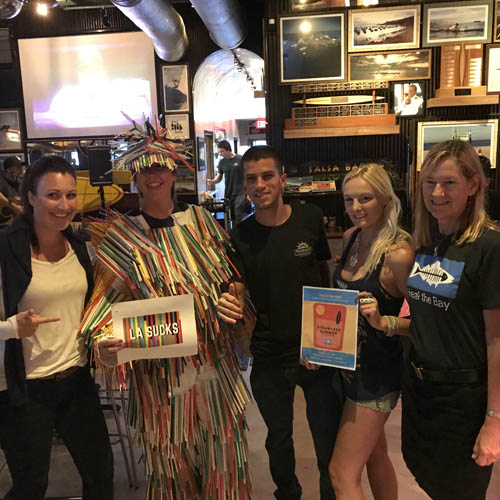
L.A. doesn’t have to suck.

The relentless traffic, all the annoying wannabes, and the really, really long lines for literally everything. (Seriously, I just wanted a cold brew & cronut!) Okay, fine. These things do suck! But, they don’t define us.

Diverse communities, vibrant businesses and a beautiful environment – this is what makes greater L.A. so desirable to call home. From the San Gabriel mountains to the Bay, we are a cultural and economic hub built on creativity, innovation and resilience. But escape from the hustle-and-bustle of undercover celebrities, hashtag fads and trendy avocado toast is only a short trip away. Whether it be to hike on nature trails, shred down mountains, swim in the sea or explore the desert, we are blessed with natural and urban settings that are uniquely intertwined.

Yet, our everyday lifestyle choices are having a negative impact that we can no longer ignore.


(Photo by: Henrique Vicente, Flickr. January 2017.)

Plastic pollution is everywhere.

The consequences and costs of convenience related to single-use plastic packaging for food and beverages are surfacing in our ocean, rivers, creeks and streams. It’s now estimated that by 2050, there will be more plastic in the ocean by mass than fish1.

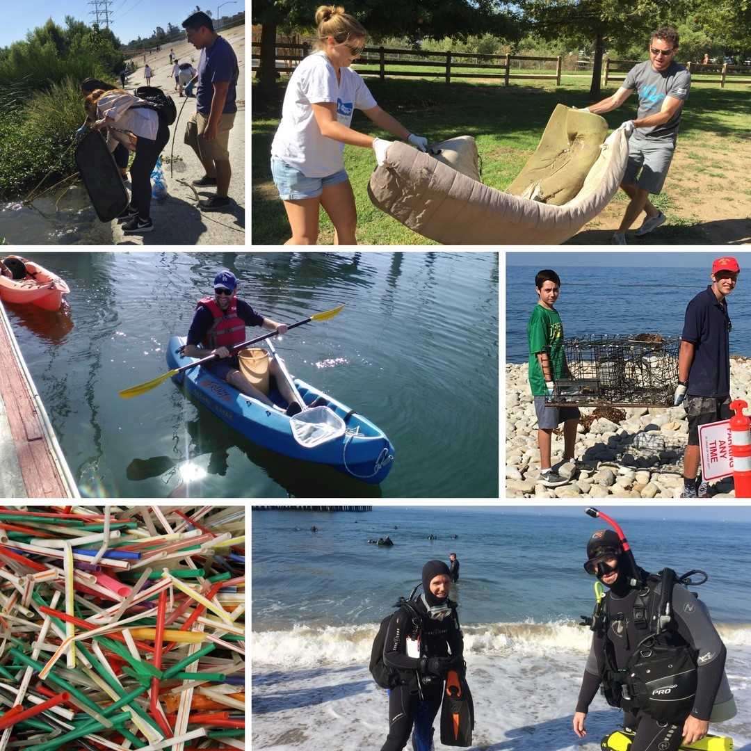
Plastic drink-related litter is one of the top items we find at our volunteer cleanups in beach and watershed areas across greater Los Angeles. Single-use lids, cups, bottles, sleeves, stirrers, six-pack rings, and straws. You name it, we find it. Our region isn’t the only one that needs to consider rethinking the drink. Some 40% of all debris found in the environment is beverage-related2.

And all this trash isn’t just gross. It’s dangerous. Marine mammals, fish and birds often get entangled in plastic or mistake pieces of it for food. After accumulating our trash in their gullet, the animals can’t digest food properly and often die.

Strawless Summer - Heal the Bay

Just keep sippin’.

Greater L.A. can lead the way and help shift America away from single-use plastic items. We took a giant step when Heal the Bay helped pass the statewide plastic bag ban in 2014 and California voters upheld the policy last year.

But this summer, we’re zeroing in on plastic straws because they kind of suck.

Plastic straws of all shapes, sizes and colors are popping up everywhere from juice boxes to cocktails to unasked-for glasses of water. Collectively, it’s estimated that Americans use roughly 500 million plastic straws daily – enough to fill up 125 school buses each day3 and wrap around our entire planet 2.5 times. Most plastic straws end up in landfills. The rest wind up polluting the environment and posing a threat to animals and aquatic life.

So, here’s what we are asking you to do. It’s simple and it works: If you don’t need a plastic straw, don’t use one!

The Strawless Summer

It is starting to heat up this summer, so now is the perfect time to cool off and skip the single-use plastic straw. We just launched our new destination, lasucks.org, where you can take the pledge to go strawless and share with your friends.


1. The New Plastics Economy Rethinking the future of plastics. January 2016. http://www3.weforum.org/docs/WEF_The_New_Plastics_Economy.pdf
2. Plastics BAN List. Publication. 5 Gyres, Clean Production Action, Surfrider Foundation, USTREAM. 2016. http://d3583ivmhhw2le.cloudfront.net/images/uploads/publications/PlasticsBANList2016.pdf
3. “The Be Straw Free Campaign”. National Park Service Commercial Services. (Last update 11/26/2013) https://www.nps.gov/commercialservices/greenline_straw_free.htm


Snapshot CalCoast 2017
Ever wanted to be a scientist? Now is your chance! The California Academy of Sciences is teaming up with the Marine Protected Area Collaborative Network for Snapshot CalCoast 2017!

From June 23rd-July 2nd, teams across California will head to tide pools in marine protected areas (MPAs) to discover, photograph, and identify intertidal marine species. Put your smartphone to good use, download the iNaturalist app, and become not only a citizen scientist, but a conservation superhero today!

Why Care About Biodiversity?
Biodiversity is at the heart of ecosystem balance. By better understanding and protecting biodiversity, we are taking action toward more effective conservation. Ecosystems that have a higher level of biodiversity are more robust, can more easily bounce back from environmental changes and are generally more sustainable. MPAs in particular have been identified to successfully increase biodiversity, which, in turn, boosts productivity, increases resilience and establishes overall healthier ecosystems.

What is a BioBlitz?
A Bioblitz is a community event in which many people come together to document biodiversity by observing and recording as many species as they can in one area at one time. Bioblitzes are not only fantastic opportunities to get involved in the community, but also to connect you to both nature and science in a positive and rewarding way. Snapshot CalCoast uses the iNaturalist platform to bridge the gap between technology and outdoor nature, connecting social media to conservation and enabling you to share your discoveries through a fun, inspiring, and easy-to-use medium.

Get Involved!
For more information about Snapshot CalCoast and how you can get involved, visit here. See below for a list of bioblitzes happening in the Los Angeles area:

Heal the Bay
Wednesday, June 28
7:30am-9:30am
Point Dume State Park
RSVP here

LA Waterkeeper
Wednesday, June 28
10:00am-1:00pm
Paradise Cove

Wishtoyo Chumash Foundation
Sunday, June 25
6:30am-11:00am
Leo Carrillo State Park
RSVP to Eventbrite required. Spaces are limited.
For more information, please contact: kmelendez@wishtoyo.org, (805) 323-7023

Aquarium of the Pacific, Sea Grant, Terranea Resort
Friday, June 30
7:30am-10:30am
Pelican Cove
RSVP to Eventbrite required. Spaces are limited.

Natural History Museum – LAC
Sunday, June 25 and Monday, June 26
5:00am-8:00am
Point Fermin
RSVP here

Want your own adventure? Head out on your own, or with friends and family! Choose any coastal location between June 23rd and July 2nd, especially within Marine Protected Areas, and share your observations. Be sure to keep an eye out for the animals on the most wanted species list! All information collected will not only help improve knowledge of coastal biodiversity, but also be used by coastal managers to improve conservation efforts. Spread the word, invite your friends and family, and together, let’s make a positive impact and document our beautiful California coast! To learn more about how to use iNaturalist, click here and be sure to share! #SnapshotCalCoast @SnapshotCACoast.


001-intro-slide 010-monarch-beach-beach-bummer-2017 009-mothers-beach-beach-bummer-2017 008-luffenholtz-beach-beach-bummer-2017 007-capitola-beach-beach-bummer-2017 006-santa-monica-pier-beach-bummer-2017 005-la-jolla-cove-beach-bummer-2017 004-lakeshore-park-beach-bummer-2017 003-cowell-beach-beach-bummer-2017 002-san-clemente-pier-beach-bummer-2017 001-clam-beach-beach-bummer-2017
<
>
This site is right in front of the luxurious five-star Ritz Carlton resort in Dana Point, but one-star water quality persists in the bird-ridden spot. Local agencies have argued that the meandering portion of Salt Creek has facilitated a greater bird population, and in turn increased the amount of bird feces at this location—ultimately leading to the poor water quality. A falconry program was implemented to reduce bird-related bacterial counts at the mouth of the creek. However, potential harm to federally threatened snowy plovers during their nesting season halted the program—a decision Heal the Bay supported. The City of Dana Point has also invested in an Ozone Treatment Facility to treat dry weather runoff.

Heal the Bay analysts assigned A-to-F letter grades to 416 beaches along the California coast for three reporting periods in 2016-2017, based on levels of weekly bacterial pollution. Some 96% of beaches received A or B grades during the summer.

But pockets of fecal bacteria still trouble our waters and threaten the health of millions of beachgoers. Here’s our look at the 10 most polluted beaches in the state – our annual Beach Bummer List.

To avoid illness, ocean-goers can check the latest water quality grades at their favorite beaches, based on the latest samples, each week at beachreportcard.org (or download the Beach Report Card app for Apple or Android). For more information, check out our Beach Report Card blog post or read the full report here.


Much-needed winter storms may have relieved California’s historic drought, but all that rain came at some cost – poor beach water quality.

Bacterial pollution at some of California’s most popular beaches spiked dramatically in 2016-17, according to Heal the Bay’s 27th annual Beach Report Card, which the nonprofit released today.

Heal the Bay analysts assigned A-to-F letter grades to 416 beaches along the California coast for three reporting periods in 2016-2017, based on levels of weekly bacterial pollution. Some 96% of beaches received A or B grades during the high-traffic summer season (April-October 2015), slightly above the statewide five-year average.

Wet weather was a different story, however. Record rainfall created billions of gallons of polluted runoff, which poured into storm drains and out to the ocean. Nearly 48% of California’s beaches received C to F grades, about 12% more than the statewide five-year average.

La Jolla Cove, a popular swim spot.

Polluted ocean waters pose a significant health risk to the tens of thousands of year-round ocean users in California. Those failing grades indicate a significant health risk to the tens of thousands of year-round ocean users in Southern California, who can contract a respiratory or gastrointestinal illness from one morning swim or surf session in polluted waters.

Beach Bummers

Heal the Bay’s infamous Beach Bummers List, which ranks the 10 most polluted beaches in the state, was split between Northern and Southern California. San Clemente Pier and La Jolla Cove are both making their first ever appearance on the Beach Bummer’s List. Clam Beach County Park, Mother’s Beach in Marina del Rey and Santa Monica Pier have each been Bummers for the past four years. Check out our Beach Bummers Slideshow, which has more details about each of the Bummers.

  1. Clam Beach County Park, McKinleyville (Humboldt County)
  2. San Clemente Pier, San Clemente (Orange County)
  3. Cowell Beach, West of Wharf, Santa Cruz (Santa Cruz County)
  4. Lakeshore Park, Marina Lagoon, San Mateo (San Mateo County)
  5. La Jolla Cove, La Jolla (San Diego County)
  6. Santa Monica Pier, Santa Monica (Los Angeles County)
  7. Capitola Beach, Capitola (Santa Cruz County)
  8. Luffenholtz Beach, Trinidad (Humboldt County)
  9. Mother’s Beach, Marina del Rey (Los Angeles County)
  10. Monarch Beach, North of Salt Creek, Dana Point (Orange County)

Mother’s Beach in Marina del Rey, a repeat Beach Bummer.

On a more positive note, 32 beaches in the state were named to Heal the Bay’s Honor Roll, meaning they were monitored year-round and received perfect A+ grades weekly, regardless of rain or dry conditions. Orange County boasted the most beaches on the Honor Roll, with 14 sites earning top marks.

Staying Safe at the Beach

“We want people catching waves, not bugs, when they head to the beach,” said Sarah Sikich, Heal the Bay’s vice president and longtime ocean policy advocate. “The reassuring news is that if you swim at an open-ocean beach in the summer away from storm drains and creek mouths you statistically have very little risk of getting ill.”

Swimming or surfing at a beach with a water quality grade of C or lower greatly increases the risk of contracting illnesses such as stomach flu, ear infections, upper respiratory infections and rashes.

Here’s how you can make sure that you stay safe at the beach:

  • Check BeachReportCard.org for the latest water quality grades.
  • Avoid closed beaches
  • Swim at least 100 yards away from flowing storm drains and piers.
  • Wait at least three days after rainfall before entering the ocean.

Baker Beach, San Francisco.

How to Stem the Tide of Bacterial Pollution

California often swings from extended dry periods to shorter periods of intense, wet weather. Our region needs to do a better job of capturing runoff before it hits shorelines. Heal the Bay advocates for reusing that water directly for non-potable purposes or sinking that water back into our aquifers rather than letting it flow uselessly to the sea.

If Southern California cities had the infrastructure in place, then they could have captured and reused a bulk of the 100 billion gallons of stormwater that drenched our region last winter. That’s enough water to meet the needs of 2.5 million people each year – about a quarter of L.A. County’s population.

In response, Heal the Bay’s policy staff is advocating for public funding measures to build nature-based projects that capture, cleanse and reuse runoff rather than dumping it uselessly into the sea. The Our WaterLA coalition is working with the L.A. County Board of Supervisors to place a funding measure on the ballot for innovative multi-benefit projects that will capture runoff and create public green spaces countywide. Look for the measure on the county ballot next year.

Heal the Bay to Forecast Water Quality

This summer Heal the Bay, Stanford University and UCLA are expanding their predictive beach water quality forecasting program. Using sophisticated statistical models, environmental data and past bacteria samples, the scientific team can accurately predict each morning when beaches should be posted with warning or open signs.

Promising results from the past two summers (at Arroyo Burro Beach, Santa Monica Pier Beach and Doheny Beach) demonstrated that agencies can post a warning notice immediately at pollution impacted beaches based on predictions rather than waiting days for test results. These new models will protect public health by providing more advanced water quality information to public health officials. This summer, Heal the Bay will run models for 10 beaches, from San Diego to Santa Cruz counties.